
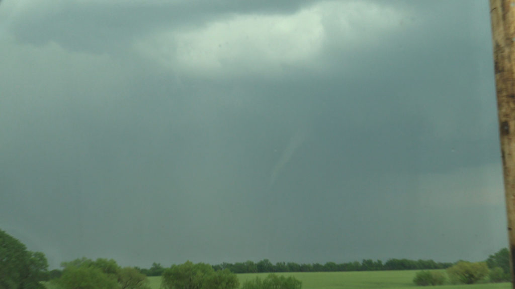
May 14th Southern Kansas Tornadic Supercell
May 14th took the May Minitour to southern Kansas. A storm formed near Arkansas City and anchored itself. Due to extremely high dew points and CAPE, the storm grew very large quickly. Wind shear was enough to start it spinning as well. It became severe and soon also was tornado warned. As the base lowered and a wall cloud formed, an elephant trunk shaped funnel dropped down and touched down for a couple of minutes before roping out. The storm maintained its structure for a couple more hours before it merged with a line of storms coming in from the west. A surprise event as it wasn’t forecasted, but nonetheless was pretty intense. Large hail also accompanied this supercell during its lifetime.

No comments yet.