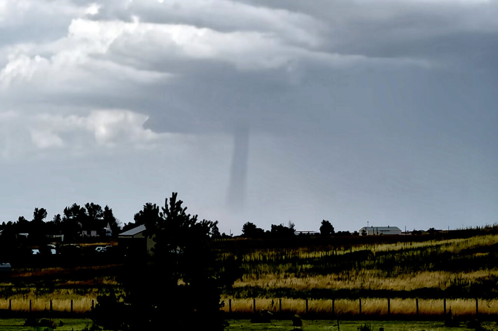
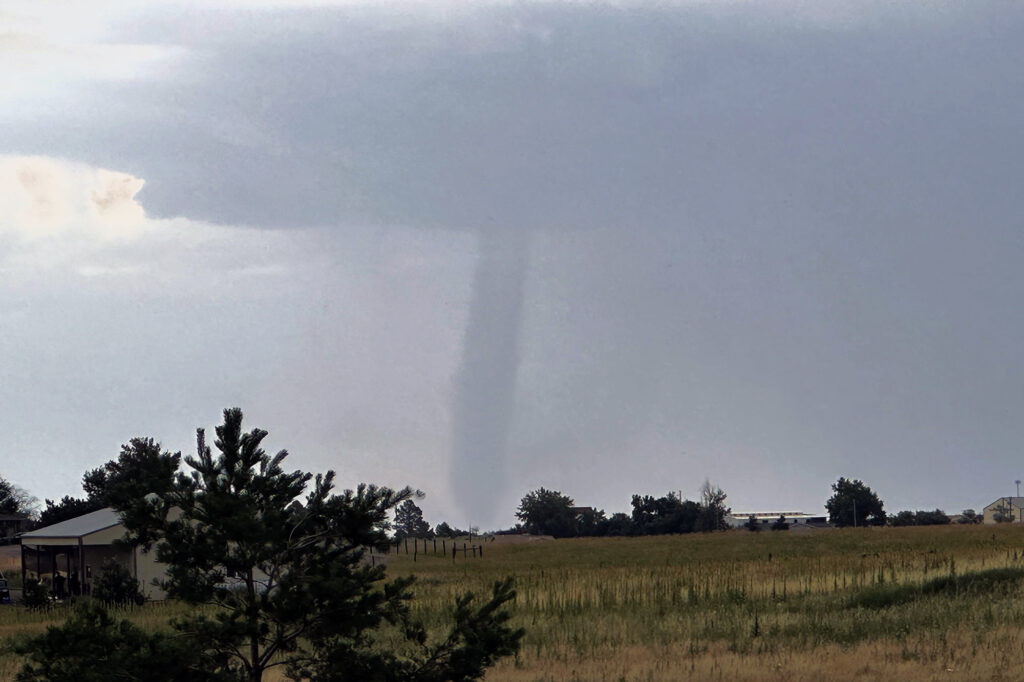
A DCVZ (Denver Convergence Vorticity Zone) boundary set up with good southeast winds along and north of the Palmer Divide in east central Colorado. As surface winds wrapped around the north side of the Palmer Divide, a Denver cyclone formed. By mid afternoon cumulus towers formed along the boundary. One such tower developed into an intense thunderstorm and spawned a landspout tornado north of our house. Caryn, doing a local chase, intercepted the storm as a mature landspout was visible from many miles away. It stayed on the ground for several minutes before lifting. The tower cam at Denver International Airport even picked it up clearly!
July 20th Southeast Colorado Tornado Warned Supercell
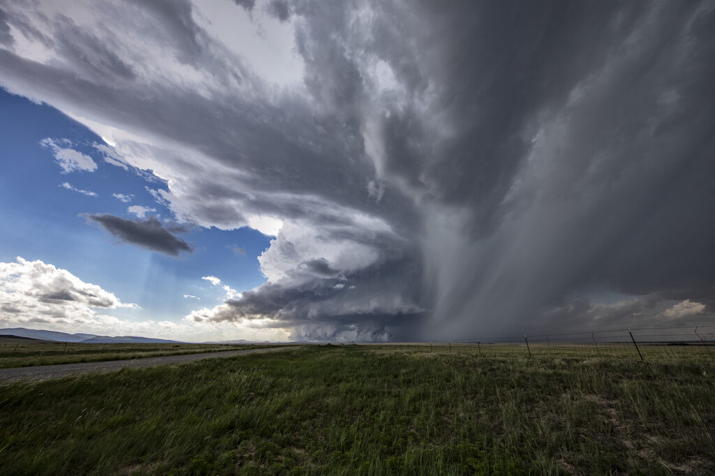
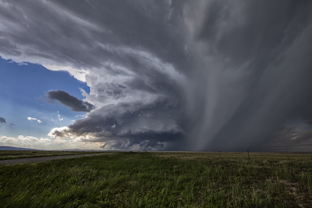
July 20th featured good shear, excellent moisture and instability, and the Palmer Divide to produce storms with upslope flow. Mid afternoon a supercell formed near Simla, Colorado and turn to the south. As it did, it was rotating very strongly and may have produced a couple of broad, weak tornadoes. The lightning was absolutely insane with the supercell and the hail was quite large, up to softball sized! As the storm moved south, it was interfered with by another supercell and the southern storm became the dominant supercell. It moved southeast and eventually collided with northeast moving storm near LaJunta. Over the next 45 minutes it struggled to maintain any intensity until it finally pushed through all the left moving storms. It became tornado warned near Las Animas and had quite strong rear flank winds along with very large hail. We ended up letting it go as we needed to be back in Denver that evening. A great local chase for our tour group and one of the prettier supercells and lightning shows on the season! Enjoy the pics!!!
July 15th Northeast New Mexico Supercell
July 15th had a lot going for it. Strong northwest flow aloft would generate good shear with surface southeast winds. High dewpoints in the 60s at high elevations, would also generate a lot of instability. The upslope flow helped develop a well structured supercell near Wagon Mound, New Mexico. This storm was well structured and also produced huge hail baseball sized. The low levels never could tighten up enough to produce a tornado, however the supercell spun southward toward I-40 near Cuervo. It was severe warned for over 4 hours as it moved towards the south. Eventually we let it go as numerous storms blew up around it and thus reduced its ability to continue to maintain its strength. Fun chase over the plains and canyons of northeast New Mexico and fortunately to road network allowed us to continue chasing it all afternoon and early evening.
July 13th Eastern Colorado Tornado Warned Supercell
July 13th featured a play in eastern Colorado along an old outflow boundary from previous day convection. Storms formed fairly early, by 1pm along this boundary. It didn’t take long for them to become well organized and severe warned. One cell developed an impressive hook on radar and spun strongly. It produced a couple of funnel clouds, but nothing that touched down. Structure was nice, but storms became HP in nature as they moved almost due south in northwesterly flow aloft. Another cell formed southwest of the first and became tornado warned. We blasted towards it since our storm was weakening due to ingesting outflow air from the new storm. As we arrived on the new cell, it was quite messy and never looked like it would produce anything. We stayed with it for a couple more hours until numerous storms exploded between LaJunta and Lamar, CO. At that point, we called it a day and dropped south to our hotel in the Oklahoma panhandle. A fun day and our first supercell came very close to producing a tornado! Enjoy the pics!
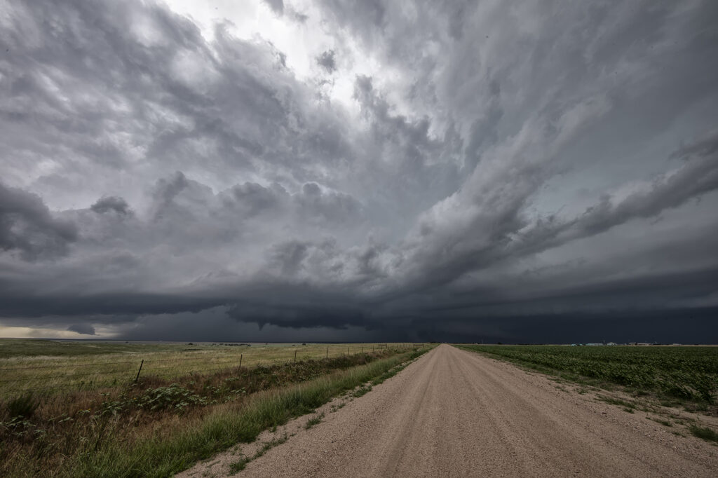
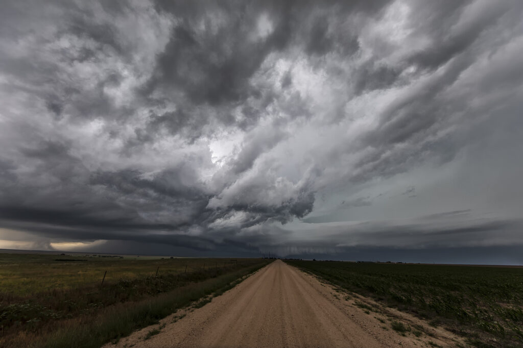
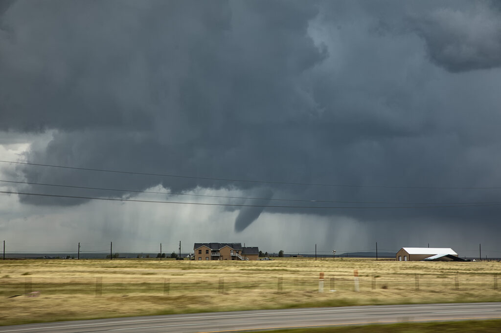
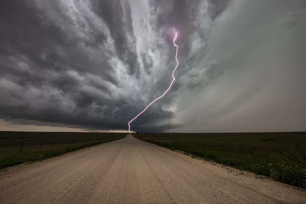
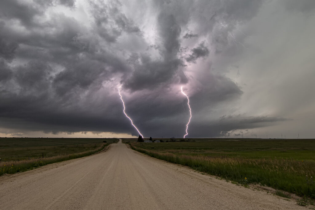
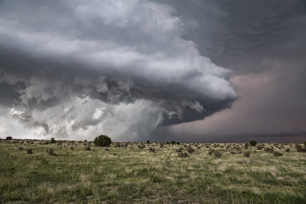
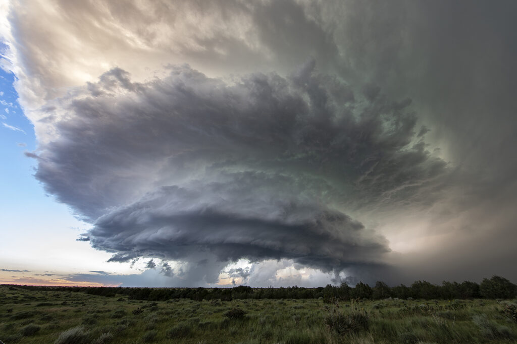
July 8th LaJunta, Colorado Tornadic Supercell
July 8th was the arrival day for our final tour of the year, Tour #9 the Great North Tornado Hunt. Due to the weather forecast that day, we took the group out for a chase in southeast Colorado. A supercell formed east of Colorado Springs late afternoon and spun like crazy all the way to Kim, CO near the New Mexico border. With strong shear, good moisture and instability in place, the storm would become a long-lived supercell and produce hail 3.5 inches diameter, as well as a nice tornado north of Kim that was on the ground for a few minutes. The structure of this supercell was one of the best of 2023! By mid evening it dissipated, so we went back to Denver to get ready for our official start of the tour. A great way to spend arrival day chasing a stunning tornadic supercell! Enjoy the pics!!
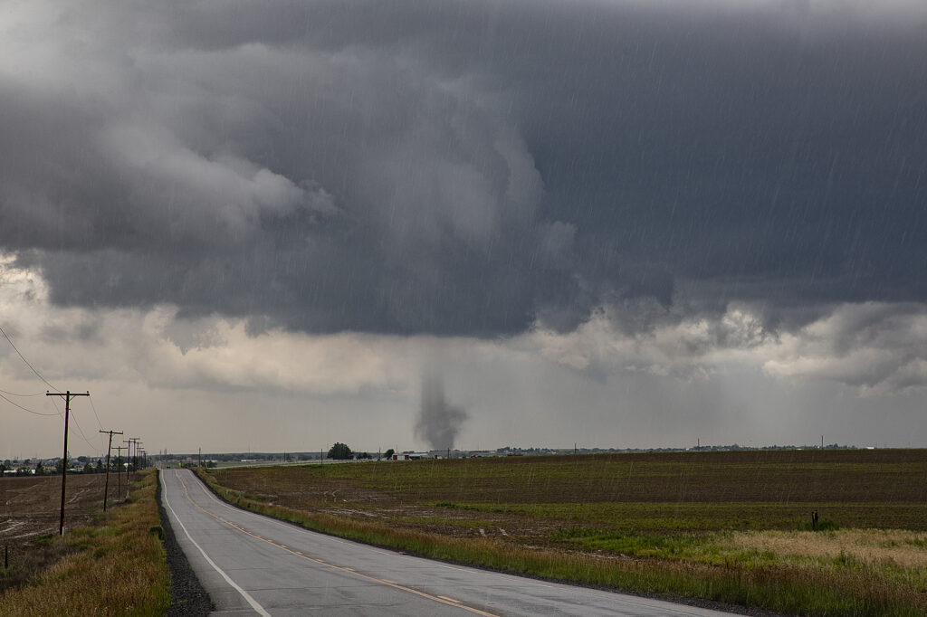
July 6th Aurora/Watkins, CO Tornadoes
It’s always fun when severe weather keeps you in your own backyard! Such was the case on July 6th! A boundary stretched across the Aurora/Watkins areas and by mid afternoon, storms rapidly developed. Soon a tornado formed south of I-70 touching down for a few minutes. About 30 minutes later, a landspout tornado formed along the boundary just northeast of Watkins persisting for several minutes. We stayed with the storms to see if any other tornadoes would form along the boundary, but as if often the case, wind fields were disrupted by ongoing storms, thus lessoning the chance another tornado would occur. Great backyard chase!