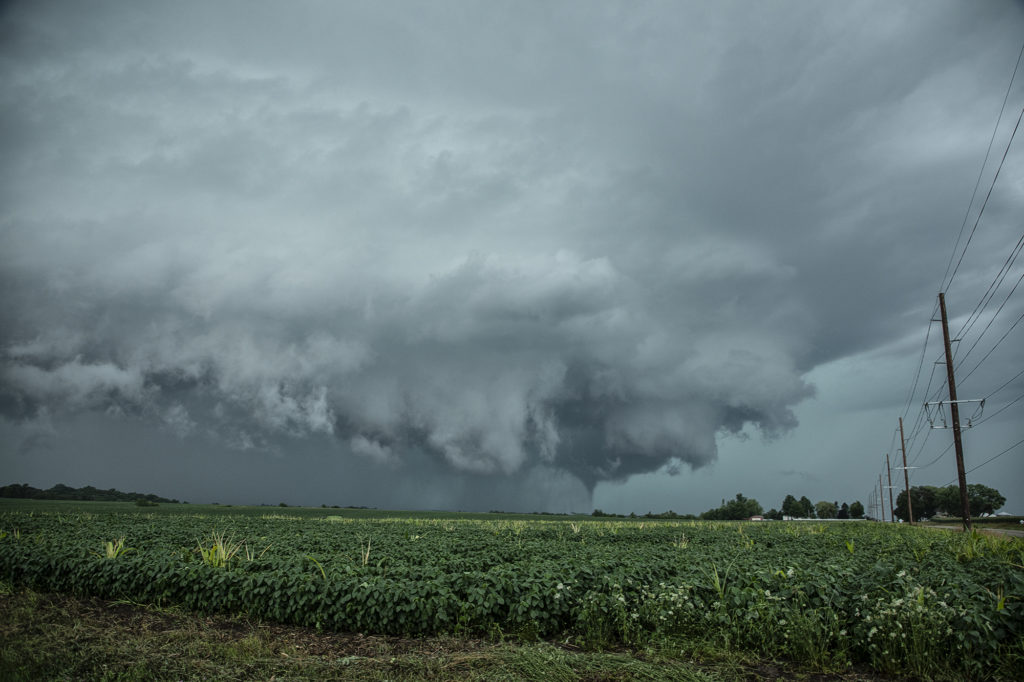
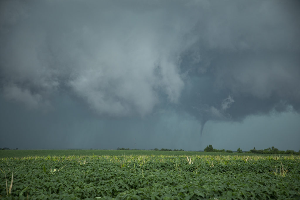
July 14th had it all. Boundary, great moisture, instability and good low level shear. We blasted from Pierre, SD to central Iowa as storms formed and became severe and tornado warned. Several tornadoes did occur in central and eastern Iowa with one particular tornado we just missed by 15 minutes being the most intense near Lake City. Frustrating day to say the least, but we still managed some great supercells and a tornado late in the day. Moral of the story is to NEVER give up until storms are weakening and loss of heating reduce instability.
July 13th Wyoming Supercell
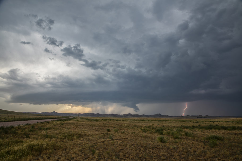
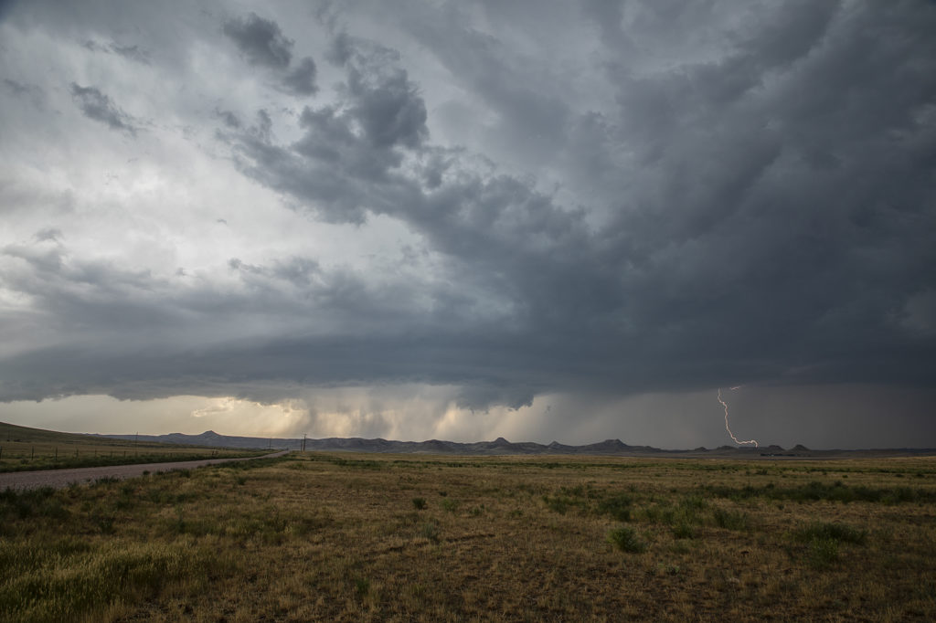
Conditions finally became conducive to severe weather again late on July 13th. Upslope flow into north central Wyoming off the Big Horn mountains would generate severe thunderstorms. Adequate wind shear, instability and moisture would be present for a couple of supercells. One such storm formed just east of Sheridan and tracked southeast to Gillette. It produced tennisball sized hail, high winds and had decent structure. As evening arrived, a complex of storms formed and extended all the way out to near Pierre, SD where we arrived at our hotel at 2am! The next day would take us to Iowa for a potent event! Enjoy the pics!