Tag Archives | 2014

August Monsoon Storms

After our storm chasing tours are over, we head to Arizona to run our monsoon storm tours and workshops. You can find these at our www.southwestphotographytours.com website. Here are some of the incredible images we had this year, including a tornado near Wilcox, AZ! We get a lot of guests from our Silver Lining Tours family that come on our monsoon storm tours, which are called “Desert Thunder”. We’d love to have you! Check them out on our other website.


July 22, 2014 – South Dakota Beautiful Supercell

As if often the case on this particular tour, storm structure and quality was amazing this day. We started in Rapid City and spent the entire day with one supercell that formed early afternoon. This storm rolled over the Black Hills and turned due south into northwest Nebraska where it became tornado warned. It did not produce a tornado, but the structure was simply a photographers delight! It produced very large hail and an incredible amount of lightning. This was our last tour day of 2014, and a fantastic way to finish the season!


July 18, 2014 – Western Kansas Tornadic Supercell

An amazing supercell with a landspout tornado was witnessed this day. We started the day in Denver and didn’t have far to go as storms exploded along a dryline/outflow boundary intersection in northwest Kansas. Good shear, moisture and instability allowed a rare mid July supercell to develop. We were on this storm from the time it was a towering cumulus cloud. The structure was fantastic. It also became quite electrified as it right turned due south towards Goodland, Kansas. By dark it was sparking away and still going. This storm also produced baseball sized hail along its path!


July 16, 2014 – Texas Panhandle Tornadic Supercell

Usually in July our Great North Tornado Hunt is in the Dakotas and even Canada, but not this year. July 16th was a pretty decent set up south with respectable moisture, instability and shear for this late. Storms formed along a dryline in the western Texas panhandle and also along an old outflow boundary in the northern panhandle. It was the latter storms that were the best, becoming tornado warned and producing a weak EF0 tornado that destroyed a barn. Structure was very nice and the lightning as well! Guests enjoyed this storm immensely !


June 27, 2014 – Southwest Kansas Supercell and Landspout Tornado

June 27th had decent potential with a dryline extending along the Kansas/Colorado border, with moisture pooling east of it. Moisture however never did get very deep and the result was large temperature and dewpoint spreads resulting in high cloud bases. However with steep lapse rates in place and developing storms along the boundary, a decent supercell formed with a weak landspout in its initial stages. We got what we figured we would with this set up and everyone was excited with the results!


June 24, 2014 – Southeast Wyoming Hailstorm

Wasn’t expecting much this day, but nature surprised us with a nicely structured supercell northeast of Cheyenne. This storm spun nicely with the marginal shear in place, and decent moisture and instability resulted in a hailer producing stones to baseball sized! We were quite surprised how big they were when we drove under the vault region of the supercell. We stopped traffic heading into it and warned of the huge hail. Most people responded by staying back till the storm passed. Nice surprise indeed!


June 18, 2014 Central South Dakota Tornado Outbreak

June 18th was an incredible day in South Dakota! Superb moisture, instability and shear was moving northwest from Nebraska and pooled along a cold front.  By mid afternoon numerous storms formed along the boundary and merged into a squall line.  This was a bit disheartening to see, but we stayed with the tail end and eventually, as the better shear arrived, supercells formed and produced at least 8 tornadoes we witnessed including a couple of strong tornadoes near Wessington Springs, SD. These storms were amazingly electrified and had great structure as well. We had two different times when we had 2 tornadoes on the ground together. The final set of twins were the last two tornadoes of the event and very photogenic. What an amazing 3 day period we had, were we witnessed nearly 15 tornadoes!


June 17, 2014 – Eastern Montana Record Tornado

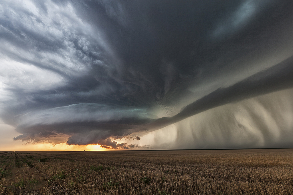
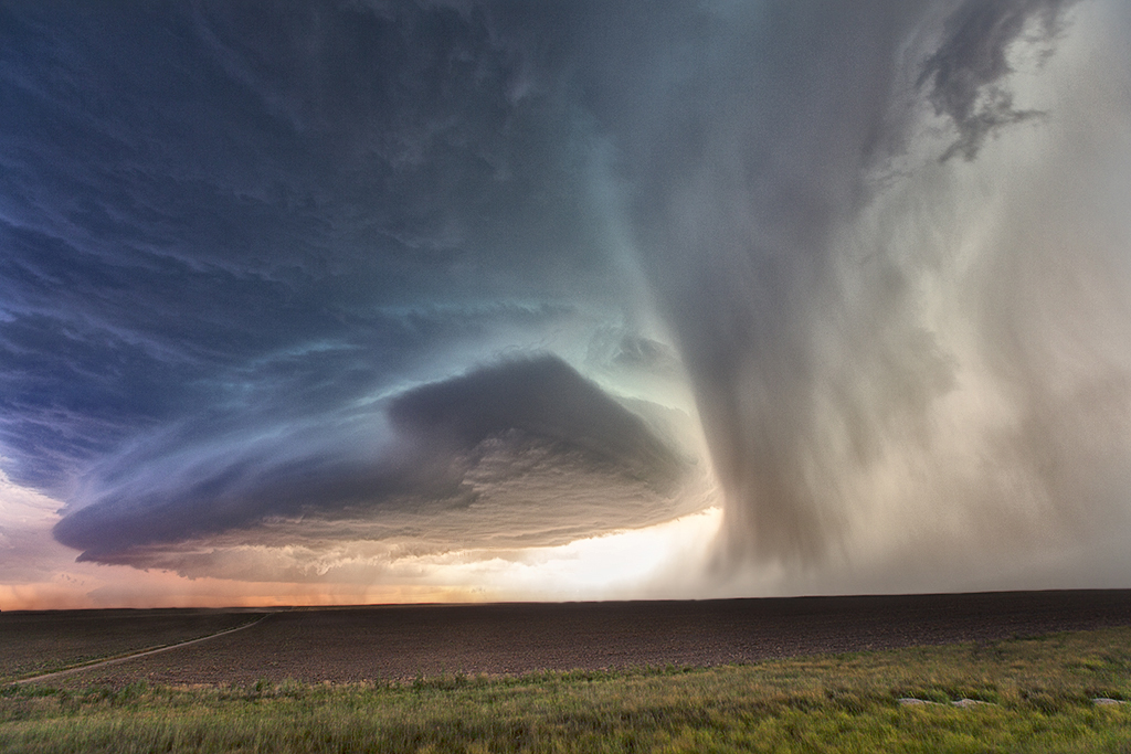
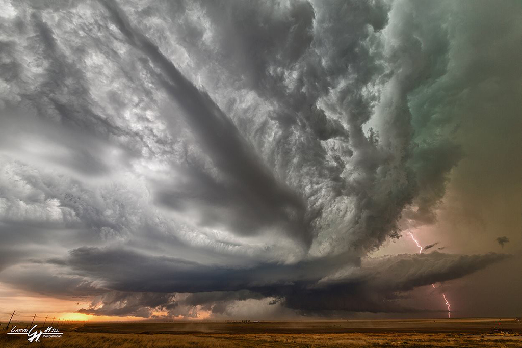
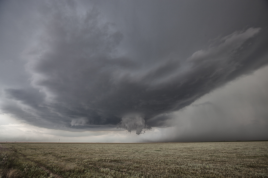
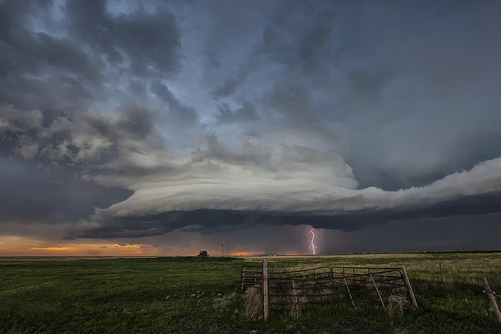
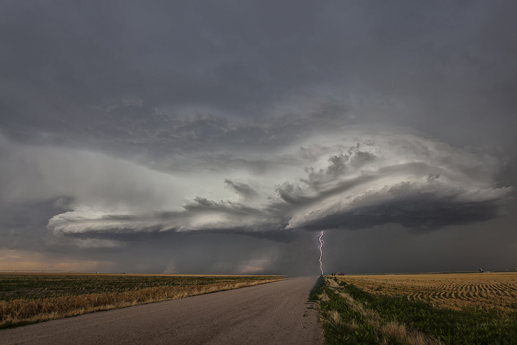
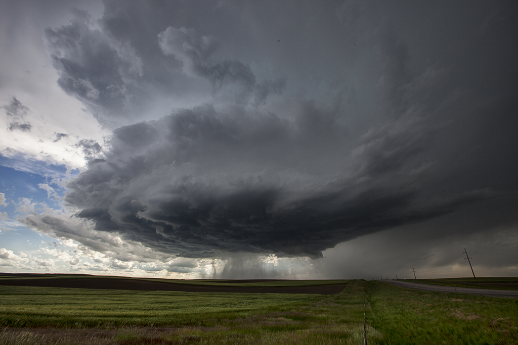
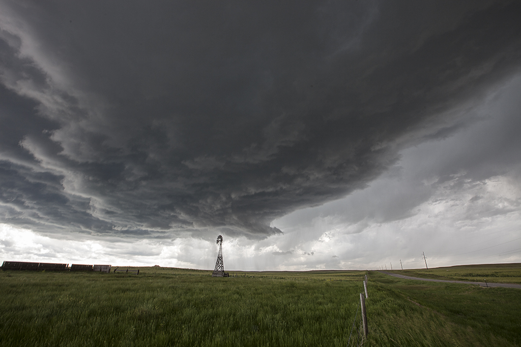
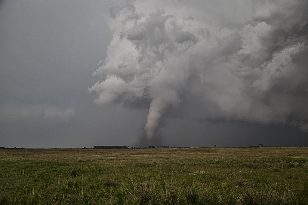
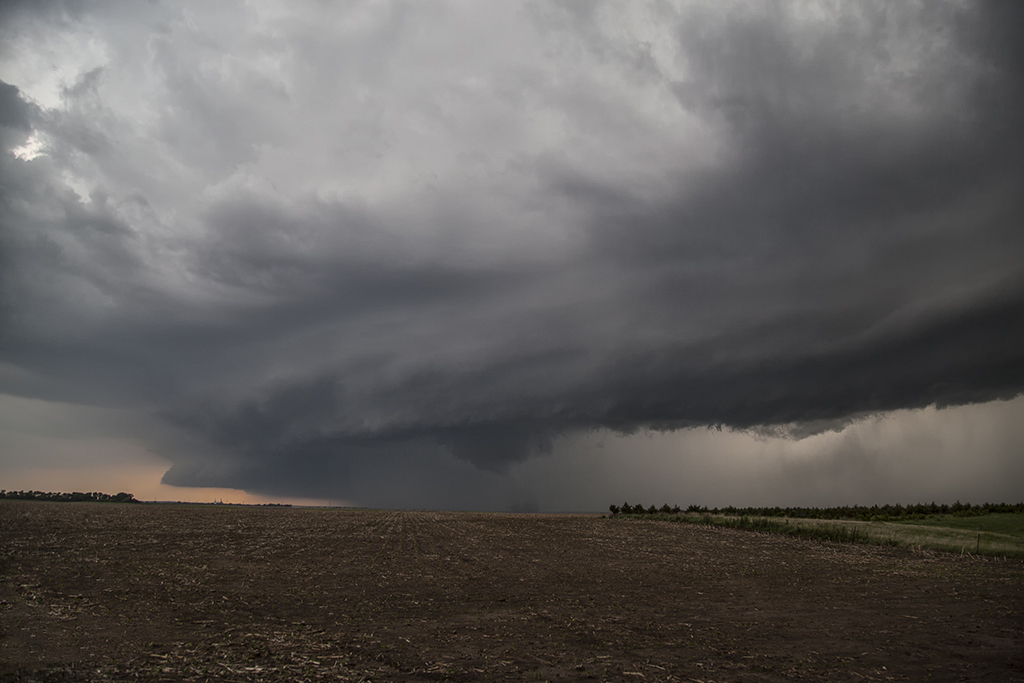
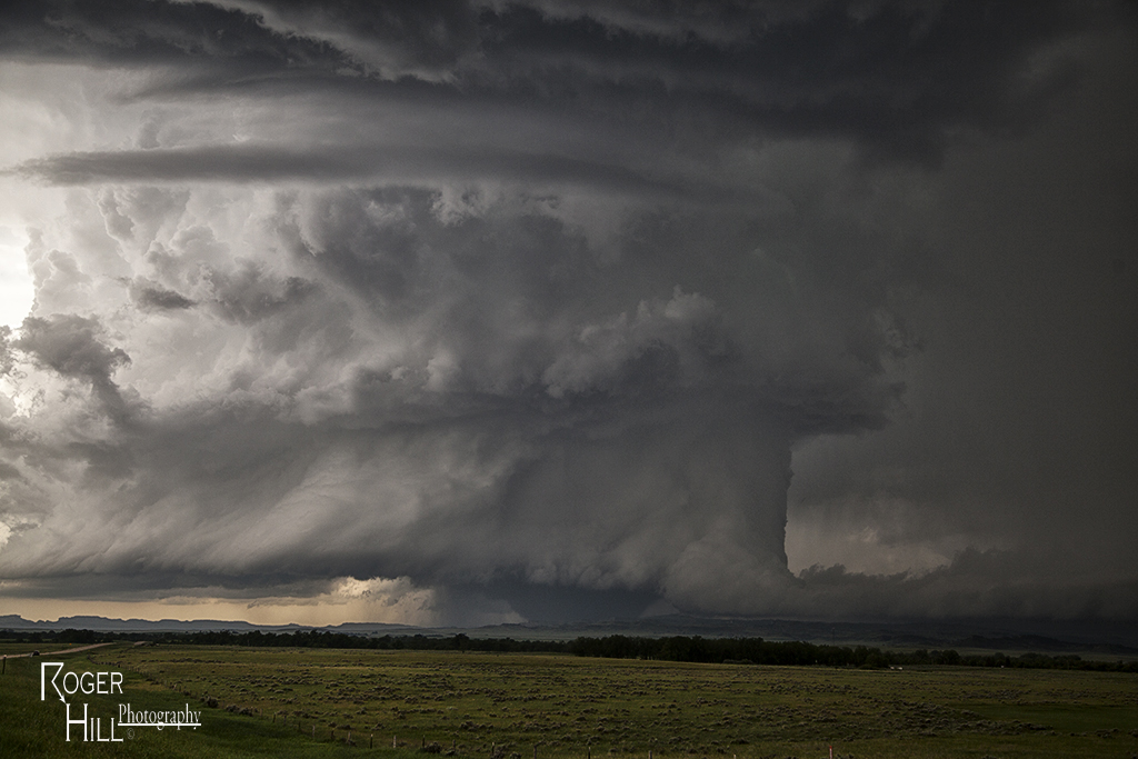
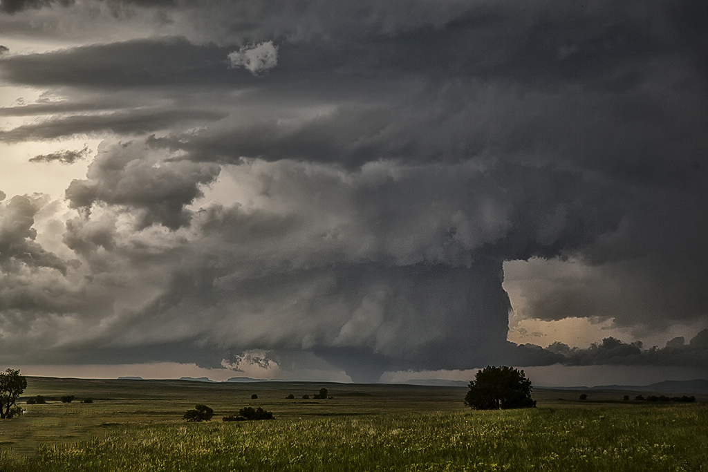
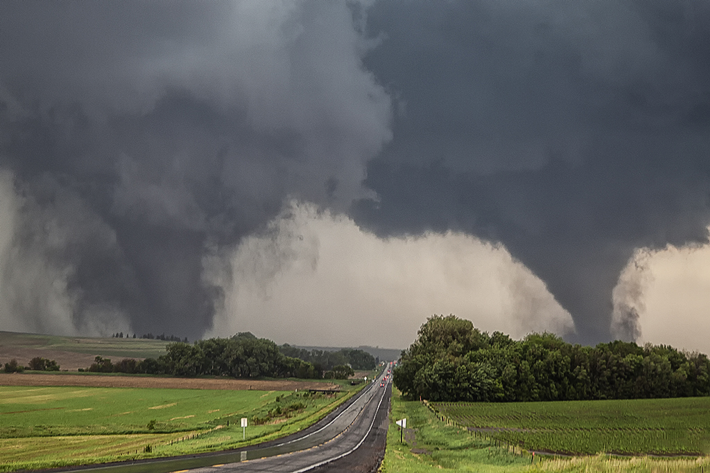
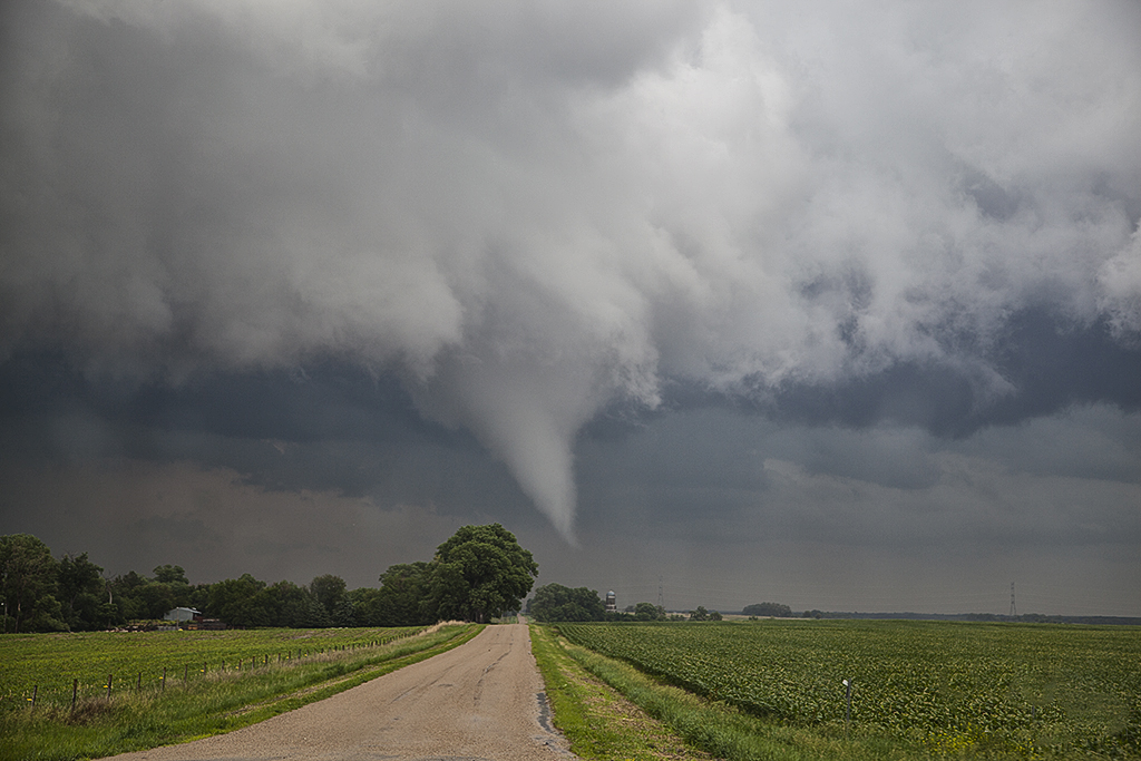
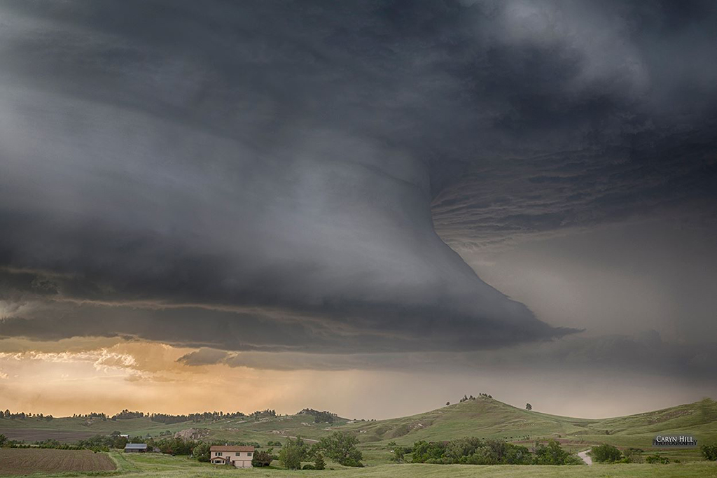
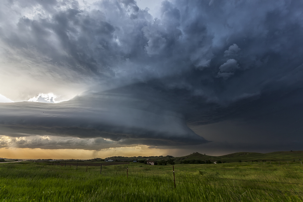
June 17th was a tough day to forecast. It was clear there were two targets, northeast Nebraska again, or far western South Dakota/eastern Montana. After analyzing both, we decided to head to western South Dakota. In the end both areas produced several tornadoes, however the largest and most powerful tornado ever recorded occurred in southeast Montana and we were privy to watch the event from a safe and spectacular distance! Very strong shear, dewpoints near 70 (unheard of for Montana!), high instability and convergence along the dryline set the stage there for violent supercells and strong tornadoes. By early afternoon the storm of the day formed near Capital, Montana as it sat and steadily intensified. We were racing trying to get there in time (VERY early initiation!!!!) , and managed to catch the tornado and supercell at its strongest and prettiest stages! The result was a nearly mile wide wedge tornado that was rated EF3 (Very high for a remote region!)  and was on the ground for nearly an hours time. Fortunately it dissipated just before reaching Camp Crook, SD or the destruction would have been severe.


June 16, 2014 Northeast Nebraska Tornado Outbreak

First, our heart felt sympathy goes out to those who suffered losses on this day. When we awoke on the morning of June 16th, I had butterflies in my stomach. I knew there would be potential for strong to violent tornadoes in Nebraska. Unfortunately those fears were realized as at least a half dozen strong or violent tornadoes would ravage the area east of Norfolk. The town of Pilger would be particularly hardest hit. We spent a good chunk of the day around Columbus analyzing data and watching things unfold.  With a temp of 83 and a dewpoint of 78, stiff east winds buffeted the area along a warm front. Conditions were ripe for powerful supercells and tornadoes. Mid afternoon storms formed along and north of the warm front. They moved into colder air and weakened. We knew it wouldn’t be long before storms would form along the warm front and ride it eastward with extreme shear. Southeast of Norfolk the first tornado formed and tracked near Stanton. Another tail end cell developed and produced the rest of the tornados this day with twin EF4 tornadoes destroying Pilger and other locations northeast of there. We watched from the back side of the tornadoes, about 1-2 miles east of us as the event unfolded. An event we’ll never forget! Tornadoes of every shape, size and strength occurred. The last time twin violent tornadoes occurred so close together was nearly 50 years ago! Amazing, and devastating to say the least!


June 13, 2014 – Nebraska Beautiful Supercell

June 13th appeared to be a decent chase day. An approaching shortwave would induce a lee cyclone that would in turn draw moisture northward into western Nebraska. A developing dryline would be the focus for several storms that would form. We played the tail end storm as it developed eastward and spun very hard. Due to fairly high cloud bases, this storm became a tad outflow dominant and never could produce a tornado. It was tornado warned twice in it’s life cycle. It did have very pretty structure and also produced very large hail and high winds. The sandhills of northwest Nebraska provide an amazing foreground for storm photography!