Didn’t think much would happen in the daylight on May 31st. A strong capping inversion in place, as well as a mistimed upper wave seemed to lead to elevated late evening storms. Once in awhile though, nature loves to throw a wrench into things. By early evening initiation occurred along a boundary near Emporia, Kansas. An outflow boundary/dryline intersection would spawn a gorgeous supercell that rapidly intensified and even became briefly tornadic. As the storm slowly drifted east towards Madison, KS, the structure and electrification became quite pretty. Somewhere in the night skies a long snaking funnel came down that a couple of chasers said touched down. We stayed with it for awhile, but had to leave to get to our hotel in Salina, as we needed to be in Colorado the next day. A beautiful supercell, great structure and superb lightning!

May 26, 2026 Del Rio, Texas Tornadic Supercell
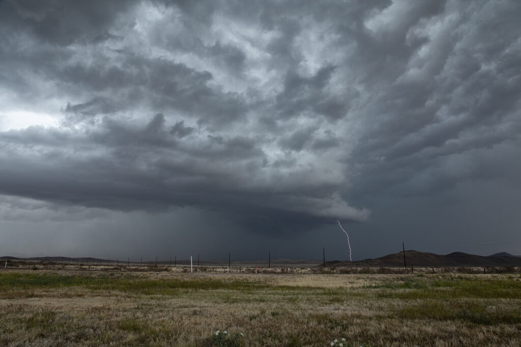
A very interesting day on May 26th. As often occurs, storms formed on the north side of the Del Burro mountains in northern Mexico. As they became supercells they right turned and never came across into the US. However, another supercell formed on the northeast side of the supercell cluster in Mexico. This storm quickly developed a strong velocity couplet and dropped a substantial tornado not far from Acuna, Mexico. As it finally approached the border, it became outflow dominant and still produced significant winds. It’s such a shame that we had to wait in the US side for this tornadic supercell to approach. It’s just too difficult to try and chase in Mexico. The tornado pic here was from a local resident of Acuna. What an amazing shot!
May 24, 2026 Tabor, South Dakota Supercell
A long drive was in store for the Prime Time Minitour for day 1! Supercells were forecast to develop over southeast South Dakota. Tornado threat wasn’t much, but it was sure to be a structure day. It did not disappoint! The group left at the crack of dawn for the 650 mile drive up to South Dakota. They were able to see the entire development of the best storm of the day near Tabor. Structure got better as the storm matured, drifting slowly southeast. After a few hours of viewing, it was time to call it a day and get ready for another chase. Just a beautiful higher based supercell! Worthy of the trip!
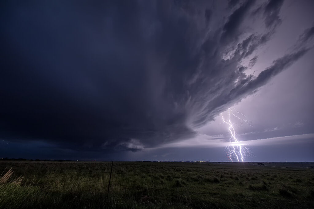
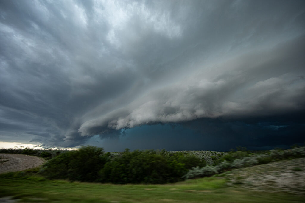
May 21, 2026 Anton, Colorado Tornadic Supercell
May 21st took us to Colorado. Between upslope into the Palmer Divide, as well as an outflow boundary, most models had storms forming near Limon, before intensifying and moving east. That is pretty much what happened. A supercell formed near Deer Trail and moved east, gaining strength and becoming tornado warned. Good shear, but relatively cool surface temps kept this from being a major event, but the storm still produced softball sized hail, several funnel clouds and one brief tornado south of Anton. As it continued to move east, it encountered cold air with temps in the 50s and became an elevated hailer. Eventually near Burlington it weakened as instability waned and nocturnal cooling set up. A fun time was had by all the guests as the structure was quite nice and the funnels fairly close with the road network being sparse. Enjoy the pics!!

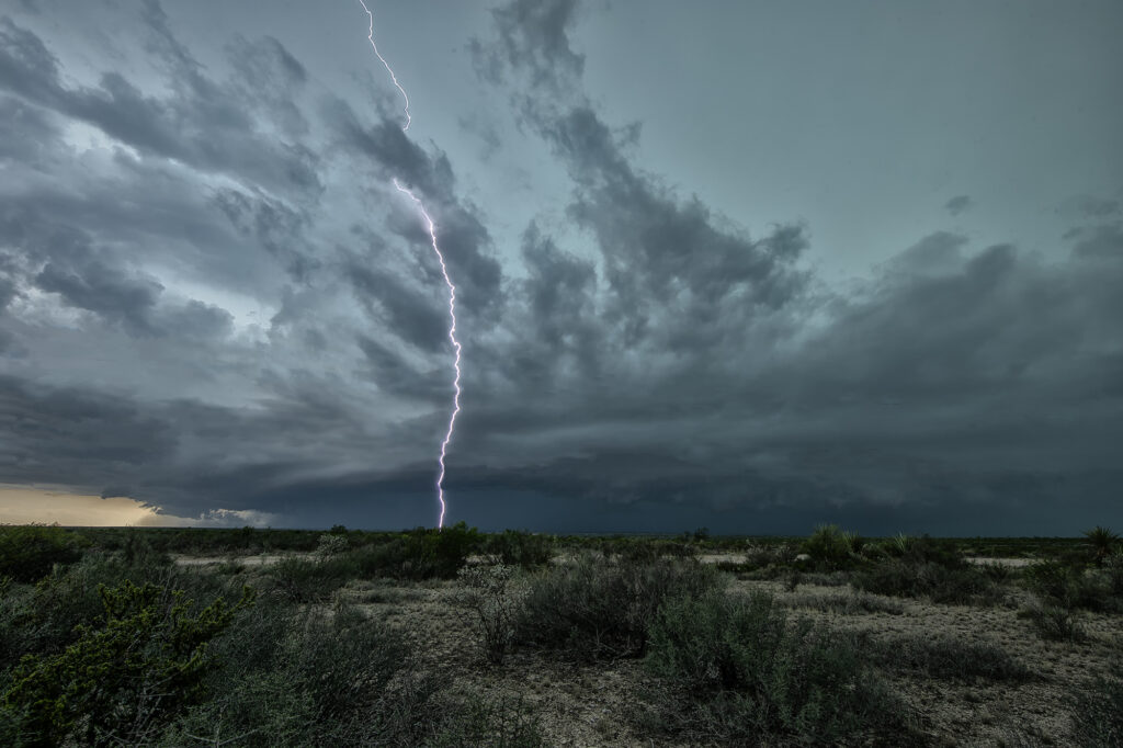
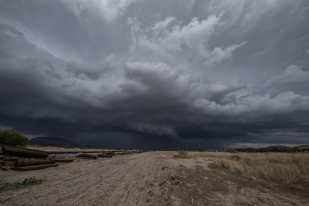
May 20, 2026 Davis Mountains Supercell
May 20th the environment was not overly conducive to supercell thunderstorms. Overnight stratus generated from elevated storms, covered the area and kept it pretty cool. Due to this low level cloud cover, we headed south from Ft Stockton to the David Mountains where the elevation is much higher. When we arrived skies were clearing instability was building. Storms formed over the mountains and eventually intensified and moved off of them to the east. One storm became a supercell, warned for big hail and high winds. As it moved it, it’s gust front blew up a lot of dust. There were many gustnadoes, which could have fooled people into thinking they were real tornadoes. Eventually the storms gusted out and weakened. A fun day, with better results than anticipated! Enjoy the pics!!!
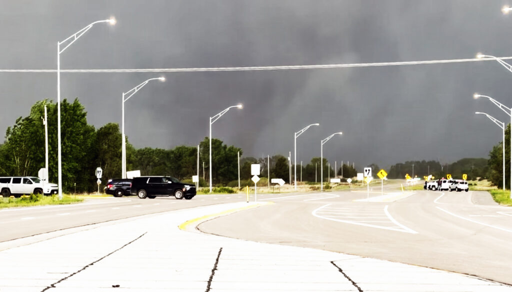
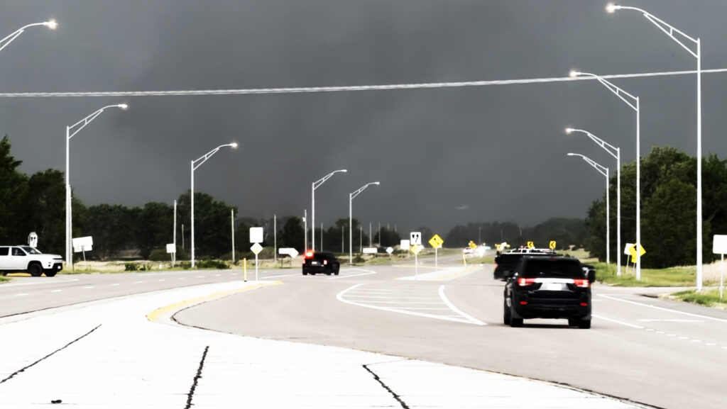
May 18th Northern Kansas Tornadic Supercells
May 18th was a good set up in Kansas. An outflow boundary laid across north of I-70 and a dryline stretched north/south along US highway 81. A significant supercell formed north of Salina and moved northeast, producing at least a couple brief tornadoes. Other supercells formed along the triple point and also became tornado warned. We chased SEVEN different supercells that had tornado warnings. The biggest problem this day wasn’t just the fact there was a lot of seeding going on, it was the shear number of chasers that were in the area. Sooner or later there will come a day when a large tornado hits a line of chasers and causes a lot of problems. Sometimes, it pays to stay back a bit and let the chaser hoards get close. But, great shear an 70 dewpoints certainly allowed for numerous tornado warned supercells to form. A few weak tornadoes did occur, and a few look a likes also that were reported as tornadoes, and were not. Enjoy the pics please!!
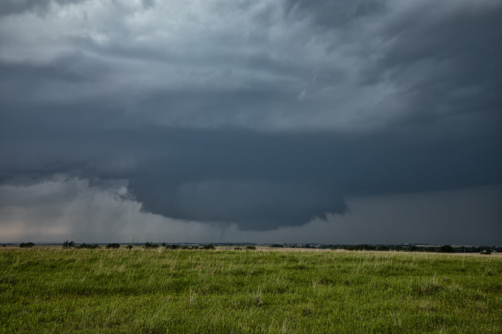
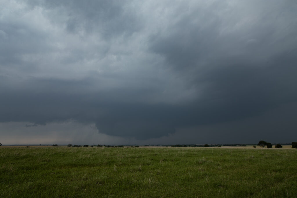
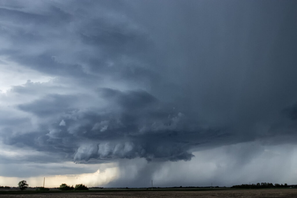
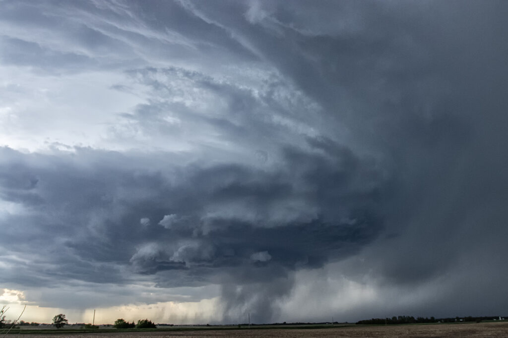
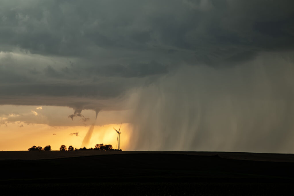
May 17, 2026 St Libory, Nebraska Violent Tornado
May 17th had a lot going for it. Great shear, good moisture and instability and a triple point just to the west of Grand Island, Nebraska would set the stage for intense supercell development. As storms formed near the triple point, they were just on the cool side of the boundary. Anchoring in that spot, one cell latched on to it and started to spin. Soon a tornado warning was issued. As we had to reposition, the storm quickly became tornadic and produced a high end EF3 tornaddo near the small town of St Libory. We couldn’t get back in front of it and had to watch the tornado from the poor contrast side to the south. Soon the storm rapidly weakened and we dropped south to chase other tornado warned storms. A wild day and some crazy moments. Our hearts and prayers go out to those affected by this strong tornado.
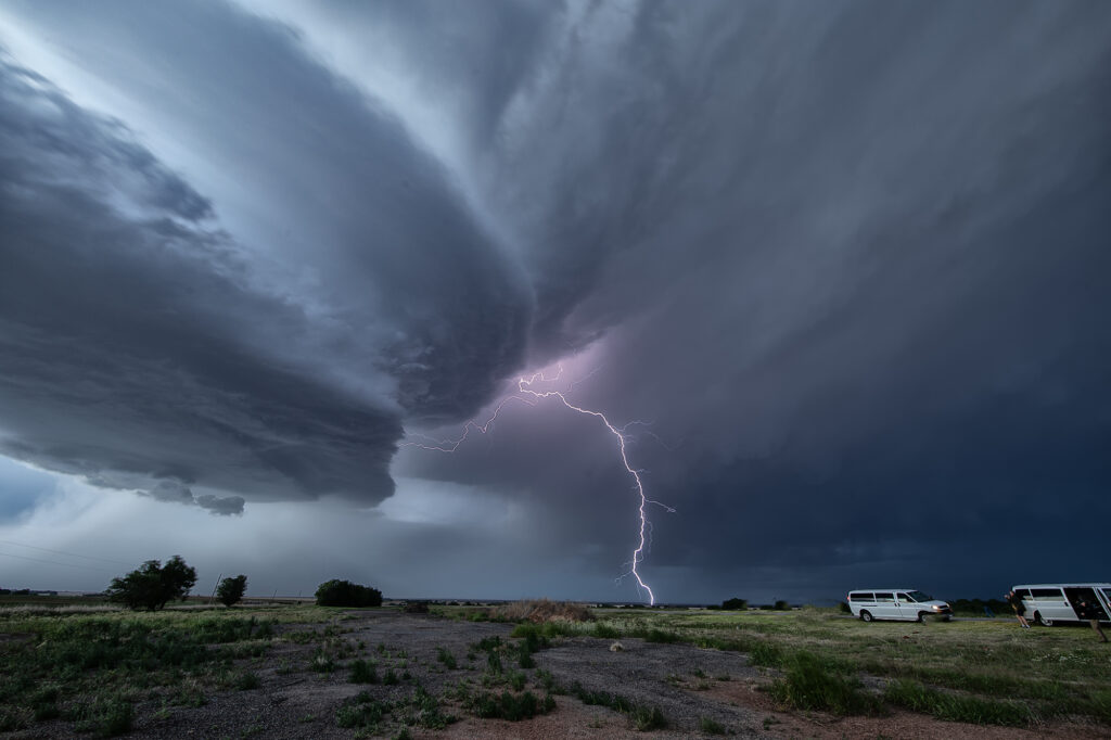
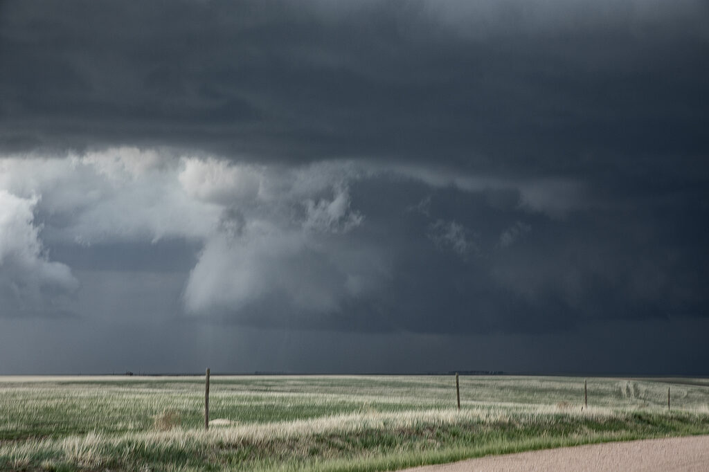
May 16, 2026 Goodland, Kansas Tornado Warned Supercell
A triple point surface low over northwest Kansas would provide the convergence needed to fire off supercell thunderstorms this day. One storm formed northwest of Goodland and meandered east/southeast becoming a prolific hailstorm. Lack of real quality moisture would prevent tornadoes from occurring, however, as a left split from a storm over Rush county raced north, it collided with our storm and caused it to spin. A tornado warning was issued and a wall cloud formed, also spinning. Due to the higher based nature of the storm, it did not produce a tornado. As it moved east, more storms formed as a complex eventually developed that had winds up to 90mph in it! We raced east to get ahead and were treated to a sunset beast that also tried to become tornadic. An awesome day, great storms and lightning, as well as a tornado warning. Enjoy the pics!!!
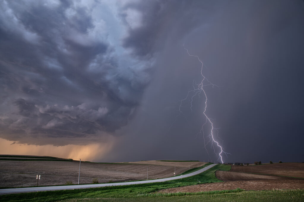
May 15, 2026 Western Iowa Tornadic Supercell
May 15th took us into Iowa. An old outflow boundary/cold front intersection would be our target in northwest Iowa. Plenty of shear, modest moisture and instability would support severe storms, with some tornado threat. We caught several storms, but one, west of Ida Grove, would produce a short-lived tornado. This storm was also an electrified beauty! Several CG strikes occurred per minute, and everyone’s cameras were clicking away! I managed to get a few decent ones as well. A fun day, tons of storms and a brief tornado to boot! Enjoy the pics!
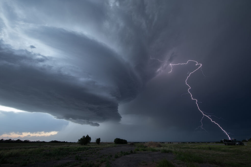
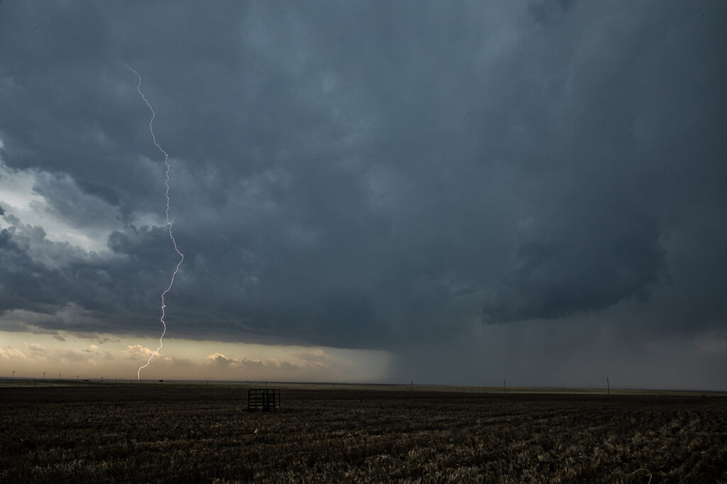
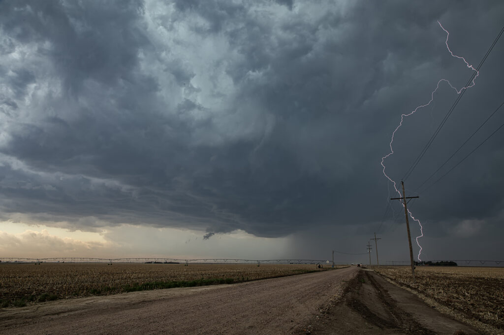
May 9, 2026 Sayre, Oklahoma Gorgeous Supercell
May 9th looked like a day where things just weren’t in sync. Good shear and lift were in place, but poor moisture with moderate CAPE were also in play. We targeted southwest Oklahoma where there was a bit higher moisture, however it was very thin. Storms blew up along a boundary near I-40 and became severe. They were fairly high based, but with good shear and steep lapse rates, they rained down hail to baseball size. We blasted north to catch the tail end storm as it moved into western Oklahoma. It hit the theta-e axis and rapidly strengthened. As it moved southeast towards us, structure steadily improved. We stayed with it till after sunset as it started producing copious amounts of CGs. Finally, it weakened around 10pm so we left and made it to the hotel before midnight. A great day with arguably the best structure of this young 2026 season! Enjoy the pics!!!