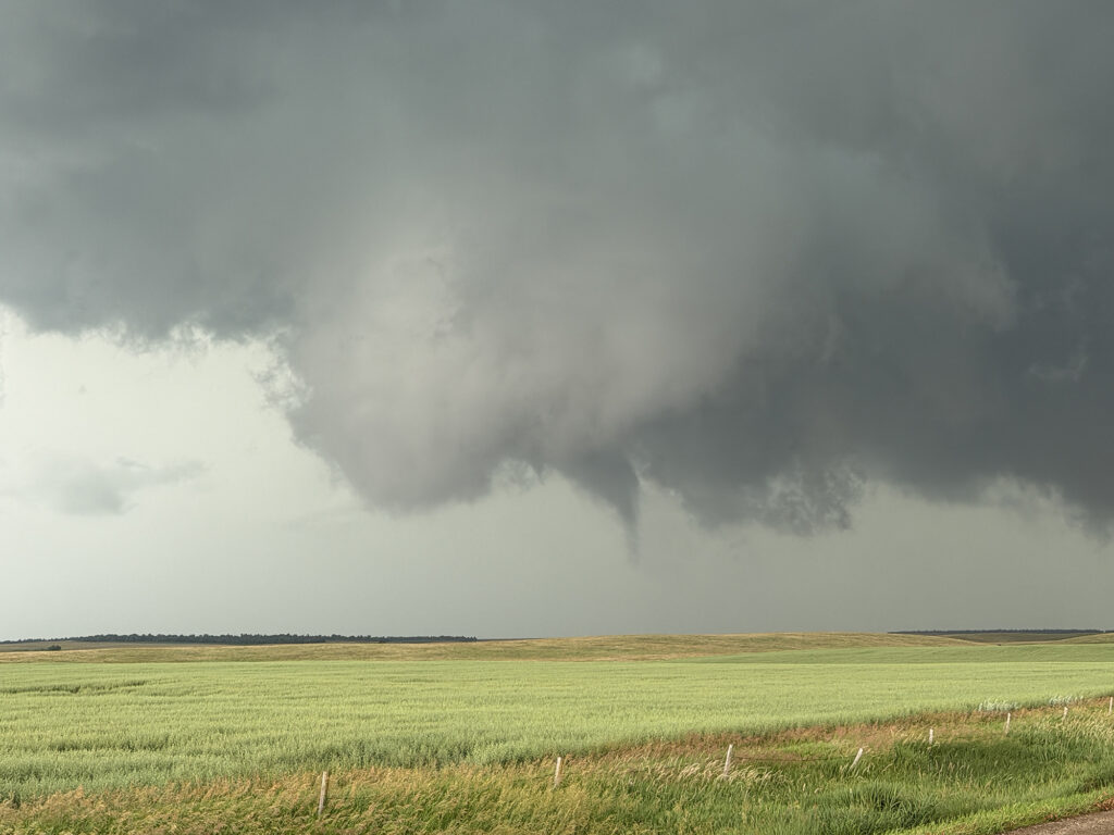
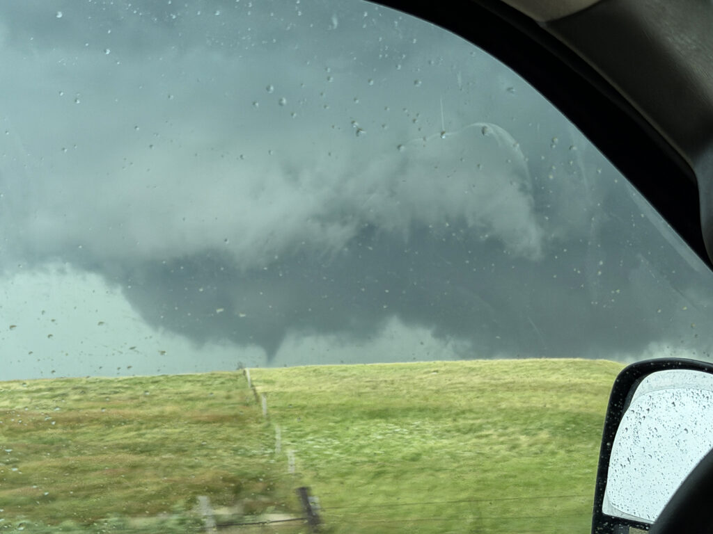
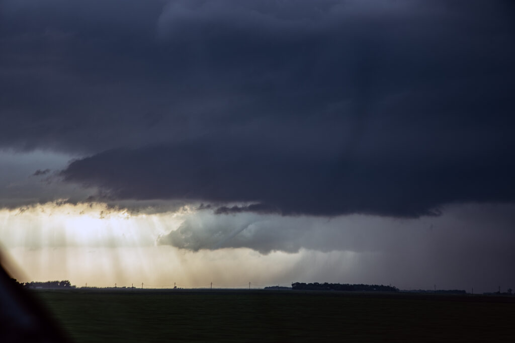
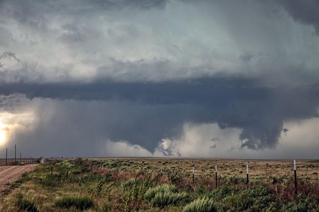
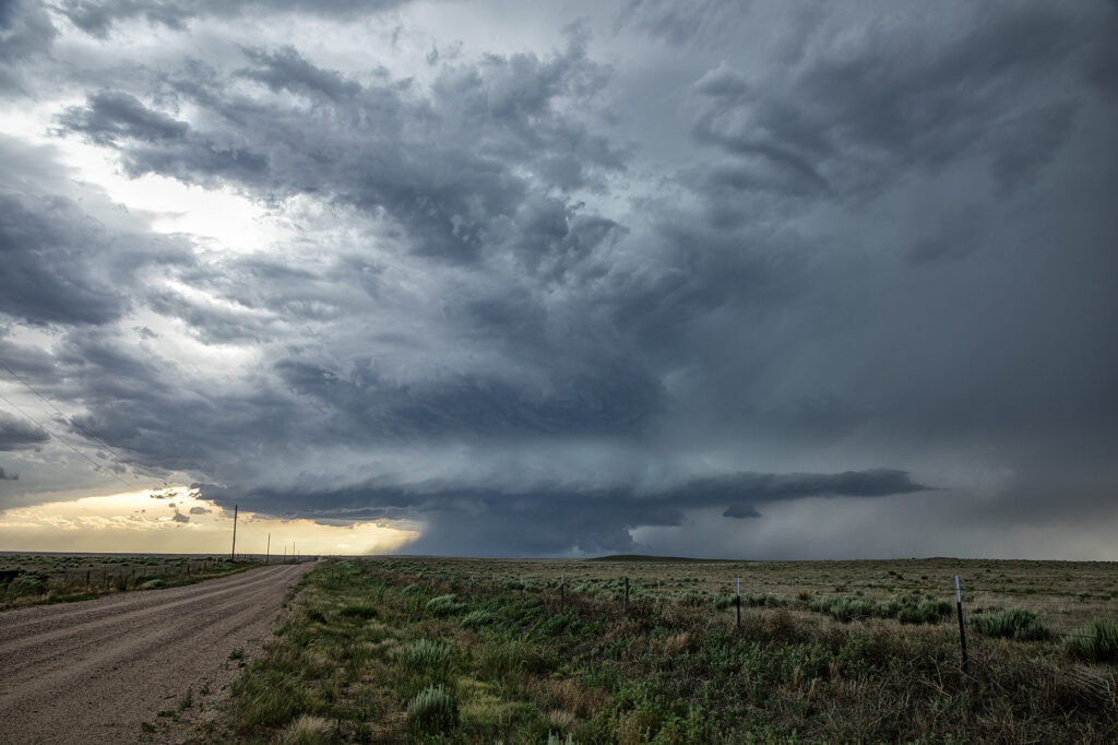
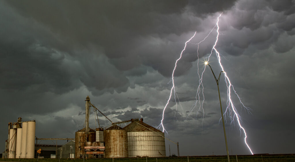
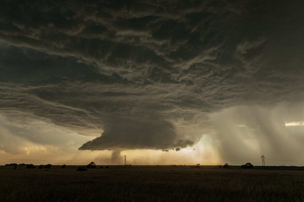
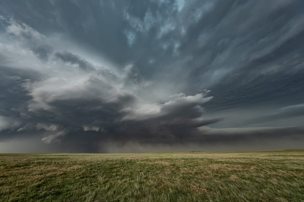
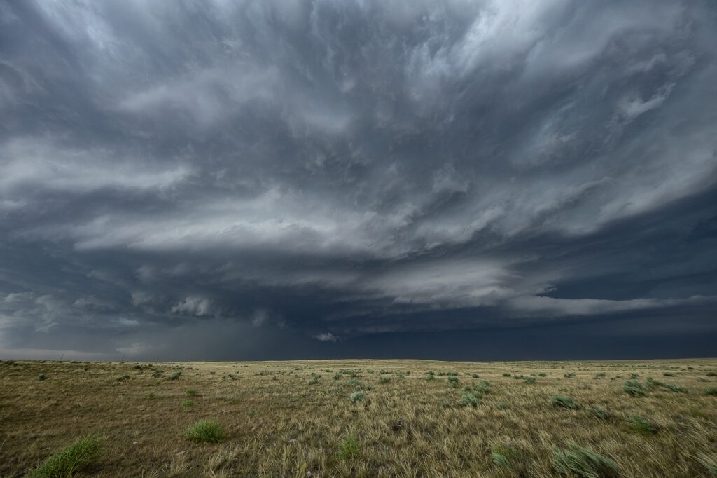
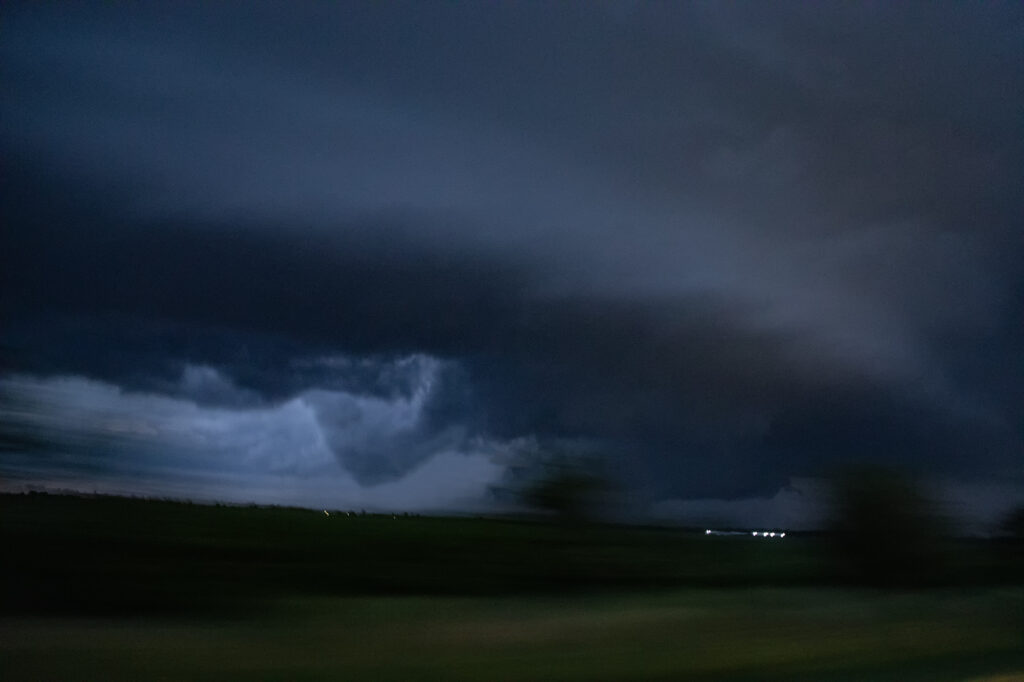
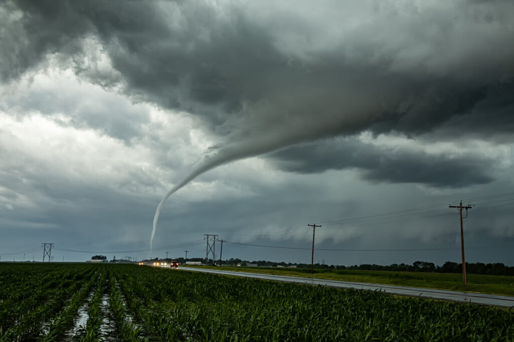
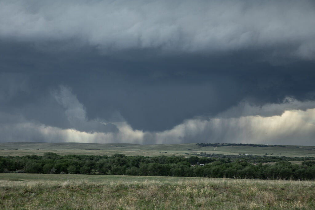
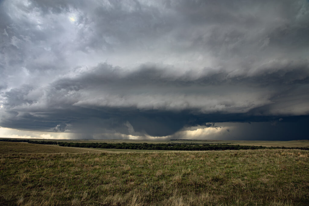
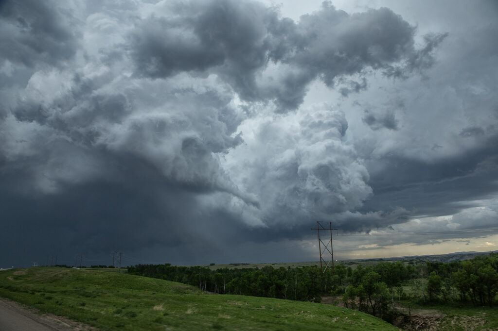
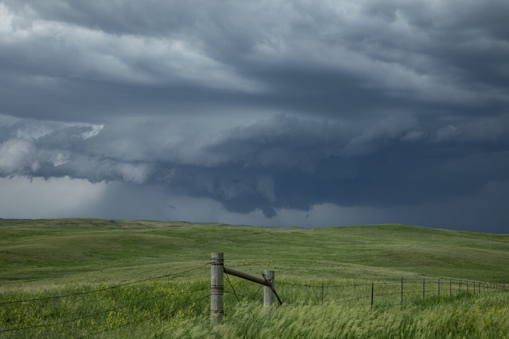
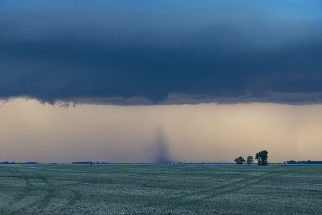
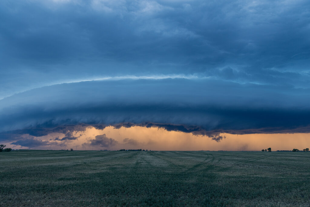
Tag Archives | twister

March 13th Rossville, Kansas Tornado

March 13th saw our first ON CALL tour of 2024 take place. We chased the 13th and 14th and intercepted either tornadic supercells or tornado warned supercells both days. March 13th took us to central/eastern Kansas to play the warm front/dryline triple point. Most models suggested storms would form there and also along the warm front. And they did both! We jumped on the first strongly rotating supercell east of Alma and watched it intensify and become tornadic after dark. A second supercell to our west also became tornadic near Alta Vista. Unfortunately, since we were committed to the initial eastern cell, we could not make it back west to play the Alta Vista cell. As our cell crossed I-70 west of Topeka it became tornado warned with two large cone funnels extending halfway to the ground. The eastern funnel touched down and became a tornado which lasted close to 10 minutes near the town of Rossville. We stayed with the storm all the way to Hoyt, where a tornado was also reported. We could not confirm one as anything was completely rain wrapped.

March 14th we chased in eastern Oklahoma and western Arkansas and intercepted several tornado warned storms. No tornadoes were confirmed, however hail nearly grapefruit sized occurred. We ended up near Atoka, OK at the end of the day chasing a tornado warned storm just north of town.

Overall, a great way to start the 2024 chase season!!!!

July 29th Adams County, Colorado Tornado

A DCVZ (Denver Convergence Vorticity Zone) boundary set up with good southeast winds along and north of the Palmer Divide in east central Colorado. As surface winds wrapped around the north side of the Palmer Divide, a Denver cyclone formed. By mid afternoon cumulus towers formed along the boundary. One such tower developed into an intense thunderstorm and spawned a landspout tornado north of our house. Caryn, doing a local chase, intercepted the storm as a mature landspout was visible from many miles away. It stayed on the ground for several minutes before lifting. The tower cam at Denver International Airport even picked it up clearly!

July 20th Southeast Colorado Tornado Warned Supercell

July 20th featured good shear, excellent moisture and instability, and the Palmer Divide to produce storms with upslope flow. Mid afternoon a supercell formed near Simla, Colorado and turn to the south. As it did, it was rotating very strongly and may have produced a couple of broad, weak tornadoes. The lightning was absolutely insane with the supercell and the hail was quite large, up to softball sized! As the storm moved south, it was interfered with by another supercell and the southern storm became the dominant supercell. It moved southeast and eventually collided with northeast moving storm near LaJunta. Over the next 45 minutes it struggled to maintain any intensity until it finally pushed through all the left moving storms. It became tornado warned near Las Animas and had quite strong rear flank winds along with very large hail. We ended up letting it go as we needed to be back in Denver that evening. A great local chase for our tour group and one of the prettier supercells and lightning shows on the season! Enjoy the pics!!!

July 8th LaJunta, Colorado Tornadic Supercell

July 8th was the arrival day for our final tour of the year, Tour #9 the Great North Tornado Hunt. Due to the weather forecast that day, we took the group out for a chase in southeast Colorado. A supercell formed east of Colorado Springs late afternoon and spun like crazy all the way to Kim, CO near the New Mexico border. With strong shear, good moisture and instability in place, the storm would become a long-lived supercell and produce hail 3.5 inches diameter, as well as a nice tornado north of Kim that was on the ground for a few minutes. The structure of this supercell was one of the best of 2023! By mid evening it dissipated, so we went back to Denver to get ready for our official start of the tour. A great way to spend arrival day chasing a stunning tornadic supercell! Enjoy the pics!!

July 6th Aurora/Watkins, CO Tornadoes

It’s always fun when severe weather keeps you in your own backyard! Such was the case on July 6th! A boundary stretched across the Aurora/Watkins areas and by mid afternoon, storms rapidly developed. Soon a tornado formed south of I-70 touching down for a few minutes. About 30 minutes later, a landspout tornado formed along the boundary just northeast of Watkins persisting for several minutes. We stayed with the storms to see if any other tornadoes would form along the boundary, but as if often the case, wind fields were disrupted by ongoing storms, thus lessoning the chance another tornado would occur. Great backyard chase!

June 28th Kimball, Nebraska Large Tornado

June 28th had a lot going for it. Good moisture, strong instability, superb wind shear and the upslope play of the Laramie Range in southeast Wyoming. A supercell formed mid afternoon and became an electrified beast! As the storm spun east/southeast, it produced huge hail baseball sized, but never really was a tornado threat. As it moved into far southwest Nebraska, it encountered better moisture which allowed the cloud base to come down. That helped the storm tap into greater low level wind shear and develop rotation. A couple of funnels occurred before a rather large, dusty tornado formed about 8 miles south of Kimball. The tornado was on the ground for over 10 minutes as it moved slowly southeast.  The storm continued to spin strongly off the Cheyenne Ridge into far northern Colorado. It weakened for a time and then reintensified east of Sterling. It continued its slow march to the east, now producing huge hail and flash flooding. We let it go at that point and went to the hotel after shooting lightning for awhile. Crazy fun day and thankfully the large tornado stayed over open lands. Enjoy the pics!!!

June 26th Big Horn Mountains, Wyoming Supercell and Brief Tornado

The first day of Photo Tour #3 took us to northeast Wyoming to chase the upslope play into the Big Horn mountains. Storms formed early afternoon and struggled to come off the higher terrain for a couple hours. A very low hanging, rotating wall cloud occurred west of Buffalo, WY and produced a 3 minute weak tornado on the top of a mountain! Quite the sight to see! As the storm came off, it became a pretty LP supercell and spun to the southeast, south of Gillette, WY. It eventually dissipated as another supercell formed north of Casper, WY. This cell was rotating nicely and produced a couple of funnels as it moved towards the flat lands east of town. Structure was nice as it persisted well after sunset. A fun day for the tour!

June 23rd Chugwater, WY to Scottsbluff, NE Tornadofest

June 23rd had significant potential in southeast Wyoming as well as southeast Colorado. We chose to play the Wyoming target instead of Colorado. And both produced tornadoes!!! When you get upslope flow into the Laramie Range in southeast Wyoming with decent moisture and instability, you chase there, plain and simple. Good shear and lift into the mountains were also present and by midafternoon storms erupted west of Chugwater. It took a bit for storms to become organized, but one such supercell over the town of Chugwater became the primary supercell this day. It spun east all the way past Scottsbluff, NE and produced at least a half dozen tornadoes, a few of which we were close to and became pretty photogenic! A Tornado Emergency was issued for one large tornado near town and fortunately did not cause any serious injuries or fatalities. Storm structure was pretty as well and the supercell also produced softball sized hail at various locations in the lifetime. A great chase day and fortunately the results were good for the local residents. Enjoy the pics!

June 22nd Highlands Ranch, CO Tornado

June 22nd took us close to home. We approached Denver after chasing north the previous day. We arrived as a supercell was coming off the foothills and intensifying as it right turned towards the Highlands Ranch area. Soon, a low level mesocyclone formed as a clear slot wrapped around it. Within a few minutes a low hanging wall cloud started spinning. Then a rather large barrel shaped tornado formed in the rich moisture and strong wind shear, and descended on Highlands Ranch. EF1 damage occurred as the tornado was on the ground for about 15 minutes traveling several miles. As the storm moved east, it back built on the southern flank towards the Palmer Divide. As we dropped south, another funnel cloud formed, but did not touch down. As we headed east from Peyton, CO the new southern storm became quite strong and was also tornado warned. However, it did not produce, but certainly was intense. Crazy day, and thankfully nobody was killed in the Denver metro area from this tornado.

June 21st Sterling, CO Tornadic Supercell

June 21st took SLT co-owner Caryn Hill out to the northeast plains of Colorado. A remnant outflow boundary from overnight storms set the stage for multiple supercells to form during the afternoon. Caryn targeted an anchored storm near Sterling. West of town it wrapped up and likely had a large tornado behind wrapping rain curtains. As the mesocyclone occluded and a new one formed just south of her position, it dropped a long, snaky tornado with a debris cloud.  Due to her driving on muddy roads, all the pics of the tornado were cell phone shots, so apologies for the quality. A great day for Caryn and a super result!!!