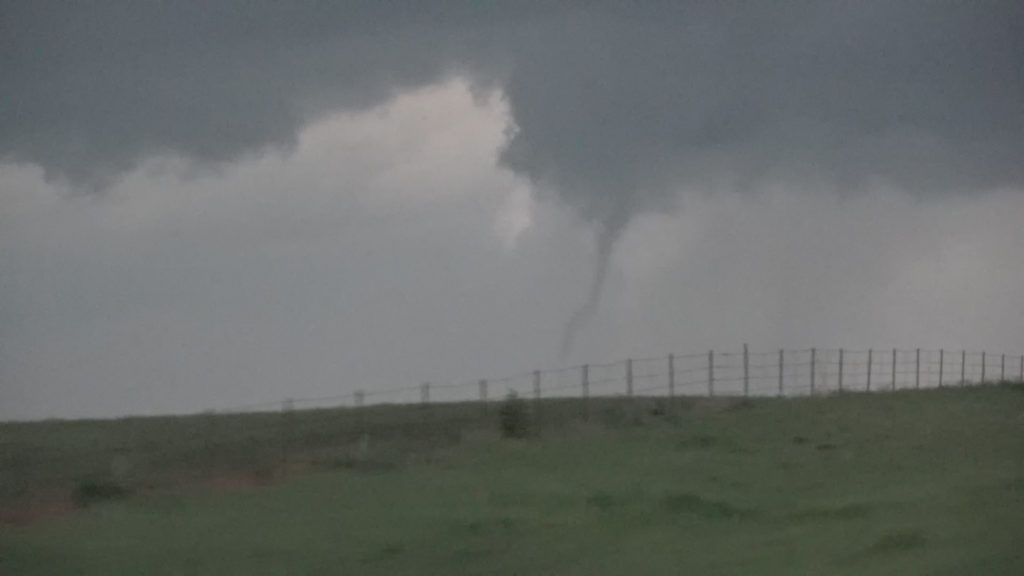
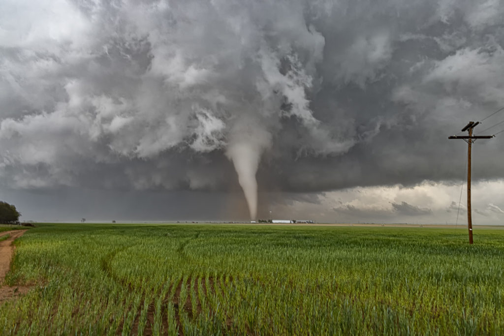
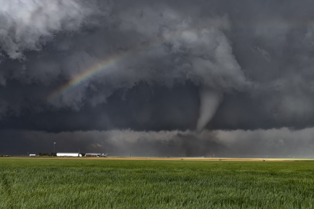
April 27th looked like a day with potential. Decent moisture, instability and shear would exist across northern Texas, with a mixing dryline situated from east of Lubbock to west of Oklahoma City. We headed to Childress to evaluate. We weren’t there long when a cluster of storms formed east of Lubbock. We blasted southwest towards Paducah, Texas to intercept these storms. The lead storm became supercellular and right turned towards Guthrie. We dropped south to position ourselves looking down the notch of this beast. As we set up to watch it, cgs starting raining down on us and the storm became tornado warned. We blasted east to just past Benjamin where we turned north to get in front of this supercell. We arrived to strong inflow and a big block shaped wall cloud with a rain wrapped tornado under it.
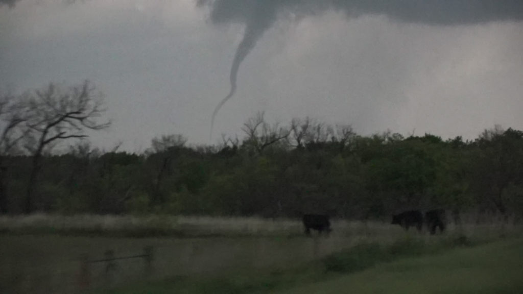
We stayed in position until the storm was almost on us then we headed back south and east. As the storm approached Electra it weakened so we let it pass. More storms were firing up along the boundary to our southwest and we waited for them to approach. One supercell dropped a brief tornado about 2 miles from our location. We dropped south after it passed to play more supercells along the boundary and were treated to a great lightning show after dark. Fun day, no major damage despite a couple tornadoes and huge hail! Enjoy the pics!