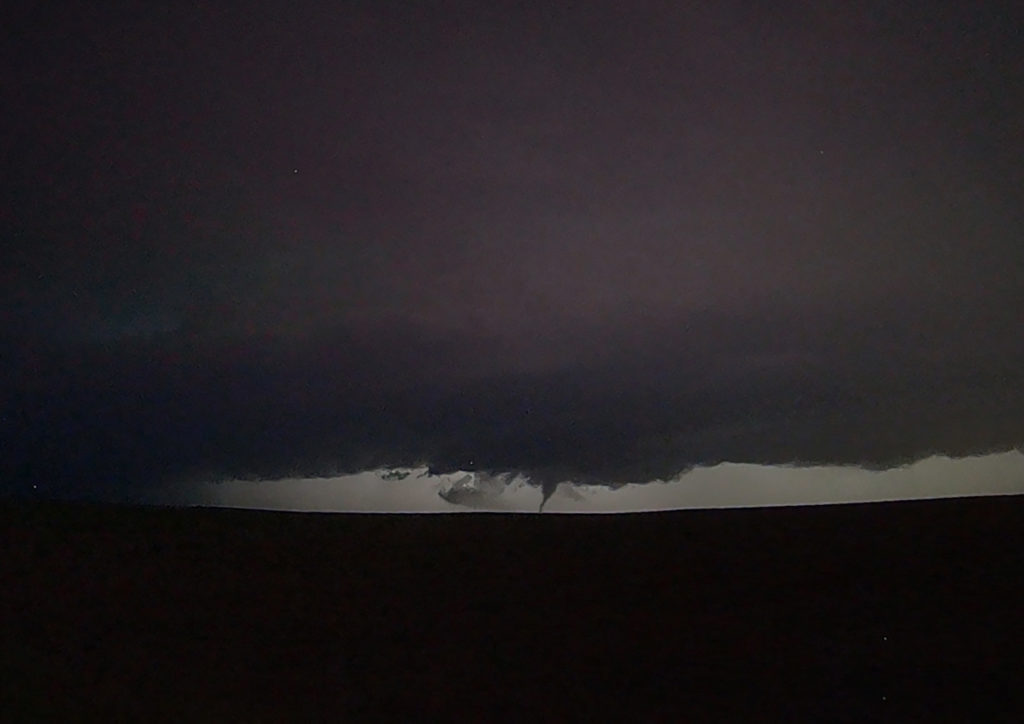
The ingredients for severe storms on June 23rd were there. We only needed a focusing mechanism to get a storm to form on and ride along the boundary. It certainly did! An outflow boundary from previous night’s thunderstorms lay across the I-70 corridor in central Kansas. Storms formed along it and continuously crossed northward into the colder, more stable air. As they did, they weakened and moved off to the northeast. Finally, a storm formed along the boundary at the intersection of the dryline and anchored along it. It started spinning wildly as we sat just a mile east of the updraft and watched low stratocumulus race westward into the updraft twisting and turning along the way. At that point it was just a matter of time before a tornado would form. During the next 3 hours at least 6 tornadoes occurred, although most were brief, dissipating within a couple minutes. We first had a slender slanted tornado that touched down near Wilson Lake. It didn’t last more than a minute. Next another tornado, a slender elephant trunk touched down just west of Dorrance. Little did we know, but another larger tornado was not visible from our position, so we moved east to get in front of the supercell updraft. The structure was insane! While we drove that 3 miles east, the larger tornado came out of the rain and near the interstate. One of our long time guests, Cathy Murphy snapped a shot of it out the rear window. (Thanks Cathy for letting us use your image!) We continued to move east as the storm also moved east, spinning like crazy the whole time. Another white tornado from our view formed near a cluster of wind turbines and was confirmed a brief touchdown. Eventually we ended up just west of Salina as the final tornado formed and also briefly touched down just before the storm died. A heck of a day! Great structure and a few tornadoes to boot! Enjoy the pics! A Youtube video will be releases shortly from this day! Check out our channel!
June 19th Long Tracked Tornado Warned Supercell Montana – North Dakota
Fantastic wind shear was available on June 19th, however, due to a frontal passage, only modest moisture was present off the Big Horn mountains of southeast Montana. This allowed only about 1000 CAPE to build in the area. Fortunately sometimes great shear can compensate for a bit of a lack in surface moisture. A storm formed just south of the Wyoming/Montana border and tracked east just north of the boundary. As it approached the Alzada, MT area it started spinning hard and became tornado warned. It pulsed up and down a few times as it moved into northwest South Dakota, eventually crossing into southern North Dakota near Hettinger. East of town we had to core punch it to get back in front of it and were promptly greeted with tons of golfball sized hail. (Video will be on our SLT Youtube channel soon!) Getting back in front of it, and moved east northeast and took us to Bismark where we spent the night being rocked to sleep by constant thunder. A great day, and a supercell that survived over a 250 mile distance! Enjoy the pics!
June 14th Lincoln, Nebraska Nocturnal Tornadic Supercell
We weren’t expecting much on June 14th. Things were mistimed, moisture was iffy and instability lacking. Storms eventually fired early evening towards Grand Island along a front and moved eastward. They started out high based and lowered as the temp/dew point spreads lessened. West of Lincoln by mid evening, a supercell emerged and started really rotating strongly. A tornado warning was issued as the storm moved east and developed a strong couplet. (An EF3 tornado was confirmed later!) As the storm approached the north side of Lincoln, it wrapped in rain and was a very dangerous supercell. You couldn’t see what was going on in the notch and we didn’t dare go north without an escape route to look down the notch. We had to let it go due to timing and lack of roads. It moved east and recycled again becoming tornado warned. Some damage was recorded east of Lincoln, but at the time of this writing it was not confirmed whether it was tornadic or RFD winds. Certainly a surprise event and thankfully no fatalities occurred!

June 12th Central South Dakota Tornadic Supercell
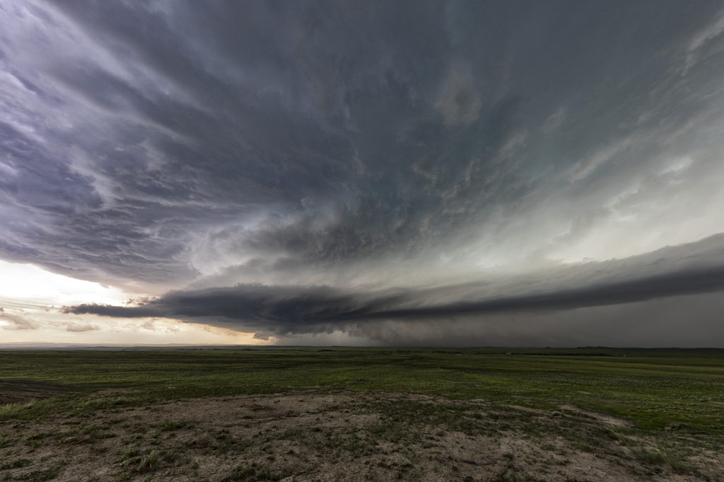
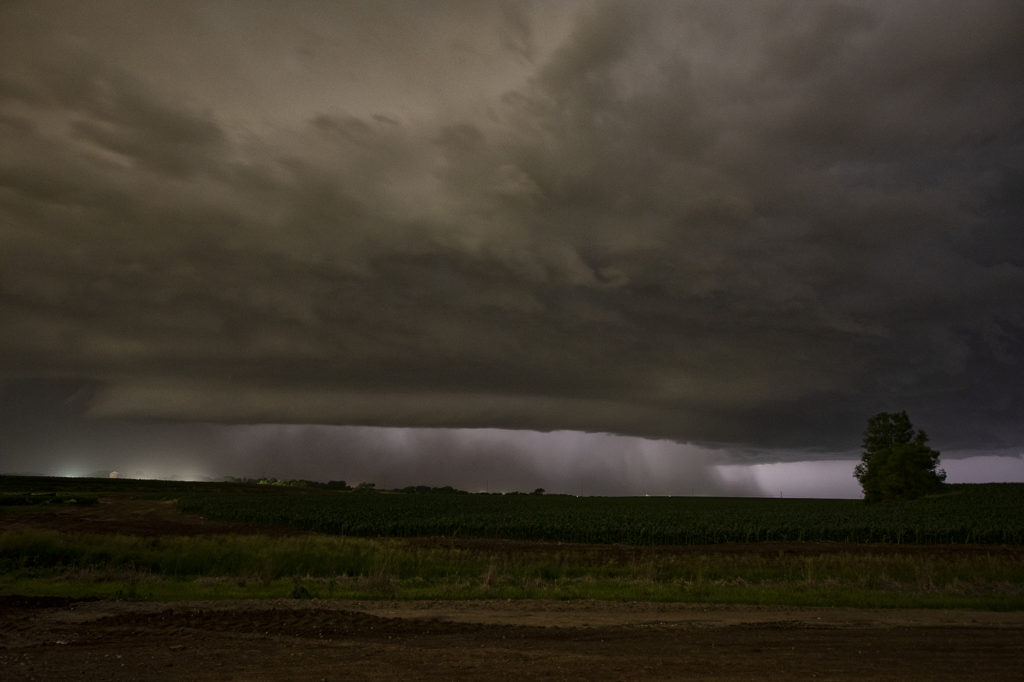
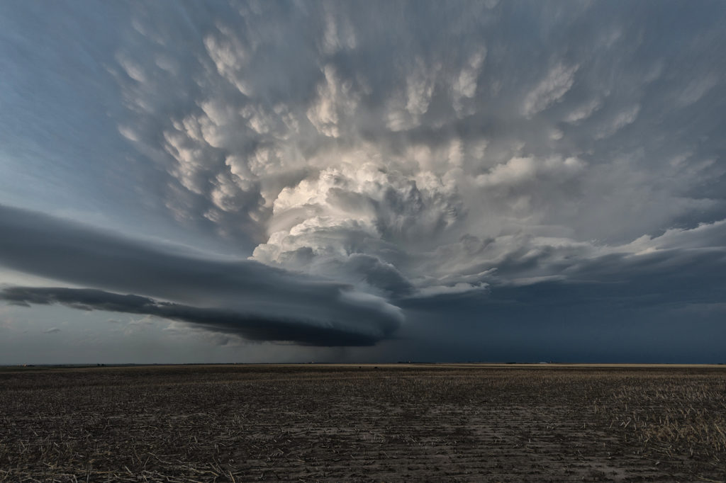
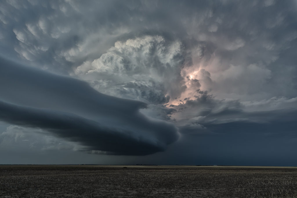
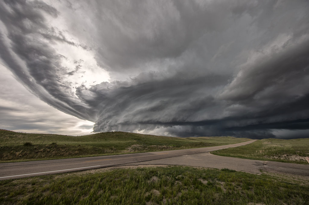
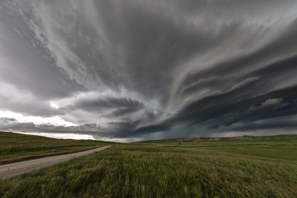
June 12th was a great day for the tours! We intercepted several storms, of which two became strong supercells. Good lift along a boundary, moderate moisture and strong instability as well as shear, would provide the needed ingredients to get these storms firing up. A cluster moved into west central South Dakota and eventually the southern most storm, referred to as “Tail End Charlie” took over the show. The southernmost storm typically gets the best feed of air and usually becomes the most intense. As it moved towards Phillip, South Dakota, it became a strongly rotating supercell. We encountered the south side of the hook as we moved east from town and had winds of 70 mph plus and tennisball hail. Out towards Midland, it took a hard right and become a beast of a storm! Near the I-90 corridor, the storm was an insanely electrified beauty of a mothership! As we watched in the night, you could see a funnel form and touch down. It was later confirmed by the NWS as a tornado. There are a couple video stills in the images below. After a few hours chasing these storms, the lined out so we let them go at midnight and headed to our hotel in Pierre. Enjoy the pics!
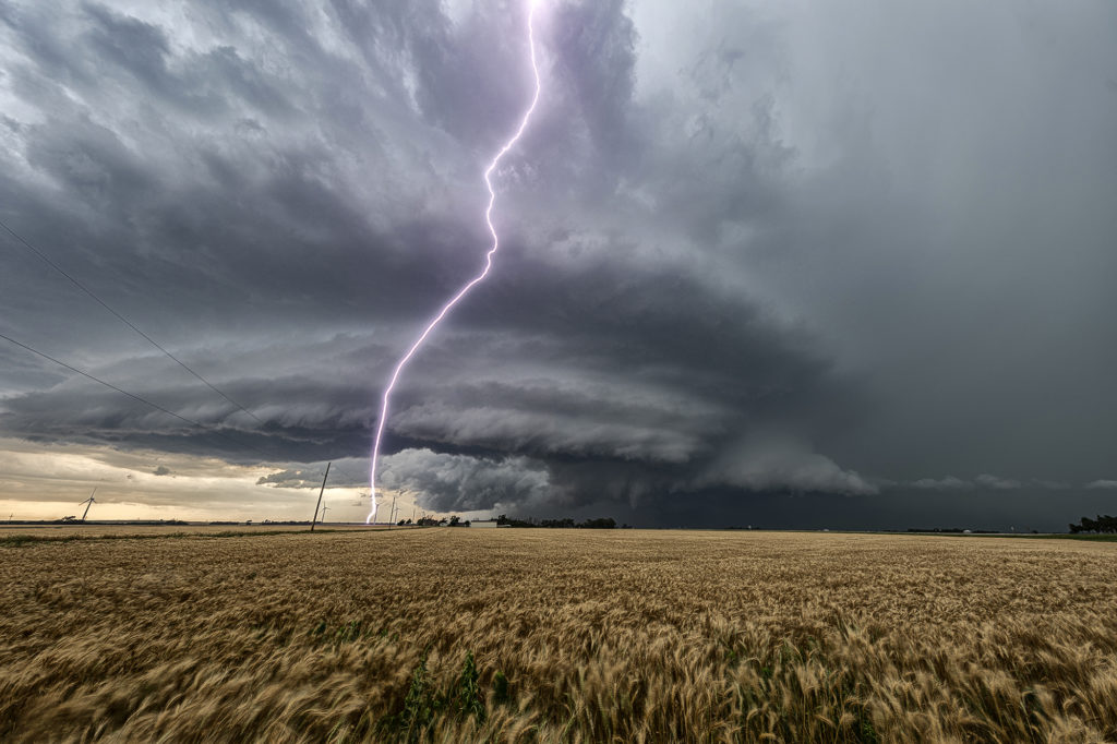
June 9th Southwest Nebraska Gorgeous Supercell!
June 9th had one target for us, southwest Nebraska. An existing boundary would be the focal point for storm development that afternoon. Numerous storms formed, several becoming severe, however only one would survive and be the storm of the day. This supercell formed south of North Platte, NE and turned hard right, spinning like a top all the way to Oberlin, KS. The structure was top notch. When it first got its act together, it did have a slowly rotating wall cloud. We thought for a minute it might try to become tornadic, but the wall cloud eventually disappeared. As the storm moved south, it had the appearance of a mothership, and as it moved into Kansas as a low precipitation supercell, the structure at sunset was just stunning! A great day for the tours and an amazing way to end the evening! Enjoy the pics!
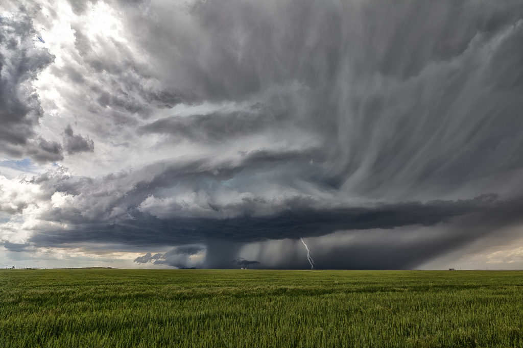
June 7th Northeast Colorado Tornado Warned Supercells
June 7th took us to the north side of the Cheyenne Ridge, playing the upslope there with moderate shear, decent moisture and instability. Several storms formed, with a couple becoming supercells and even tornado warned. It is amazing what some chasers call a tornado (landspout) when it occurred in a part of a thunderstorm that landspouts wouldn’t even form in! Stay tuned to a narrative we will publish explaining how and where a landspout would form.
These storms moved southeast into northeast Colorado and became quite intense, producing very high winds and baseball sized hail. The continued moving southeast eventually into northwest Kansas and were continuously tornado warned or severe warned. Structure was very nice as they marched into central Kansas overnight. A fun day for the tours with plenty of excitement with the storms as we moved in very close to where rotation was, but no tornadoes were confirmed. Check out the images below!
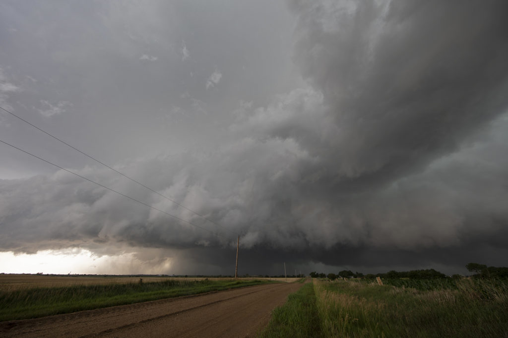
June 6th Western Nebraska Supercells
Sometimes you get a set up where shear is really strong, but moisture is a bit lacking. June 6th was one of those days where if only the moisture and resulting instability were a bit stronger that a significant severe weather event would occur. It looked like storms would form off the Black Hills and ride a frontal boundary to the southeast. By mid afternoon, a supercell formed northwest of Thedford, Nebraska and became severe. As it moved east it weakened while others formed further northwest. A storm did form off the hills and trek southeast into northwest Nebraska and became a formidable supercell. The structure was nice and the colors of the storm were superb! Having it in the sand hills is always a challenge to chase due to lack of roads. We were able to stay with it all the way past Stapleton before it eventually weakened to the southeast. A fun chase, pretty structure and beautiful landscapes! Enjoy the pics!
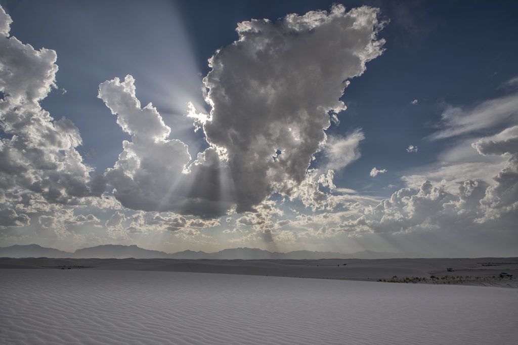
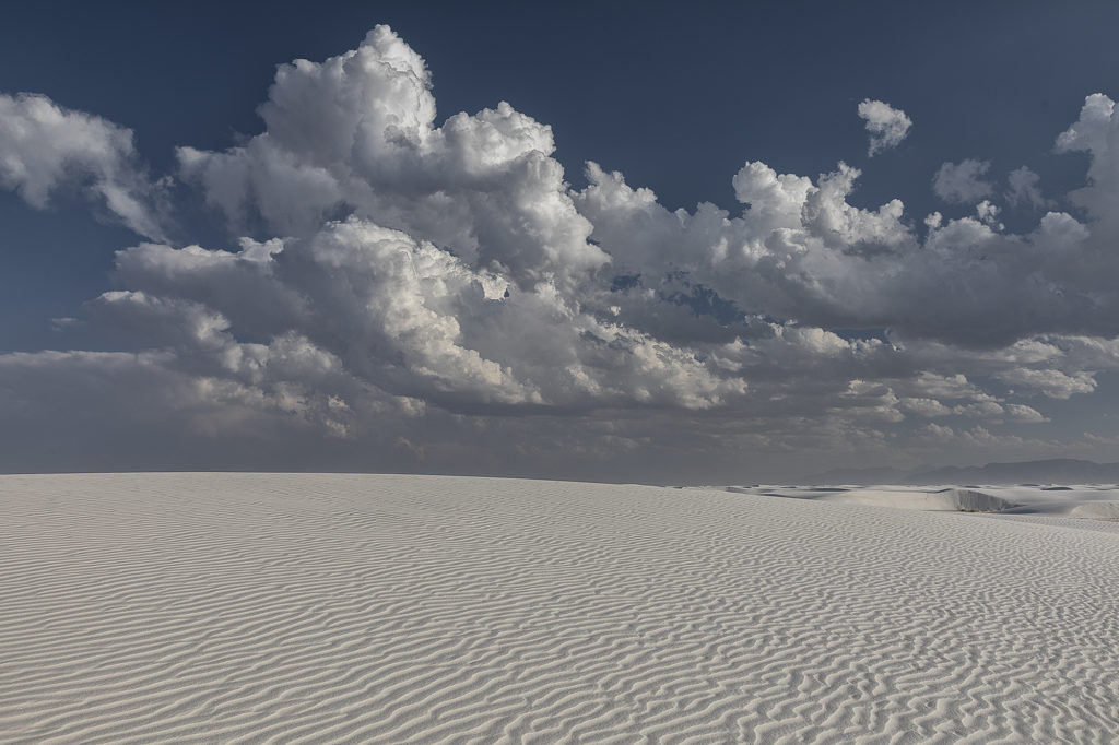
June 2nd White Sands, New Mexico Fun!
What do you do when storms are not forecast across the plains? We head to scenic areas for some sight seeing and photography. June 2nd took us to White Sands National Park, New Mexico. Storms were forecast over the central New Mexico mountain chains and we hoped they would move towards us over White Sands. The did exactly that, but weren’t producing much lightning. Still a very scenic spot with developing storms around. Made for some stunning photography!
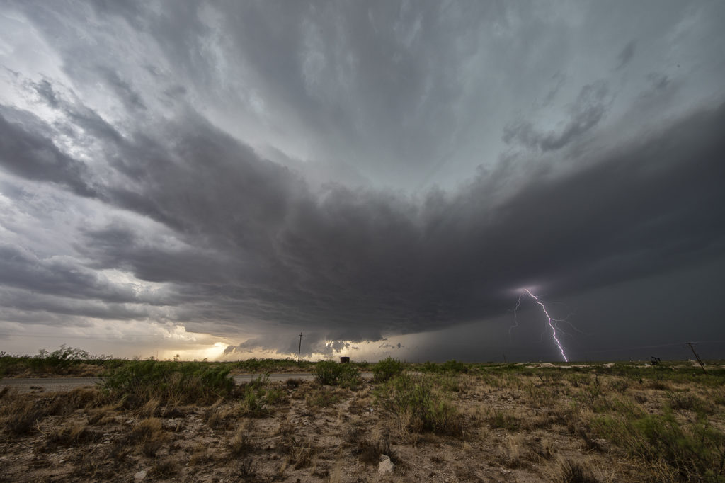
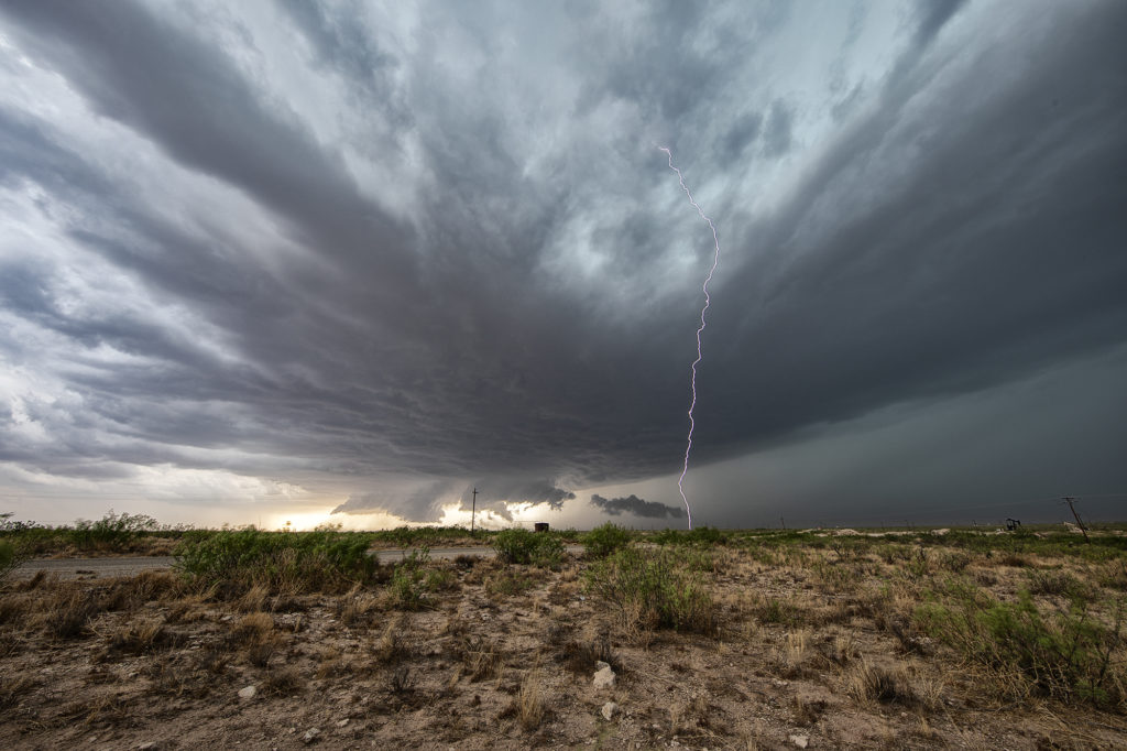
June 1st Southeast New Mexico Powerful Supercell
The first day of June took us towards far southeast New Mexico. A couple supercells developed along the dryline west of Jal and drifted eastward, becoming quite prolific hailstorms. The storm’s structure was very nice and it had a wall cloud throughout it’s life cycle. However, low level rotation was lacking. The cell was an amazing lightning machine producing numerous cgs every minute. As it moved southeast, other storms for and soon a cluster of high based severe storms rolled into southwest Texas. We went to our hotel in Midland and watched as the storm approached from the northwest, with tons of blowing dirt, lightning and hail.