
April 25, 2026 Southeast Oklahoma Tornadic Supercell
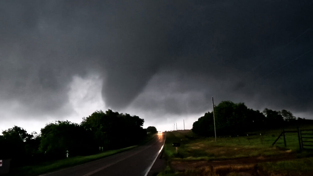
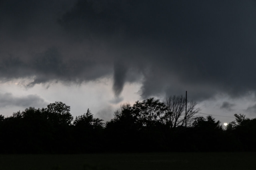
Day 1 of the Close Encounters tour kept us very close to Oklahoma City. A warm front/dryline triple point was just south of town. Models show extreme instability developing during the afternoon, with isolated supercells forming. Mid afternoon we drifted to Sulfur as storms formed close by. As they moved east the weakened moving north of the warm front. Eventually one storm anchored on the boundary and started spinning. It produced and bog cone funnel that just could stay consolidated, and fell apart after a few minutes. Due to many storm interactions, we dropped south to the tail in cell near Mill Creek. As we arrived a tornado formed. We saw the debris cloud from a rock plant and were able to stop in time to take photos and videos. It was on the ground for about 5-6 minutes. This day was a ton of hard chasing but in the end we managed to see a tornado. Enjoy the pics!
No comments yet.