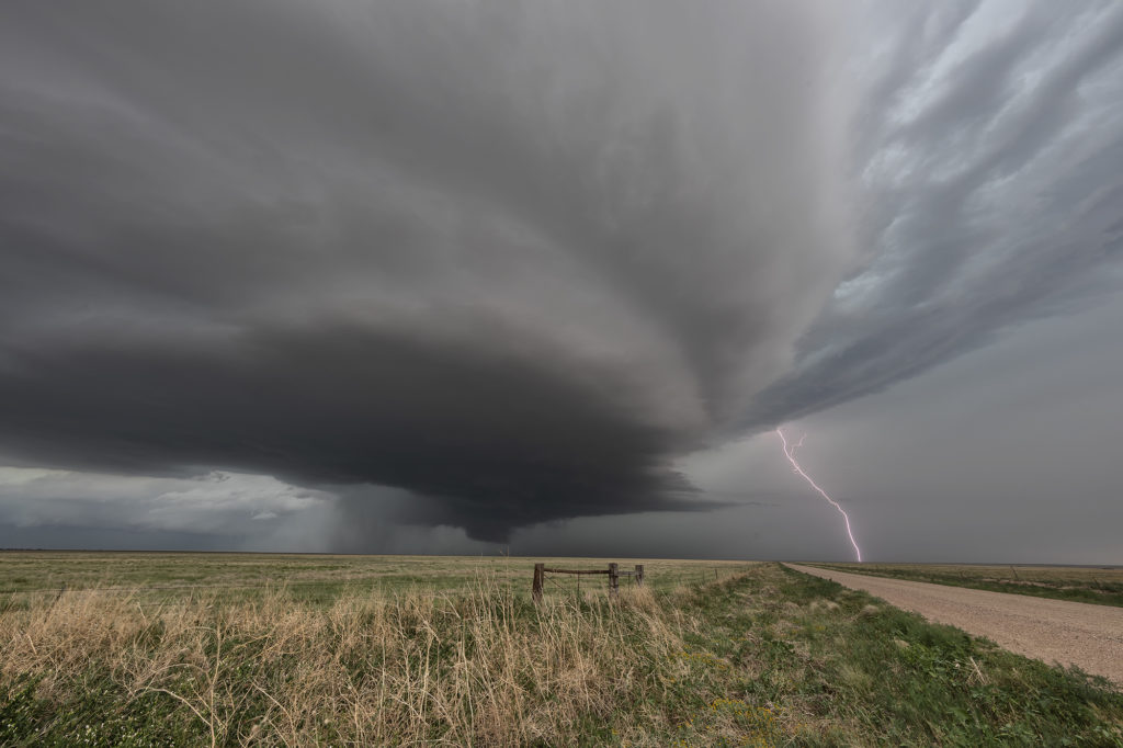
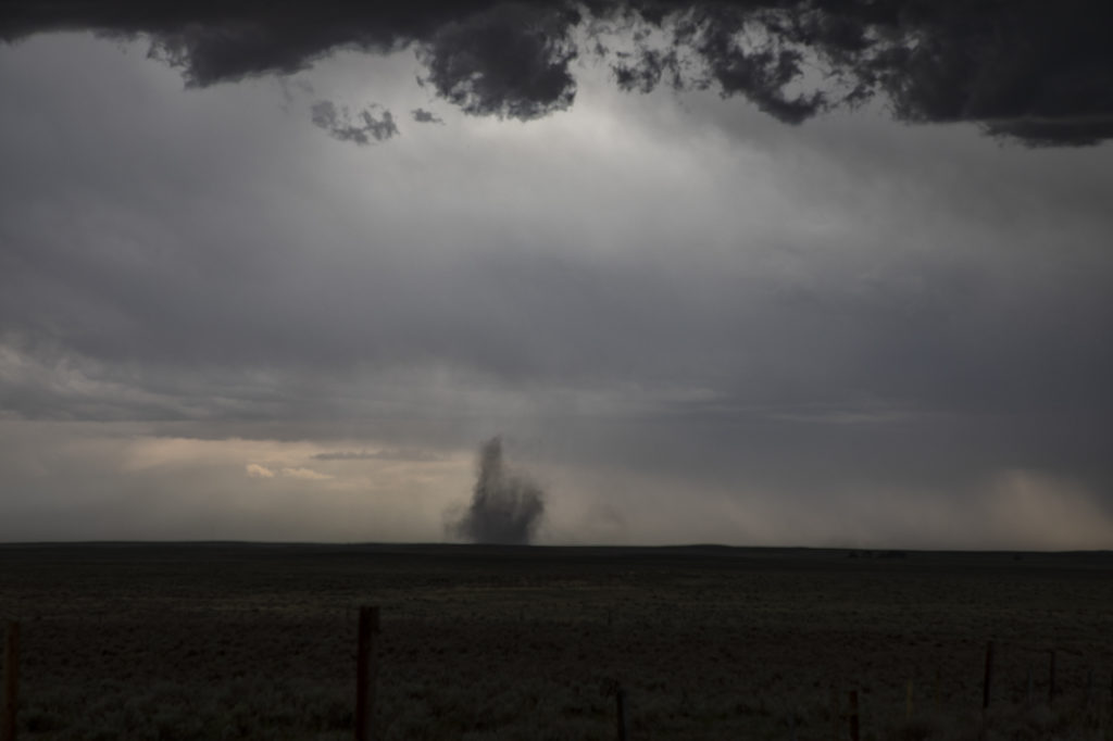
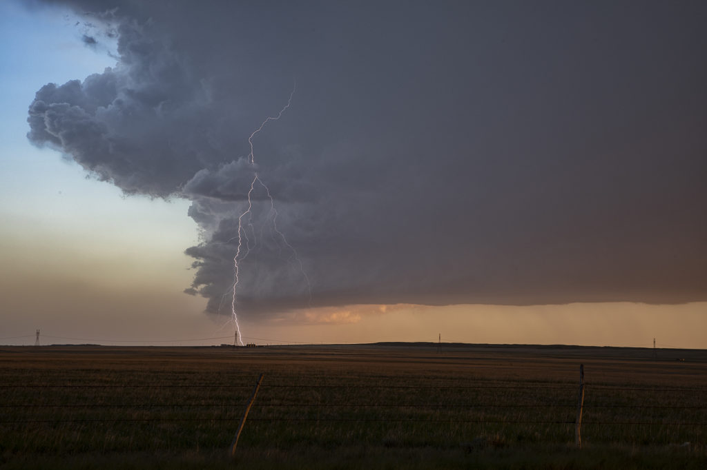
August 19th looked too good not to chase. Good moisture, high CAPE values, strong lift with an approaching wave and good low level shear along a boundary would set the stage for a good day! Mid afternoon storms exploded over northeast Colorado and slowly intensified. One particular storm, south of Holyoke, CO became a supercell. As it drifted east/northeast along the boundary it took off and became tornado warned. Very very strong low level rotation was occurring and the low level mesocyclone eventually became rain wrapped where you couldn’t see it anymore. Extremely heavy rains (4-9 inches!) prevented me from taking dirt, now mud, roads to get into the notch for a better look. However, the storm did produce a tornado, possibly two, one of which was a fast funnel in the hook area before it wrapped up in rain. A fun chase day, and good results, just wished for a better view in the notch! Enjoy the pics!
May 22nd Colorado Tornadic Supercells
May 22nd had great potential in Colorado. Good upslope flow and moisture, as well as great instability and wind shear would set the stage for intense tornadic storms! One storm formed early in the afternoon and produced a fast tornado west of Akron. A second supercell formed south of Limon and produced several tornadoes. We were able to intercept the first supercell and tornado west of Akron, but tried to blast down towards Limon later and couldn’t get there in time for the second storm. Still we caught a pretty tornado and then the end of the second tornadic supercell. A fun day, very hectic and exciting!! Enjoy the pics!!!!
May 23rd, Last Chance, Colorado Tornadic Supercell
May 23rd had great potential in Colorado and western Nebraska. A strong upper low over the Rocky Mountains would draw in large amounts of moisture, while the lift and diurnal heating would generate large amounts of instability. The upper flow was weaker than we would like, which would likely result in high precipitation type supercells, very dangerous storms. A tornado watch was issued before noon and the initial storms formed east of Pueblo, CO. Fast motion carried them towards Limon and points north where one supercell emerged. This storm had a nice wall cloud and tail cloud and had a couple of funnels/weak tornadoes under them. The storm became strongly HP in nature so we eventually left it for points south where shear would allow more isolated updrafts with better visibility under them. All in all, this day under produced, which we were afraid of due to the weak winds aloft. However, any day where you catch a tornado, no matter how brief it was, is always a good day! Enjoy the pics!
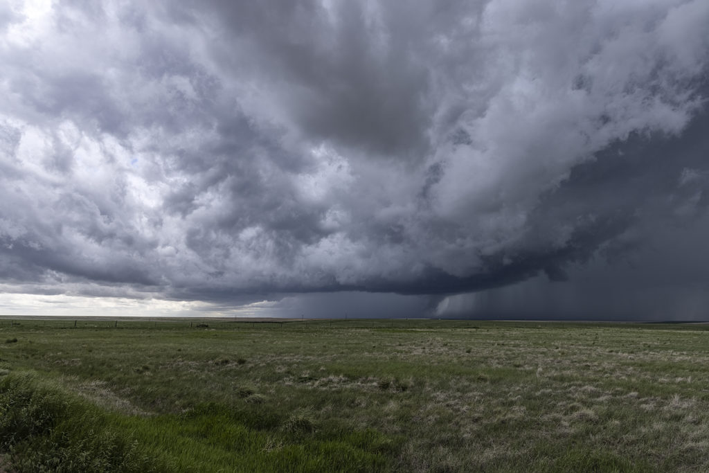
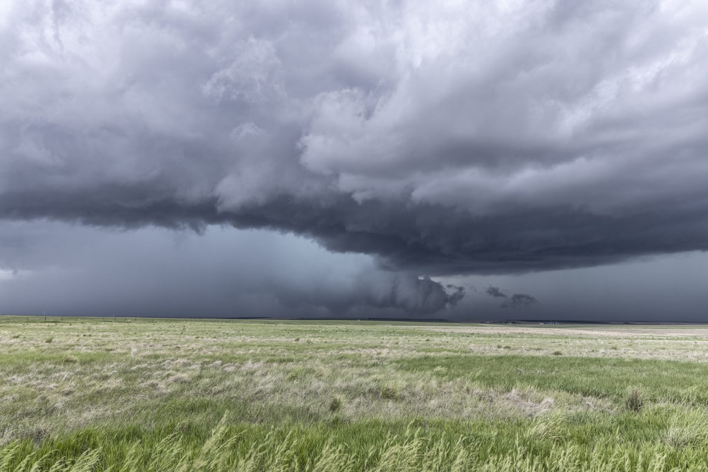
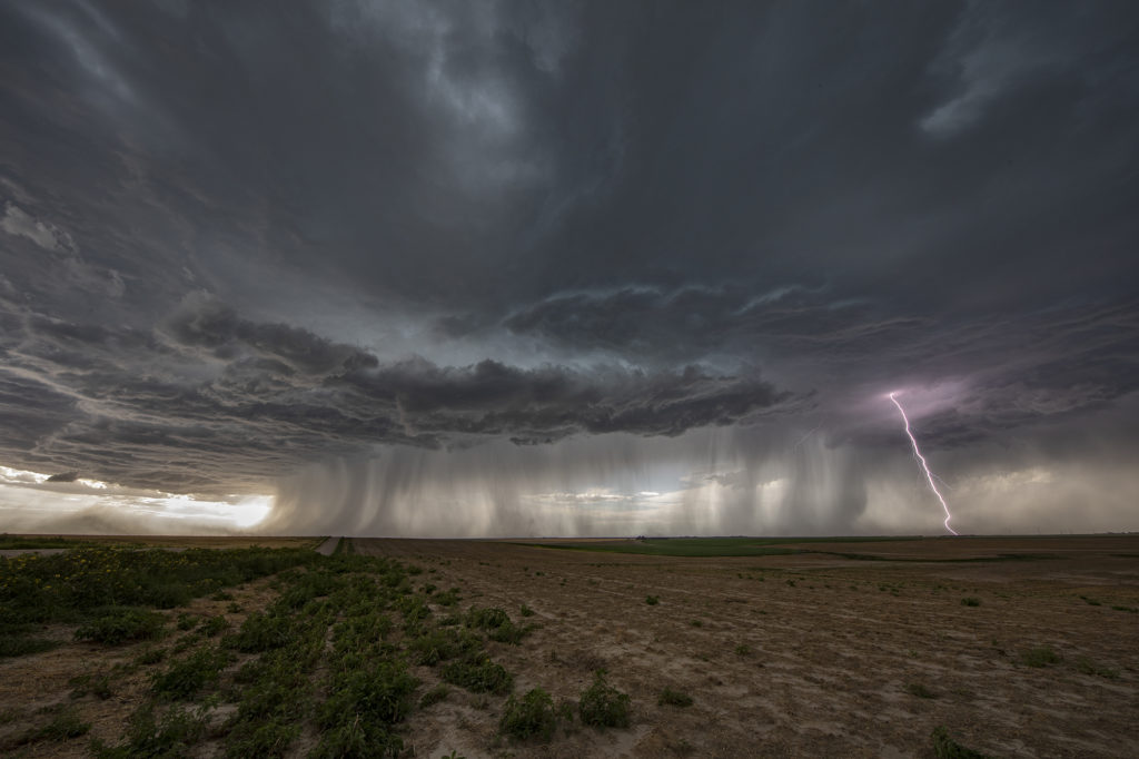
July 14th Southeast Colorado Tornado Warned Supercell
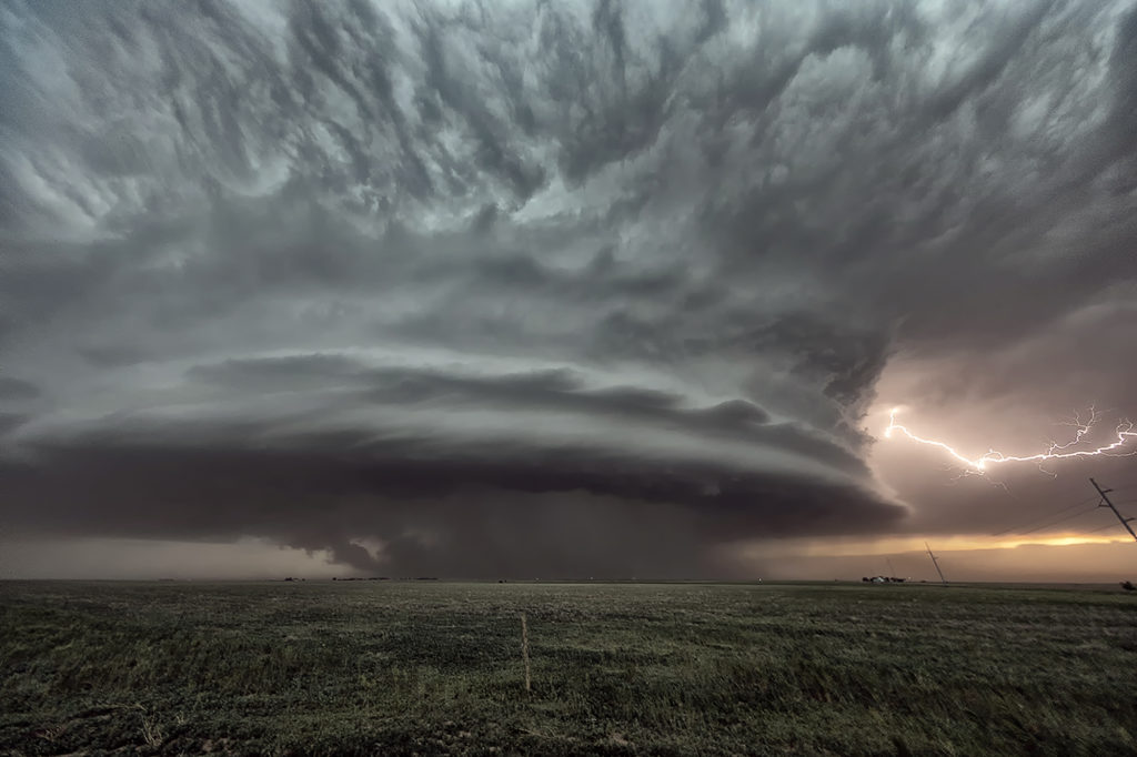
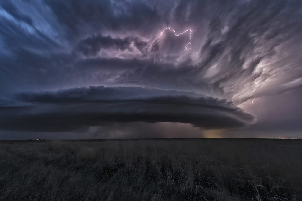
July 14th kept us in Colorado to chase off the Palmer Divide into southeast Colorado. A sagging cold front we push moisture westward into the Palmer Divide, causing storms to develop by mid afternoon. Those storms produced copious amounts of hail, but became undercut by outlfow and died. The boundary pushed south as more storms formed along it east of Pueblo. Near the town of Sugar City, one storm formed and spun hard. It quickly became tornado warned and stayed that way for a few hours. A couple of times, it had the look like it wanted to drop a tornado, but it never did. As it merged with numerous storms west of Lamar, the storm interaction with others caused it to produce a quick 1 minute spin up. The structure with this supercell was quite nice. It was also quite electrified! Eventually this cluster of storms pushed into western Kansas and weakened as we followed it east to Garden City. Great day! Beautiful storm and it certainly tried to get very interesting! Please click on a pic for a larger image. Enjoy!

July 13 Eastern Colorado/Western Kansas Supercells
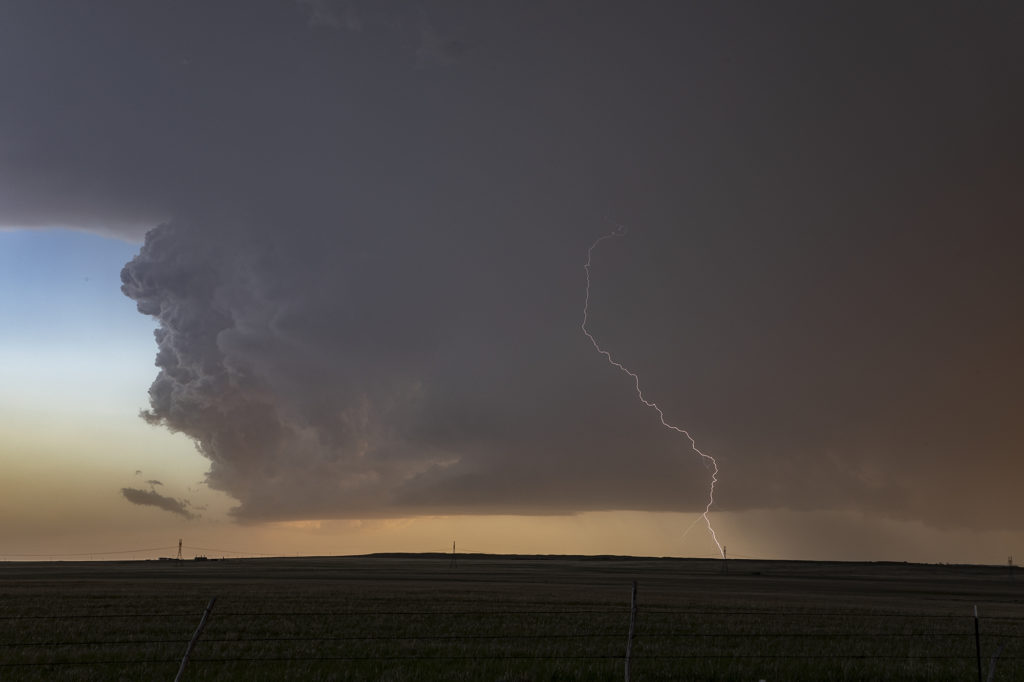
July 13th was the second day of our Tour 9, Great North Tornado Hunt tour, and it took us east of Denver towards the Kansas border. Decent shear, limited moisture and CAPE, and an approaching dryline, would set the stage for high based storms to form. As the storms moved into Kansas, they intensified and the bases came down. We had a couple very pretty rotating storms in far western Kansas that were quite electrified. The final storm of the day was a very nicely structured LP supercell near Leoti, that spewed out numerous lightning strikes and intercloud discharges. I thought for a minute that it had some tornado potential, however the base lifted, the wall cloud dissipated and it eventually died as well. A fun day, great storms and super lightning. Please click on a pic for a larger photo. Enjoy!
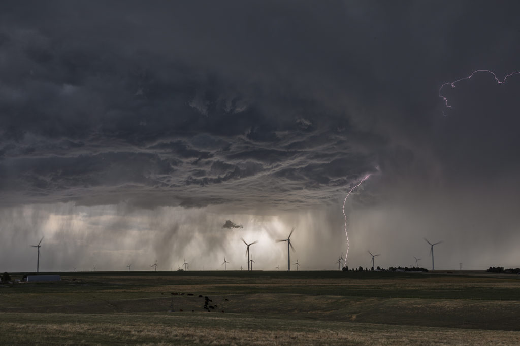
July 3rd Northeast Colorado Tornadoes
July 3rd brought us back to Colorado for the final day of the Photo Tour. Nature decided to give us some pre4th fireworks! A boundary set up north/south of a line from Ft Morgan to east of Limon. Intense storms formed along it and with a wind shift in place, two landspout tornadoes formed that we were able to witness. They lasted several minutes each before dissipating. Storms were quite sever with hail tennisball sized and lots of lightning as well. We intercepted the first cells on highway 71 south of Brush and followed the southward building line from there. Good shear, moderate CAPE, but limited low level moisture fueled the severe storms till eventually they gusted out and weakened. Fun final day of chasing for the tour before returning to Denver later in the evening. Please click on a pic for a larger image. Enjoy!
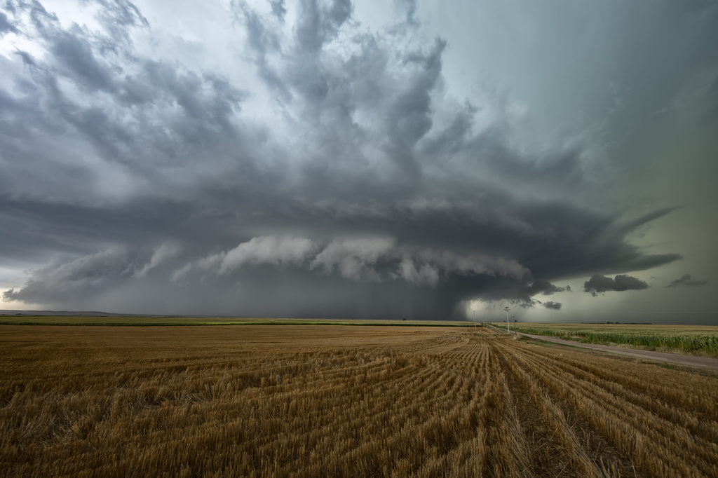
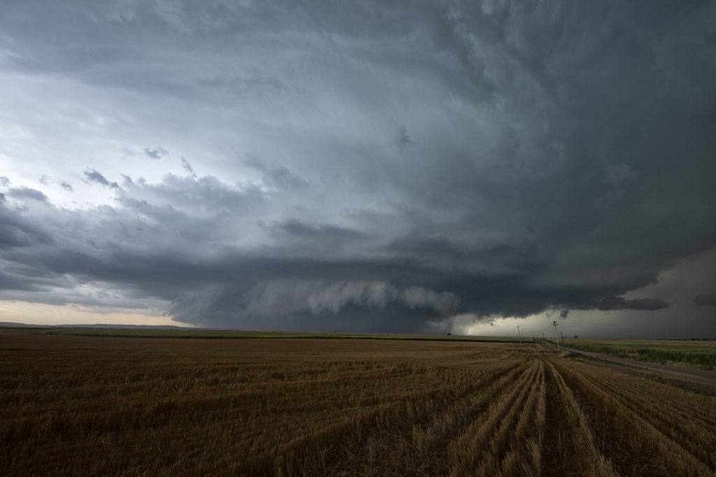
May 24th Southeast Colorado Beautiful Supercell
May 24th appeared to be a more marginal day. But sometimes, those days pleasantly surprise! This would be the case this day as good upslope flow would allow for a couple isolated supercells to develop in southeast Colorado and southwest Kansas. The best moisture was in southwest Kansas along an outflow boundary, but sufficient moisture was pushed into Colorado to support moderate CAPE and long lived supercells. We intercepted our storm east of Springfield, Colorado and stayed with it through the evening hours east of Hugoton, Kansas. This storm was well structured and produced baseball sized hail. The inflow into this storm was severe in strength and was amazing to see this storm process the amount of air it did! A great chase, fun day and everyone thoroughly enjoyed this supercell! Please click on an image for a larger pic. Enjoy!
May 20th Northeast Colorado Tornadic Supercell
May 20th looked decent on paper. Strong shear, decent moisture, and moderate CAPE set the stage for intense storms. An outflow boundary/cold front pushed slowly southeast across Wyoming and northeast Colorado. We dropped from Cheyenne into Weld county, Colorado as numerous towers formed. We noticed a column of dirt in the distance (some 20 miles away!) and it turned out to be a landspout tornado that occurred near Greeley. We couldn’t get close enough for a good photo, but a few guests got a shot or video or two of it from our vantage point. The storms congealed into a tail end supercell and were very electrified! As the sun set, the forward flank downdraft lit up with the most incredible orange I have ever witnessed in a storm! After sunset, the sky was illuminated with numerous continuous lightning strikes that were a treat to watch. Click on an image for a larger pic. Enjoy!
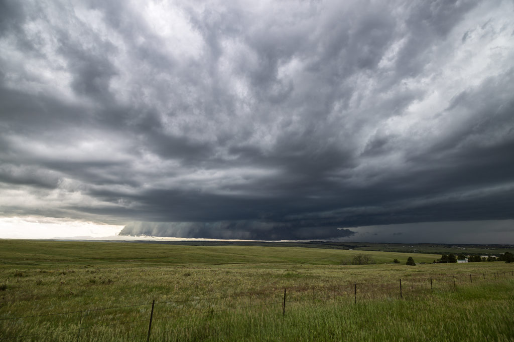
June 21st Palmer Divide Briefly Tornadic Supercell
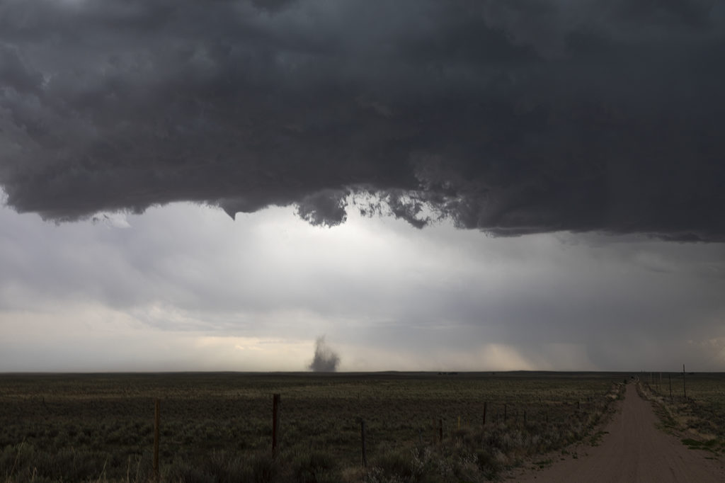
We weren’t expecting anything significant on June 21st. However, as often happens in the upslope regions of Colorado combined with terrain features, a decent supercell formed north of Colorado Springs along the Palmer Divide. Good directional shear due in part to strong easterly winds helped the storm to organize and rotate. As the cell approached the town of Kiowa, the low levels started spinning strongly. You can see a hook forming visually and rotate pretty rapidly. A tornado warning was issued by the NWS and soon an area of rotating debris was seen under the hook area of the storm. This weak tornado only lasted a couple of minutes.
As the cell moved further east, it encountered less surface moisture and instability, which caused it to steadily weaken and eventually dissipate east of Limon. Several other storms initiated in the cold side of the first cell’s outflow and never could really intensify for long periods. A fun chase and right in our backyard.
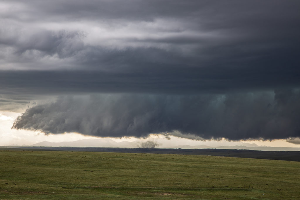
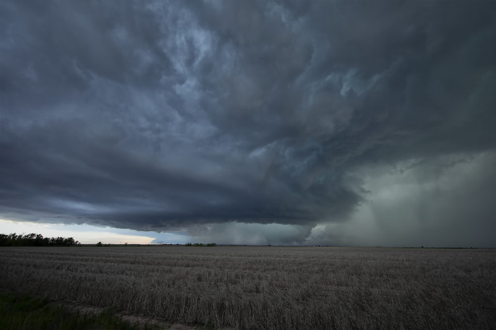
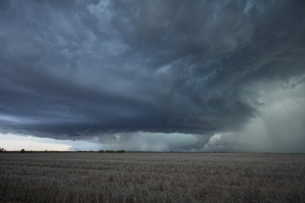
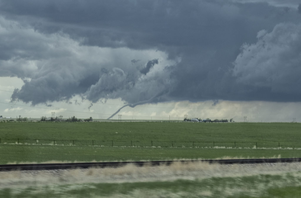
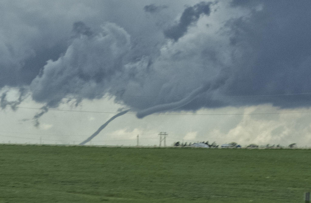
May 27th Northeast Colorado/Southwest Nebraska Tornadic Supercells
This day had a lot going for it. Great shear, good moisture and instability, and a dryline would help set the stage for intense supercells. Our first storm of the day formed near Ft Morgan and tracked northeast along I-76. It became a rather large and occasionally disorganized supercell. However as it approached Sterling, it wrapped up hard and produced a brief, small tornado. Further to the east, a second, well organized and photogenic supercell formed. It produced a few brief tornadoes, however the structure of this storm would be one of the prettiest for 2019! As it came towards Imperial, a beautiful sculpted storm was present. At one point west of town, not only did the storm have a stunning appearance, but a partially rain wrapped tornado became visible. The cone shaped twister was on the ground for a few minutes before wrapping in rain again as we lost visibility of it. An amazing day with gorgeous storms and a few tornadoes! Enjoy the photos below!