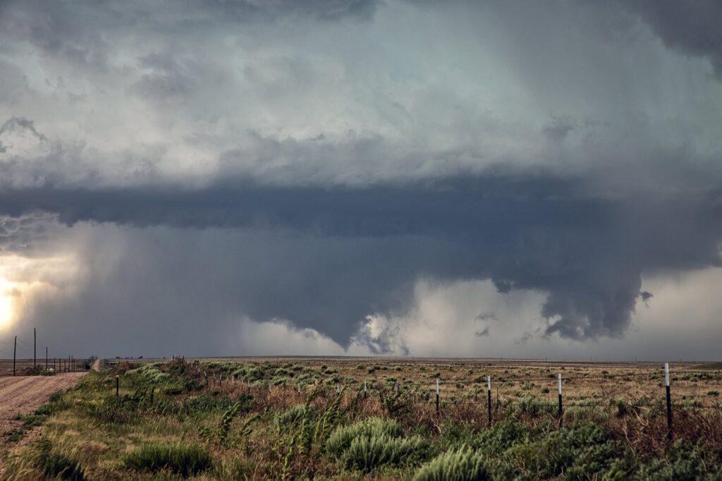
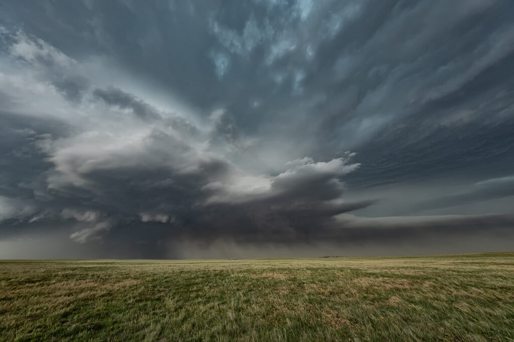
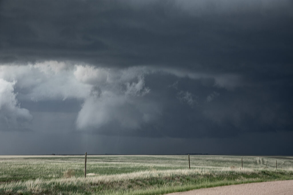
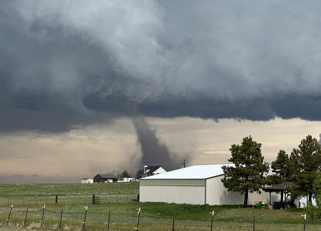
June 26th was the final day of our annual lecture tour. Needing to stay close to Colorado, nature decided to throw us a pretty supercell! A line of storms exploded on an outflow boundary south of Limon. A moisture surge came in the from the east and allowed the tail end storm to become quite intense. Structure was pretty and it spun hard. Hail fell the size of baseballs, but a wall cloud formed in the notch and really started cranking up. A cone funnel formed and descended and ascended a couple of times. Finally, it touched down before lifting back up and dissipating. We stayed with the supercell to Eads where outflow from another storm pushed north and hit our storm, causing it to become tornado warned. Another wall cloud developed and had the look. It tried hard to develop a tornado but just couldn’t get the job done. It eventually became completely undercut by outflow and diminished. A fun day and we got a lot more than what we thought we’d get! Enjoy the pics!
June 24, 2026 Northeast Colorado Tornadic Supercell
June 24th promised some intense supercells in Colorado and nature did not disappoint. Mid afternoon saw storms erupt on the south side of the Cheyenne Ridge north of Ft Morgan. These became severe and supercellular quickly, eventually resulting in a tornado warning south of Brush. As the supercells moved south, they encountered drier air and weakened. Then another storm formed on an outflow boundary north of Haxtun and became tornadic. Several tornado reports came in as we blasted north. When we got within 15 miles, you could make out the broad cone shaped funnel, but could not confirm touch down. As we got close, of course, the storm weakened. Other storms formed along the outflow boundary to our west and also became severe. Quite the sight at sunset watching the raging supercell with lightning strafing across the sky!

June 22, 2026 Northeast Colorado Tornado Warned Supercell
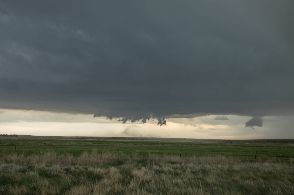
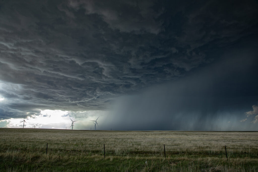
June 22nd took us to the Cheyenne Ridge along the Colorado/Nebraska border near Kimball. Storms formed on a convergence boundary there and immediately started spinning and became severe. One storm became dominant and an intense supercell. It was tornado warned off and on its entire life cycle, which lasted nearly 6 hours! The amount of air this supercell processed was astonishing, as inflow was being drawn in at 50-60mph! Blinding dirt occurred as it was lofted in the air due to dry soil conditions and into the updraft. Several times lowerings formed and spun hard, but nothing was able to focus long enough to produce a tornado. Giant hail softball to grapefruit sized fell as the storm maintained a steady state of intensity throughout the afternoon and evening. At times it became very photogenic as the updraft contained multiple striations showing rapid rotation and had the appearance of a huge soda can. One of the strongest supercells in Colorado in the past few years! Enjoy the pics!
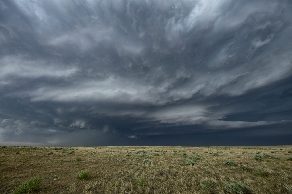
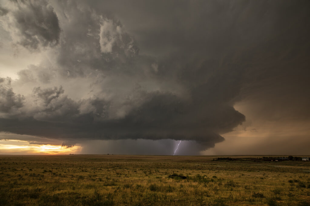
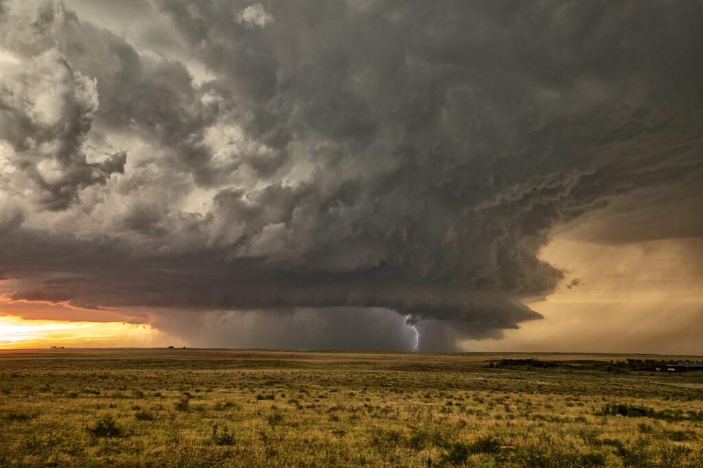
June 8, 2026 Simla, Colorado Tornado Warned Supercell
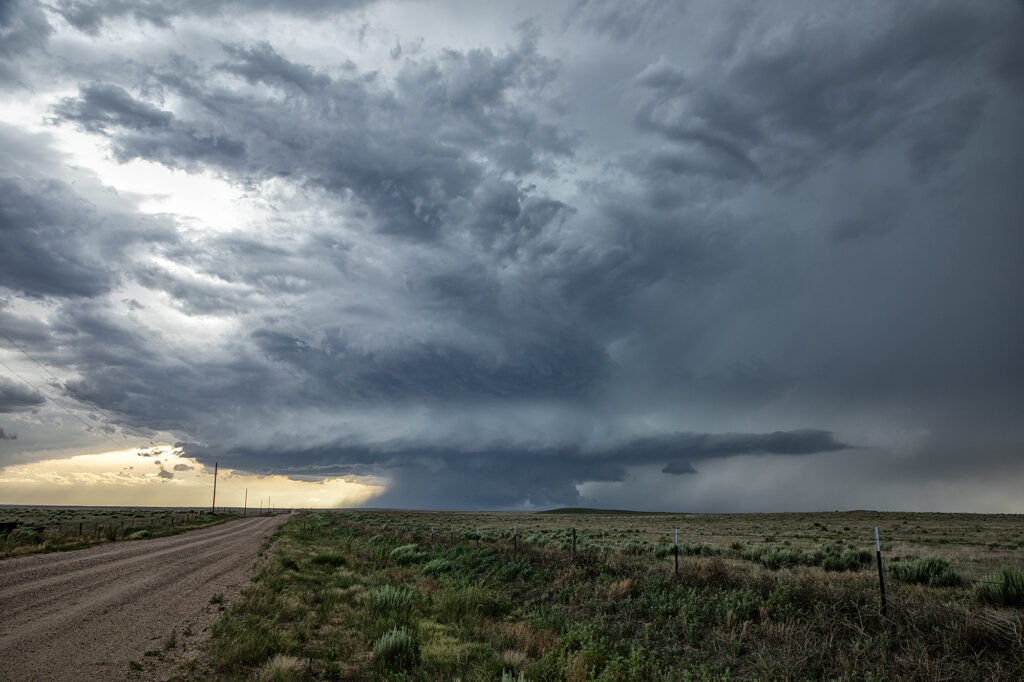
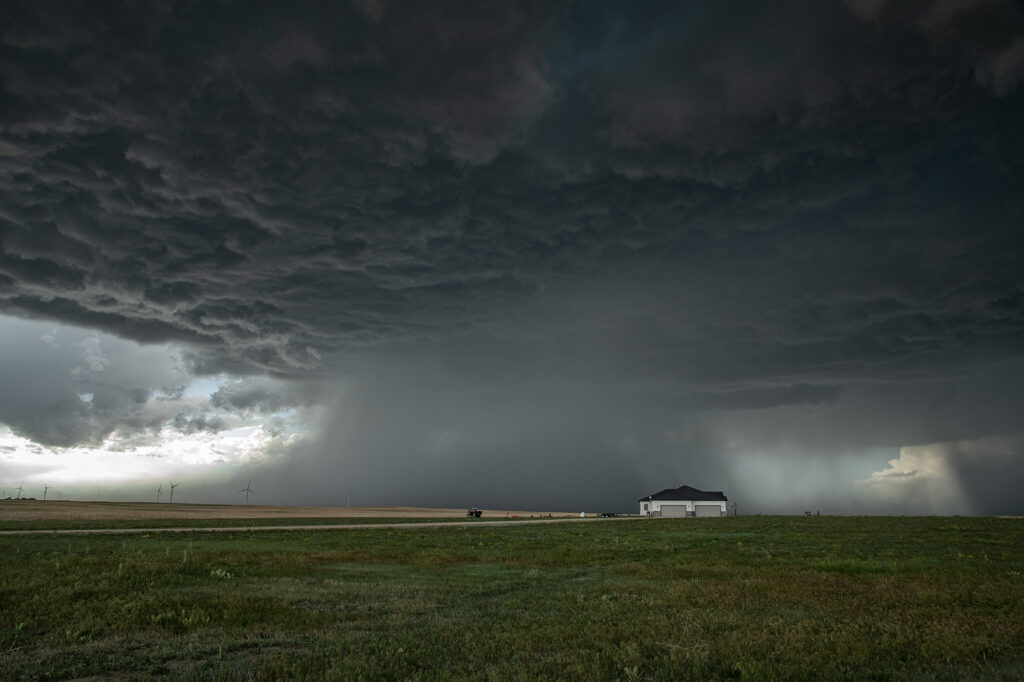
Upslope flow on the north side of an outflow boundary into the Palmer Divide set the stage for an intense supercell to form. It was tornado warned several times and came as close as it possibly could to producing a tornado without doing it! The structure was amazing, and as it anchored west of Simla, it spun hard. A massive bowl formed with a merry go round under it spinning wildly! However, this is a year where there seems to be a lot of close calls without storms actually producing a tornado! Someone called in a multivortex tornado, which is absolutely false. There was never a touch down and we were very close to the action the entire time. As it moved east of Limon, CO, the structure was just gorgeous. When it approached the Kansas border it became outflow dominant and steadily weakened. It has been a long time since I saw a storm’s low level mesocyclone spin that hard and NOT produce a tornado!
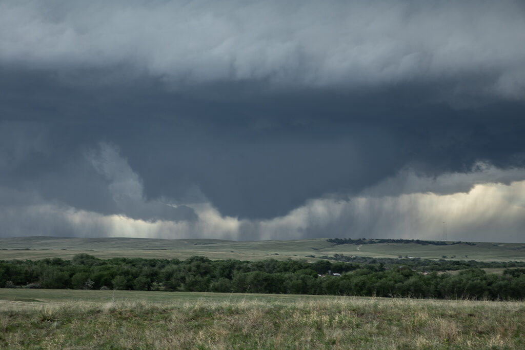
May 21, 2026 Anton, Colorado Tornadic Supercell
May 21st took us to Colorado. Between upslope into the Palmer Divide, as well as an outflow boundary, most models had storms forming near Limon, before intensifying and moving east. That is pretty much what happened. A supercell formed near Deer Trail and moved east, gaining strength and becoming tornado warned. Good shear, but relatively cool surface temps kept this from being a major event, but the storm still produced softball sized hail, several funnel clouds and one brief tornado south of Anton. As it continued to move east, it encountered cold air with temps in the 50s and became an elevated hailer. Eventually near Burlington it weakened as instability waned and nocturnal cooling set up. A fun time was had by all the guests as the structure was quite nice and the funnels fairly close with the road network being sparse. Enjoy the pics!!

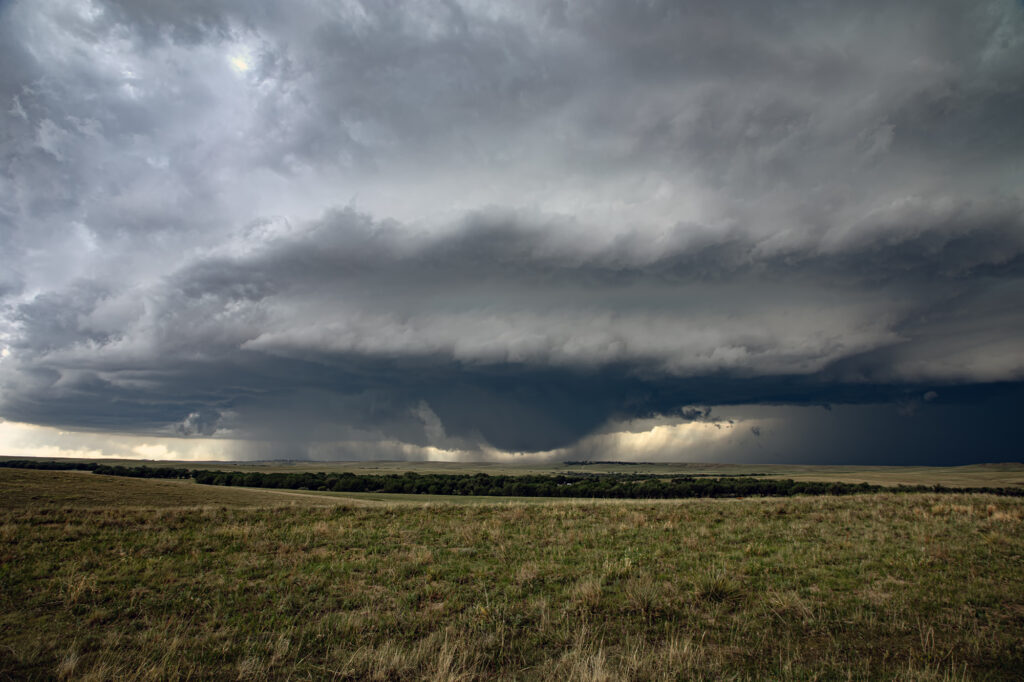
August 4th Kim, Colorado Tornado Warned Supercell
When you have nothing to photograph during our Desert Thunder tour, you go where there are storms, even if not in Arizona. Models were consistent on the set up in southeast Colorado on August 4th. We headed out and drove from Tucson, AZ to Springfield, CO. One lone supercell formed on the “LaJunta Low” just southwest of Lamar and right turned all the way to the New Mexico border. Structure was great and the lightning was amazing! We even watched a semi truck’s trailer get a direct hit, glowing it a bright orange in color! As the supercell turned into better moisture and instabillity, it steadily strengthened until it became tornado warned for 2 hours. It slowly took on HP features as the RFD cut around the updraft with a lot of precip and hail, blocking our view of what was happening under the base. A couple of times there appeared to be a cone shaped funnel that persisted for several minutes. Eventually though, the precip became too dense to see under it anymore and we had to admire the beautiful structure! A long way to come for a storm, but it was well worth it! Enjoy the pics!
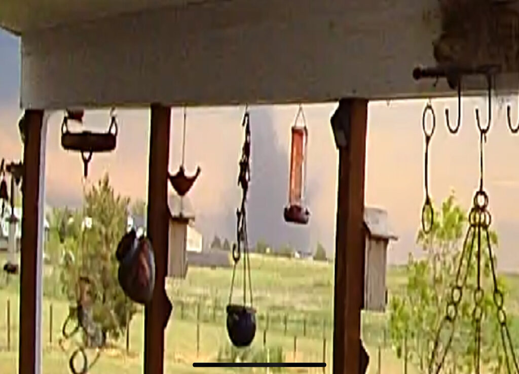
May 18th Bennett, CO Tornadoes Event
It is not often that the hunter becomes the hunted. However, of May 18th, that is exactly what happened at our home near Bennett, CO. A supercell thunderstorm developed southwest of our house. It produced it’s first of 4 tornadoes near Southlands (Aurora). The second tornado formed southwest of Box Elder Creek Ranches where we live. As it traveled northeast, Caryn Hill saw it and took action. She alerted locals in our miniranch neighborhood and then took off to chase it. It entered our residential area causing EF1 damage. It destroyed barns, garages, other structures and unfortunately killed farm animals. The second tornado dissipated northeast of our house as a third and then fourth tornado formed. These caused extensive damage near Bennett and were both rated EF2. Caryn stayed with the supercell and tornadoes as they moved north of Bennett and eventually roped out. After returning to Box Elder Creek Ranches, she and other neighbors jumped in to help those with damage. Our place was mostly spared, with just some downed trees, and a roof leak which we aren’t sure exactly how it happened. I guess with 80-100 mph winds hitting around the tornado anything is possible! Here’s some pics and also a Youtube video of the event.
May 31st Eastern Colorado Supercell
May 31st featured a short wave trough moving across Colorado, with limited moisture, but strong shear. Most models developed storms off the Palmer Divide, intensifying as they moved east/southeast. That is exactly what happened. A storm started spinning and became tornado warned west of Cedar Point, but never showed strong enough rotation to produce a tornado. Another storm formed to the south of it and ended up being the storm of the day. As it steadily intensified, a severe thunderstorm warning was issued for it. As it approached Limon a DESTRUCTIVE STORM warning was issued for hail baseball sized. We encountered hail about golfball size as we had to punch the core and get ahead of it south of Hugo. About 10 miles south of town, structure became quite nice and a lowering formed with slow rotation. I thought for a bit that it might produce a tornado, but to no avail. It never could balance its updraft and downdraft well. With the sun getting low in the sky and having to be back in Denver soon, we waived goodbye one last time and headed home. A fun day and close to Denver made it an even better treat! Enjoy the pics!
May 29th Southeast Colorado Tornado Warned Supercells
May 29th brought the last tour day of the Prime Time Mini-tour and Mother Nature brought some nice storms for the ride back to Denver. Started the day in Lubbock, TX with a plan to chase around the Springfield, CO area. Moisture started to mix out in that area, but a nice cumulus field started to build just west of Lamar as a weak La Junta low was forming. We headed for that area and watched from just south of Highway 50 as cells developed between Caddoa and Lubers. As the cells consolidated, lightning became more frequent and we got some nice lightning photos. The southernmost cell then became severe warned and we headed towards the east side of Wiley to stay in front of the strengthening southern storm. After a short time, we had to reposition to the east again along county road 196 and then south to Highway 50. During this time, the cell just to the north of our storm became tornado warned (radar indicated). Unable to get closer to the northern cell, we were able to watch that supercell and the southern LP supercell from our position. As both supercells began turning hard right over and just to the east of Lamar, we took dirt roads to get to a great vantage point looking over open land and observing both cells. The northern supercell was once again was radar indicated tornado warned, but no tornado was observed nor reported. The storms were nearly stationary at this point, moving southeast very slowly which allowed us lots of time to watch and admire. As darkness set in, we decided to start our 4 hour drive back to Denver. Working our way around the south side of the storm, we were treated to an incredible view of the structure of the southern LP cell, causing us to stop and take more pictures. A great day was had by all, super way to end the 4 day tour!


May 20th Akron, Colorado Tornado Warned Supercell
May 20th took us to eastern Colorado for what appeared to be a decent set up on paper. High based storms formed before moisture could work its way west, however they did not last. By later in the afternoon a storm developed rapidly southwest of Akron as a cluster of cumulus deepened. The storm hit the better air and became severe. Structure improved, and soon a lowering developed with RFD dirt wrapping around it. A merry go round ensued. The developing rotation could not tighten enough to produce a tornado, but it was fun watching it try. Lightning became intense so we had to vacate our position and move east and south. Eventually the storm became quite messy and we chose to leave it since we had to be in Iowa the next day on a far better set up (see the next chase account!!!). Enjoy the pics!