Tag Archives | 2008

May 14th, 2008 West Texas Tornadic Supercell

The set up on May 14th looked great. I had been looking forward to this day for many days, and it did not disappoint. Overnight convection produced an outflow boundary that intersected the dryline near Midland, Texas. An upper level low was moving out of the southern Rockies and was forecast to produce good lift and cooling over the dryline/outflow intersection by later afternoon. We arrived northwest of Big Springs as a nice storm formed, showing rotation from it beginning. It produced a landspout tornado as it formed with strong shear along the boundary. As it matured, it produced nearly golf ball sized hail.

Another storm formed directly in front of it and as it encountered the outflow from the newly formed storm, it’s base came down very low and it produced the tornado shown above, followed by another smaller tornado, along with numerous funnels before dissipating as the eastern most storm became the dominant storm. The eastern storm approached Abilene and produced a couple of brief tornadoes, along with baseball sized hail. Click on the image below for a larger image.

May 6th, 2008 Roswell, New Mexico Supercell

May 6th had good supercell potential, but the tornado threat was minimal with marginal low level shear. Upslope flow would develop into southeast and east central New Mexico and generate supercell thunderstorms of f the mountains west of Roswell. This beautiful supercell formed and gave us a spectacular show as it tracked eastward across all of east central New Mexico and was eventually tornado warned. It did not produce a tornado, but produced hail nearly softball size. The structure was text book classic, then morphed into a monstrous hp supercell.

May 2nd, 2008 Arkansas and Mississippi Tornadic Supercells

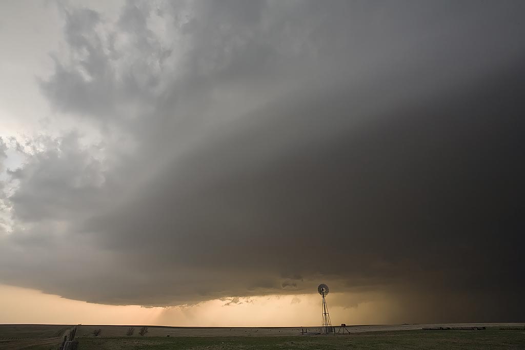
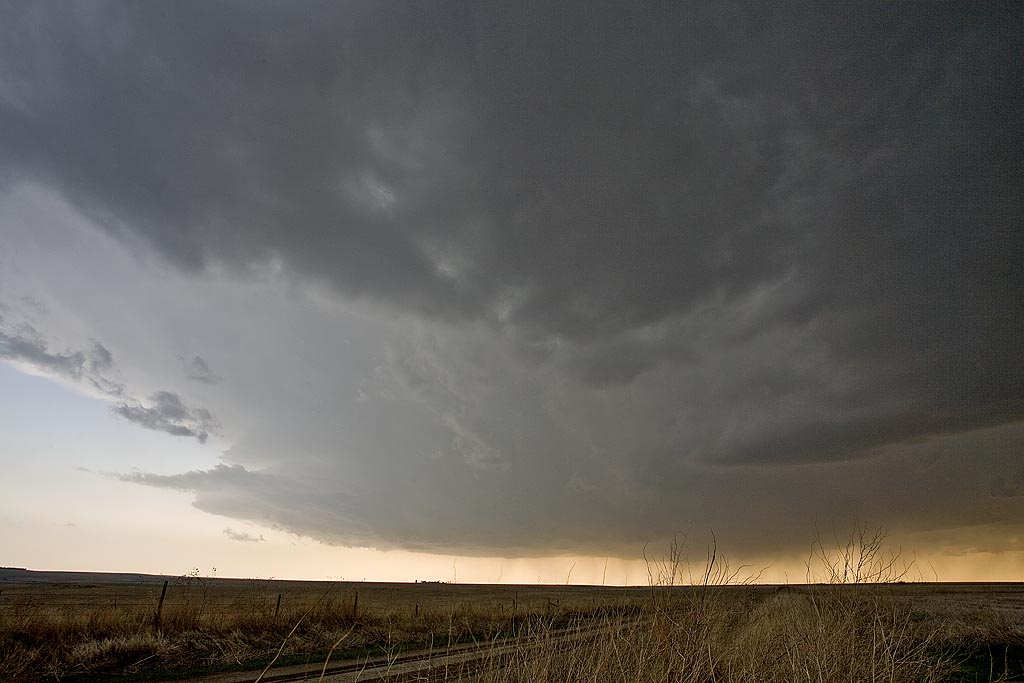
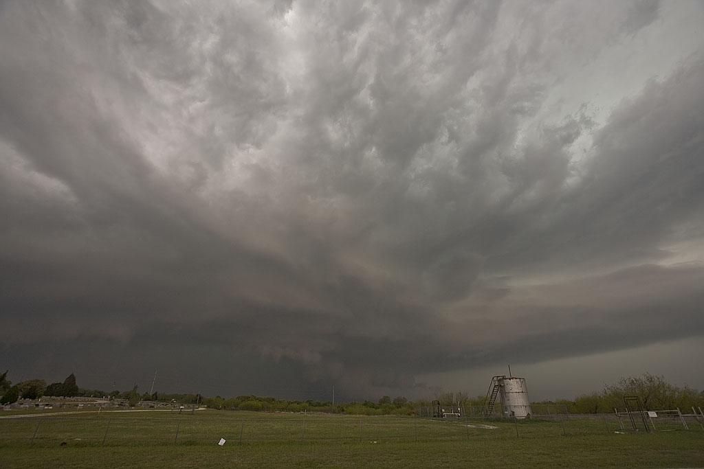
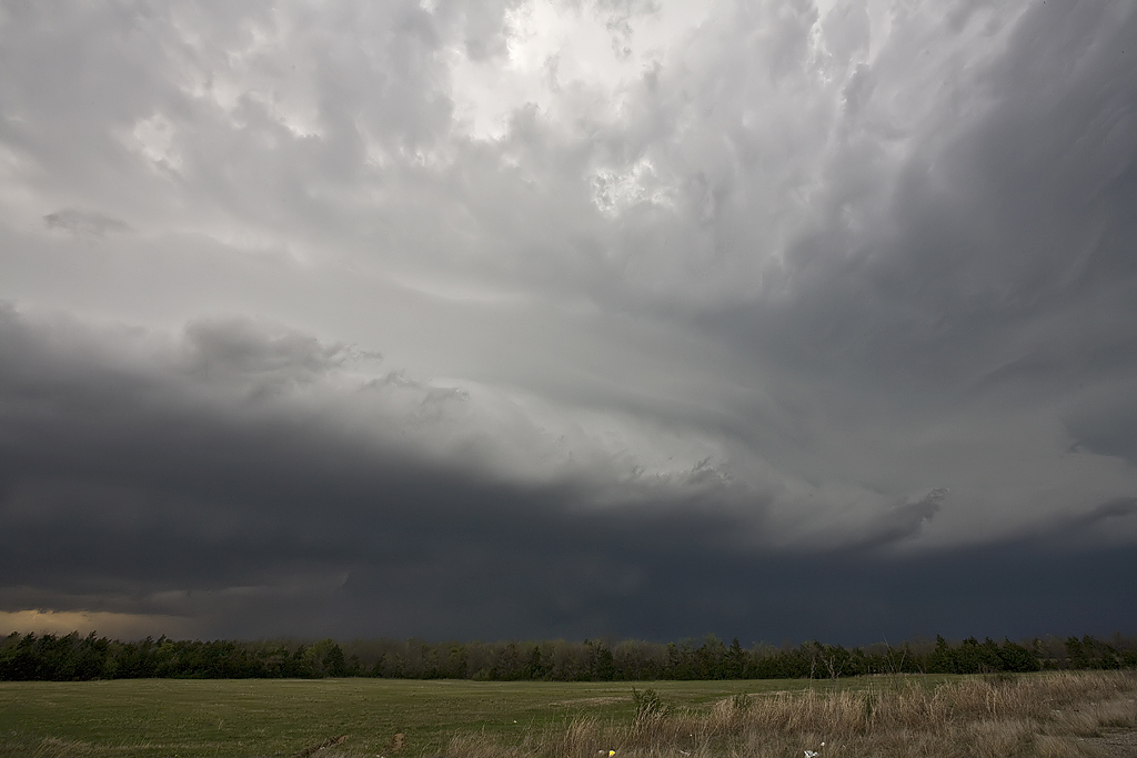
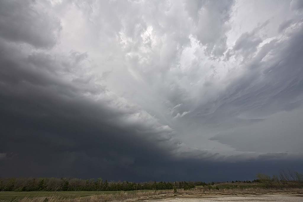
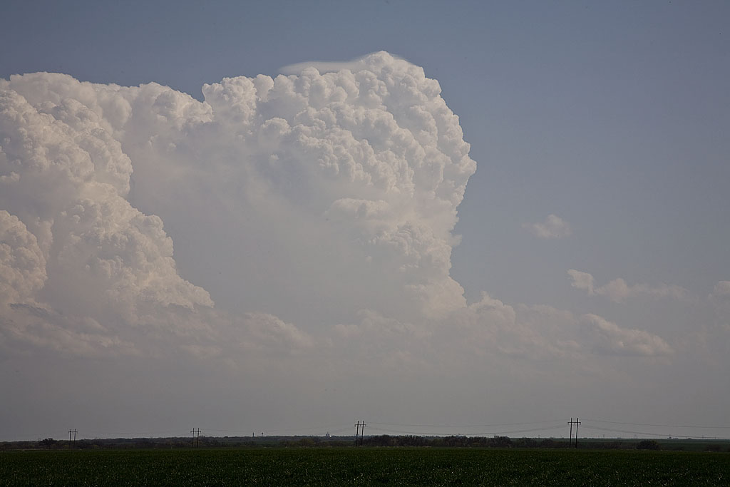
May 2nd had big potential. But, when we awoke in Joplin, Missouri, a huge squall line had moved through, taking the instability and moisture with it. I was afraid the squall line would be all that formed that day. Despite great kinematics and good thermodynamics, I figured the day would be spoiled by this raging squall line. I couldn’t have been more wrong. We blasted east and south through southern Missouri and northern Arkansas to my target northwest of Memphis. As we did, it became apparent that this day would go down as a major event. The squall line became cellular with numerous tornado warned, long lived tornadic supercells forming from Little Rock, AR eastward and southeastward through western Tennessee and western Mississippi. We intercept numerous tornado warned superells and filmed 3 tornadoes, one very close near Gilmore, Arkansas. Early evening found us farther into Mississippi than I have chased, while intercepting two significant tornadic supercells, both near New Albany, MS.

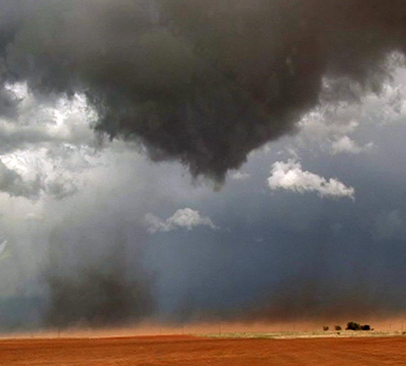
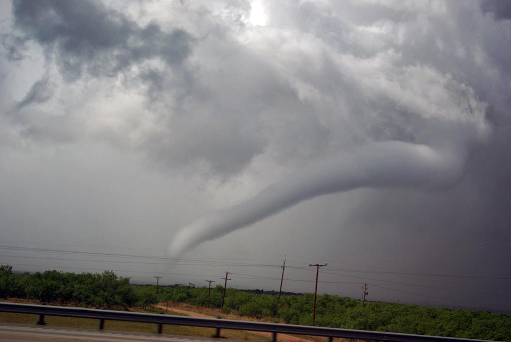
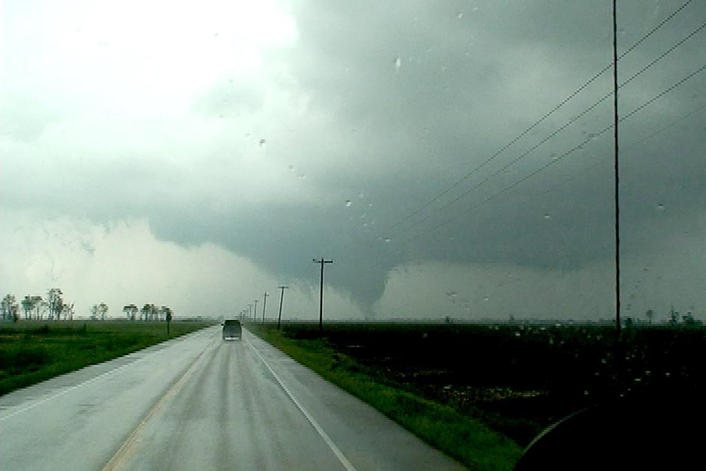
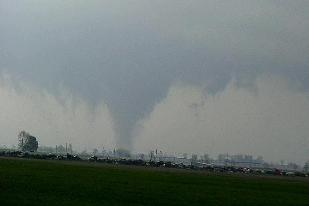
Our first tornado occurred just north of Marked Tree, Arkansas, and was a short lived multivortex tornado. The second tornado was a rather large, strong cone tornado near West Ridge, Arkansas that unfortunately caused considerable damage to many farmsteads. The closest tornado that we caught was near Gilmore, AR as a tornadic supercell approached our location from the southwest. The tornado passed only a few hundred yards from our location. Unfortunately, in the heat of navigating our group, I was not able to get my digital camera out until we intercepted the supercells near New Albany, MS. Thu all the tornado photographs are video stills.

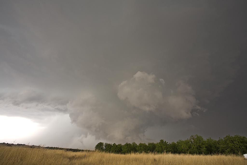
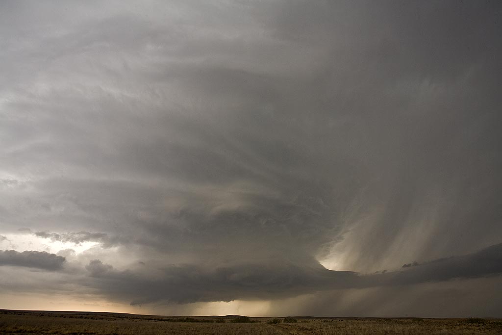
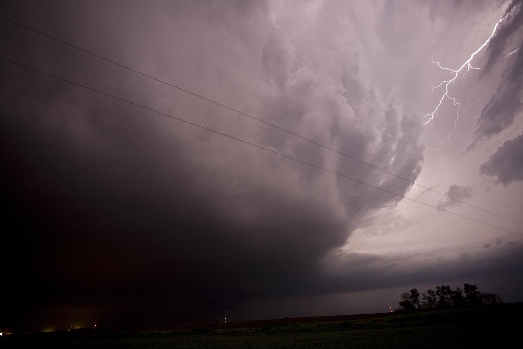
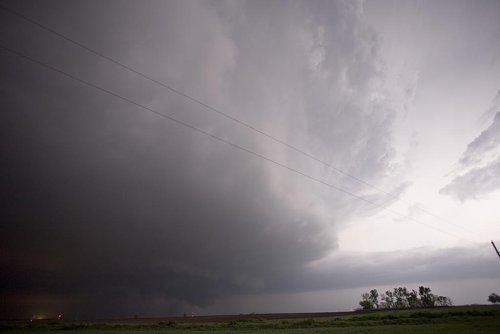
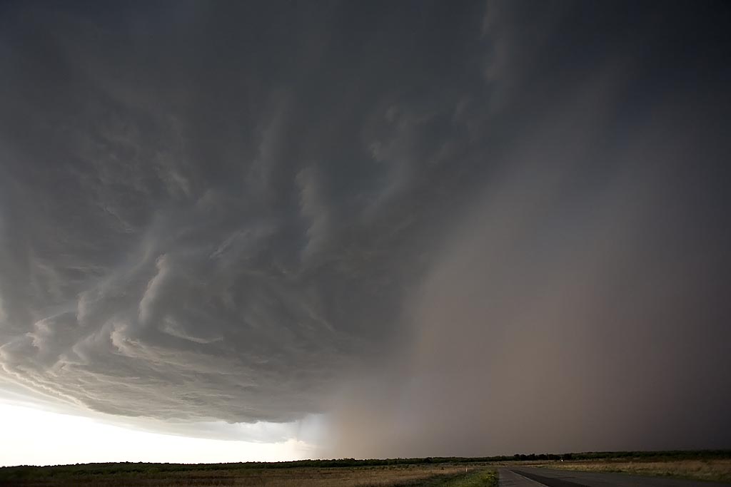
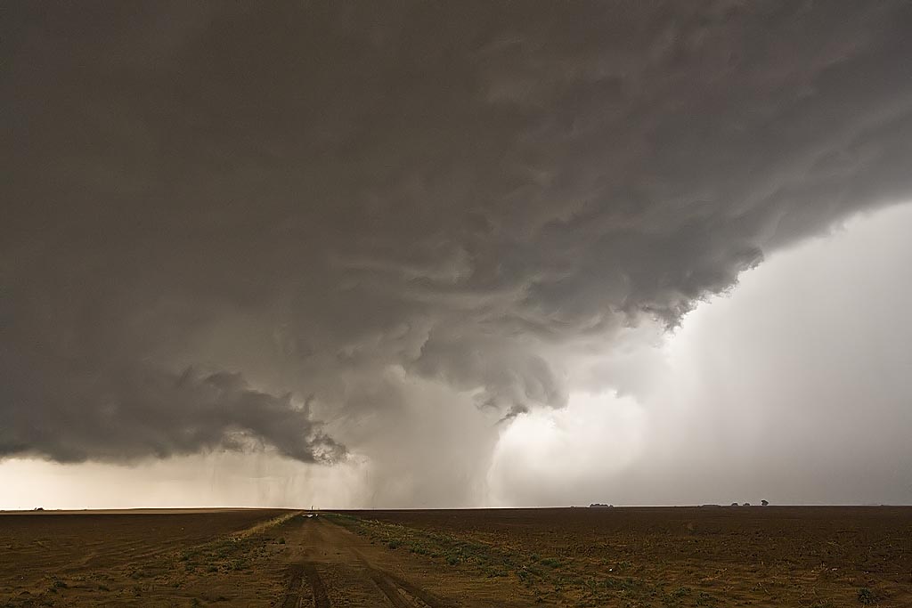
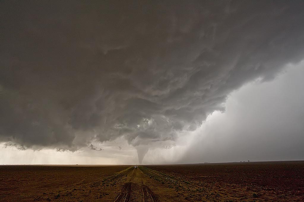
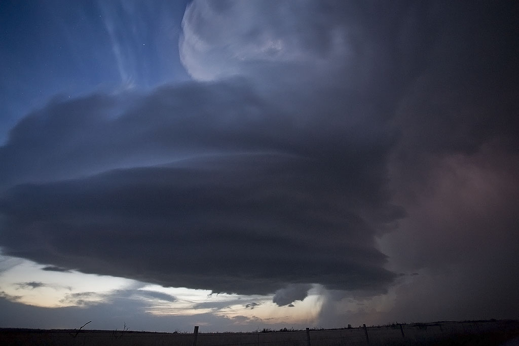
Our final excitement came as we tried to punch the hook of a tornadic supercell just north of New Albany. I stopped us about two miles north of the tornado as radar was showing over 140 kts of shear in the circulation. This could have been disastrous had we continued on the highway. The final supercell had structure like I had never seen before in east of the Mississippi river! As it passed into New Albany, the RFD ripped up trees and downed power lines, as a rain wrapped tornado churned just north of town. Please click on the thumbnail image for a larger image.

May 1st, 2008 Kansas Supercells

May 1st promised a set up that contained good shear, a sharpening dryline, but questionable moisture. All indications were that storms would form, initially high based, over southeast Kansas and possibly northern Oklahoma. As the evening went on, models showed moisture deepening and storms becoming quite intense. We played the area around Independence, Kansas. By late afternoon, storms formed, a few becoming supercells. They quickly became a cluster of supercells, with embedded mesocyclones, but just couldn’t get the job done to produce a tornado.

A couple of isolated supercells developed in northern Oklahoma and one produced several tornadoes not far from Stillwater. However, we just couldn’t get there to chase it. Finally after dark, one intense supercell, tornado warned, developed on the tail end of the line of storms near Altoona, Kansas. Photos and video revealed a bowl shaped wall cloud, possible funnel, but nothing could be confirmed touching down.

April 26th, 2008 Texas High Based Supercell

April 26th featured a diving shortwave from the northern Rockies, and meager moisture return behind a departing storm in the eastern US. Shear was respectable, but with limited moisture, we new there wouldn’t be much of a tornado threat. However, the thought of high based supercells producing hail and good lighting was enough to get us east of Lubbock, Texas. A nicely structured storm formed and tracked southeast for several hours, producing hail to 2″ in diameter, decent structure and tons of awesome lightning.

April 24th, 2008 Northwest Kansas Supercells and Tornado

April 24th was going to be a touch and go day. Strong shear, but sparse moisture would be forecast in Kansas, while much better moisture, but a strong cap would occur in Oklahoma. Hence the ages old question, where to chase. I finally decided that north would be best where a weaker cap would certainly result in initiation, even with meager dewpoints in the mid 50s. We arrived in Colby as two high based supercells developed. We would stay with these storms throughout the evening as one storm would become dominant. It even produced a nighttime tornado that shows up clearly at a high ISO. After we left it, it produced a 1/3 to 1/2 mile wide tornado near Beloit after midnight. We awoke the next morning in Kearney, Nebraska to snow.

April 23rd, 2008 West Texas Supercells and Tornado

April 23rd looked like a significant severe weather day. It did not disappoint. My target was along the outflow boundary and dryline intersection, which I forecast to be near Lamesa, Texas. We headed out from Wichita Falls, where we spent the night before, around 8 AM. We encountered several storms, some severe, on our drive. We finally made it there just as a storm went up, but just north of the boundary. Finally by mid afternoon, the storm, propagating south, pulled the boundary into it.
Even though it still had that cold look to it, it was able to produce a 10 minute long tornado near Patricia, Texas, that was quite photogenic. We had inflow winds near 50 MPH, but cool, feeding the storm. An hour later the storm died as it moved east into more stable air. Thus we stayed put at the triple point, as another gorgeous supercell developed. It did all it could to produce a tornado, but just could not focus long enough to do it. It did, however, it produced baseball sized hail northwest of Big Springs, Texas and had gorgeous structure!

April 17th, 2008 North Texas HP Supercells

April 17th didn’t hold high promise to me. Storms seemed they would form and become undercut by the advancing front. One such storm did just that, developing west of Throckmorton, TX as the front surged south of it. However, it managed to get decent air and right turn, pulling the frontal boundary into the updraft. This storm had rapid rotation in the notch as scud and a tail cloud formed, streaming in from the east, as the rear flank core surged around the updraft. There “could” have been something buried in the rain and baseball sized hail, but we weren’t punching the core to find out. The second storm had tornado warnings west of Fort Worth, TX, and by the time we got to it, it also became quite HP, eventually lining out as numerous storms formed, merging into a line.

April 1st, 2008 Southeast Oklahoma Supercells

April 1st looked like a decent day for tornadic supercells in southeast Oklahoma. By the end of the day, it would greatly disappoint a lot of storm chasers. Storms had problems with entrainment and undercutting all day long. We were able to get on two tornado warned cells near I-35 not far from Madill and points east. The storm pictured above, rode an outflow boundary and did all it could to produce, but in the end just couldn’t do it due to outflow problems. 

April 7th, 2008 Northern Texas Supercellfest

April 7th was a decent looking day with a strong dryline/warm front intersection over western Oklahoma and north Texas. We arrived mid afternoon as a tornadic supercell developed west of Wichita Falls. SPC issued a PDS tornado watch and upgraded to Moderate Risk. We witnessed a brief tornado in the occluded mesocyclone, and then had great photo ops for two other lpish supercells. We also encountered tennisball to baseball sized hail with all three storms. Check out the photos below.