
May 14th, 2008 West Texas Tornadic Supercell
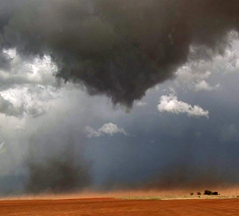
The set up on May 14th looked great. I had been looking forward to this day for many days, and it did not disappoint. Overnight convection produced an outflow boundary that intersected the dryline near Midland, Texas. An upper level low was moving out of the southern Rockies and was forecast to produce good lift and cooling over the dryline/outflow intersection by later afternoon. We arrived northwest of Big Springs as a nice storm formed, showing rotation from it beginning. It produced a landspout tornado as it formed with strong shear along the boundary. As it matured, it produced nearly golf ball sized hail.
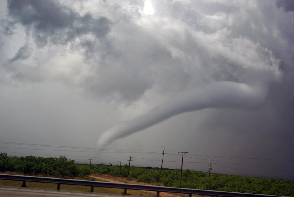
Another storm formed directly in front of it and as it encountered the outflow from the newly formed storm, it’s base came down very low and it produced the tornado shown above, followed by another smaller tornado, along with numerous funnels before dissipating as the eastern most storm became the dominant storm. The eastern storm approached Abilene and produced a couple of brief tornadoes, along with baseball sized hail. Click on the image below for a larger image.
No comments yet.