
April 23rd, 2008 West Texas Supercells and Tornado
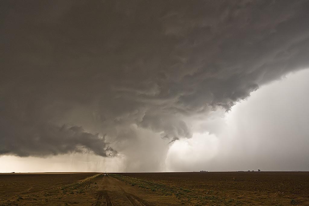
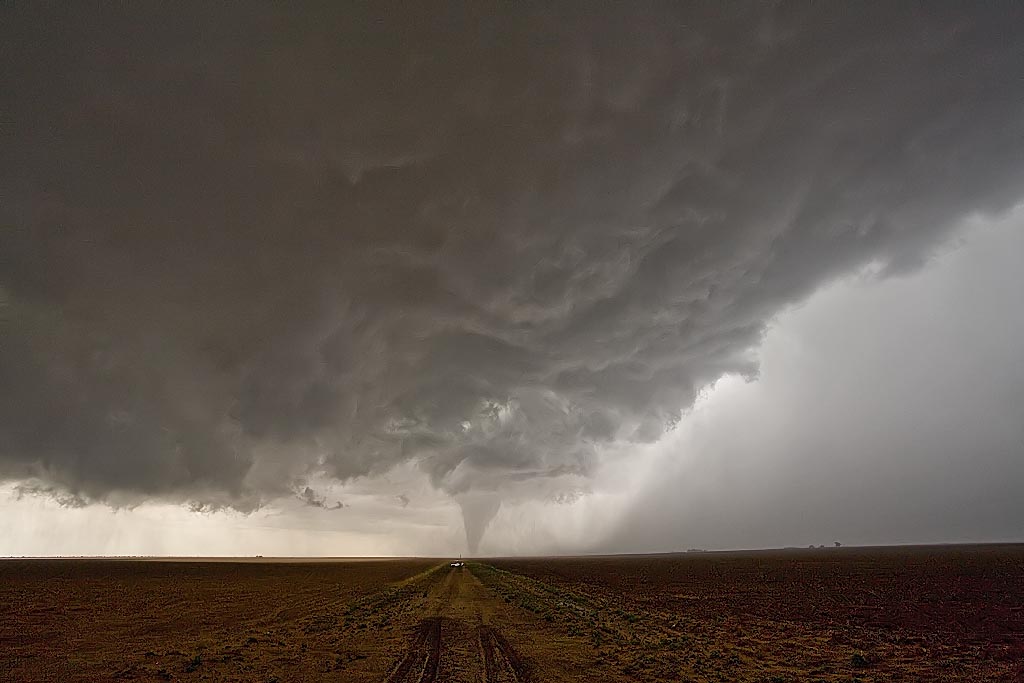
April 23rd looked like a significant severe weather day. It did not disappoint. My target was along the outflow boundary and dryline intersection, which I forecast to be near Lamesa, Texas. We headed out from Wichita Falls, where we spent the night before, around 8 AM. We encountered several storms, some severe, on our drive. We finally made it there just as a storm went up, but just north of the boundary. Finally by mid afternoon, the storm, propagating south, pulled the boundary into it.
Even though it still had that cold look to it, it was able to produce a 10 minute long tornado near Patricia, Texas, that was quite photogenic. We had inflow winds near 50 MPH, but cool, feeding the storm. An hour later the storm died as it moved east into more stable air. Thus we stayed put at the triple point, as another gorgeous supercell developed. It did all it could to produce a tornado, but just could not focus long enough to do it. It did, however, it produced baseball sized hail northwest of Big Springs, Texas and had gorgeous structure!
No comments yet.