
July 17th South Dakota Tornadic Supercells
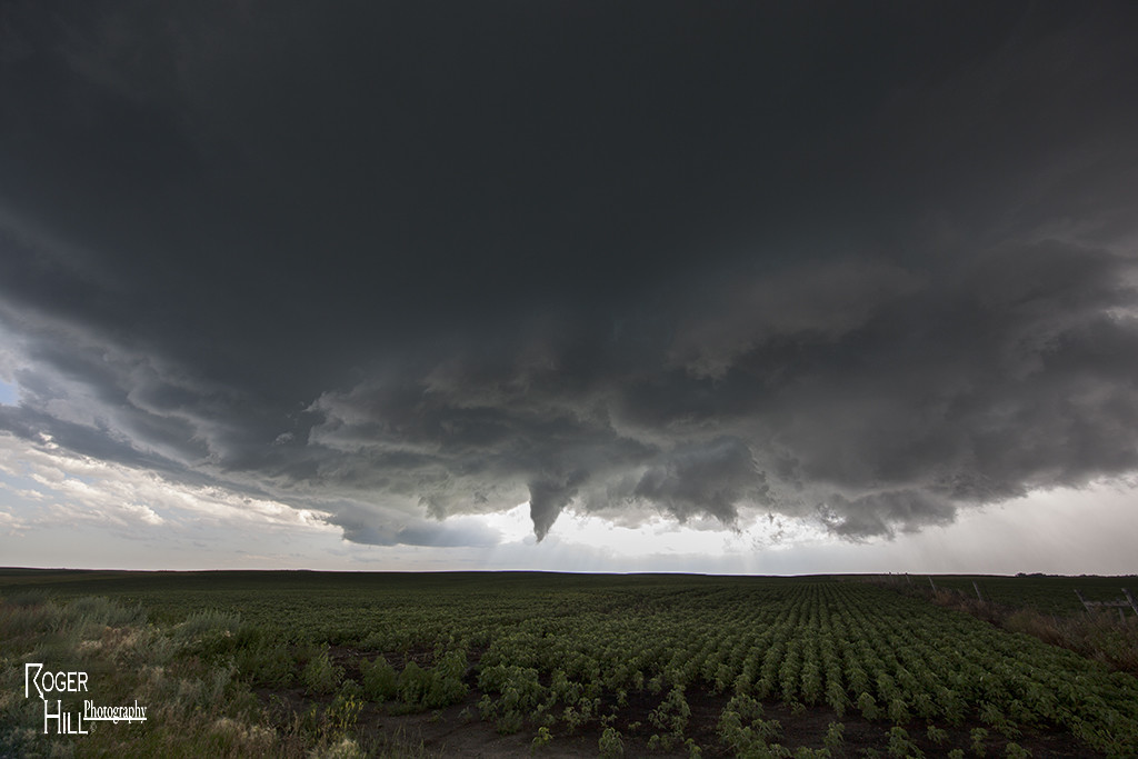
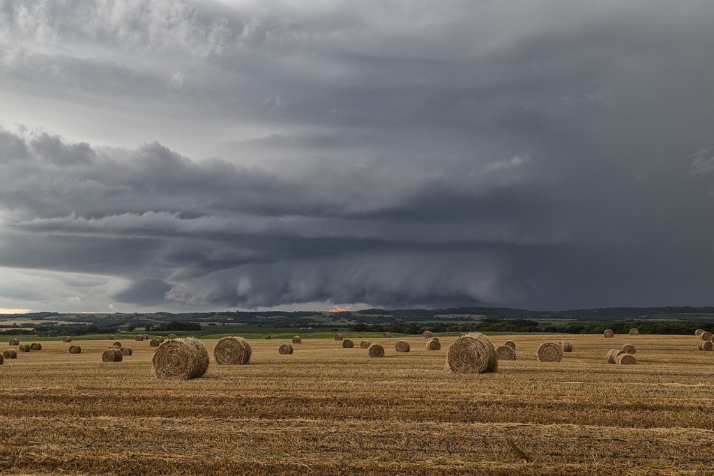
July 17th had incredible potential across the Dakotas. Our Great North Tornado Hunt tour was in place in far northeastern South Dakota awaiting initiation. A subtle short wave trough was moving across the region at peak heating, while 5000 CAPE values developed along with upper 70 dew point readings. An approaching cold front/dryline triple point would spark the first supercells, and then later the cold front would spark several more. We witnessed on such storm develop near Britton, SD which had incredible structure, huge hail to baseball size and a couple funnel clouds. Later another supercell formed near Eden, SD and dropped a tornado southeast of town. We stayed with the storms into western Minnesota where they weakened as they moved out of the strong instability. We finally dropped south towards Watertown, SD for the night as a really pretty shelf cloud approached town. A great day for the Great North tour, and it would be the first of several excellent set ups we had on this tour!
No comments yet.