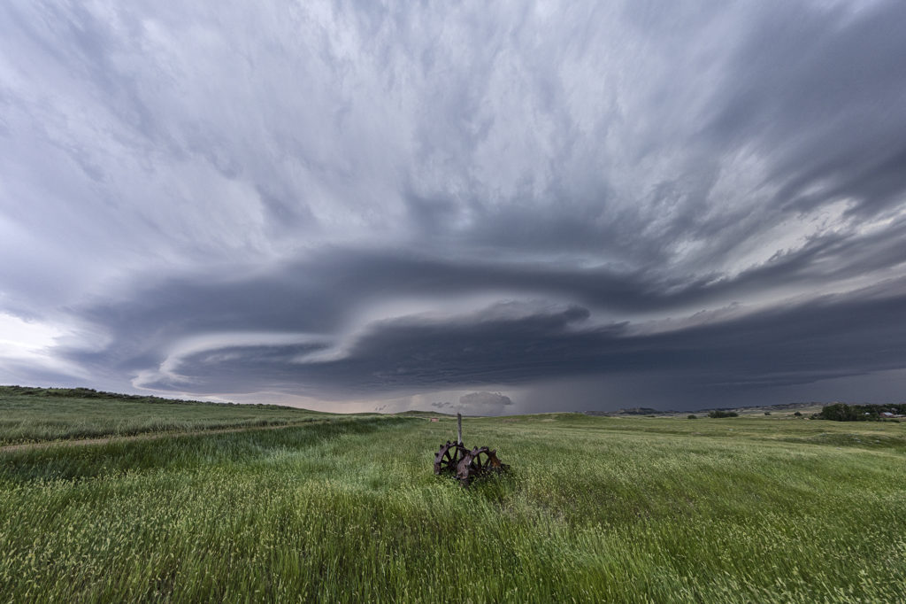
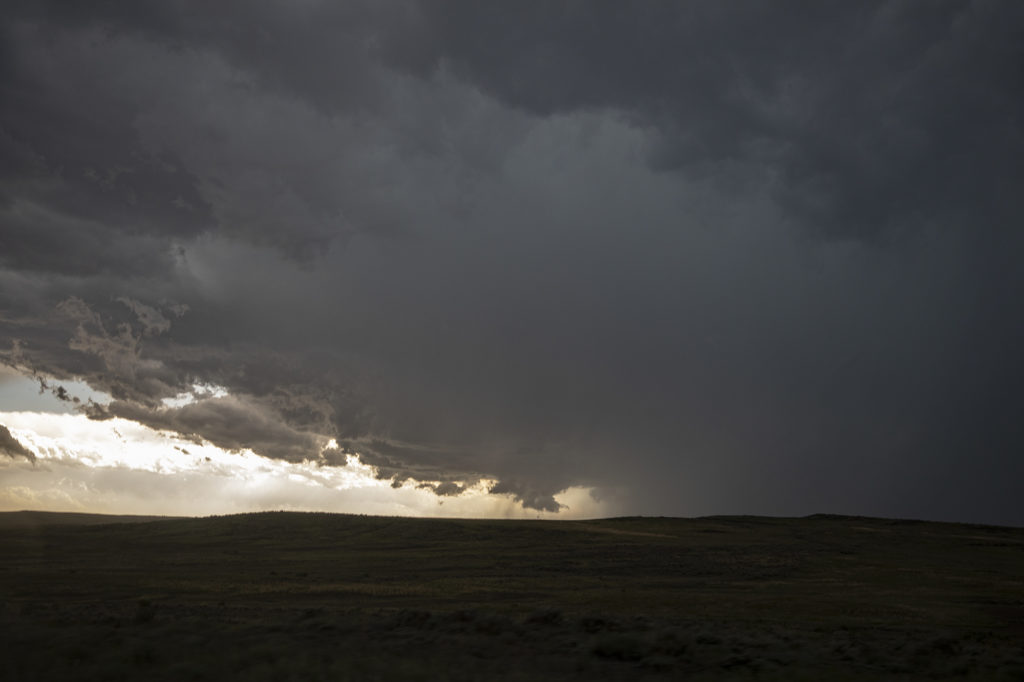
June 3rd didn’t quite live up to it’s potential. A tornado watch was issued mid afternoon and a few supercells formed. They just didn’t have the look. Lower level winds we not optimal, but still sufficient to get them to spin. We caught one storm near Miller, SD and stayed with it a couple hours as it was tornado warned. It eventually moved into a hostile environment and we let it go. Blasting back towards the I-90 area near Plankinton at sunset we encountered a gorgeous shelf cloud with a couple embedded supercell structures. It was just a gorgeous sight!! The line produced winds over 80 mph and hail golfball sized. A nice way to end the day!
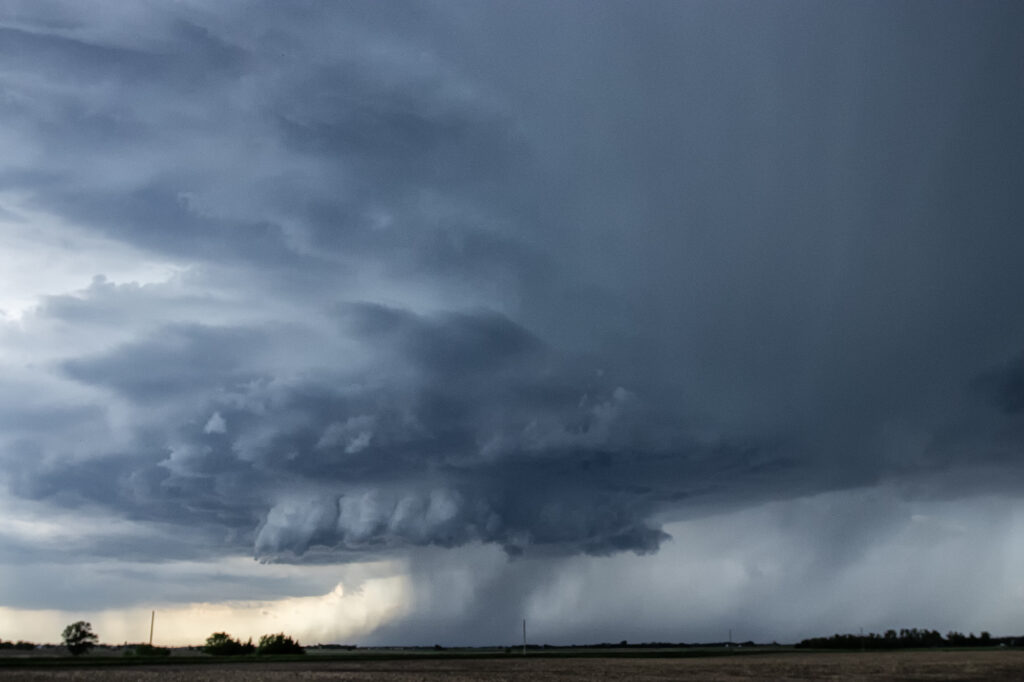
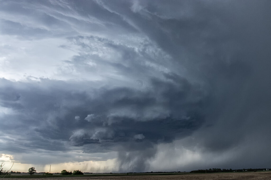
May 24, 2026 Tabor, South Dakota Supercell
A long drive was in store for the Prime Time Minitour for day 1! Supercells were forecast to develop over southeast South Dakota. Tornado threat wasn’t much, but it was sure to be a structure day. It did not disappoint! The group left at the crack of dawn for the 650 mile drive up to South Dakota. They were able to see the entire development of the best storm of the day near Tabor. Structure got better as the storm matured, drifting slowly southeast. After a few hours of viewing, it was time to call it a day and get ready for another chase. Just a beautiful higher based supercell! Worthy of the trip!
June 29th Edgemont, South Dakota Supercell
Modest amounts of moisture, wind shear and CAPE would lead to storms forming along the Black Hills. One storm latched onto an outflow boundary and spun southeast along the southern side of the hills into northwest Nebraska. We encountered some intense hail up to tennisball size! The structure was nice and the cell had that classic “hail core green” look to it. It made for some nice photos ops with the structure, colors and pretty scenery of the Black Hills. We pushed around the supercell towards Chadron, NE where numerous storms formed and weakened the supercell due to too many cell interactions. A fun day, nice supercell, broken windshield from the hail and pretty colors!! Since this was the photo tour’s first day, they thoroughly enjoyed it! Enjoy the pics!
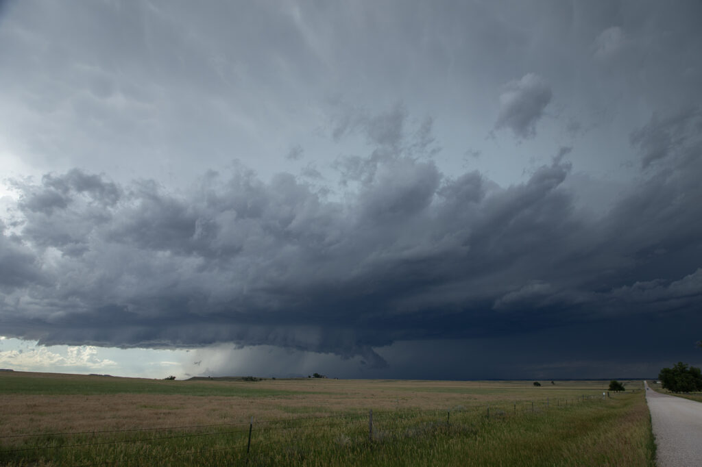
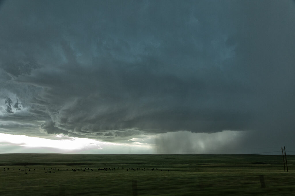
July 10th Southeast Montana Supercells
Southeast Montana was the target this day for what appeared to be a decent chance of high based supercells. Great shear was in place, but limited moisture and instability would temper the threat of significant severe weather. Nonetheless, storms formed off the Big Horn mountains and moved east and intensified. Hail the size of half dollars and winds to 70mph occurred from these supercells. Structure was typical for high based storms and one can wonder only what if there would have been better moisture and instability. It was still a fun day and we at least had severe storms.
June 12th Central South Dakota Tornadic Supercell
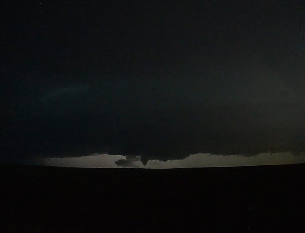
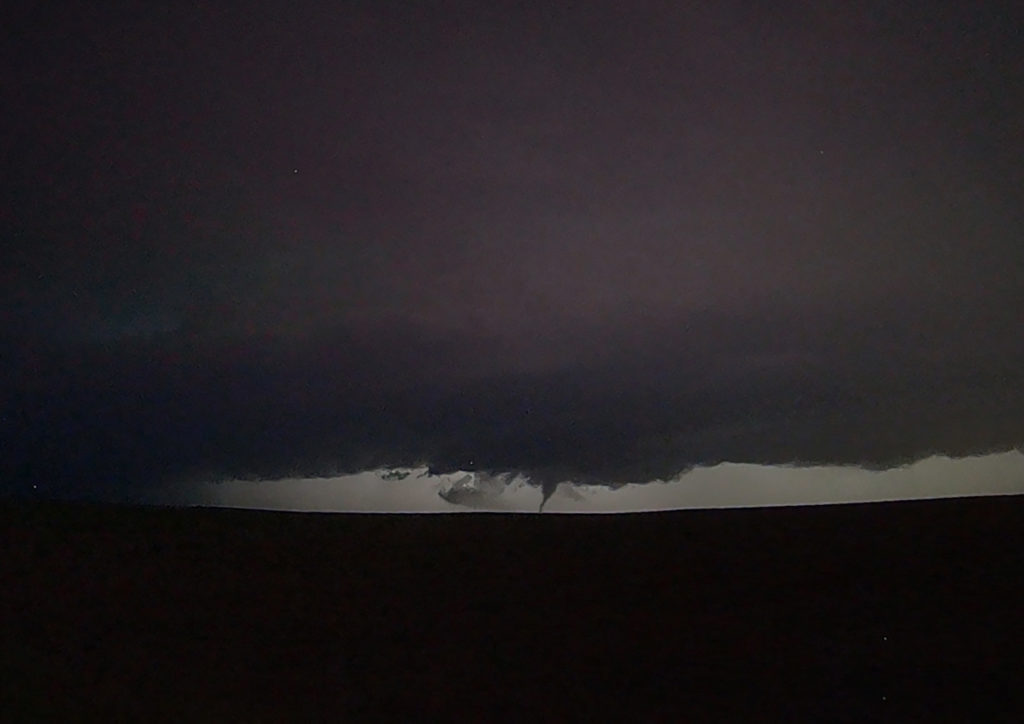
June 12th was a great day for the tours! We intercepted several storms, of which two became strong supercells. Good lift along a boundary, moderate moisture and strong instability as well as shear, would provide the needed ingredients to get these storms firing up. A cluster moved into west central South Dakota and eventually the southern most storm, referred to as “Tail End Charlie” took over the show. The southernmost storm typically gets the best feed of air and usually becomes the most intense. As it moved towards Phillip, South Dakota, it became a strongly rotating supercell. We encountered the south side of the hook as we moved east from town and had winds of 70 mph plus and tennisball hail. Out towards Midland, it took a hard right and become a beast of a storm! Near the I-90 corridor, the storm was an insanely electrified beauty of a mothership! As we watched in the night, you could see a funnel form and touch down. It was later confirmed by the NWS as a tornado. There are a couple video stills in the images below. After a few hours chasing these storms, the lined out so we let them go at midnight and headed to our hotel in Pierre. Enjoy the pics!
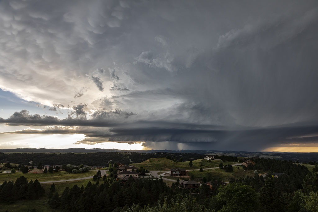
July 6th/7th Northeast Wyoming/Southwest South Dakota Tornadic Supercell and Severe Storms
July 6th was an inbetween day for our tours. However, as we often do, if there is a decent set up, we’ll run one of our on call tours. That’s exactly what we did the 6th and 7th! On July 6th we started in Denver and blasted to southeast Montana where storms were forecast to form along a boundary with good instability and shear. We’ve seen numerous tornadoes in this region over the years and some outstanding supercells! Today would be no different! We made it south of Broadus, MT and turned east on a dirt road near Biddle. We had a great view of the developing supercell. As we continued east, the forward flank core caught up with us so Caryn had to push it a bit to get out of the heavy rain so we wouldn’t get stuck. Low and behold as we were blasting east on muddy roads, trying to get south of Alzada to head south towards Hulett, WY, our wonderful storm tornadoed. Couldn’t see it from our location, thanks to horrid road network. However, if you were north of Hulett, you had a decent, albeit distant view. We stayed with the storm as it crossed the Black Hills near MT Rushmore and onto the nearly plains. It became a stunningly beautiful supercell as it tracked towards the Badlands. Gorgeous!
On the 7th we played southeast Montana again. However moisture quality was much poorer than the day before. Storms formed along a boundary and became a squall line as they moved east. They were still pretty and offered some very photogenic moments! We stayed in front of them back to Rapid City, SD where we spent the night before returning to Denver the next day.
Please click on a photo for a larger image. Enjoy!
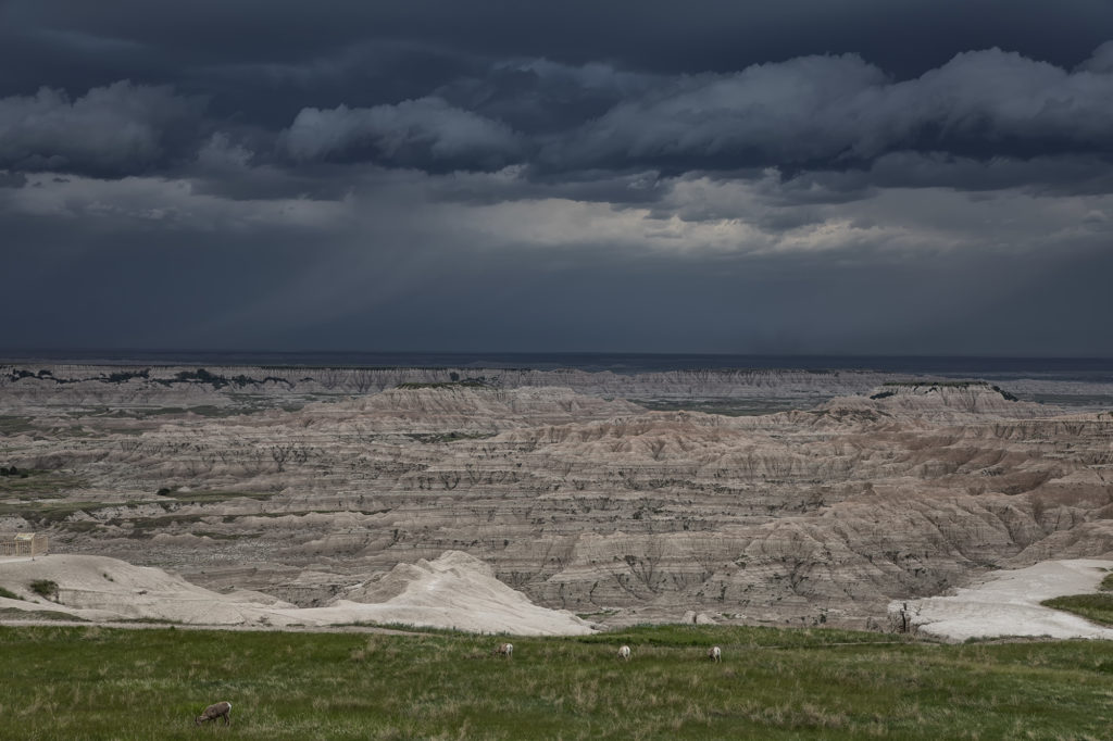
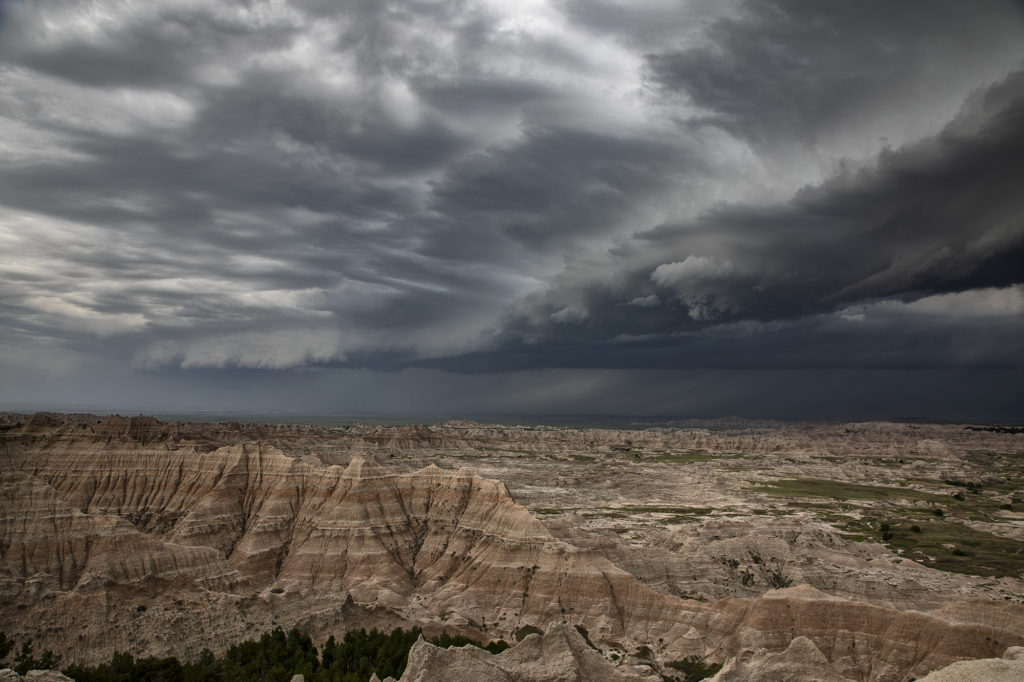
June 6th South Dakota Badlands Severe Storm
June 6th appeared to be a day of fast moving squall lines, and it panned out to be just that. Storms formed early afternoon over Colorado and Wyoming and raced north, at times over 100 mph, to the northeast! These storms produced extreme wind damage as the pushed through the Dakotas by evening. As they approached Badlands National Park, they were severe with hail and winds, while the badlands themselves, provided a very photogenic foreground. Please enjoy the pics and click on an image for a larger photo.
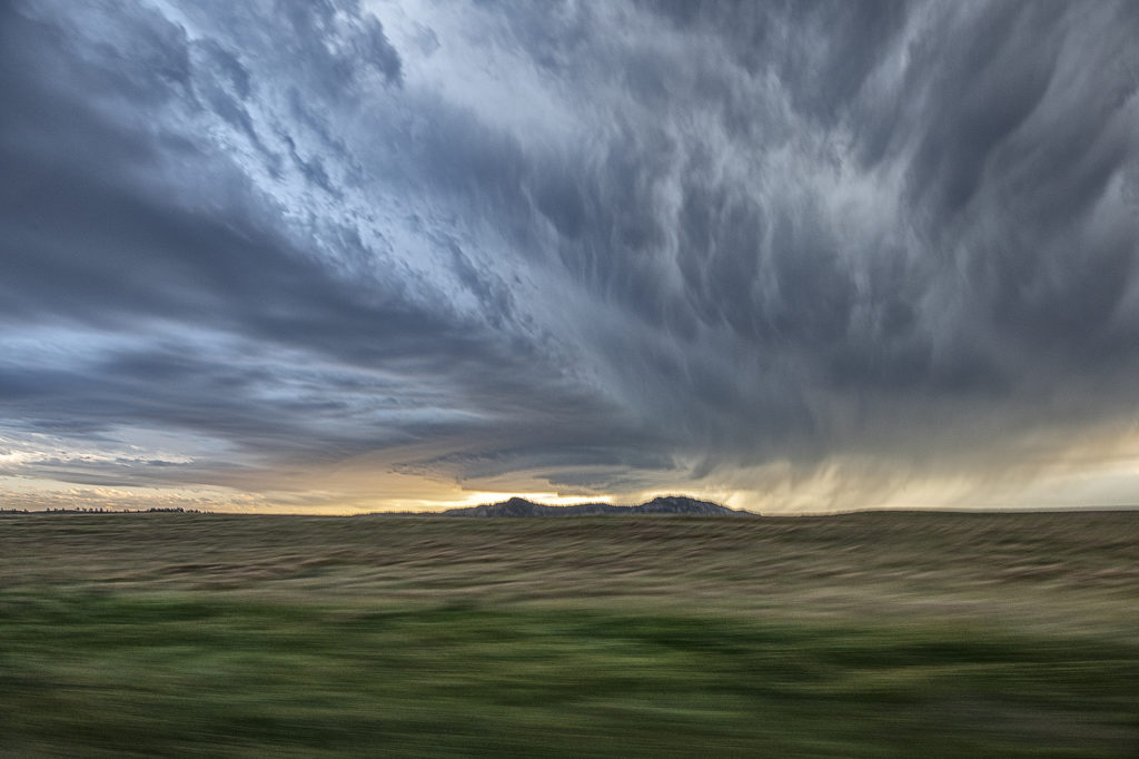
July 11th Black Hills of South Dakota Severe Storm
We weren’t expecting much on July 11th. Nature decided to give us a pretty storm southwest of Spearfish, SD late day. The cell was very photogenic, and throw in the fields of sweet clover and you had a winner! The cell traveled for a few hours across northeast Wyoming into western South Dakota, where it dissipated over the Black Hills. Very pretty to watch and photograph! Enjoy the pics!
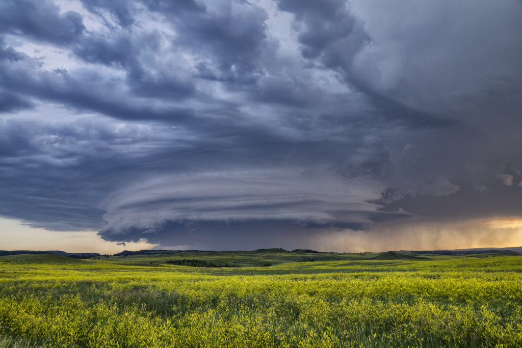
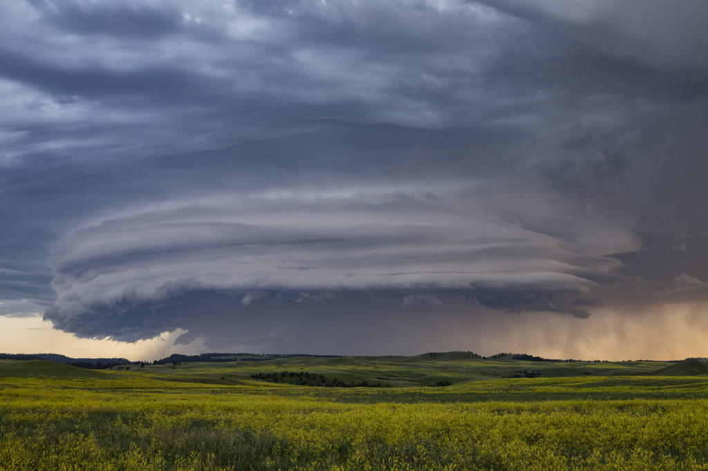
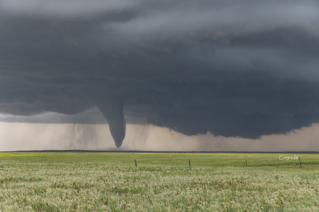
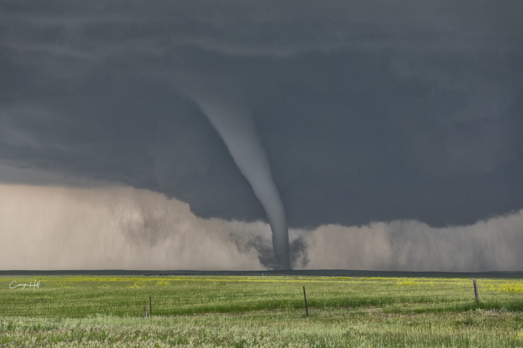
June 28th Southeast Montana/Northwest South Dakota Tornado Outbreak
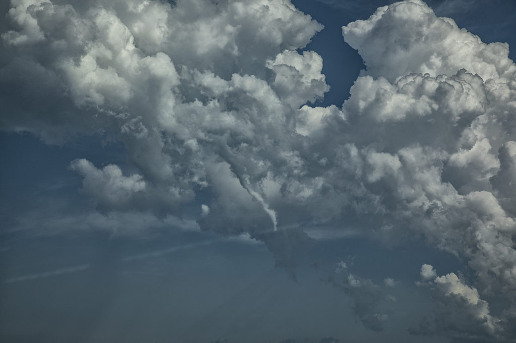
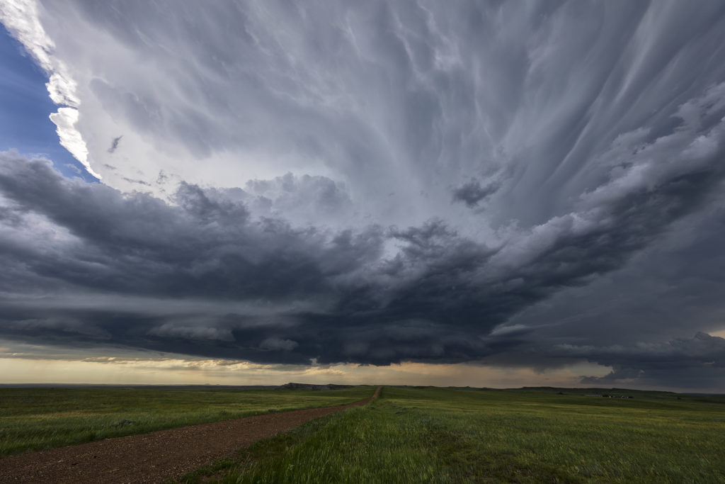
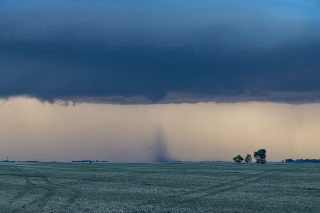
An incredible day! The most significant tornado outbreak of 2018 to date occurred from one supercell this day! Southeast Montana and northwest South Dakota was the scene for this cyclic tornadic supercell that produced at least 8 and possibly more tornadoes in that area. The highest CAPE values I’ve seen in this area in 33 years of chasing occurred with 8000 joules of CAPE! Strong shear as well as mid 70s dewpoints, and throw in an awesome Black Hills Convergence Zone boundary and it would be only a matter of time before this supercell formed and morphed into the best storm of 2018! By mid afternoon several cells fired along the boundary and drifted north. All but one cell continued on this trek, with the one lone cell quickly becoming a supercell, which right turned along the boundary and turned into a beast! The structure was top notch and the tornado event that unfolded was incredible. Tornadoes of every shape, size and strength would form from late afternoon through sunset as the cell continued its slow march into northwest South Dakota. At one point we even had an anticyclonic tornado that developed on the south side of the updraft and raced directly towards us. Caryn would see it and take evasive action quickly as it passed in front of us. Then a large half mile wide wedge formed directly in front of us and roared across the countryside getting an EF3 rating! An amazing sight to behold!!! The storm continued into northwest South Dakota south of Camp Crook and continued producing tornadoes in the dark. Lightning would illuminate them making for some of the most spectacular storm photography this season! Please enjoy the pics!
June 10th Northwest South Dakota Tornado Warned Supercell
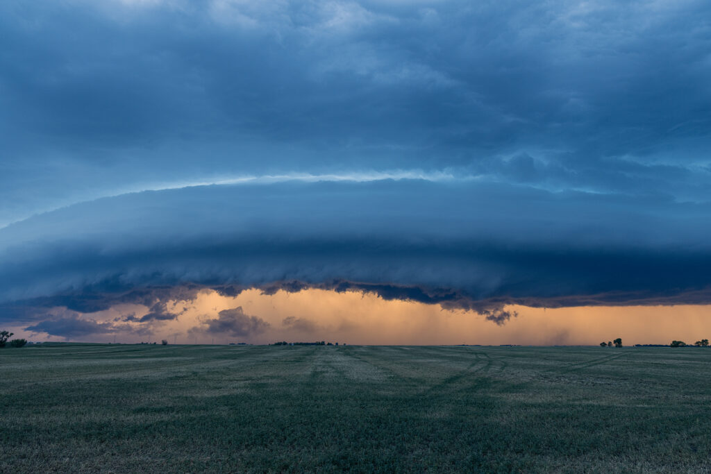
We expected a good day this day in South Dakota! Great instability, near 70 dewpoints, good shear and a dryline/outflow boundary intersection would set the stage for intense supercells late in the afternoon. By mid afternoon, a cluster of congestus formed in northwest South Dakota south of Buffalo. Soon several cells tried initiating there, with one dominant storm taking over the show. It quickly grew to 60,000 feet tall and became severe warned. Structure was decent and a wall cloud, complete with clear slot formed as it became tornado warned. This cell would weaken and intensify several times, but it never seemed a major threat to produce tornadoes. The tornado warning on the supercell continued for several hours, as broad cyclonic rotation occurred. It just never seemed like the rotation tightened enough to produce more than a weak funnel or two. By early evening, the storm lined out with a really pretty shelf cloud that had embedded mesocyclones that also became tornado warned. Still, a fun day, giving us many hours of chasing time on this pretty storm!