Tag Archives | spring

May 27th Northeast Colorado/Southwest Nebraska Tornadic Supercells

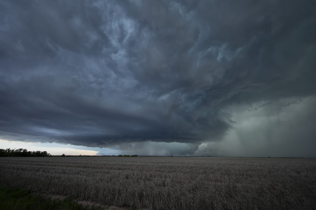
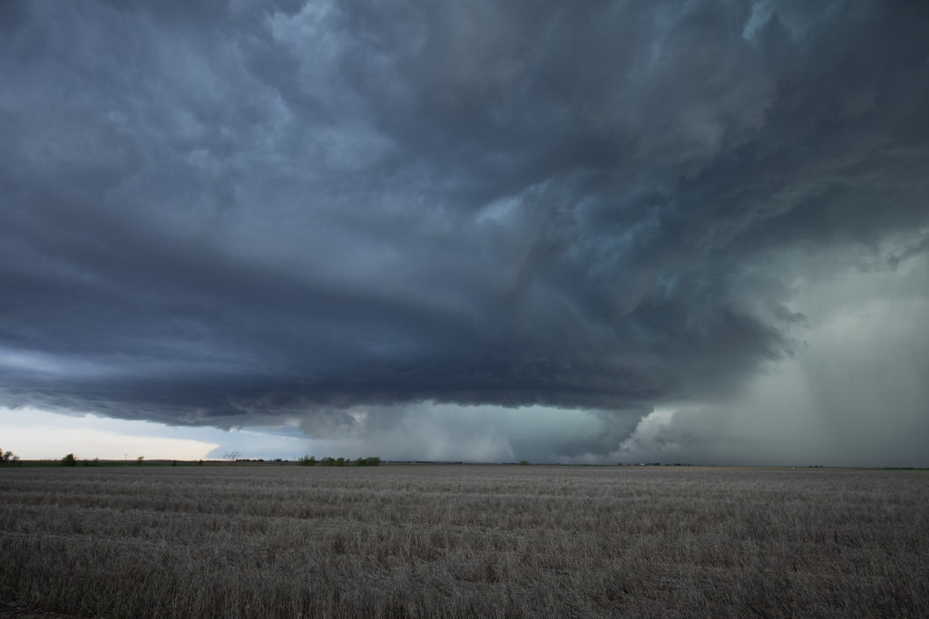
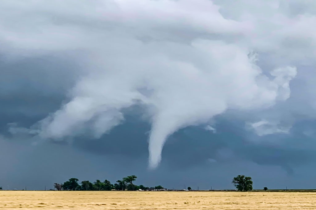
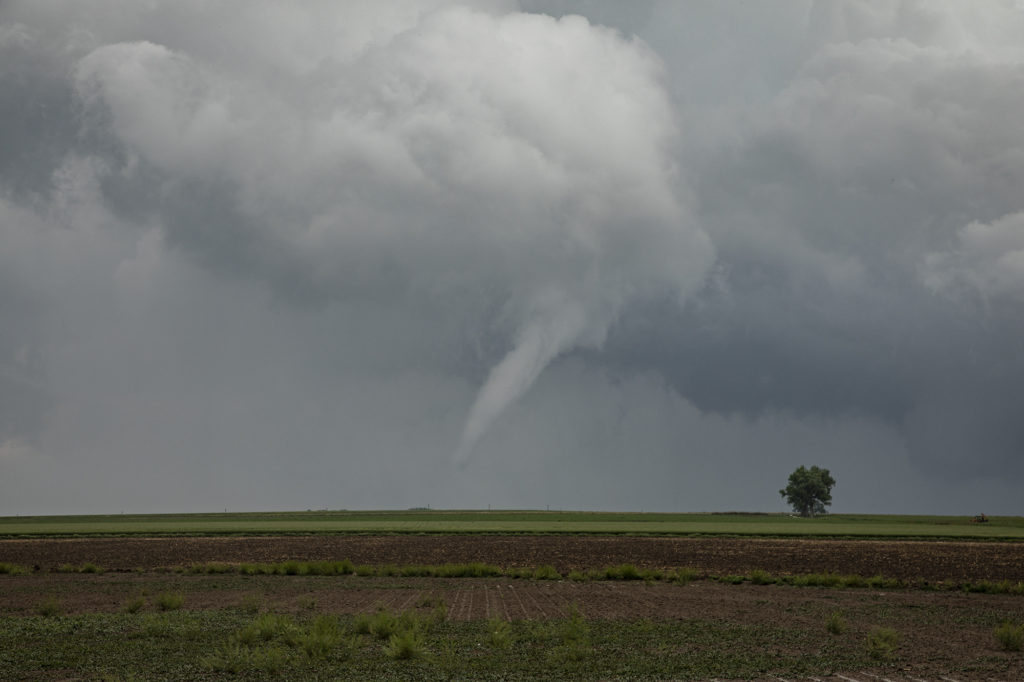
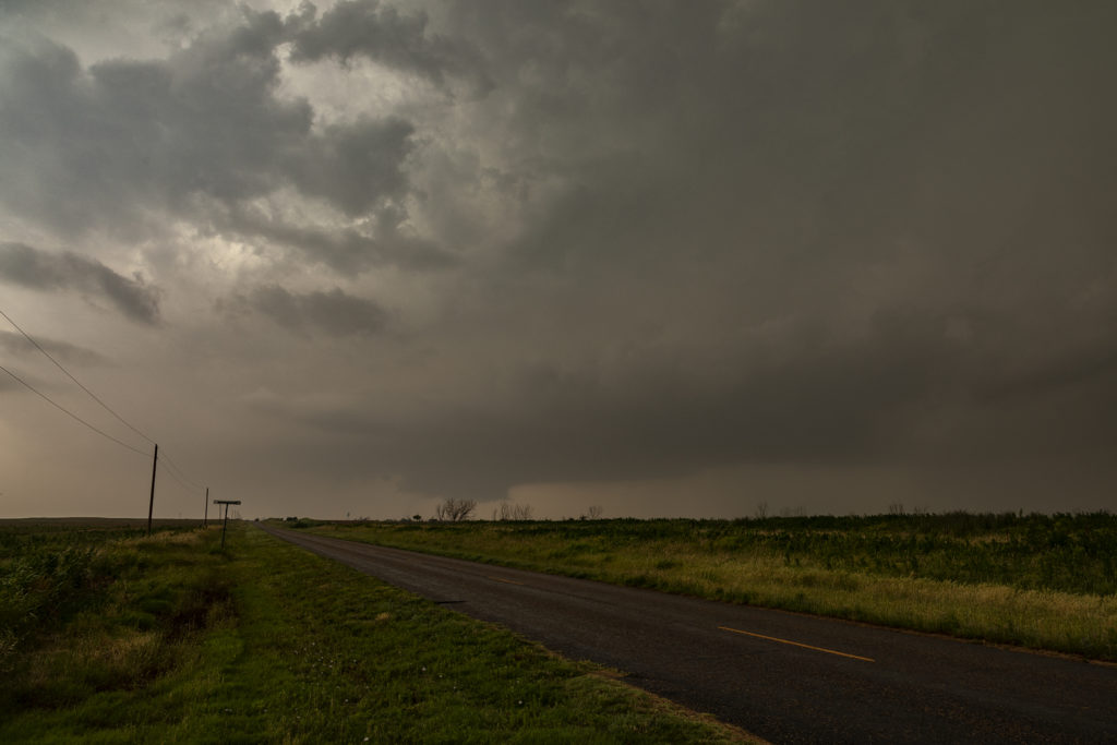
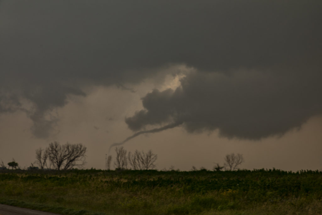
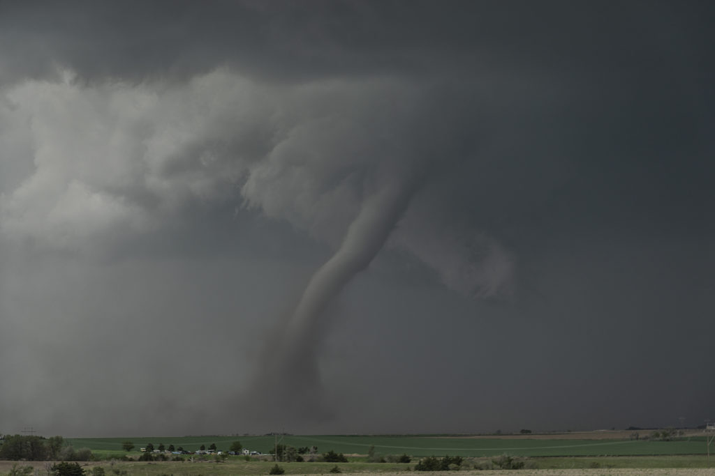
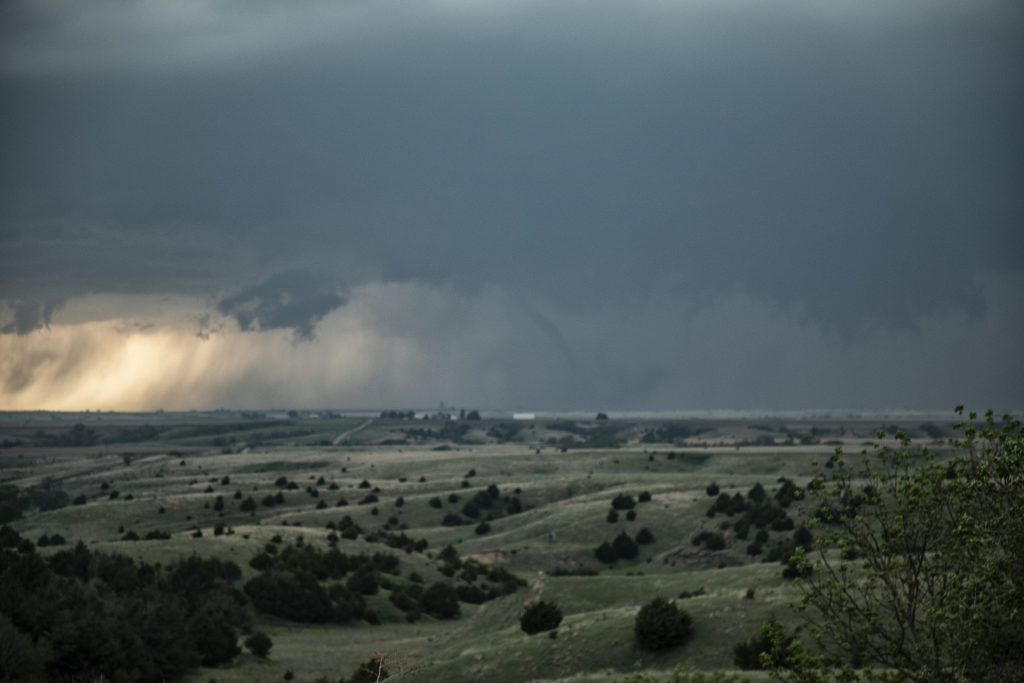
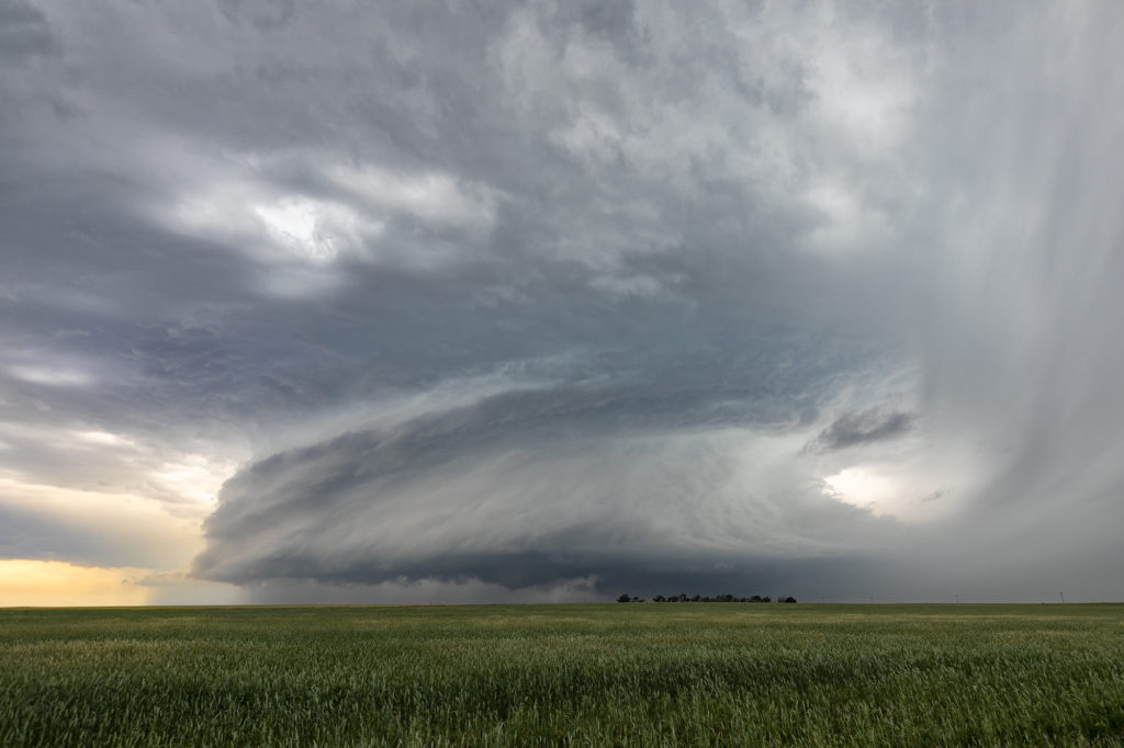
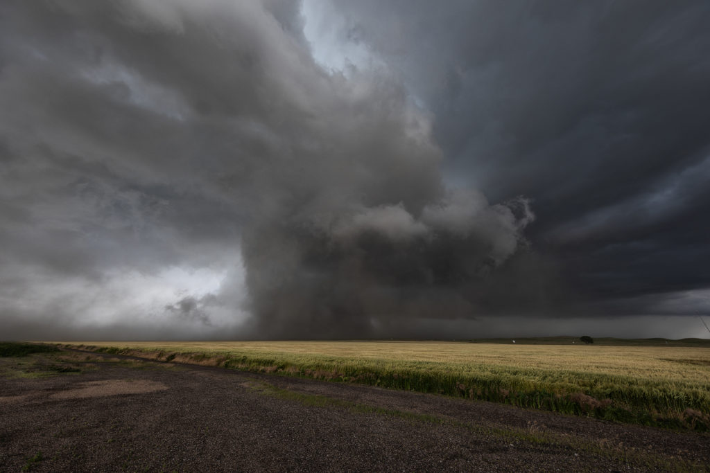
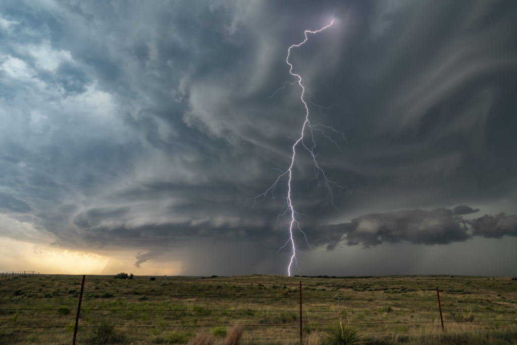
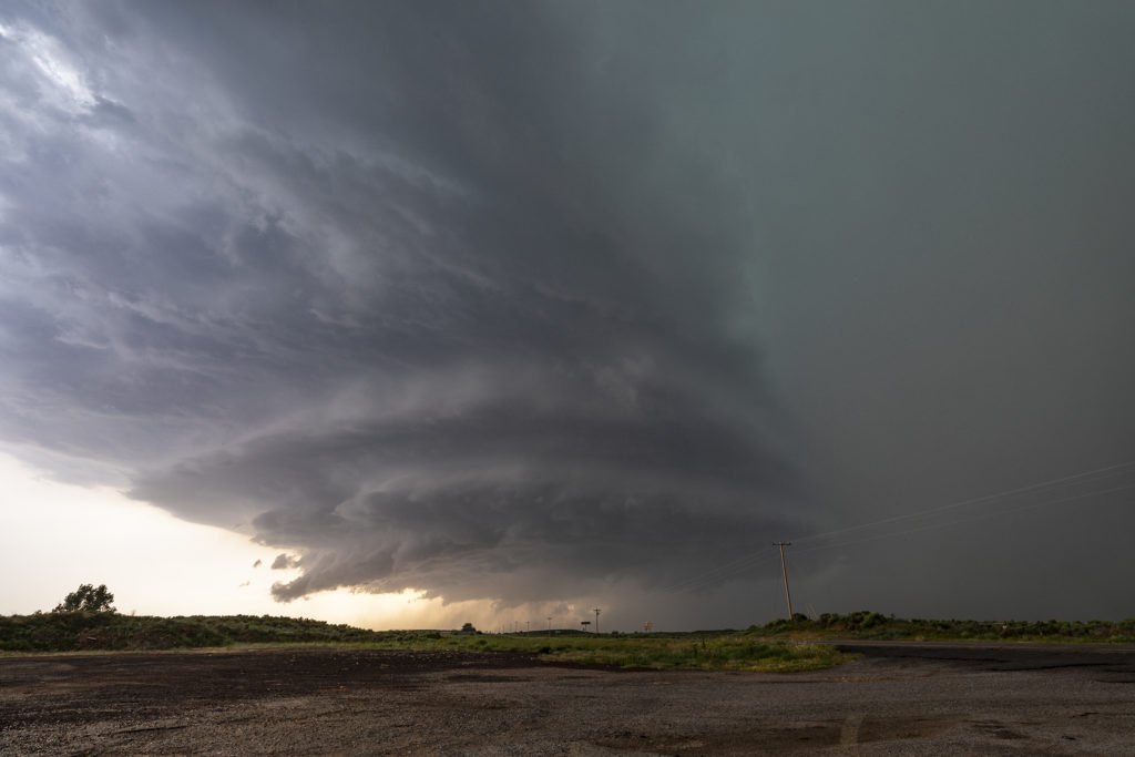
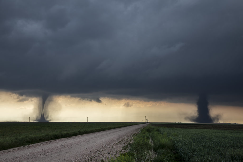
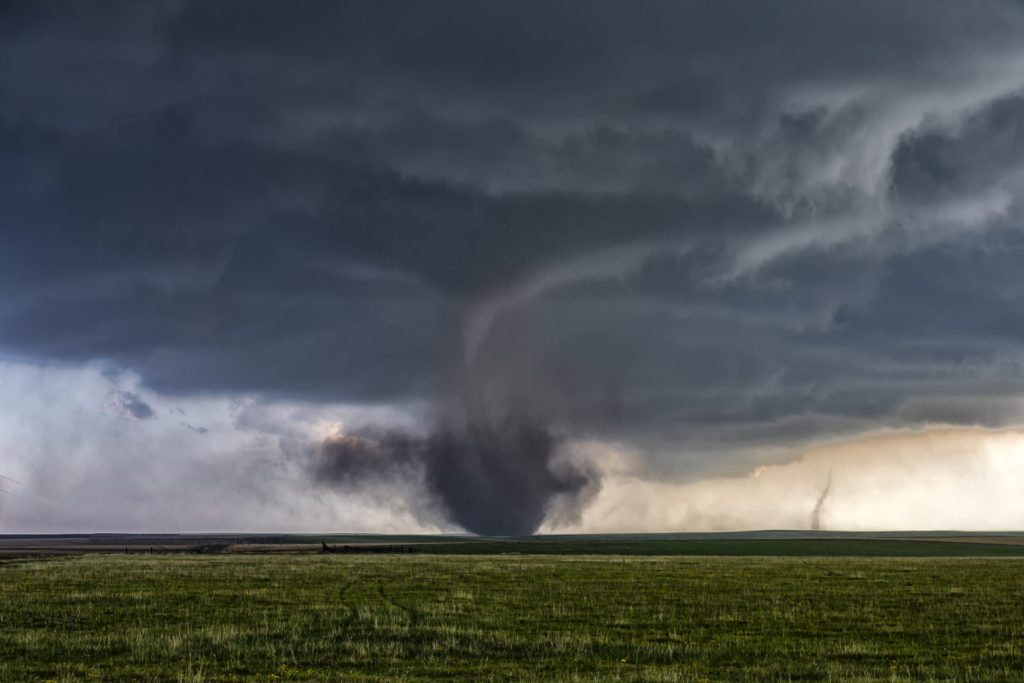
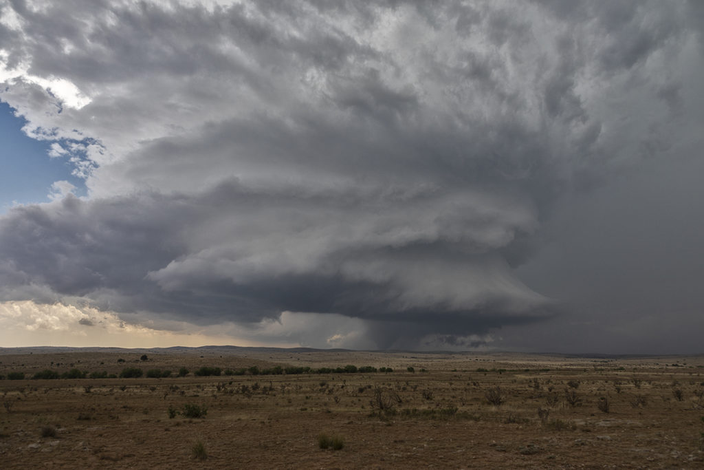
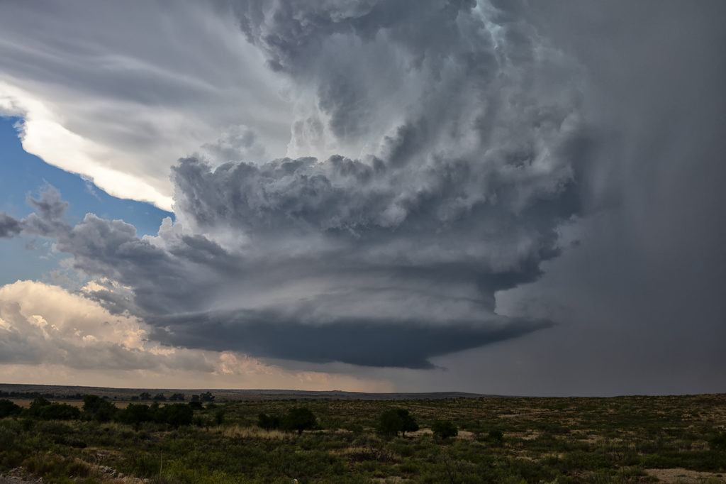
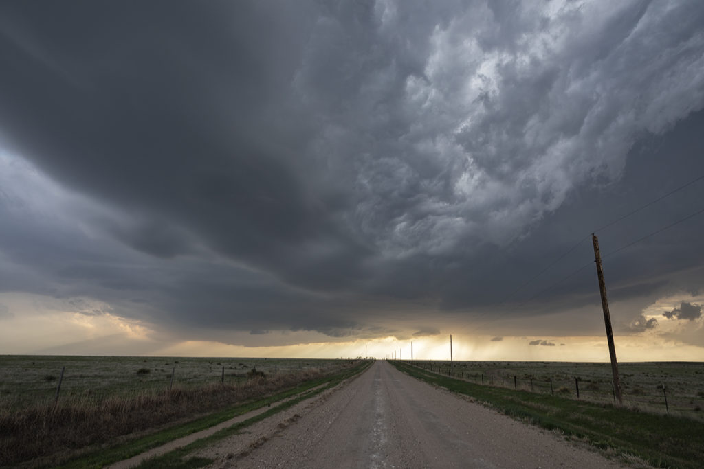
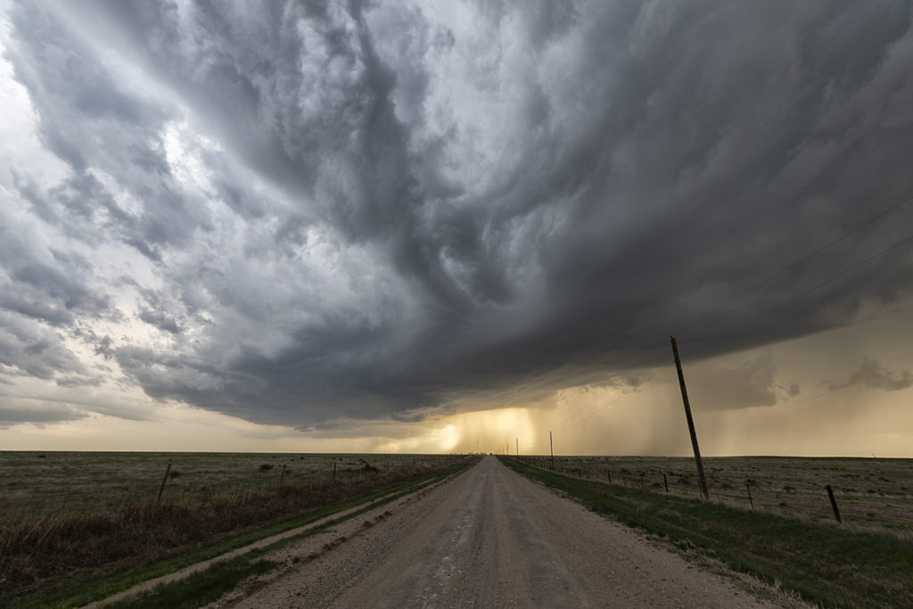
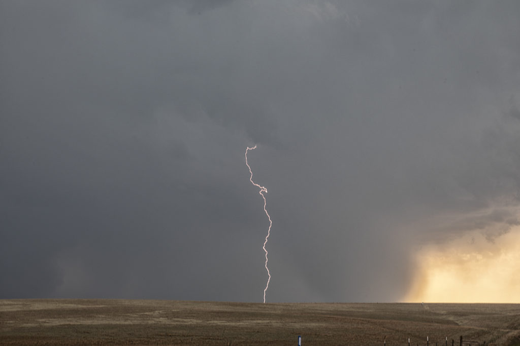
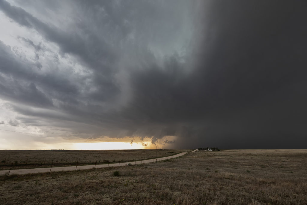
This day had a lot going for it. Great shear, good moisture and instability, and a dryline would help set the stage for intense supercells. Our first storm of the day formed near Ft Morgan and tracked northeast along I-76.  It became a rather large and occasionally disorganized supercell. However as it approached Sterling, it wrapped up hard and produced a brief, small tornado. Further to the east, a second, well organized and photogenic supercell formed. It produced a few brief tornadoes, however the structure of this storm would be one of the prettiest for 2019! As it came towards Imperial, a beautiful sculpted storm was present. At one point west of town, not only did the storm have a stunning appearance, but a partially rain wrapped tornado became visible. The cone shaped twister was on the ground for a few minutes before wrapping in rain again as we lost visibility of it. An amazing day with gorgeous storms and a few tornadoes! Enjoy the photos below!

May 26th Southeast Colorado Tornadic Supercell

May 26th ended up being an exciting Colorado storm day! We captured a tornadic supercell just north of Lamar that had a brief pretty white elephant trunk shaped tornado. The day started out really messy as numerous elevated thunderstorms formed over eastern Colorado. An existing boundary that was visible underneath the elevated storms would set the stage for late day supercells, one of which was long lived and quite nice. By mid afternoon we were watching storms west of Lamar. They were in drier air with high cloud bases and could never really get intense.

Further east towards Lamar one storm rapidly developed along the boundary and tracked northeast. Moisture, instability and wind shear was much better in this location! It quickly dropped a funnel that persisted for nearly 10 minutes, touching down a couple times but causing no damage in the rural areas. It moved northeast and weakened as a second storm approached from the southwest and became tornado warned. It tried hard several times to produce but in the end it never did. We followed it northeast to the Kansas border before dropping further south and east into Kansas for late evening lightning.  An exciting day in Colorado and western Kansas! Enjoy the pics below. (First bright pic of white tornado is a cell phone shot)

May 20th Texas/Oklahoma High Risk Day

My 20th looked downright scary on all models. SPC issued a HIGH RISK for long tracked violent tornadoes and had a greater than 95% probably of numerous/violent tornadoes on their tornado watch box they issued. Schools closed, Air Force bases evacuated aircraft, lots of safety precautions were made. It ended up being a major, major bust. Very few tornadoes occurred and there were no violent tornadoes. Fortunately we played the dryline in northwest Texas where strong heating and good convergence would result in a couple of supercells forming by mid afternoon. We blasted down to Paducah, Texas from Childress and watched one storm produced two tornadoes. One was on the ground for about 5 minutes and the other about 10 minutes. They were fun to watch skipping across the countryside!  Chaser convergence was horrendous this day, as expected being close to Oklahoma. We opted for another target later in the evening instead of fighting with the mobs in Oklahoma, but neither target panned out. Fortunately we got tornadoes this day as many, many chasers did not! Fun day, frustrating day and a disappointing day in the end. No lives were lost, very little injuries occurred. Good news for the plains!

May 17th Southwest Nebraska Tornadic Supercell

May 17th was an amazing day. Storms formed along a dryline in northwest Kansas and northeast Colorado and pushed into southwest Nebraska. One supercell approached McCook, NE and dropped a few tornadoes along the way. Strong wind shear, great instability and good surface moisture set the stage for this and other storms to form. The first tornado was quite pretty as it tracked just west of town. A couple more formed in the hills where roads were bad and thus not greatly visible from where we had to intercept them. None the less the storm was a very pretty supercell and long lived. It persisted for several hours before weakening north of Kearney, Nebraska.

June 17th Colorado/Nebraska Tornadic Supercells

June 17th had big promise. Great wind shear, good moisture, high CAPE and a dryline and outflow boundary intersection set the stage for what would be a great day! We started in Ogallala, Nebraska and just had to drift westward towards northeast Colorado. Mid afternoon initiation was pretty convincing that supercells and possible tornadoes would occur. The initial supercell spun like mad, dropping baseball sized hail and producing at least two tornadoes. Structure was very pretty, however blowing dirt in the rear flank downdraft area (rfd) would block viewing of the mesocyclone at times. A big dusty tornado occurred near Julesburg, CO followed by another tornado near Big Springs, NE. The cell would eventually gust out northwest of North Platte, NE but not before producing one more small tornado. A fantastic day that produced an awesome supercell. Meanwhile, SLT co-owner Caryn Hill chased locally and intercepted a highly sculpted tornado warned supercell near Otis, Colorado! Probably the best structure for 2018 to that day! Enjoy the photos!

June 12th Oklahoma Panhandle Supercell

June 12th really didn’t look that good on paper.  Weak wind shear should have resulted in storms being multicellular or pulse. However, one storm formed on the Kansas border and drifted southwest and became a very pretty supercell. The big story with this storm was lightning and structure. At one point this storm was producing cgs at the rate of 5 per minute. Instability was quite strong and lapse rates were very steep.  The storm drifted westward for several hours and maintained its intensity. At one point it was a pretty stack of plates looking supercell. Colors were fantastic as well. Kudos to local fire departments for getting out and putting out the grass fires that were caused by this cell! There were many!! Mid evening the storm weakened and still gave us quite the light show as we drove to our hotel. Enjoy!

May 28th Eastern Colorado Tornado Outbreak

May 28th had good potential. An outflow boundary laid across eastern Colorado from north of Seibert, Colorado to Colby, Kansas and points east. Great shear, instability, moisture and lift along the boundary, as well as the dryline extending south from Oakley, would allow numerous storms to form. A couple became tornado warned in far eastern Colorado. One particular supercell anchored itself north of Seibert along the boundary and became a tornado machine. We were on the scene early and watched as numerous tornadoes formed, with up to 3 on the ground at the same time (Total of 11!!). Several of the tornadoes were actually landspouts (nonsupercell tornadoes), however a couple certainly had mesocyclones and were therefore supercell tornadoes. It was an amazing sight for our guests to witness as we were able to get within a mile of a few tornadoes, and within a half mile of one stronger tornado!  Please enjoy the photos from this amazing event!!!!!

May 23rd Roswell, New Mexico Large Tornado

It’s not often you wake up in Roswell, New Mexico with screaming southeast winds and 67 dewpoints.  Low stratus clouds were racing west towards the Sacramento mountains! Even though mid and upper level winds were not particularly strong this day, there was sufficient speed and directional shear to get a supercell to form. We weren’t expecting tornadoes, but with high dewpoints and strong instability we knew the potential existed. Funny thing was most chasers were racing north to play a system in the central plains, but we couldn’t pull ourselves away from Roswell.  In the end, we’re certainly glad we did! There wasn’t another chaser that witnessed what we did this day, with a quarter mile wide strong tornado under an amazing sculpted updraft! This cell produced huge hail as well and rolled across the countryside for hours all the way to Roswell. One of the most rewarding surprise days of 2018 for the tours!!!  Enjoy the pics!! Please don’t forget to check us out on Facebook as well as Twitter and Instagram!

May 18th Northern Kansas Supercell

A complex, but decent set up occurred on May 18th. A dry line, warm front and cold front would be big players this day, but the question was which would produce the best storms. The dryline fired up early and often producing numerous storms with huge hail. The cold front fired up in Colorado with clusters of storms moving into western Kansas. But it would be the warm front in northern Kansas that would produce the longest lived supercells, nearly anchored along it. Unfortunately, none would produce significant tornadoes, but a couple would produce hail baseball sized and as well as one landspout tornado. We chased a cell south of Oakley that would  have pretty structure, tons of lightning and even a cone funnel that would could not determine if it touched down or not due to the angle it was from us. I fun and exciting day ended with a fantastic lightning show in Garden City, Kansas.

May 13th Texas Panhandle Supercells

May 13th brought a good set up with strong convergence, good instability and moisture, but weak shear. This would result in high precipitation storms nearly anchoring across the Texas panhandle into south central Kansas. These storms would produce copious amounts of huge hail, high winds and especially flash flooding. Due to weak low level shear, they would not produce tornadoes. One particular supercell grew to a very large storm. A second storm was south of it and the inflow was so strong from the main supercell it pulled to southern storm into it and completely destroyed it! Crazy to see this happen! The large storm became a formidable high precipitation supercell as it slowly moved east towards the Oklahoma border. Lightning was also intense in many of the storms and we were treated to quite a light show as we drove back to Oklahoma City.