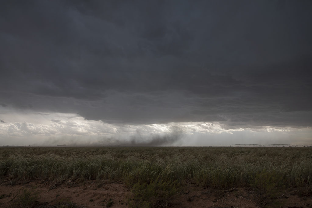
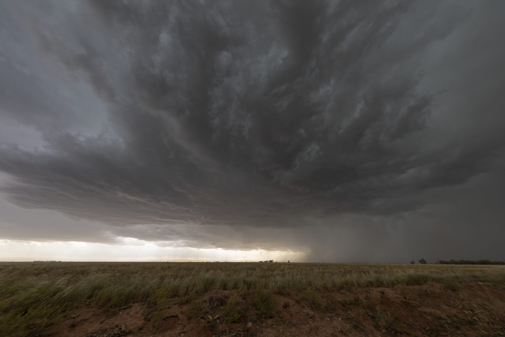
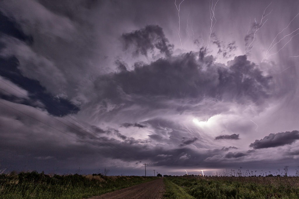
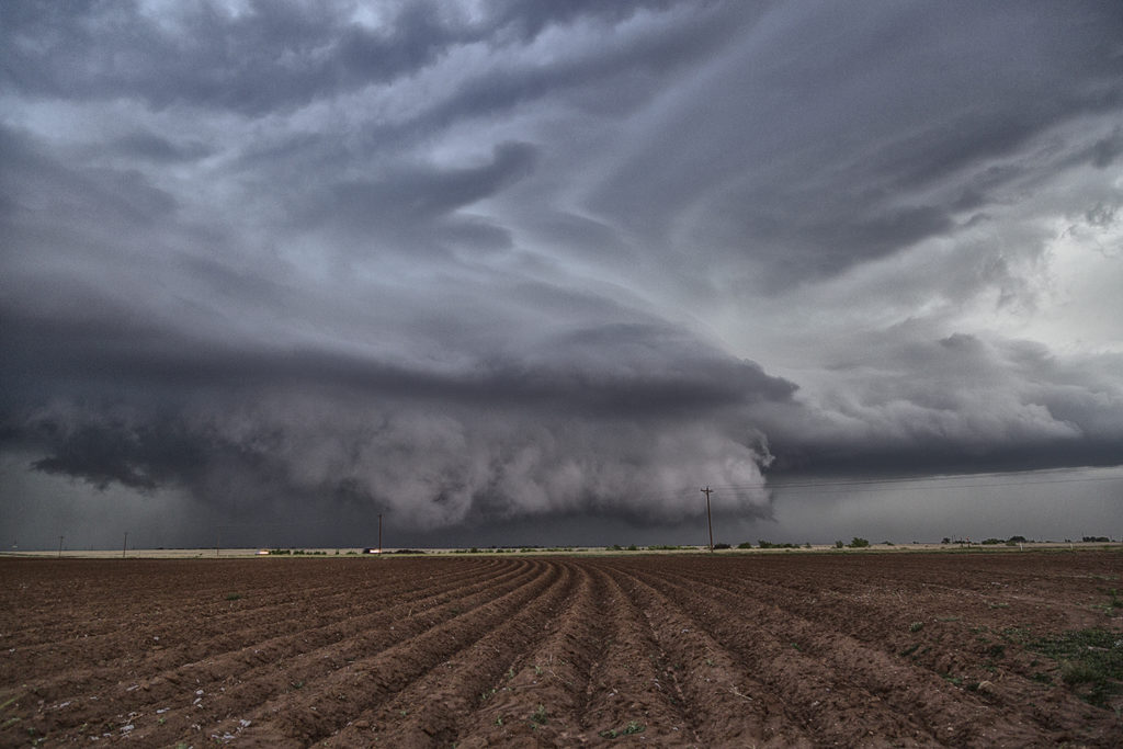
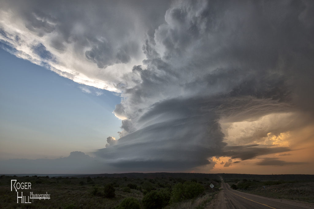
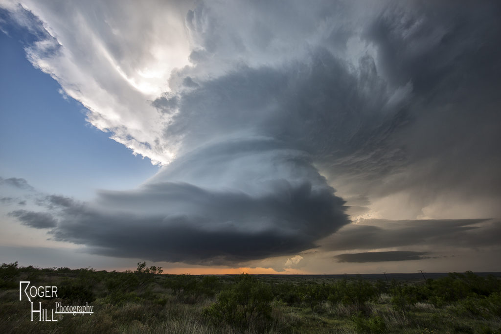
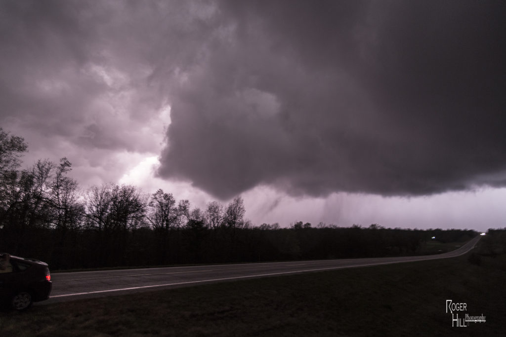
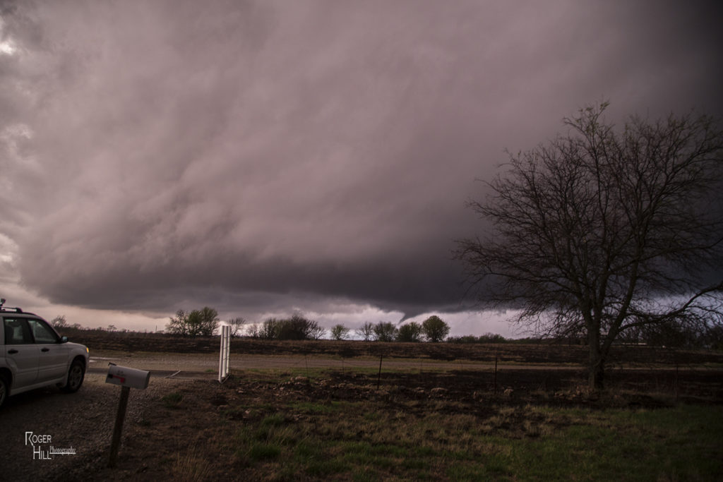
The end of April took us to the Texas panhandle for storms. The season has not even started yet due to persistent continental polar airmass intrusions, pushing surface moisture into the gulf of Mexico. Finally, we have a few days where moisture is returning, albeit slowly! With dew points in the 40s and 50s, storms during this two day period were high based, but marginally severe, producing large hail and high winds. Storms clustered along the dry line occasionally having supercellular appearances, however due to limited moisture, the tornado threat was zero. Enjoy the pics!
May 9th Southwest Texas Tornadic Supercells
May 9th was a wild day in Texas and New Mexico. A large closed low over the desert southwest would slowly approach the region. Strong deep layer shear, however with fairly weak surface winds, would overspread the area by late afternoon. Decent moisture and instability would contribute to a very unstable airmass. Storms exploded in the higher terrain of northeast New Mexico first, then later developed over southeast New Mexico and eventually spread into southwest Texas. We intercepted a tornado warned storm near Clovis, New Mexico which didn’t have the appearance of becoming tornadic. Then another supercell developed in southwest Texas and moved towards Enochs. Just northeast of Enochs it produced two tornadoes. We would continue following it northeast until it weakened near dark. At that time another supercell formed near Hobbs, New Mexico and quickly raced northeast towards Whiteface, Texas. This storm spun hard, but never could produce a tornado. Overall, the weak low level shear would result in only brief tornadoes this day, but it was still a great chase event.
May 23rd Northfield, Texas Night Tornadoes
May 23rd was a big day of ups and downs. Nature seemed to play a cruel joke on us and give us all the potential ingredients for a major severe weather event, but put all those ingredients too far east of the dryline in the Texas panhandle to do much good. Storms formed and were high based, never a tornadic threat, along the dryline. These cells would move off and die due to a capping inversion. Finally late afternoon one storm formed at the tail end of a cluster and moved far enough east to intercept 70 degree dewpoints and 4000 CAPE values. This storm would go crazy near dark and produce at least 2 significant tornadoes. The first tornado, a tapered cone, churned across the countryside west of Northfield, while the second tornado, a large EF3 multivortex turned wedge tornado, would be very close to Northfield. Lightning would illuminate this tornado and at one point, 4 bolts were visible around the tornado. An AMAZING event to say the least! Fortunately there were no fatalities from these tornadoes. Night time tornadoes are especially dangerous as you cannot see them unless they are lit by lightning or hit power lines to cause them to glow green. An incredible event to what would be the warm up day for the next day, the largest tornado outbreak in a couple years in western Kansas!
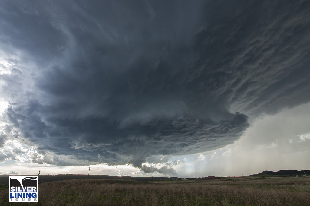
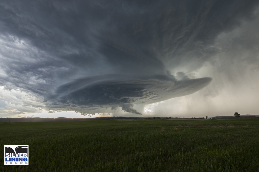
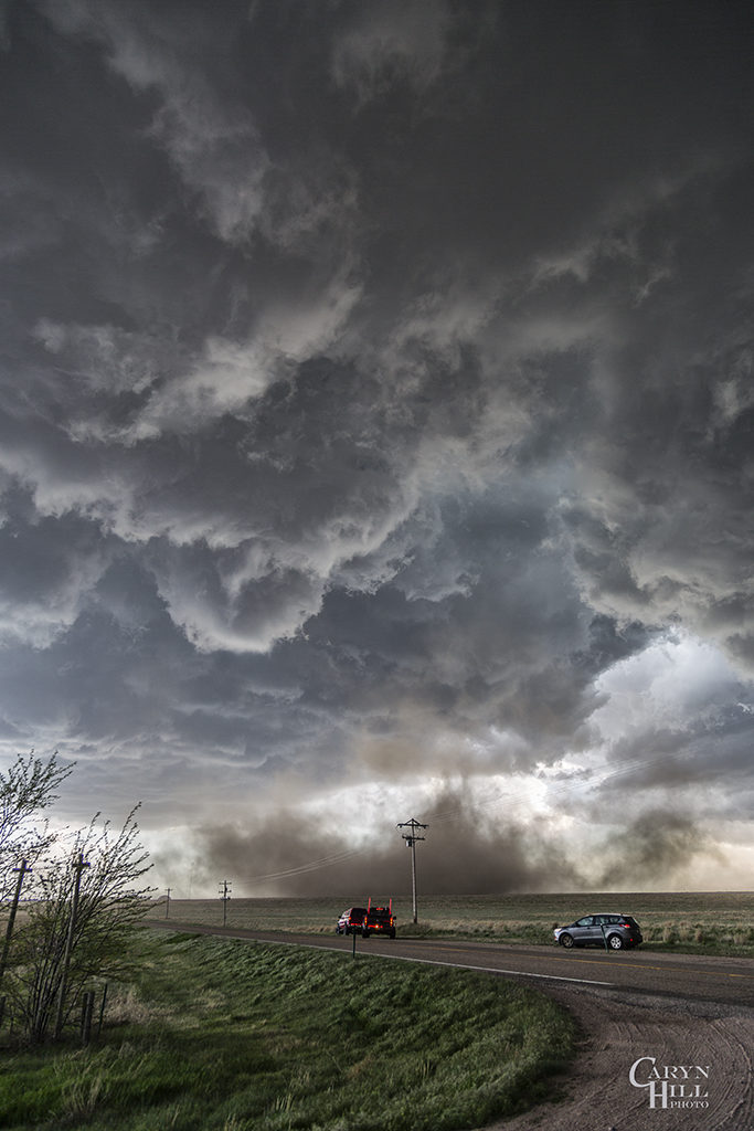
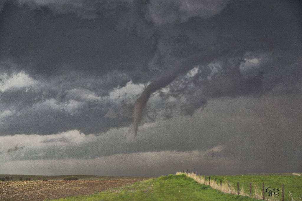
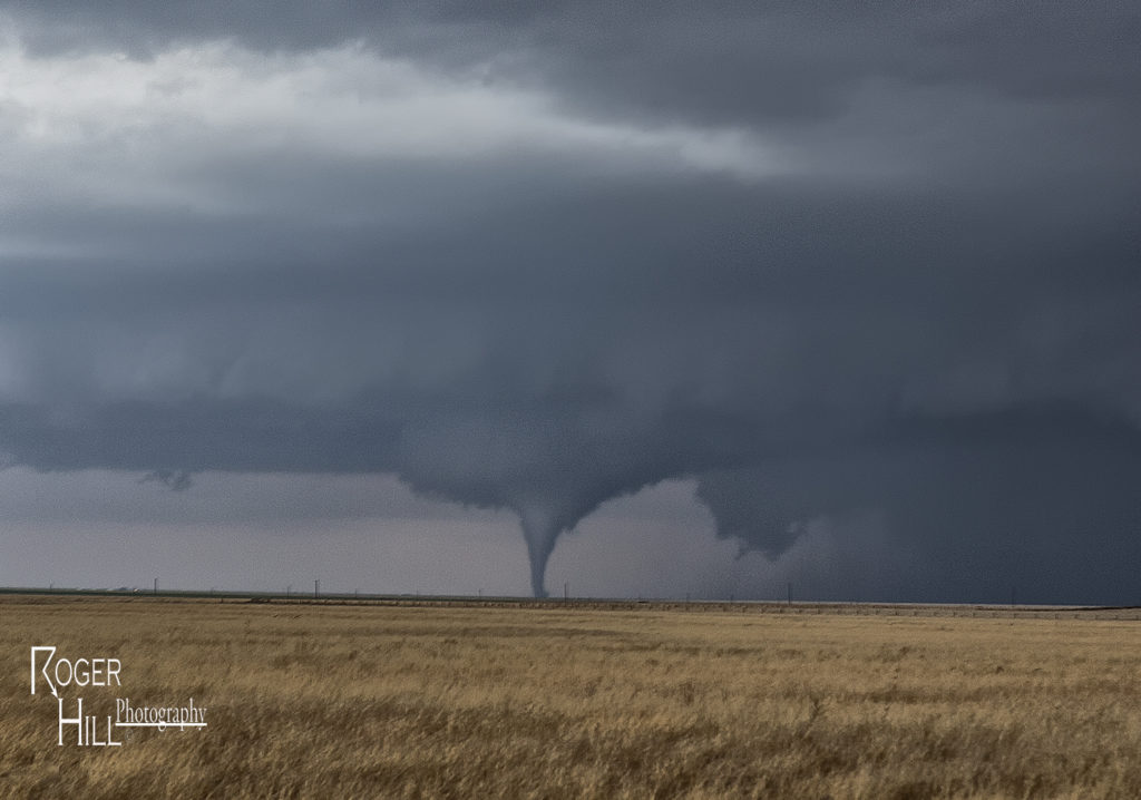
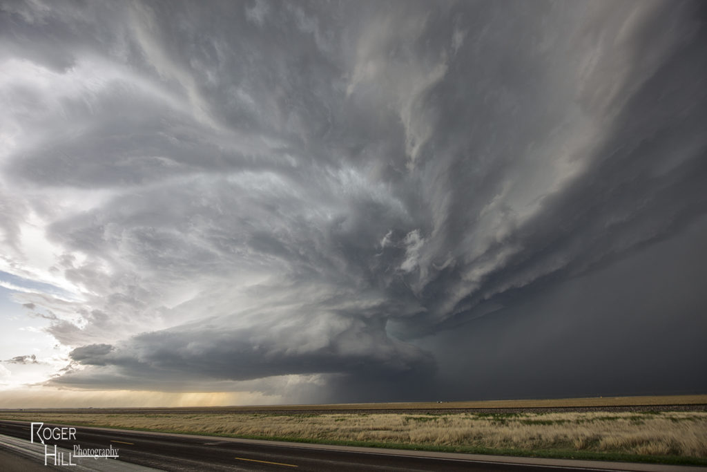
May 7th Wray, Colorado Tornadoes
On May 7th we had high hopes for something big to happen. It certainly did not disappoint! Numerous storms formed early afternoon along and south of a warm front draped over eastern Colorado. Upslope flow was deep, while shear, instability and moisture were quite good as well. Too many storm interactions early in the afternoon caused messy modes, with several tail end supercell type storms to form and be the ones that produced the most severe weather. A cluster of cells near Ft Morgan early in the afternoon would produce tornadoes along the warm front, but we decided to target more southern tail end storms that were receiving the best feed of air.
Late afternoon, our on call tour led by Caryn Hill would intercept a supercell south of Wray that would produce a pretty elephant trunk shaped tornado. It would die off fairly quickly before the main show would start. A mixture of supercell and nonsupercell tornadoes would form, nearly a half dozen in all. The final tornado is one that has been well publicized, a beautiful whitish tornado as seen in the pics below, with a reddish debris cloud nearly to cloud base! Remember SLT will get you there!
April 15th Eva, Oklahoma Tornadoes
April 15th had potential. We weren’t sure how storm modes would end up, and the bigger question was how good of quality would low level moisture be this day. The various models were at odds with each other. We decided to target the northern Texas panhandle dryline and hope storms could form, mature and then move off the dryline into better air. We sat around the Dalhart, Texas area waiting for initiation to occur. By mid afternoon storms started to form, but due to many splits, storms never maintained for very long without having merging issues. A couple storms did intensify and one particular supercell even became tornado warned southwest of Stratford. It actually tried hard as a wall cloud formed and was steadily rotating. However, its rear flank downdraft became too strong and undercut the storm’s updraft causing it to weaken. It cycled up and down a couple times, and then near Stratford, something happened. The storm was ingesting very unstable air as inflow dramatically increased. You could see a huge dirt plume skyrocketing upward as rapid lift was occurring in the storm’s forward portion of the updraft.
A tornado warning was reissued as the storm crossed into the Oklahoma panhandle. Soon a cone shaped funnel formed and was visible for about 5 minutes before it dissipated. The structure of the supercell was top notch as a sculpted liberty bell formed and spun wildly. We raced up the highway towards Eva and sat on US 64 east of town about 5 miles. An elephant trunk shaped tornado soon formed and stabbed the ground a few times and dissipated. Quickly another larger truncated cone shaped tornado formed and stirred up dirt and debris for a minute or two and also dissipated. As the supercell crossed 64 heading towards Eva the supercell had a very strong RFD surge as a new wall cloud quickly lowered to our northwest. Soon a pretty white elephant trunk shaped tornado formed, followed by a second one just to the east of the first. These two danced around for 10 minutes, often creating multiple vortices under them and then dissipated soon afterwards. By this time darkness was approaching and the storm was weakening, so we broke off our chase and headed for home. Great day and fortunately all tornadoes occurred in open country!
March 30th Northeast Oklahoma Tornadoes
March 30th took us to northeastern Oklahoma and southeastern Kansas on our first chase of the season for a day that promised intense storms and strong tornado potential. Things got messy pretty quickly in southeastern Kansas so we dropped south into northern Oklahoma. First, just south of Caney, Kansas an intense supercell formed. This storm had an amazing wall cloud that was rotating rapidly. It became tornado warned, but due to too many cell mergers, it never produced. We dropped south towards Nowata, Oklahoma as a tornado warned supercell approached. This storm had incredible structures and soon dropped a truncated cone shaped tornado (rated EF1) northeast of town that skipped across the countryside for 5-10 minutes before dissipating. The supercell continued northeast from there and dropped a second tornado (rated EF0) in open land. This tornado actually looked stronger as darkness set up, but we were never able to get close enough to it. Fun chase day, great results, and a long trip back to Denver.
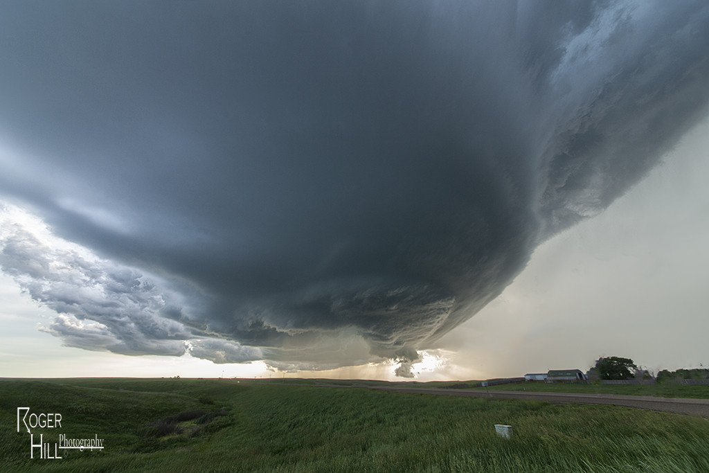
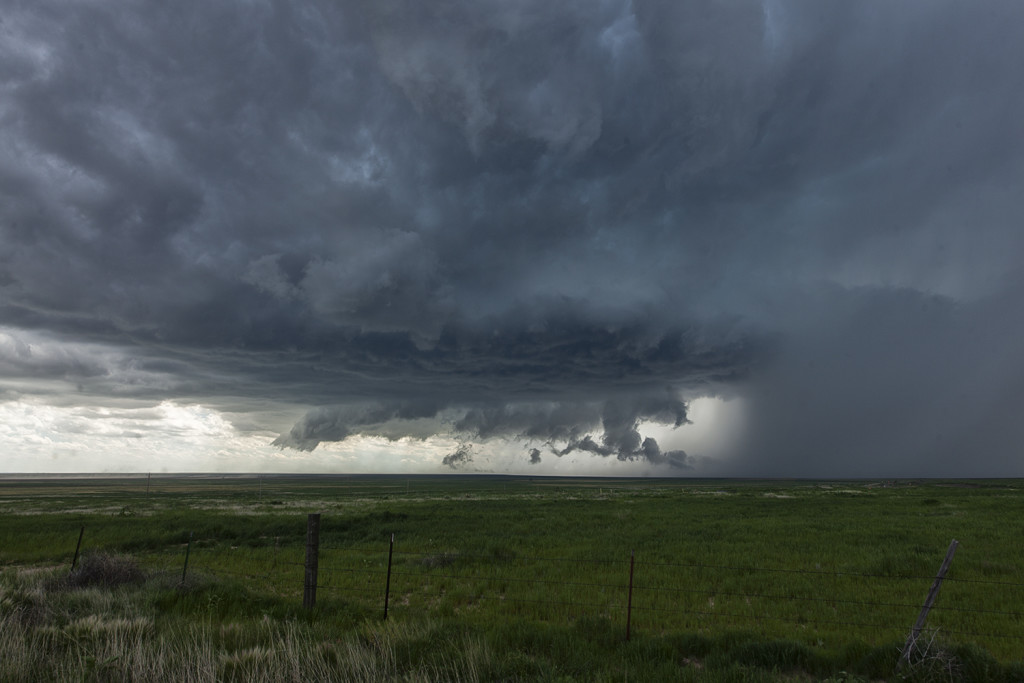
June 21st South Dakota Tornado Outbreak
June 21st was a day that had great potential. Very good shear, moisture and instability were in place across the high plains into the western Dakotas. An approaching shortwave trough would provide the necessary lift to spark intense supercells in southeastern Montana. One particular supercell formed near Baker, Montana and cycled several times as it entered northwest South Dakota. This storm would be responsible for a half dozen tornadoes we witnessed across northern South Dakota. The first tornado occurred as the storm really ramped up near Ralph, South Dakota. It would cycle several times and keep producing tornadoes all the way to near Eagle Butte where it dissipated late evening. The structure was some of the best of the season and several tornadoes were quite photogenic! Tour 8 scored big with this gorgeous beast!
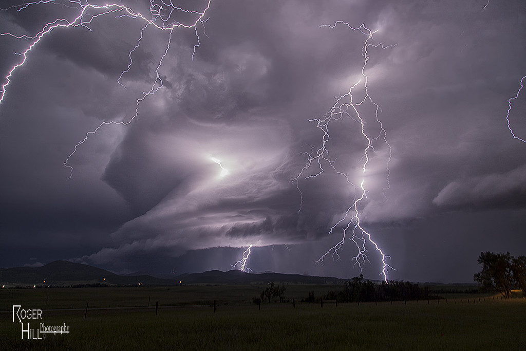
June 17th East Central Wyoming Tornado Warned Supercell
June 17th had a short wave trough moving across the northern high plains. Decent moisture and instability was in place to fuel significant storms. However a capping inversion kept storms from forming until late in the day. A storm complex moved out of Montana into eastern Wyoming, and it was this complex that developed significant rotation as a storm in front of the line became absorbed into it and caused it to rotate rapidly. A tornado warning was issued for the western Black Hills as the storm approached Beaulah and into the Spearfish area. The structure as dusk was quite nice and the lightning was amazing! One of the best lightning displays all season so far!
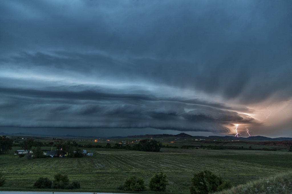
June 11th Southeast Colorado Supercell
June 11th had issues, but still produced some nice storms. Marginal moisture, but decent shear overlaid eastern Colorado. By mid afternoon storms formed along a boundary that stretched across east central and southeast Colorado. One particular supercell tracked along the boundary from north of LaJunta to far southeast Colorado. It struggled to stay on the moist side of the boundary occasionally, but managed to be quite a prolific hail producer. Never a real threat to produce a tornado, it did however manage to produce several short lived funnels. By early evening a cluster of storms formed south of Lamar. A tail end storm became a powerful supercell and was tornado warned for a couple hours. Visually it was stunning with constant rotation under the updraft. Two tornado reports came in, however they were not validated. As the supercell tracked into southwest Kansas, it became an outflow dominant storm and produced significant winds.
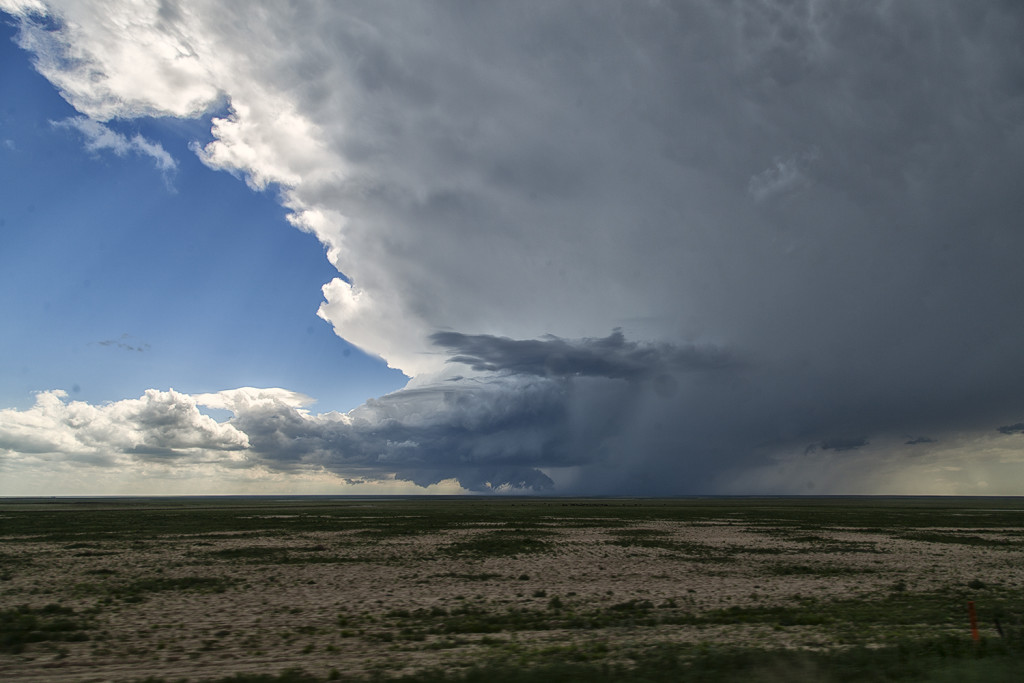
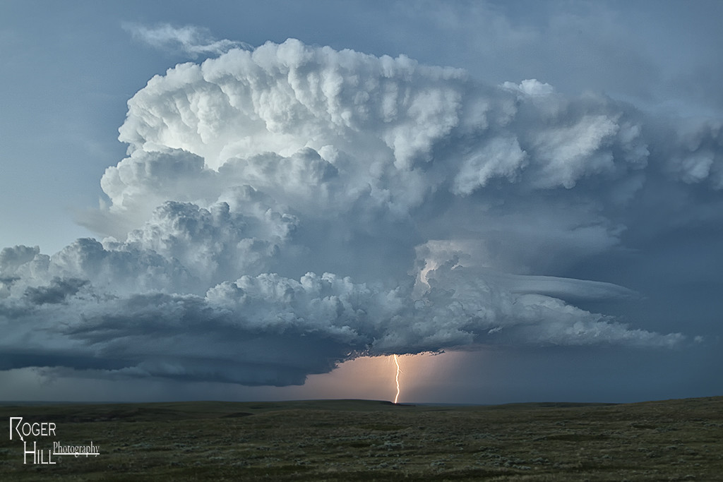
June 1st South Dakota Supercell
For Tour #5 and Photo Tour #2, June 1st took us to the Black Hills area of South Dakota. Good upslope flow coupled with high CAPE values, would produce a very nice supercell storm that anchored itself to the east side of the Black Hills. This storm spun nicely, even tried to produce a tornado, but didn’t quite have enough low level shear to become tornadic. It did,, however, produce tons of very large and damaging hail to baseball size south of Sturgis. The storm persisted for several hours before decreasing in intensity just before dark. Both tours had a very nice treat on this day, and along with great structure, the storm produced some incredible lightning!