
June 17th Colorado/Nebraska Tornadic Supercells
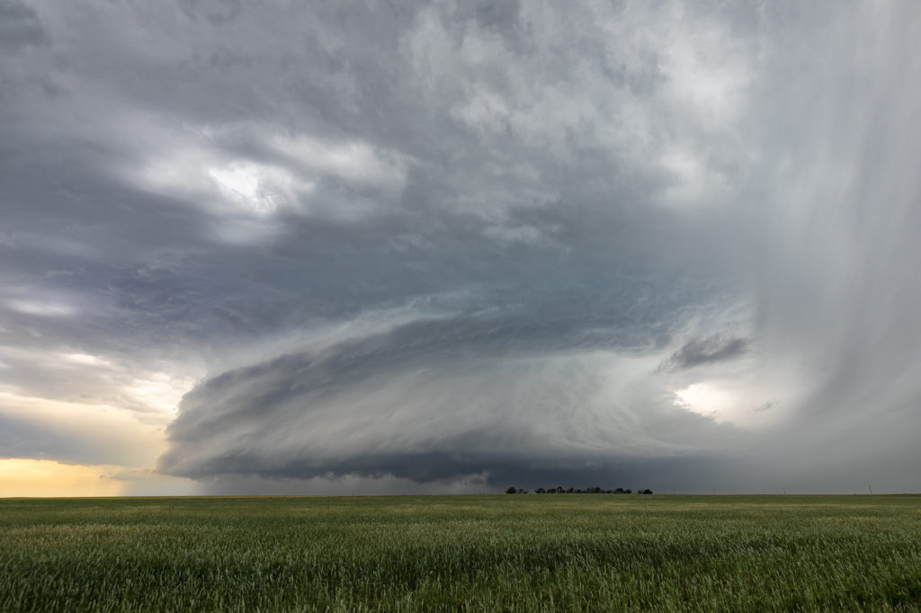
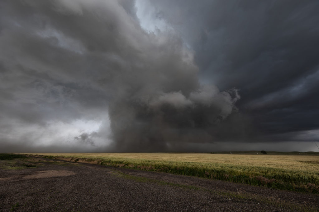
June 17th had big promise. Great wind shear, good moisture, high CAPE and a dryline and outflow boundary intersection set the stage for what would be a great day! We started in Ogallala, Nebraska and just had to drift westward towards northeast Colorado. Mid afternoon initiation was pretty convincing that supercells and possible tornadoes would occur. The initial supercell spun like mad, dropping baseball sized hail and producing at least two tornadoes. Structure was very pretty, however blowing dirt in the rear flank downdraft area (rfd) would block viewing of the mesocyclone at times. A big dusty tornado occurred near Julesburg, CO followed by another tornado near Big Springs, NE. The cell would eventually gust out northwest of North Platte, NE but not before producing one more small tornado. A fantastic day that produced an awesome supercell. Meanwhile, SLT co-owner Caryn Hill chased locally and intercepted a highly sculpted tornado warned supercell near Otis, Colorado! Probably the best structure for 2018 to that day! Enjoy the photos!
No comments yet.