
May 24th Southwest Kansas Tornadic Supercell
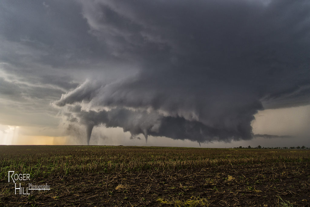
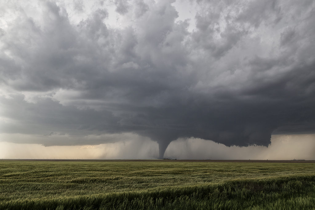
May 24th had the best of both worlds. As Photo Tour #1 went to Colorado for its rewards, Tour #4 had a special day along an outflow boundary south of Dodge City. As Tour #4 moved north out of Oklahoma, hard cumulus towers formed along the boundary near Minneola. Soon, a storm emerged from these towers and would become an intense tornadic supercell as it drifted north towards Dodge city and spun like crazy. It took it awhile to really get going good, but when it did, a huge wall cloud formed, and started spinning wildly. The first of a dozen tornadoes would form of every shape, size and intensity, and at some point as many as 3 tornadoes were on the ground at the same time. Dodge city eventually came under a tornado emergency as a large multivortex tornado hit the west side of town. As the supercell moved north of town, many other storms formed and eventually turned into a huge cluster of severe storms that moved across Kansas. As that happened, we left the storm and went to Garden City for the night. An amazing day, with a dozen tornadoes from this storm and the fact both of our tours capitalized on the days potential was even more special!
No comments yet.