
June 24th Southern Kansas Supercells
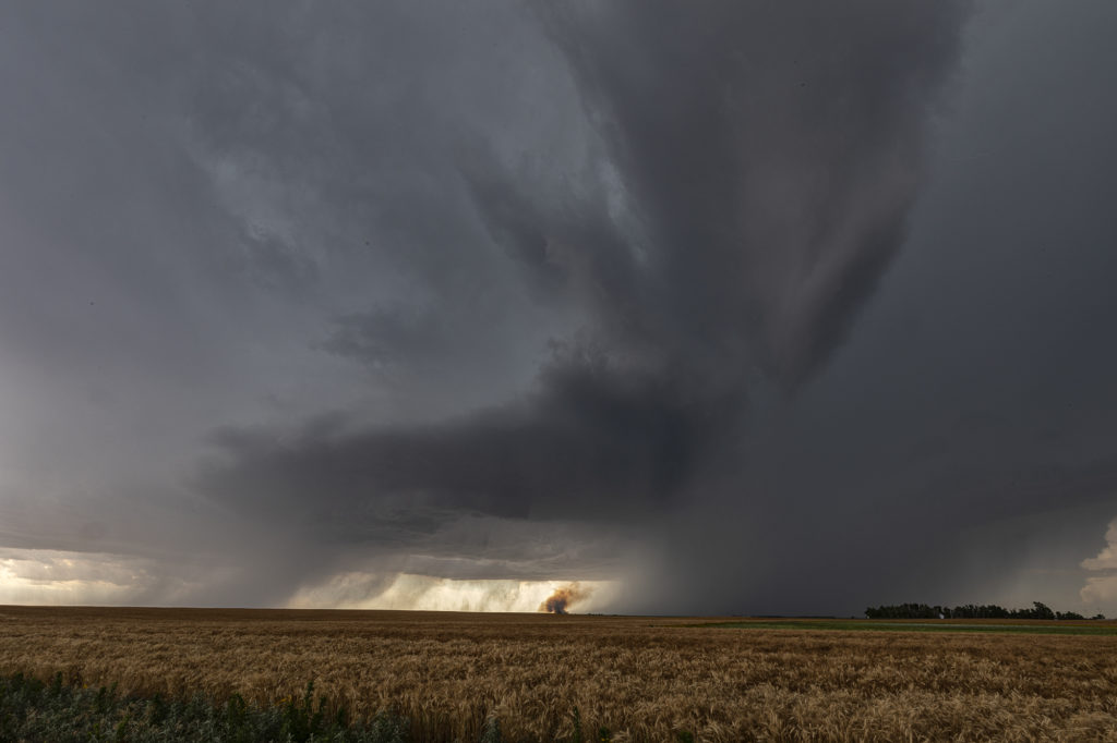
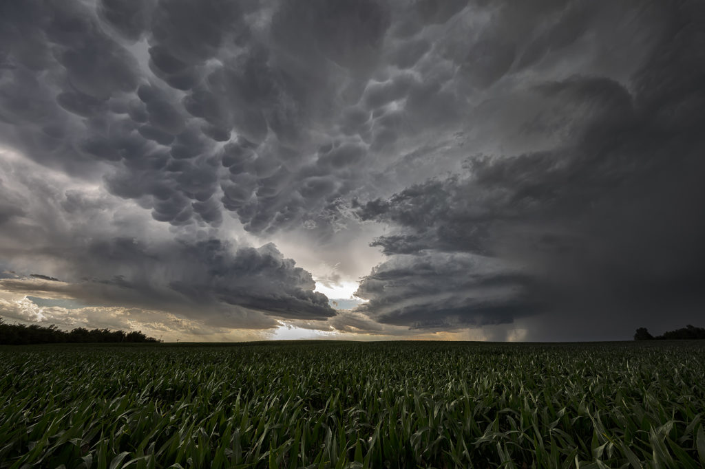
We had high hopes for some great supercells in southern Kansas on June 24th. The atmosphere didn’t disappoint! High CAPE, strong shear, moderate moisture and decent lift along existing boundaries would set the stage for afternoon severe thunderstorms. An explosive supercell formed in central Kansas mid afternoon and became severe. This storm produced hail to baseball size and high winds. It weakened as it remained nearly stationary and other storms formed south and west of it. A well structured supercell emerged and became very electrified. A grassland fire occurred and fortunately was put out before consuming any farmsteads. As it continued to move south/southwest, it became undercut by outflow and slowly weakened. It continued to produce very large hail and high winds during the remainder of it’s life as it slowly drifted south into far southern Kansas. A fun day of chasing with well structured storms and very large hail. We stopped and examined the hail stones we found up to tennisball sized. Click on a pic for a larger photo. Enjoy!
No comments yet.