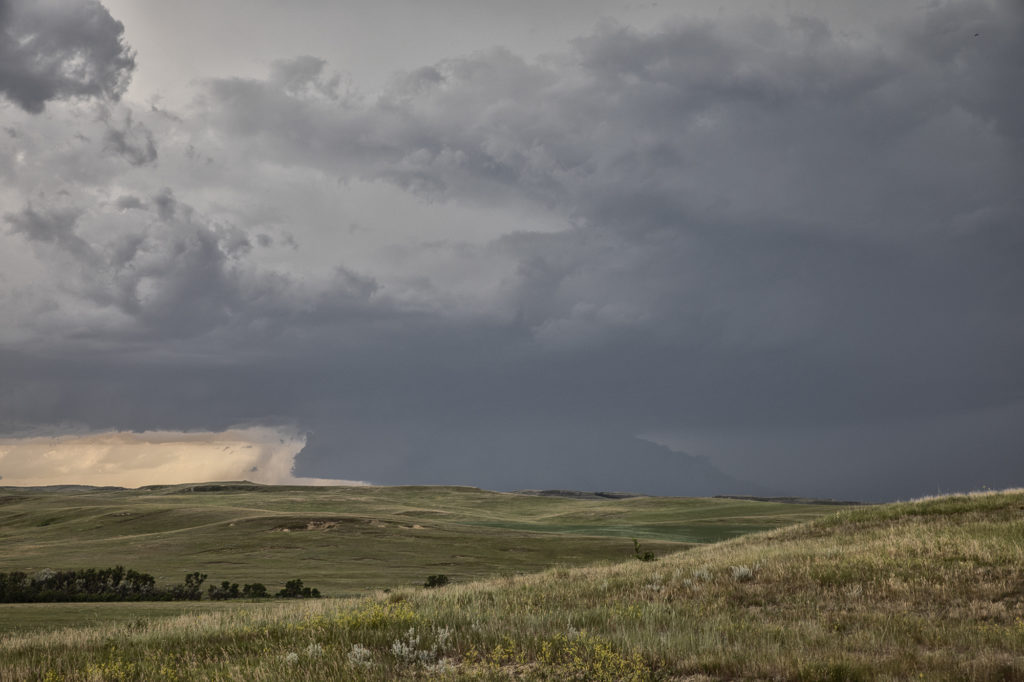
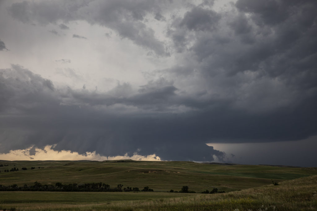
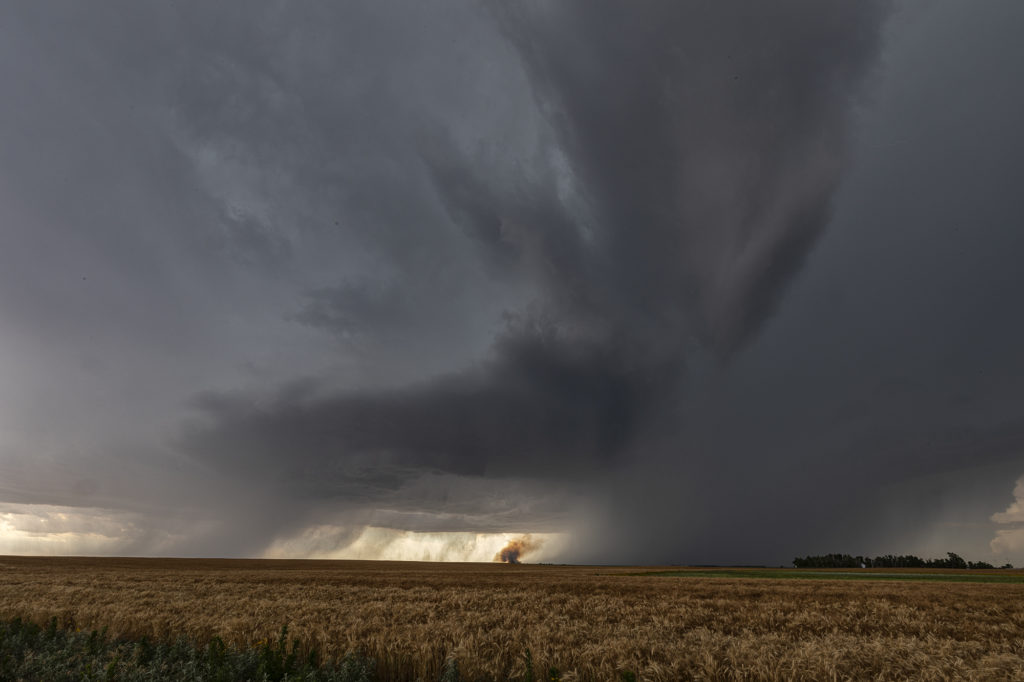
August 19th looked too good not to chase. Good moisture, high CAPE values, strong lift with an approaching wave and good low level shear along a boundary would set the stage for a good day! Mid afternoon storms exploded over northeast Colorado and slowly intensified. One particular storm, south of Holyoke, CO became a supercell. As it drifted east/northeast along the boundary it took off and became tornado warned. Very very strong low level rotation was occurring and the low level mesocyclone eventually became rain wrapped where you couldn’t see it anymore. Extremely heavy rains (4-9 inches!) prevented me from taking dirt, now mud, roads to get into the notch for a better look. However, the storm did produce a tornado, possibly two, one of which was a fast funnel in the hook area before it wrapped up in rain. A fun chase day, and good results, just wished for a better view in the notch! Enjoy the pics!
July 21st Southeast Wyoming Supercells
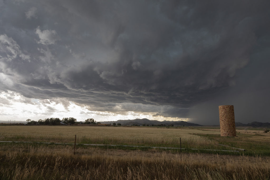
The final tour day of our 2020 season brought us into southeast Wyoming to play in the upslope flow into the Laramie Range. Several storms formed in this region and tracked southeast towards Cheyenne and points east. Decent moisture and instability, coupled with moderate shear, would help storms become organized and develop into some pretty structured supercells. Our first storm, north of Chugwater, had nice structure and produced a lot of hail. It spun hard a couple times and at one time we thought it had some tornado potential. It get really messy so we decided to target a new cell southeast of Cheyenne near Carpenter. This storm was a treat to watch! We found an old abandoned car that became the centerpiece of our photos/video as the cell slowly dropped towards us. The storm’s structure was that of the classic “stack of plates” and was fun just to watch as it drifted towards us. Both of the storms we chased this day had great structure and were very photogenic. Enjoy the pics!
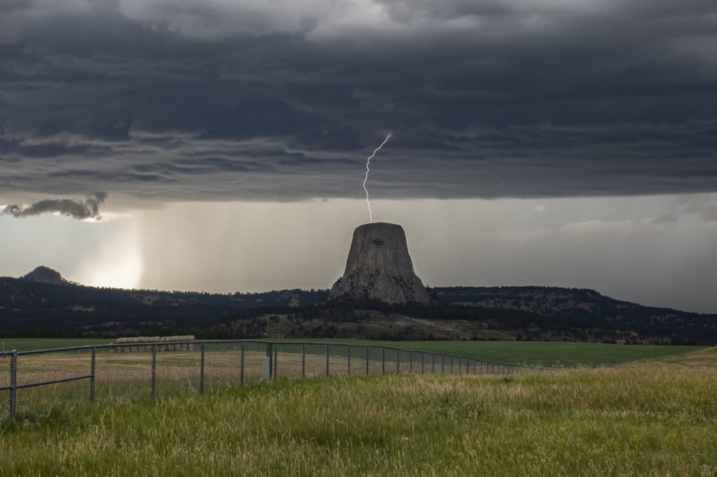
July 19th Devil’s Tower, Wyoming Beautiful Supercell
July 19th was a spectacular day! Good moisture, high instability, good wind shear and a boundary along the Wyoming/Montana border would set the stage for intense supercell development. One such storm formed northwest of Devil’s Tower and drifted southeast. As it crossed Devil’s Tower we had quite the lightning show! I managed to capture a bolt hitting the top of the tower! As the storm moved southeast near Sundance it became extremely electrified producing a CG every 3-4 seconds! At one point, it had an appearance like it was ready to produce a tornado. We lost visibility in the hills and could not confirm one way or another if it did. Later, a second supercell tracked southeast from near Buffalo, WY down to Lusk, WY. This storm constantly spun hard, had pretty structure and was also tornado warned numerous times! It’s structure was top notch and had various rotating wall clouds throughout it’s life. But, as continued to be the theme for 2020, storms had great structure but just couldn’t produce significant tornadoes. Overall it was my favorite day in July for chasing, and one we captured some incredible photos! Enjoy!
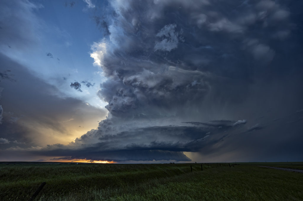
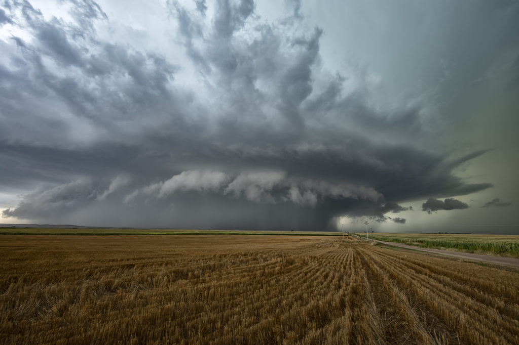
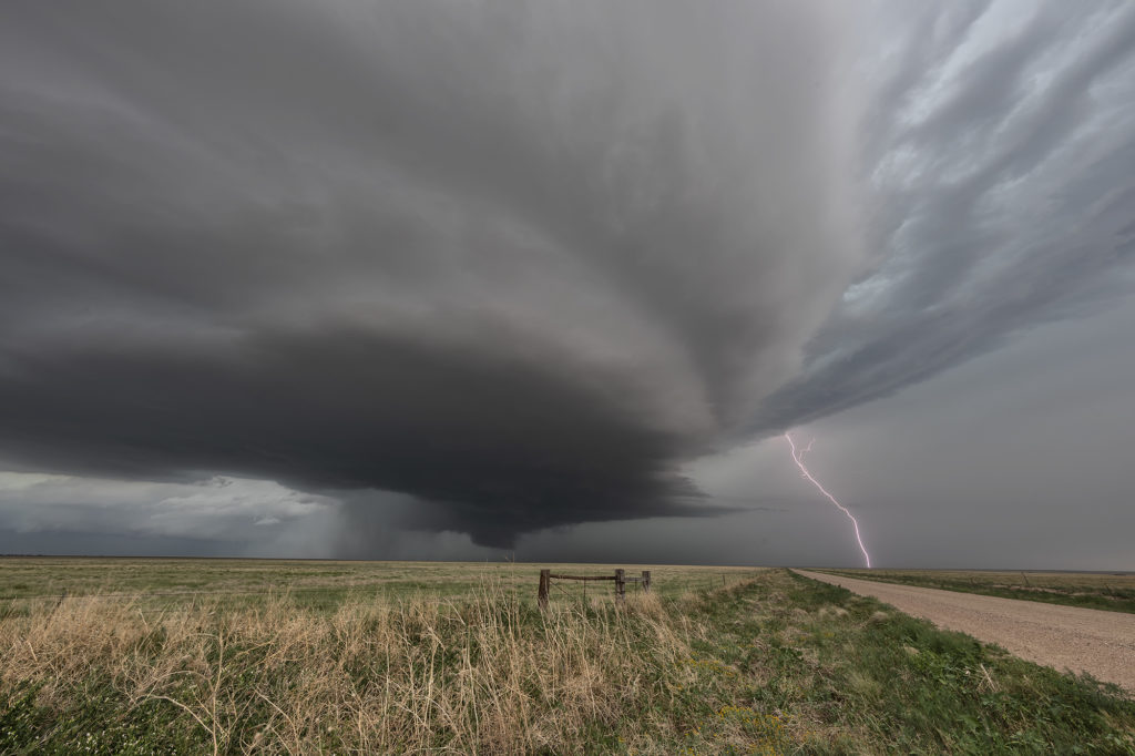
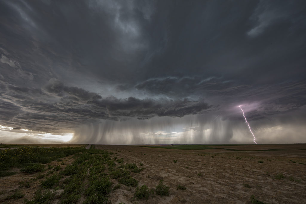
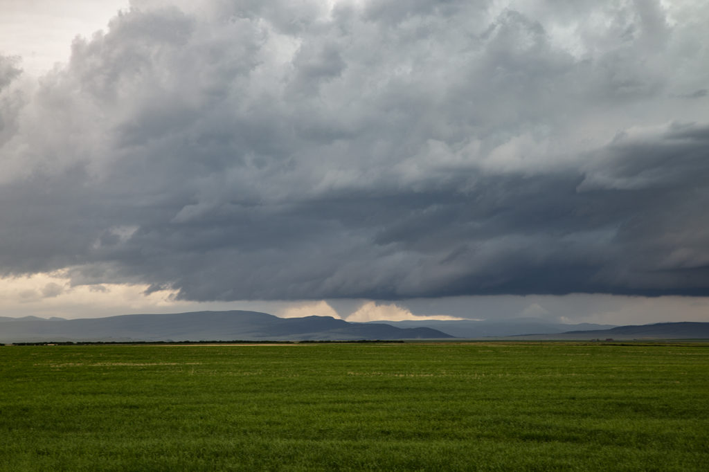
July 14th Southeast Colorado Tornado Warned Supercell
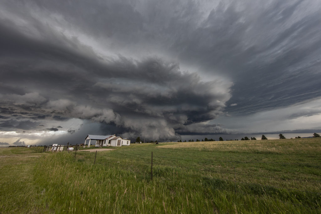
July 14th kept us in Colorado to chase off the Palmer Divide into southeast Colorado. A sagging cold front we push moisture westward into the Palmer Divide, causing storms to develop by mid afternoon. Those storms produced copious amounts of hail, but became undercut by outlfow and died. The boundary pushed south as more storms formed along it east of Pueblo. Near the town of Sugar City, one storm formed and spun hard. It quickly became tornado warned and stayed that way for a few hours. A couple of times, it had the look like it wanted to drop a tornado, but it never did. As it merged with numerous storms west of Lamar, the storm interaction with others caused it to produce a quick 1 minute spin up. The structure with this supercell was quite nice. It was also quite electrified! Eventually this cluster of storms pushed into western Kansas and weakened as we followed it east to Garden City. Great day! Beautiful storm and it certainly tried to get very interesting! Please click on a pic for a larger image. Enjoy!

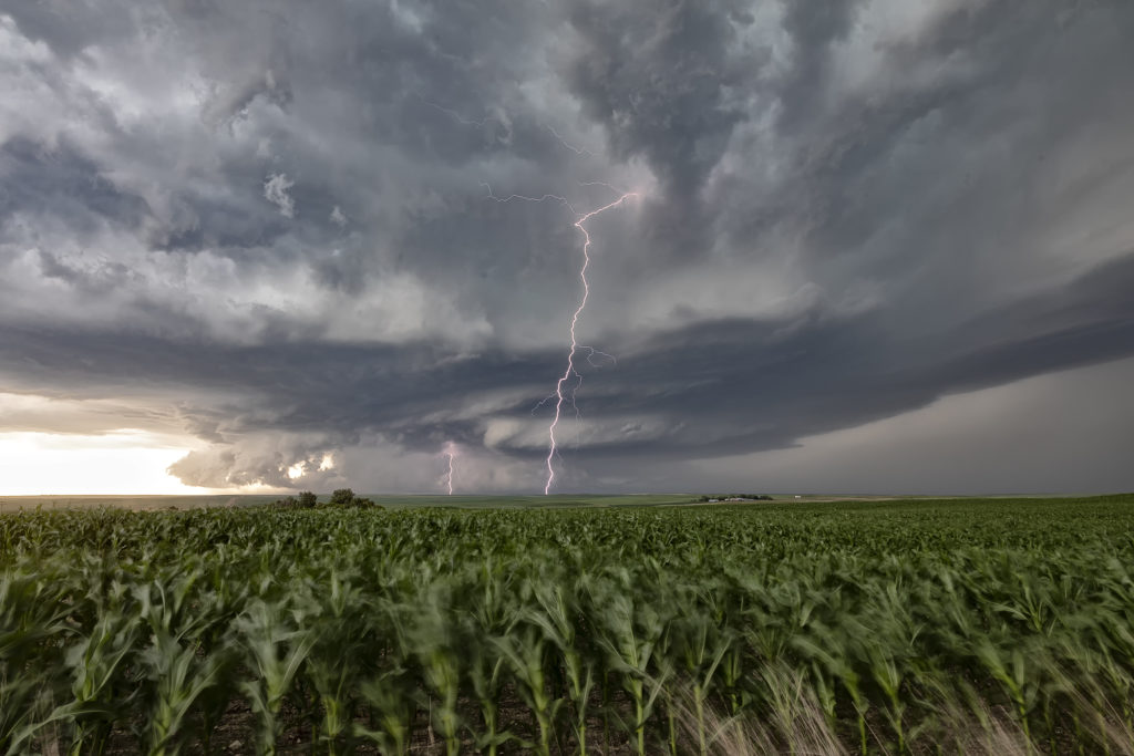
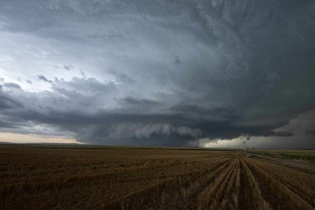
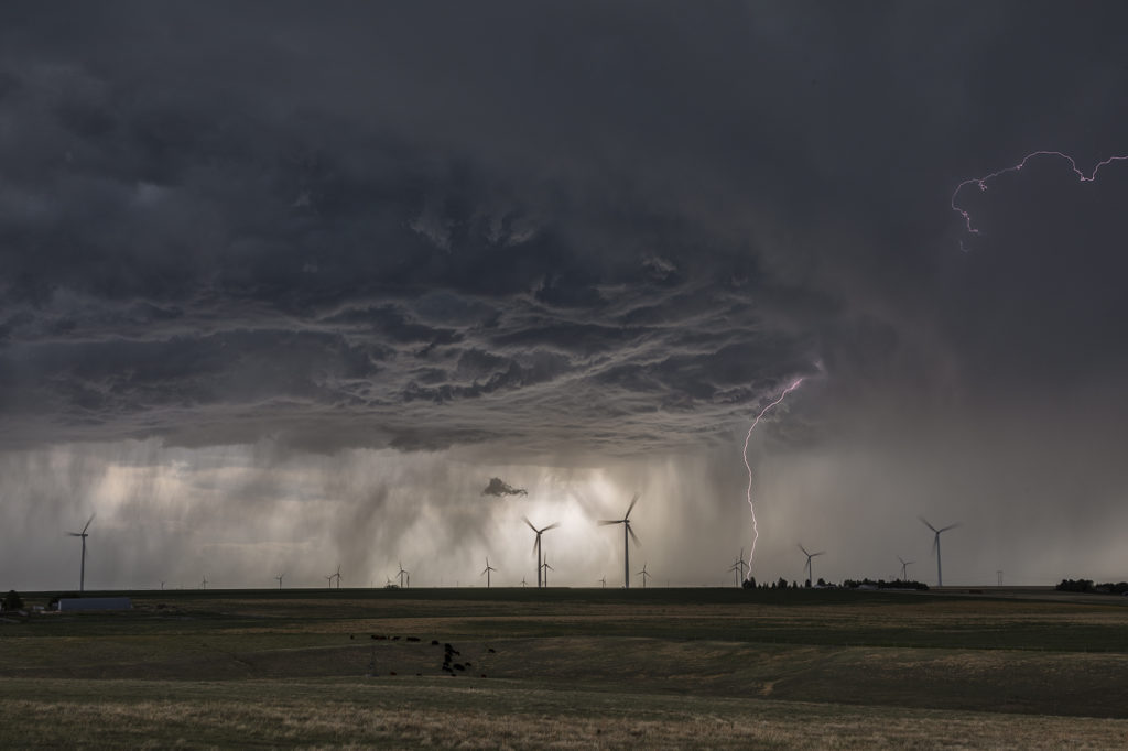
July 13 Eastern Colorado/Western Kansas Supercells
July 13th was the second day of our Tour 9, Great North Tornado Hunt tour, and it took us east of Denver towards the Kansas border. Decent shear, limited moisture and CAPE, and an approaching dryline, would set the stage for high based storms to form. As the storms moved into Kansas, they intensified and the bases came down. We had a couple very pretty rotating storms in far western Kansas that were quite electrified. The final storm of the day was a very nicely structured LP supercell near Leoti, that spewed out numerous lightning strikes and intercloud discharges. I thought for a minute that it had some tornado potential, however the base lifted, the wall cloud dissipated and it eventually died as well. A fun day, great storms and super lightning. Please click on a pic for a larger photo. Enjoy!
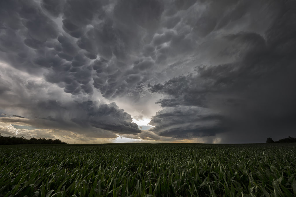
June 29th Theodore Roosevelt NP Tornadic Supercell
June 29th took Photo Tour #3 westward to Theodore Roosevelt National Park area where a triple point would set up and cause supercells to form. Strong shear, high CAPE values, good moisture and lift at the triple point helped to generate one intense supercell northeast of Wibaux, Montana that moved into western North Dakota. We positioned ourselves down wind to allow the storm to mature as it approached. A large wall cloud formed that started rotating with wrapping rain/hail engulfing it. A brief tornado occurred that we could see in the distance. Unfortunately there weren’t many roads to allow us to get closer or even stay with it. Numerous other storms formed and became quite a messy MCS. We stayed with them all the way to New Town, ND where another tornado warning was issued. A messy murky system approached as we decided to retreat and get out of it’s way. We headed on northwest to Williston for the night. Yours truly lost his cell phone as huge hail started falling and ended up driving back to the park in the middle of the night to find it. Success, it was found! (Destroyed and cracked, but it was found!!!) Please click on a pic for a larger image. Enjoy!
June 24th Southern Kansas Supercells
We had high hopes for some great supercells in southern Kansas on June 24th. The atmosphere didn’t disappoint! High CAPE, strong shear, moderate moisture and decent lift along existing boundaries would set the stage for afternoon severe thunderstorms. An explosive supercell formed in central Kansas mid afternoon and became severe. This storm produced hail to baseball size and high winds. It weakened as it remained nearly stationary and other storms formed south and west of it. A well structured supercell emerged and became very electrified. A grassland fire occurred and fortunately was put out before consuming any farmsteads. As it continued to move south/southwest, it became undercut by outflow and slowly weakened. It continued to produce very large hail and high winds during the remainder of it’s life as it slowly drifted south into far southern Kansas. A fun day of chasing with well structured storms and very large hail. We stopped and examined the hail stones we found up to tennisball sized. Click on a pic for a larger photo. Enjoy!
June 27th Judith Basin, Montana Tornadic Supercell
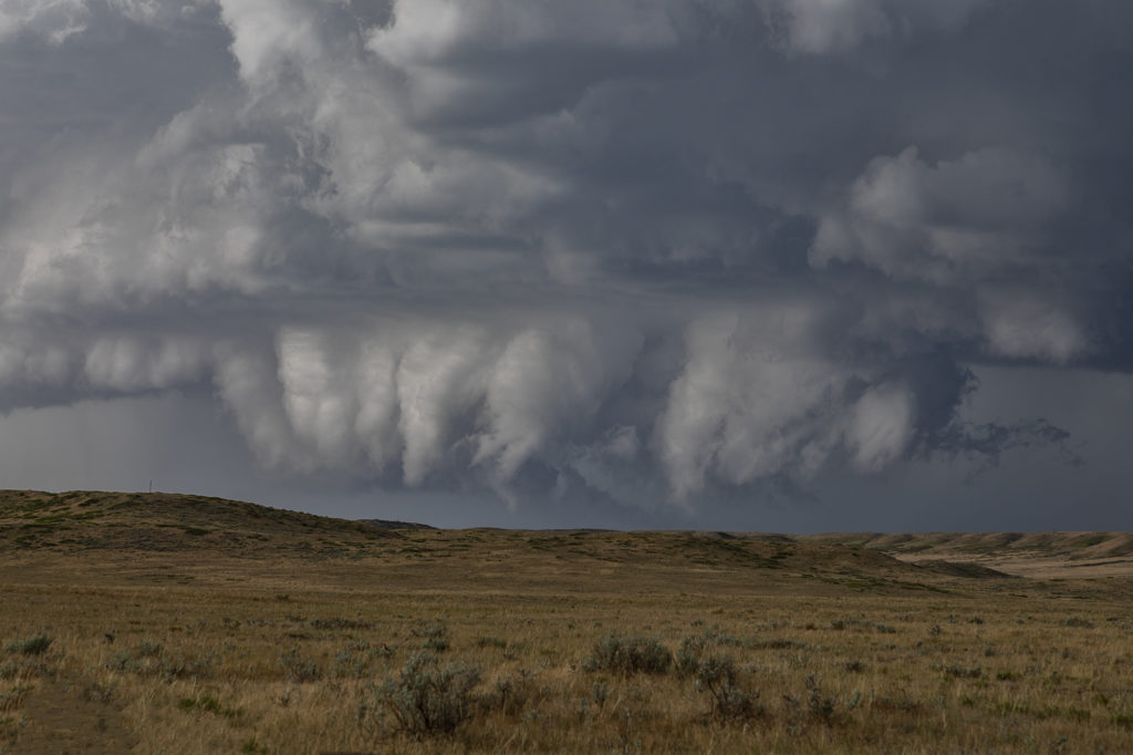
We had high hopes for June 27th in central Montana. Great shear, instability and decent moisture would provide the needed ingredients for storms this day. Lift in the mountain areas would give us the final missing link for storm formation. Mid afternoon storms developed southwest of Eddie’s Corner where we had made our base. As the cells came over the mountains, they intensified and became supercells. One storm southwest of Utica, MT spun wildly and was very pretty. It didn’t take long for a cone tornado to form. It stayed in the higher terrain where there was no road network, so we had to position ourselves to get the best distant view of it. As the cell approached us, it was nicely structured.
We decided to drop south to the tail end storm, which was also tornado warned. A pretty sculpted supercell was quite photogenic! Outflow from northern storms gushed south, undercutting the supercell and killed it. Further south near Judith Gap, another storm form and became my favorite cell of the day! Gorgeous structure, strong rotation and intense lightning occurred. As it moved east, we decided to take the dirt roads eastward toward Roundup. The storm became a jaw dropper and drifted east over the yellow sweet clover fields and made for an amazing sight! It became tornado warned one last time just north of Roundup where we waved goodbye and headed to our hotel for the night. An awesome day and the guests on Photo Tour #3 got their money’s worth from this event! Enjoy the pics!!!!!
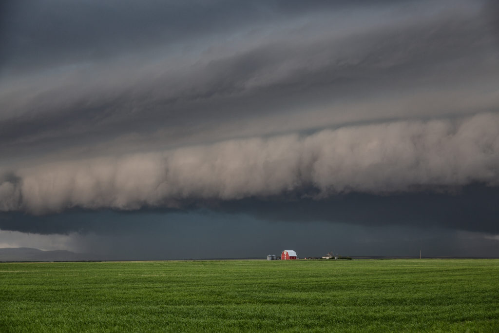
July 9th Northeast Montana Tornadic Supercell
July 9th had big potential. It wasn’t clear whether that would be across the international border into Canada or if storms would right turn along a warm front into northeast Montana and northwest North Dakota. Fortunately, for ease of chasing, storms crossed into the US and gave us quite a show! An intense supercell cycled and really ramped up as it crossed north of Plentywood, Montana. Due to high CAPE, strong deep layer shear, dew points in the lower 70s and the aforementioned warm front, the stage was set! This supercell became a monster, the storm of the day, as it rolled through Plentywood, MT and into far northwest North Dakota. Huge hail to baseball size, microburst winds of nearly 120 mph and an EF1 tornado that hit Plentywood, would be the highlight this day. A second supercell soon followed the path of the first and had just amazing structure as it rolled through Plentywood. Highways ended up being blocked due to debris from downed trees, power lines and houses through town. Fortunately there were no fatalities. Check out the photos below. Enjoy!!!