
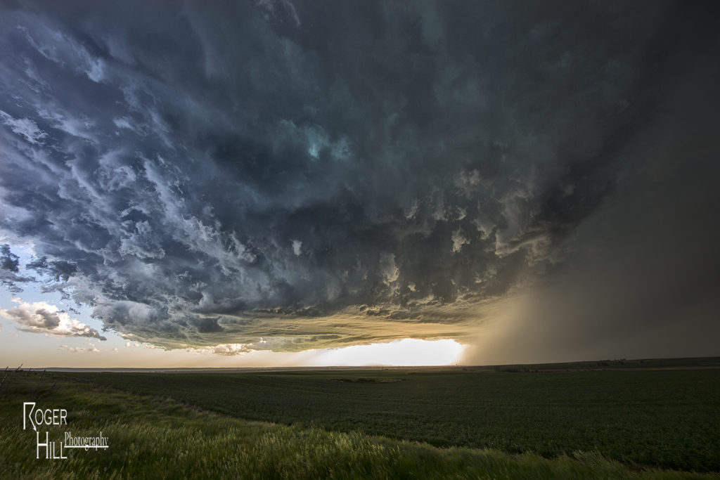
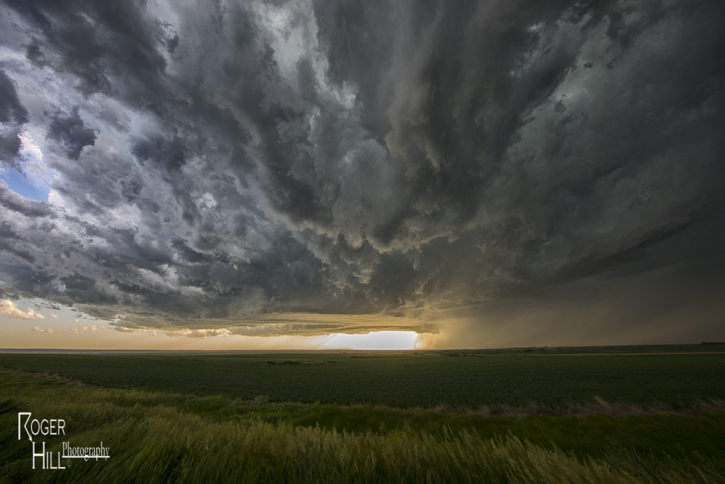
June 21st Northeast Montana Tornado Warned Supercell
June 21st was the first day we had decent shear, instability and some moisture to work with. A dryline and old outflow boundary set up in northeast Montana and would be the focus for supercells late afternoon. We drove to Bainville, Montana and waited at this cute little gas station/restaurant for storms to form and intensify. We were torn between cells near Glascow or further southeast near the Belfield, North Dakota area. We ended up choosing the northeast Montana storms. After a few cycles, a supercell emerged near Wolf Point as we drifted west towards Brockton to intercept it. Although it was a bit higher based, the structure was nice. As the supercell moved east, it became tornado warned near Culbertson. Near Fairview, a report of a tornado occurred, but we couldn’t see anything under the base. Not sure what the locals were looking at as with lcls at 800MB, it was pretty obvious the tornado threat was fairly limited. It stayed tornado warned all the way to Watford City, North Dakota where it was feeding on outflow air from storms to the east, and weakened quickly. Fun chase day, good storm, lots of lightning, hail and wind. Northeast Montana is a very pretty area to chase in!
No comments yet.