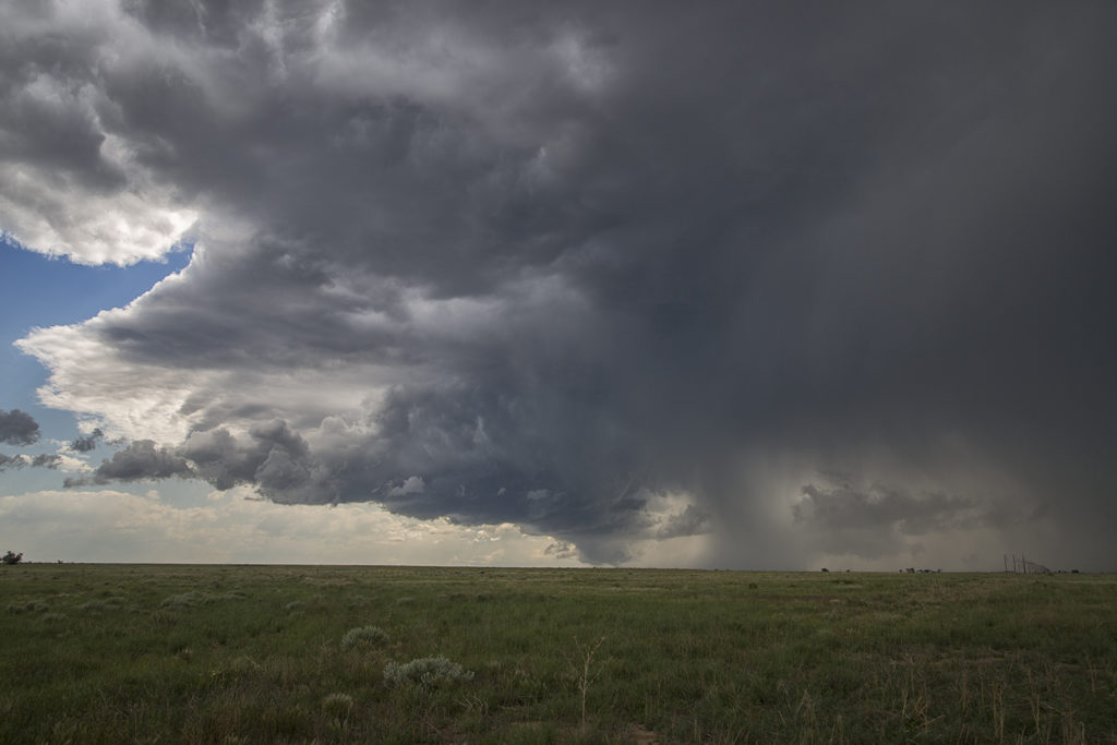
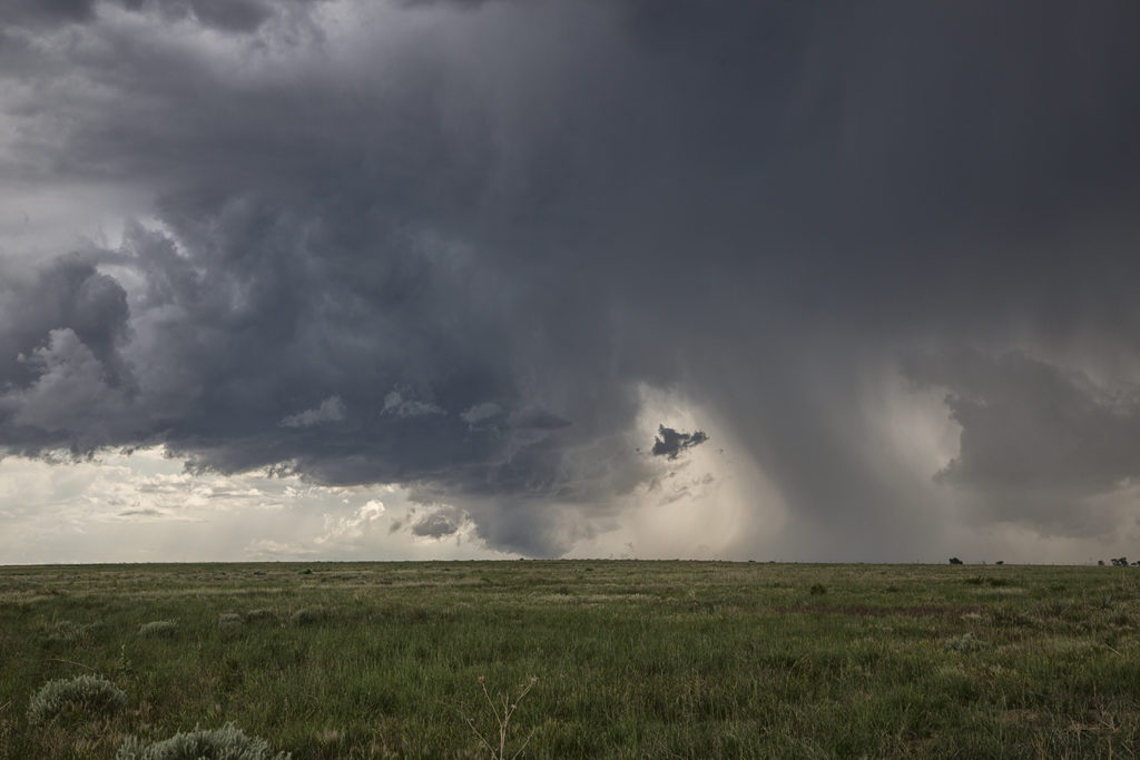
The first day of the Reunion tour provided a decent high plains set up. Upslope flow into western Nebraska would push 60 dewpoints along a boundary as moderate westerly mid level winds would help generate enough wind shear for supercells. Two such storms formed along the northwest/southeast oriented boundary and would produce giant hail to softball size. Both supercells were tornado warned with the second storm producing a confirmed tornado near Eckley, Colorado. Structure was decent as well. We came back through the area the next day to find thousands of acres of cropland shredded to the ground, mostly corn. Sometimes hailstorms can produce more significant damage than a tornado can. This was the case with these storms.
June 22nd Western Illinois Tornadic Supercell
We made a long hard dash from North Dakota to Illinois on June 22nd for what appeared to be a setup that had high tornado potential. Extreme instability, upper 70s dewpoints, strong wind shear and a warm frontal boundary would set the stage for a pretty decent tornado event. By late afternoon we arrived near Moline as storms finally got going along the boundary. Several supercells evolved along the warm front and several became tornadic. We intercepted two supercells that produced tornadoes, albeit weak tornadoes. Surprisingly there was only one tornado rated EF2 this day, which occurred well after dark. We chased along and north of I-80 from east of Moline to north of Peru, Illinois. Too many cell interactions made for a sloppy event, although the first tornadic supercell we intercepted near Hooppole had very pretty structure. I was sure this storm would drop a significant tornado. It produced a weak tornado that skipped along the ground for a couple minutes. As it continued east, it produced another tornado, a short lived multiple vortex tornado northwest of Peru. Later another supercell we saw in the dark produced the EF2 southeast of us. We couldn’t stay up with it. A long day, but a rewarding day for the tour!
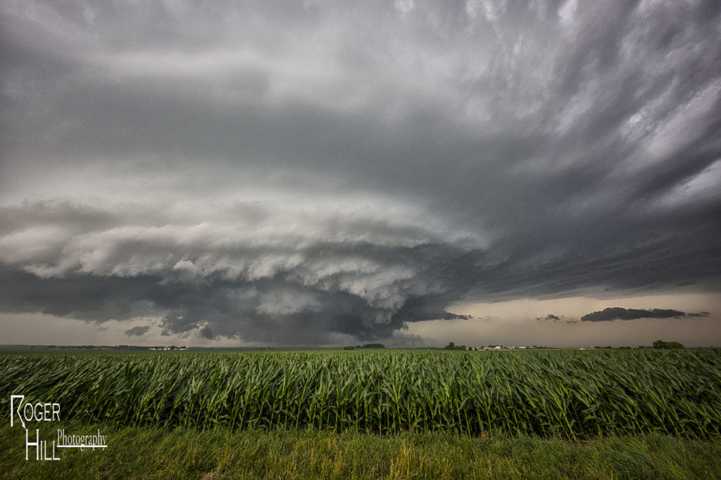
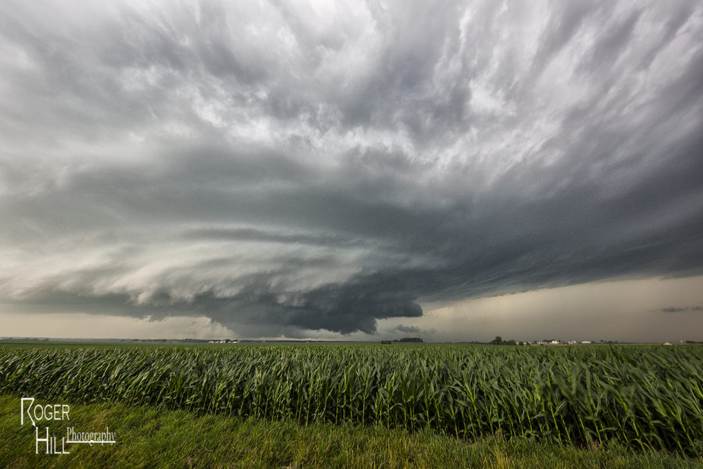
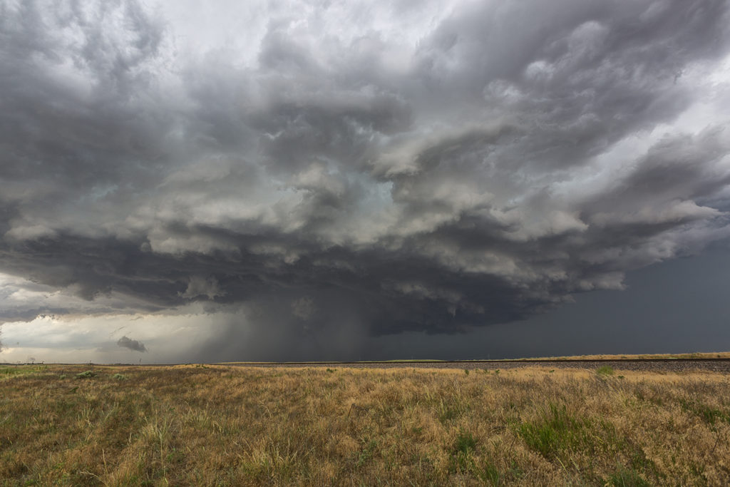
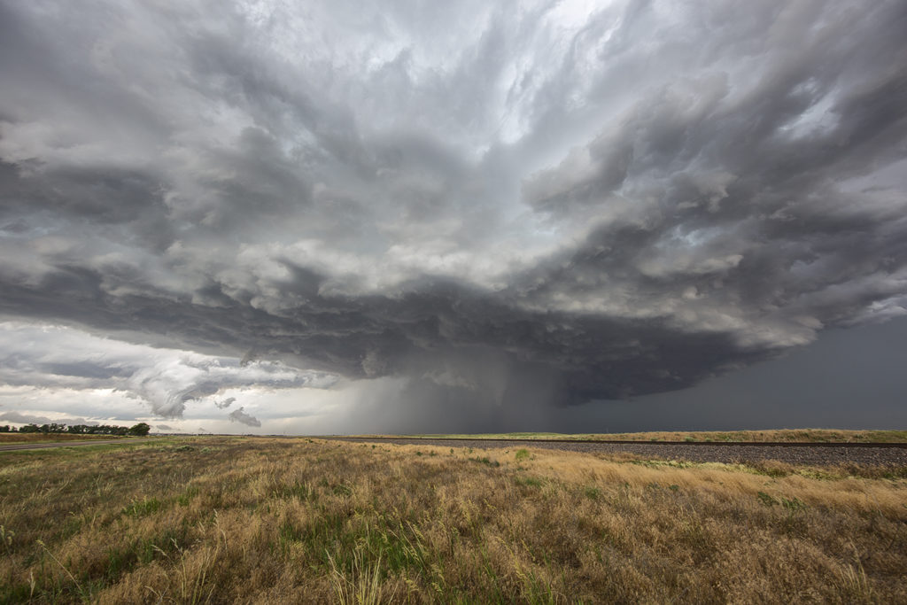
June 21st Northeast Montana Tornado Warned Supercell
June 21st was the first day we had decent shear, instability and some moisture to work with. A dryline and old outflow boundary set up in northeast Montana and would be the focus for supercells late afternoon. We drove to Bainville, Montana and waited at this cute little gas station/restaurant for storms to form and intensify. We were torn between cells near Glascow or further southeast near the Belfield, North Dakota area. We ended up choosing the northeast Montana storms. After a few cycles, a supercell emerged near Wolf Point as we drifted west towards Brockton to intercept it. Although it was a bit higher based, the structure was nice. As the supercell moved east, it became tornado warned near Culbertson. Near Fairview, a report of a tornado occurred, but we couldn’t see anything under the base. Not sure what the locals were looking at as with lcls at 800MB, it was pretty obvious the tornado threat was fairly limited. It stayed tornado warned all the way to Watford City, North Dakota where it was feeding on outflow air from storms to the east, and weakened quickly. Fun chase day, good storm, lots of lightning, hail and wind. Northeast Montana is a very pretty area to chase in!
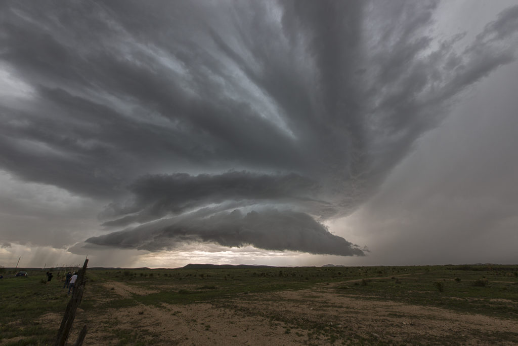
June 13th Pueblo, Colorado Severe Storm
Colorado was our destination on June 13th. We found ourselves chasing close to home near the Pueblo area. An early day storm had produced a tornado near Trinadad, but we couldn’t make it there fast enough. We caught a marginal supercell as shear had increased. However low level moisture and instability were still very low for mid June standards. nonetheless this storm produced golfball sized hail, lightning and heavy rains.
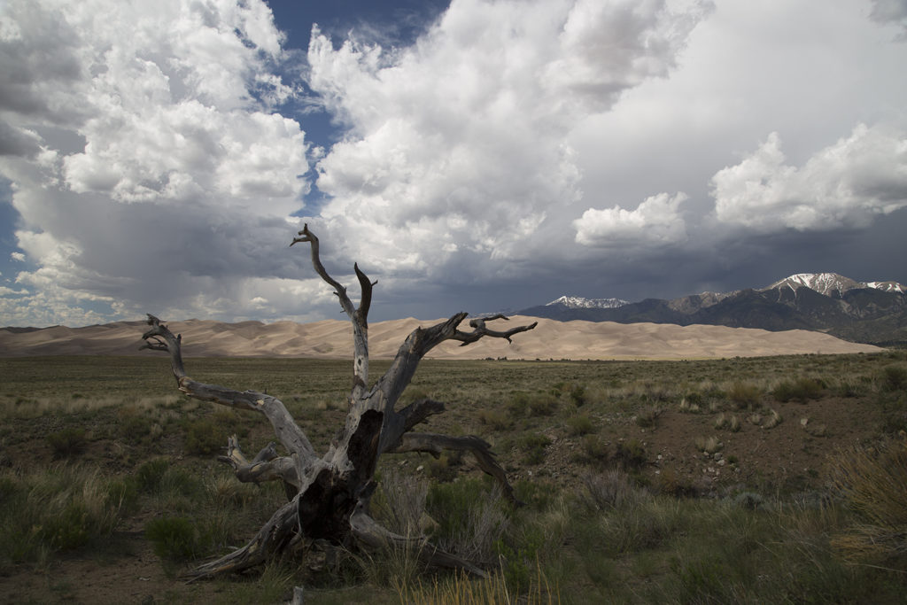
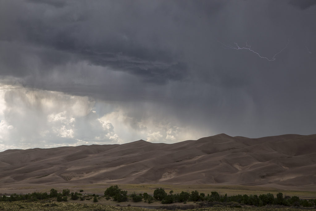
June 5th Great Sand Dunes National Park Storms
June 5th continued the extended period of low severe weather potential across the United States. However, we always do everything we can to get our guests a storm of any kind! June 5th looked like a good day for storms in the Alamosa/Great Sand Dunes NP area. So off we went. By mid afternoon storms formed over the mountains and some slid off the mountains into the valleys below. It just so happened to be in a very scenic area in the Great Sand Dunes park. When there’s not much of a chance of severe storms we like to take our guests to scenic areas, with this area being quite pretty. Storms rolled over the dunes and produce heavy rain, lightning, wind and small hail. All in all it made for a pretty satisfying day, with a nice Mexican dinner in Alamosa to follow.
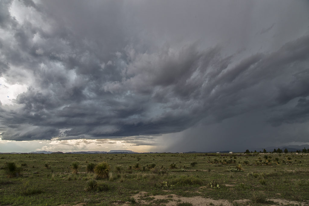
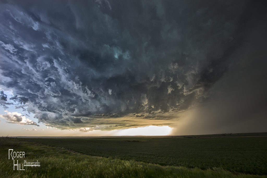
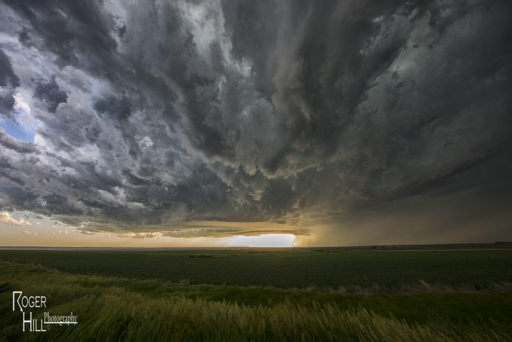
June 1st Marathon, Texas Supercell Thunderstorm
June 1st continued the streak of limited moisture and shear for the US. We decided to chase the Davis mountains in southwest Texas and were treated to a pretty storm with very large hail to tennisball size. Two supercells emerged from the mountains with one storm in particular becoming a prolific hail producer. It tracked from near Marathon eastward to Sanderson where it dropped its largest stones of the day, measured 2.5″ in diameter. Later on, the storm gusted out and outflow kicked up a cluster of new cells on the Mexico border that were producing an incredible amount of lightning strikes. Pretty indeed, and a great way to finish the day!