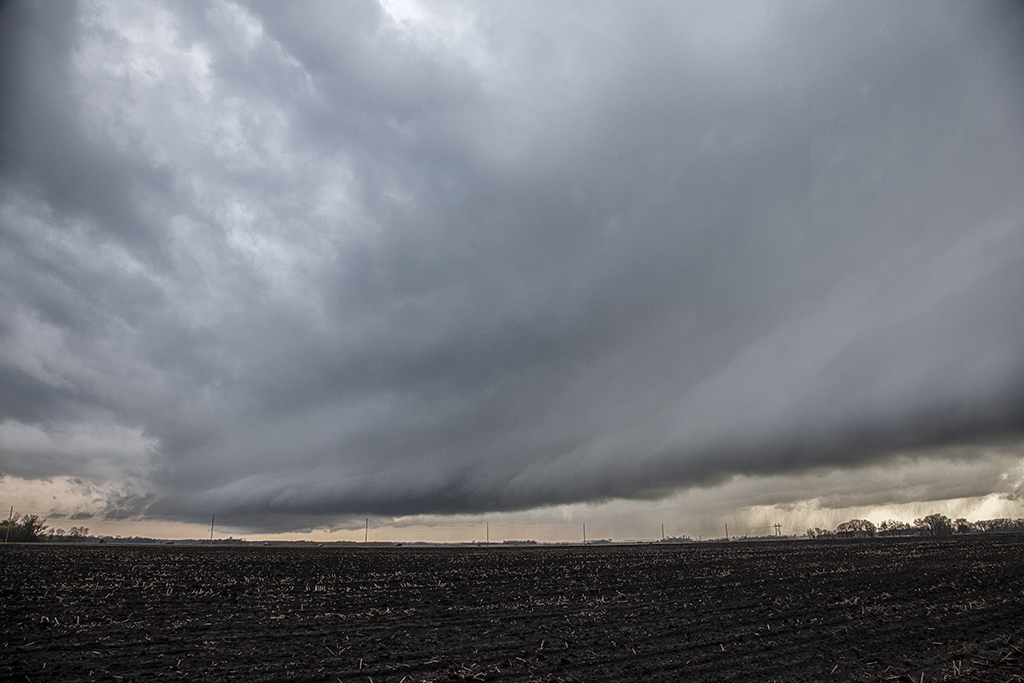
June 12th featured awesome shear, but a dearth of low level moisture. Dewpoints in the 50s to low 60s wouldn’t be enough to get intense tornadic storms to form. Most storms were higher based and quickly became outflow dominant. We positioned ourselves near Wadena, MN and chased a storm that formed southwest of there straight down I-94 towards the Twin Cities. The storm spun hard, but had a tendency to be linear and quite gusty. Another cell formed along a boundary just to the east and acquired supercell characteristics. It developed a lowering that someone report a tornado from. From our vantage point, I had a hard time believing that report. Another over zealous chaser in action! We stayed with our storm and near St Cloud, it became tornado warned. At one point it had a lowering that looked like a broad funnel forming, however, that’s as far as it went. Soon the gust front hit us and we called it a day. A bit of a frustrating day in which there was some decent potential for nice supercells and even a couple of tornadoes, but to no avail.

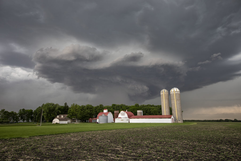
June 2nd Southern Minnesota Tornadic Supercell
June 2nd appeared to have some promise for severe storms in southern Minnesota. Very hot and relatively moist air would reside along and south of a stationary front south of the Twin Cities. Large temperature/dewpoint spreads would result in higher based storms. High CAPE and moderate shear also existed. A cluster of cell formed along the boundary, and eventually the eastern most cell would mature into an intense hail/tornado making supercell. I was completely surprised to see a multiple tornado warnings for the storm despite the higher base! It produced a couple of weak tornadoes and very large hail 3 inches in diameter. It persisted for several hours before gusting out, with an eventual line of severe storms forming and moving southeast through southern Minnesota. This area is very photogenic and has many stunningly photographic farmsteads! Check out the photos and please click on an image for a larger pic. Enjoy!
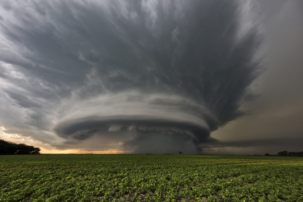
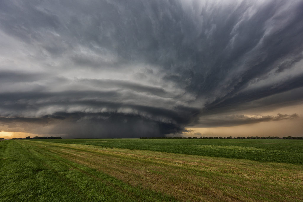
July 11th North Dakota and Minnesota Tornadic Supercell
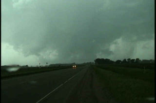
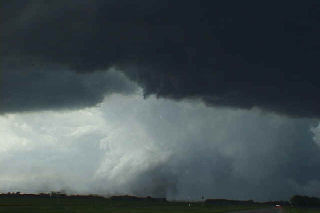
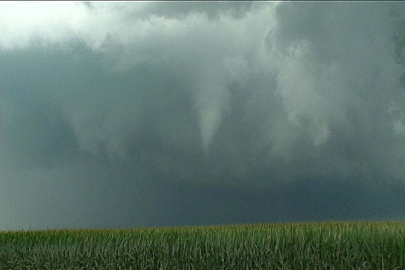
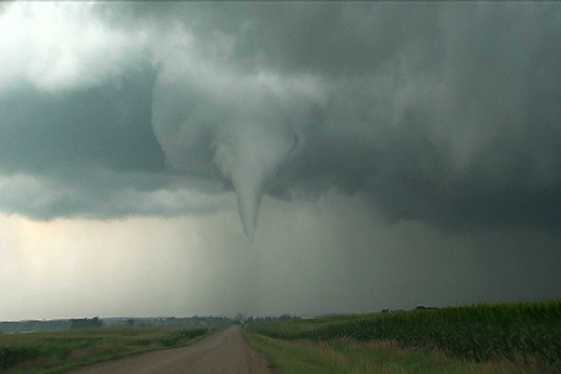
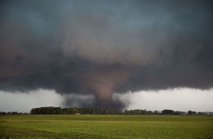
July 11th took as to eastern North Dakota. An advancing dryline, strong moisture return and extreme instability would set the stage for numerous supercells, some tornadic. We started the day just west of Grand Forks, ND as convergence caused cumulus towers to explode. It didn’t take long for severe and tornado warnings to be issued! We played with the first to do so northwest of town. It had decent structure and very large hail. A large wall cloud formed and spun strongly. An occasional shear funnel would occur, but nothing imminent to touch down. Soon, a supercell formed on the southern end of the line and quickly became severe. It developed a strong area of rotation and a hook on radar. we quickly dropped south to intercept the storm, driving through blinding rain and hail golfball sized. As we cleared the core, a large circular updraft came into view and it was obvious it was spinning strongly. A mulitvortex tornado occurred back in the core that we couldn’t see. It stayed on the ground for over 20 miles as it approached the Minnesota border.
We stayed with the storm all the way to northeast of Fargo is the structure was jaw dropping! At one point, the rain cleared enough to get a brief glimpse of the large tornado! (pic below) Eventually it weakened as upshear convection would form and interfere with the supercell. The lightning was extreme, intense and very close numerous times. Several times we had to get back into the vans for our safety and to keep our guests safe. Finally near sunset, we let the storm cluster go and headed west for what would be several days of chasing in Canada!
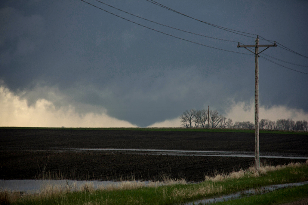
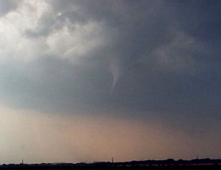
May 8, 2014 – Southern Minnesota Tornado
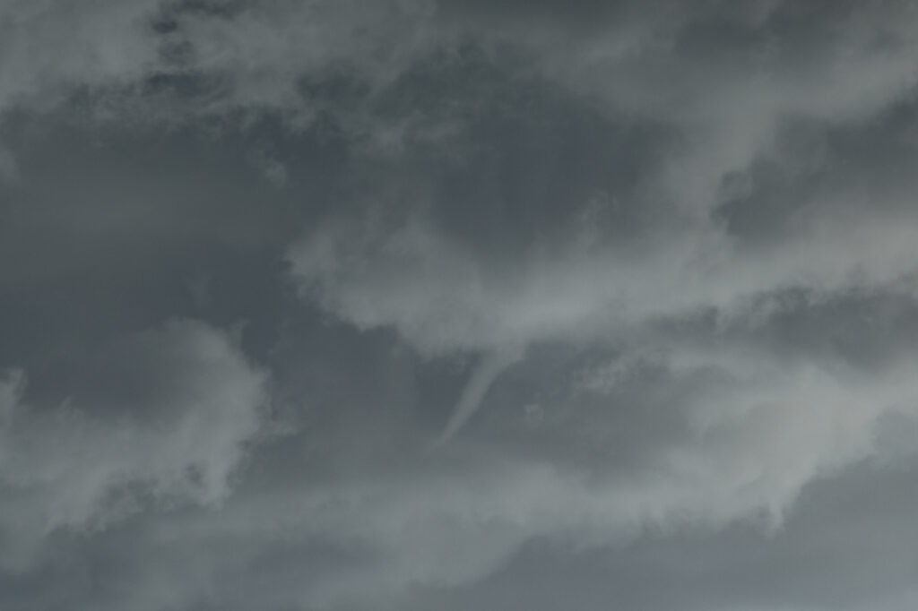
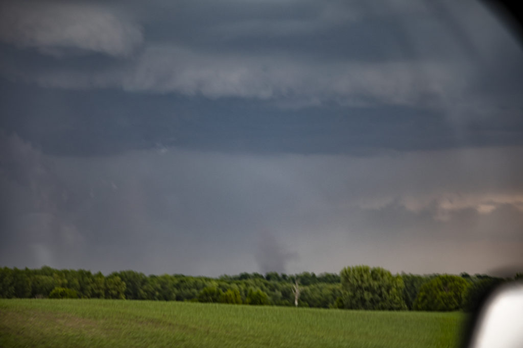
May 8th took us quickly north to southern Minnesota. A warm front, triple point and advancing short wave would set the stage for several severe storms this day. Tornado threat seemed to be tied to the warm front and it did not disappoint! We were ALMOST late getting there due to the long distance we had to travel, however, we arrived right as the storm became tornadic, witnessing a large multivortex/cone tornado south of Judson, MN. Soon though, the storm crossed the warm front into colder air and weakened. All in all, it was a short, but successful chase day! Due to my concentration on the task at hand, I did not capture a decent photo. This tornado pic is from SLT guide Travis Farncombe. Thanks Travis!!
July 14, 2010 Northfield, Minnesota Tornadoes
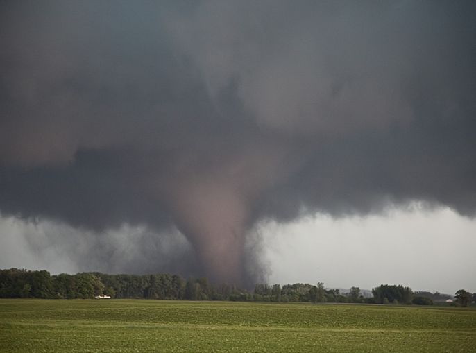
Had high expectations this day as all parameters pointed to a significant tornado outbreak. I just had a gut feeling it would line out quickly and that you would have to be in position to intercept any discreet supercells before they lined out. That is what happened. I took the Canadian Prairie tour to Faribault, MN for lunch and watched as surface based storms broke the cap. We blasted up I-35 and approached highway 19. We quickly noticed an amazingly rapid development in the mesocyclone of this supercell and it took a matter of moments and it dropped a nice truncated cone tornado that crossed I-35 and flipped a couple vehicles as the white debris cloud moved into a field next to the interstate. This tornado skipped along the countryside for a couple miles and lifted.
Quickly, another tornado, a slender truncated elephant trunk shaped tornado touched down and rotated around the outer periphery of the mesocyclone. It stayed in contact for only a few minutes before lifting. The rotation in the mesocyclone was still quite intense. Another long snaking elephant trunk tornado touched down with full condensation to the ground and looked very nice. Unfortunately it did a bit of damage, as shown below. All this occurred not far from Northfield, MN. Then the cells lined out and the show was over on a day that was hyped to be a big tornado outbreak.
June 17, 2010 Southern Minnesota Tornado Outbreak!
Another spectacular day! Witnessed 13 tornadoes in southern Minnesota from near Kiester to north of Albert Lea. There was a near mile wide wedge that was on the ground for nearly an hour! Decided to play further south for the later show and was rewarded for patience. Pretty tough sitting tight and waiting while numerous tornado reports filter in from north of you. My sympathy goes out to all those who suffered losses this day. We came across many damaged properties where authorities were already heading to the scene.
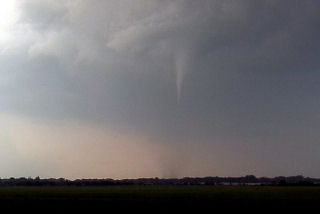
June 29th, 2005 Southwest Minnesota Tornadoes
The set up this day was conducive to supercells. A dryline/cold front would advance across far western Minnesota and provide the focal point for thunderstorm development. We started in west central Minnesota north of Marshall. Convection developed and went linear quickly. So we dropped south where the cap was stronger and caught a nice isolated supercell. This storm produced at least 2 tornadoes we could confirm.
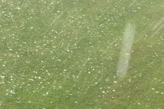
July 2nd, 2003 Elbow Lake, MN Hailstorm
July 2 took me to the northern plains to chase a supercell in western Minnesota. Conditions were not favorable for tornadoes, but cold air aloft and good mid level flow would prove enough for rotating supercells producing very large hail. One such storm hit the Elbow Lake, MN area with 5″ diameter hail. I was fortunate or unfortunate enough to experience this supercell personally.
June 11th, 2001 Benson, MN Tornadoes
This day was one of my all time favorites. An incredible set up with a warm front lifting northward through southern Minnesota, an approaching short wave and developing cyclone in northeast South Dakota set the stage for explosive thunderstorm development. The day started in Granite Falls, MN under cloudy skies with elevated convection. The morning convection soon cleared and left us with southeast winds at 35 mph with a temp of 90 and a dewpoint of 72!!! WOW!!! All things were pointing to the area northeast of Watertown, SD as the hot spot. Winds were backed wonderfully, but the atmosphere was strongly capped. Shortly after 2 PM, the first surface based tower exploded after several hours of excellent convergence, into a strong supercell that within an hour, produced the Benson tornadoes. This supercell was on the wet side of classic, but morphed into an intense HP storm. By the time it approached the twin cities, we left it for the night. Please check out the photos below, as some are breathtaking!!!