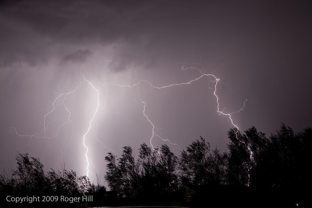
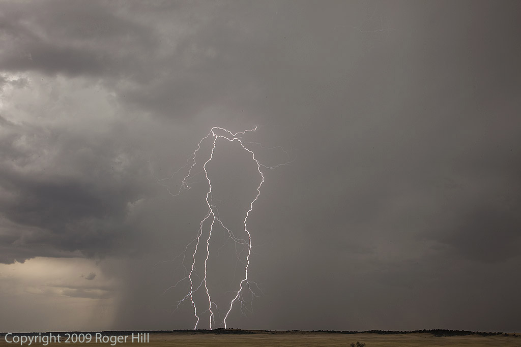
Below are some images taken from my house during the month of August and early September. During our typical monsoon season, July and August provide some great lightning photography opportunities. A couple of the shots towards the bottom of the page had a rain drop or two on the lens and thus came out blurred on those spots.

August 7, 2009 Sturgis, South Dakota Hailstorm
August 7th looked like a decent setup for western South Dakota. Good shear and moisture, moderate instability and strong lift would help fire off several supercells, including the Sturgis storm. We followed that storm from the time it passed Sturgis until it died near Murdo well into the night. It left behind a path of massive hail damage. It also injured numerous bikers and caused millions of dollars in damage at the Sturgis Bike Week Rally.
July 31, 2009 Kansas Tornadic Supercell
What a pleasant surprise this day was! I was hoping for a couple of high based supercells in western Kansas and certainly got much more than I hoped for! Several supercells developed from southwest Nebraska southward along a boundary in western Kansas. Caryn and I intercepted a tornadic storm just south of Gove that produced hail almost golfball sized as well as at least 2, possibly 3 tornadoes.
July 20, 2009 Kansas Beautiful Supercell
July 20th had decent promise for severe storms. An old boundary lay northwest to southeast across Kansas, with increasing shear and lift with an approaching wave. Severe storms formed along the boundary, with a storm I intercepted in central Kansas near Great Bend. The storm of the day was in southwest Nebraska, but this storm as well was tornado warned. Check out this new time lapse video:
July 18, 2009 Texas Panhandle Nicely Structured Supercell
July 18th was another day of good northwest flow, albeit the moisture and instability were a bit less than the 17th. We captured a beautiful LP/low end Classic supercell in the Texas panhandle north of Dalhart and stayed with it till it died south of I-40 in eastern New Mexico. Crazy chasing down here in July when you should be up north! But, this was a beautiful storm that also produced TONS of hail. Check out the time lapse and hail video below.
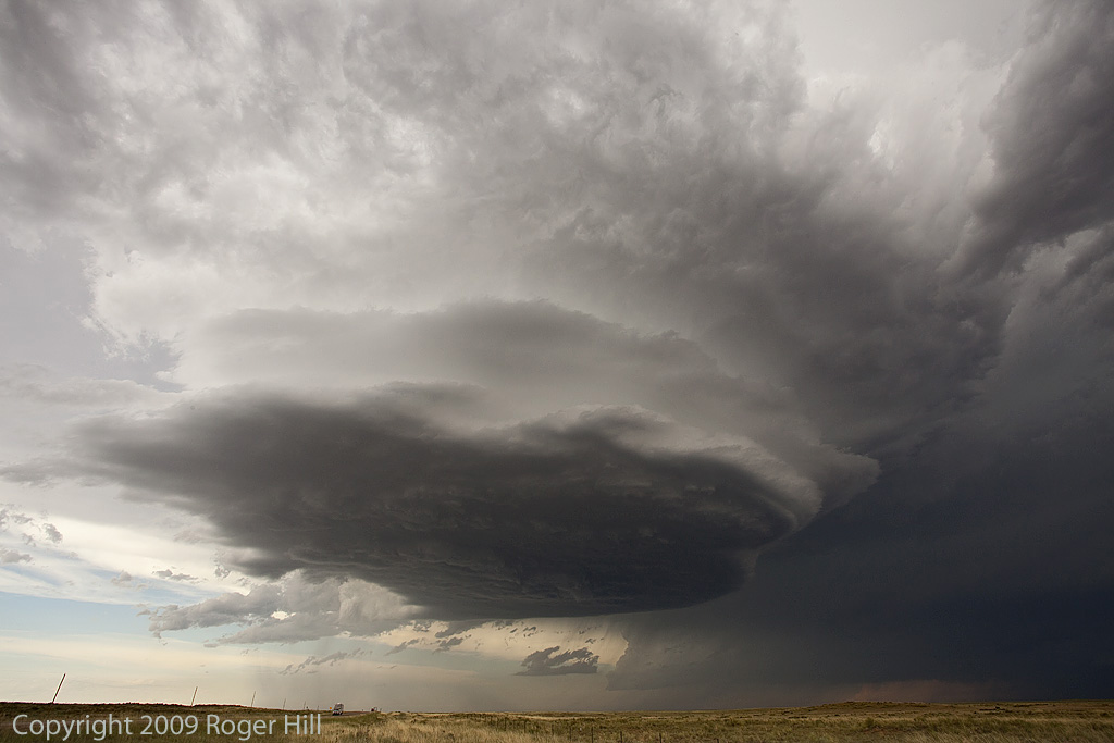
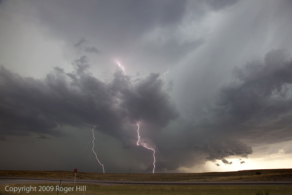
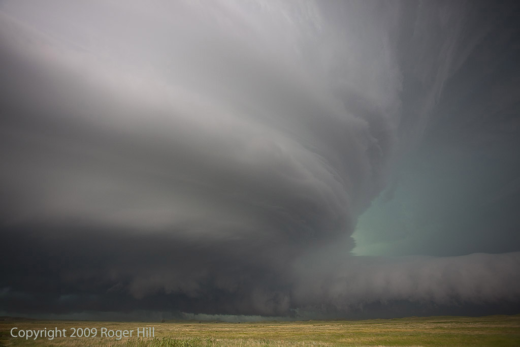
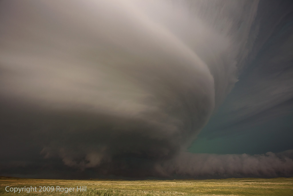
July 17, 2009 Texas Panhandle and Colorado Supercells
July 17th was a classic northwest flow event. Good deep layer shear, moisture and instability would cause storms developing over the higher terrain of Colorado and northeast New Mexico to increase in intensity as they moved southeast across eastern Colorado and the Texas panhandle. We intercepted a nicely sculpted severe storm northwest of Dumas, Texas that produced near golfball sized hail. But the storm of the day was a southwest moving tornadic supercell in southeast Colorado. It had magnificent structure, 50 mph inflow winds, baseball sized hail and a tornado. I also was able to do a time lapse over an almost 80 minute period of the updraft as it spun nicely. Watch the video below!
July 13, 2009 Valentine, Nebraska Amazing Supercell
July 13th was one of those days you don’t soon forget. A supercell formed near Rapid City, SD and tracked all the way southeast of Valentine, NE by late evening. It was a storm to behold! Beautiful structure, likely a couple tornadoes buried in rain and hail to baseball size was the story of this day. It was tornado warned for over 6 hours!
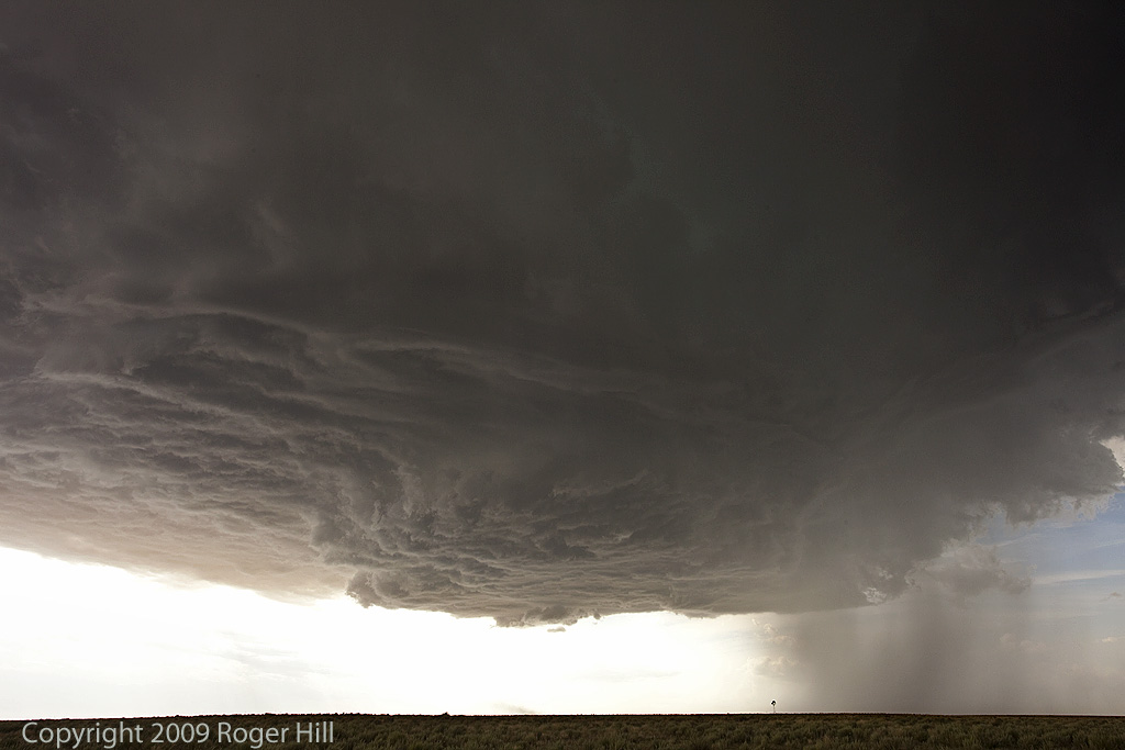
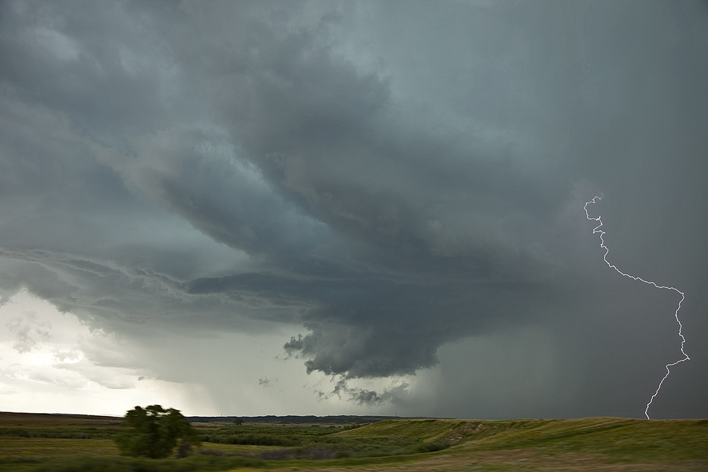
July 12, 2009 Eastern Wyoming Supercell
July 12th was a surprise for me. I didn’t think there were enough ingredients for a significant supercell event. I was wrong, and happy I was at that! By late afternoon a storm came off the Laramie range and produced a great lightning show. Just north of that cell, another beautifully structured beast formed and became the storm of the day! There was major motion under the updraft base/wall cloud and I was surprised it was never tornado warned. It was severe and produced signficant hail to tennisball size.
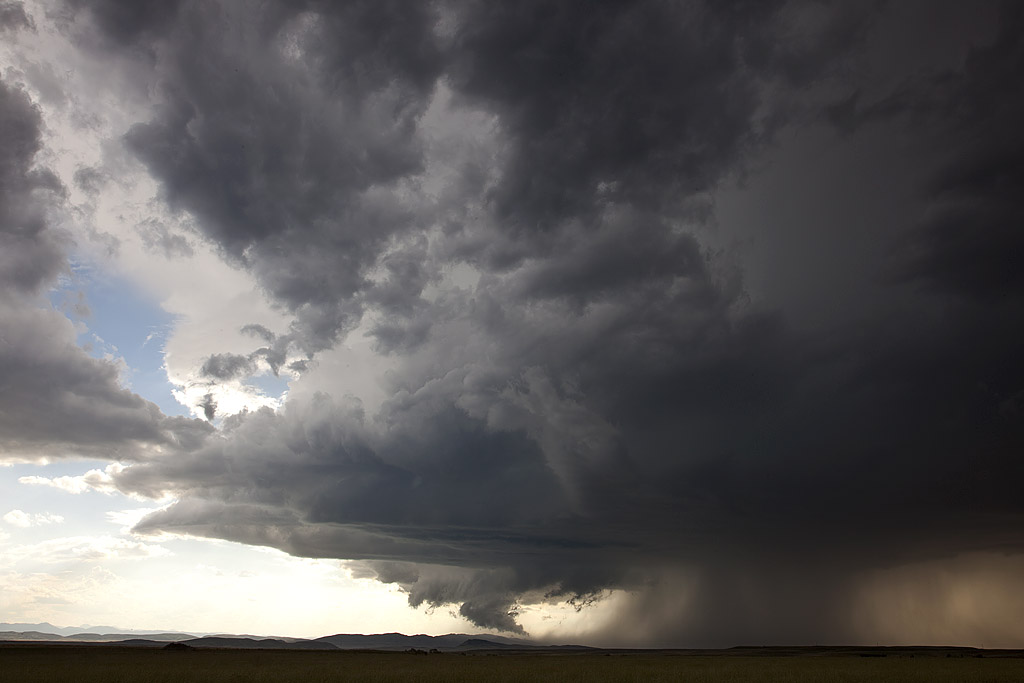
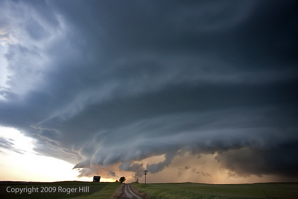
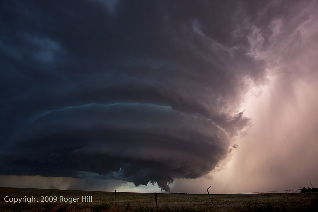
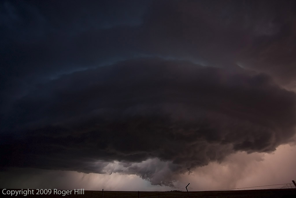
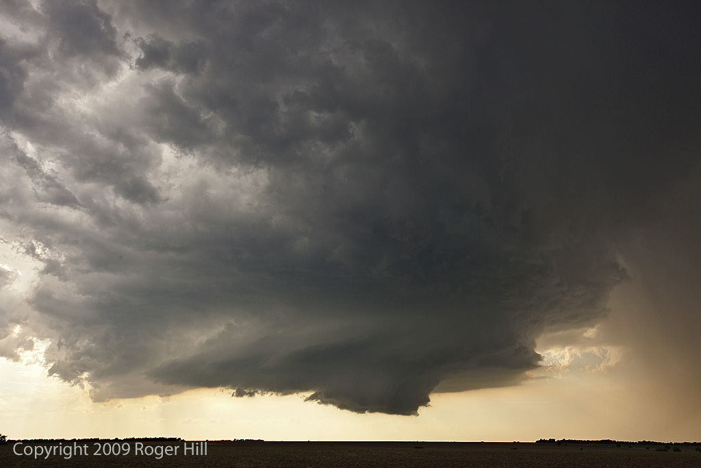
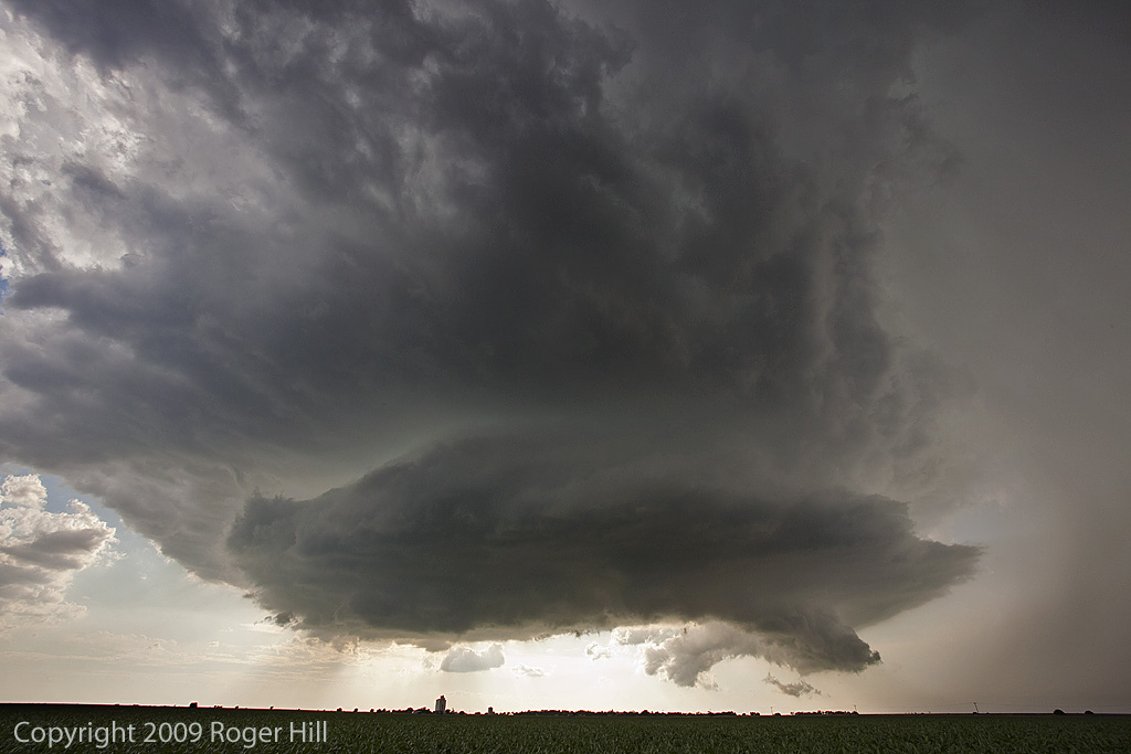
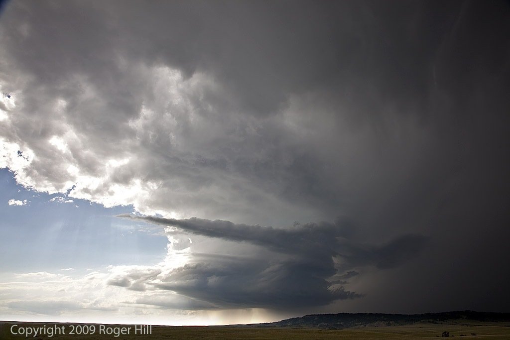
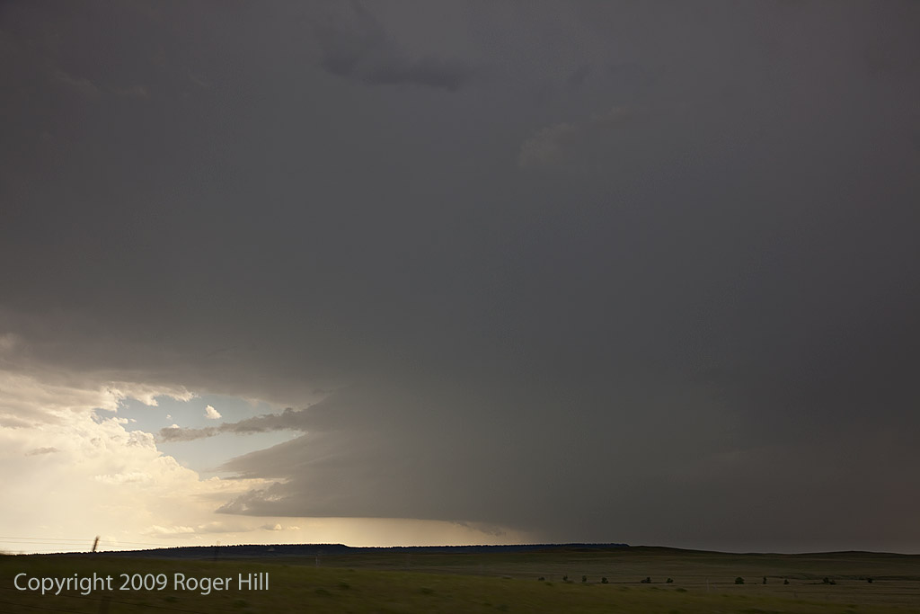
July 8, 2009 Northeast Wyoming Supercells
July 8th I couldn’t resist the drive to northeast Wyoming and southwest North Dakota for what looked like a decent setup. A slowly advancing cold front, along with a dryline intercepting it, ample moisture and instability, would provide a favorable environment for severe storms, supercells and tornadoes. Unfortunately, that rare occurance that the triple point didn’t produce a long lived supercell, while tornadic supercells formed north and south of us came to a reality. Still, we had two nicely structured supercells, the latter of which shown above came very close to producing a tornado.
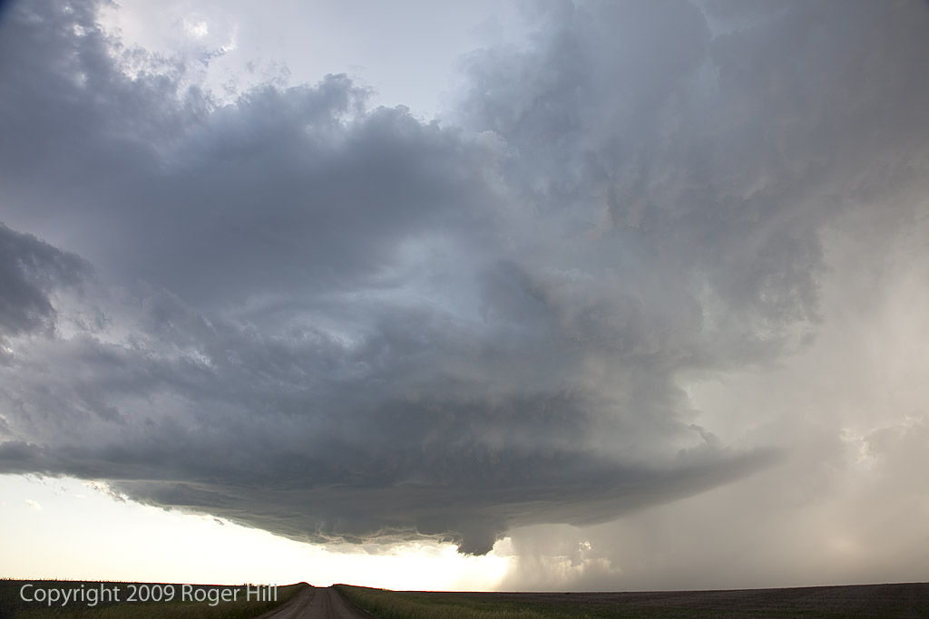
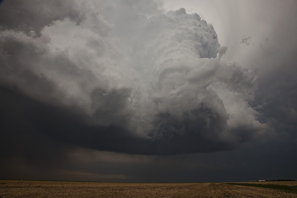
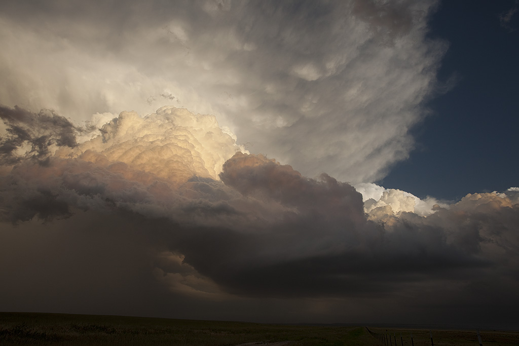
June 24, 2009 South Dakota Long Lived Supercell
June 24th had potential. Good deep layer shear, decent moisture, high instability and a mesolow along an outflow boundary would provide all the ingredients to produce several supercells in South Dakota. We spent part of the afternoon in Murdo and waited for something to happen. Finally by early evening, a tornado warned supercell formed and right turned strongly into far south central South Dakota and eventually into Nebraska. This storm had great structure and tried several times to produce a tornado. It did produce hail to baseball size.