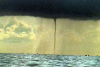
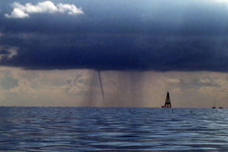
We arrived in Marathon, Florida to chase waterspouts this week. We captured a nice waterspout from the sea while deep sea fishing at 9:30 AM on Aug 6th. Pics of the spout are shown below. This spout stayed in contact with the ocean for nearly 20 minutes! Unfortunately I forgot my Nikon D70, so all the shots here are video stills.
July 10th-17th, 2005 Canadian Prairie Images
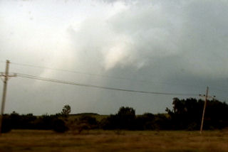
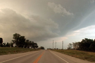
The following images were taken while chasing the Canadian Prairie Provinces this summer. Beautiful country, but we did not catch a tornado. See the images below for our fun during this chase period!
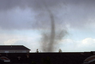
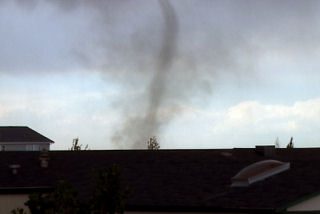
July 3rd, 2005 Surprise Colorado Tornado
Well, what can be said here. Caryn and I were walking out of our house on the porch and low and behold and landspout tornado developed just north of the house under a high based storm which had developed on a boundary. It stayed on the ground for about 3-5 minutes before dissipating.
July 1st, 2005 Northwest Kansas Supercell
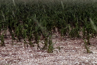
I didn’t expect much on July 1 with limited moisture and large temperature/dewpoint spreads. We did catch a nice high based hailer northwest of St Francis, Kansas. This storm had decent structure and produced tons of hail to golf ball size. Unfortunately this hail clobbered numerous cornfields and did considerable damage.
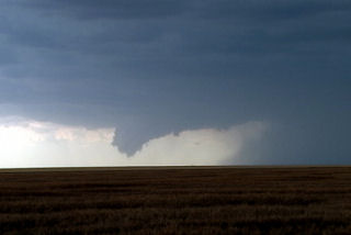
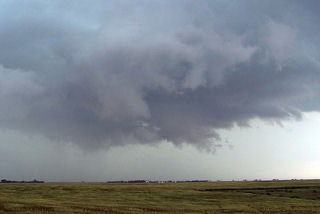
June 30th, 2005 Neosho County Kansas Possible Tornadic Supercell
June 30 was a surprise day! Things did not look that great to start, but intense instability along with an old outflow boundary would provide the focal point for severe thunderstorms. Elevated storms developed during the morning and early afternoon, followed by surface based storms along outflow boundaries later that day. We raced east from Wichita to catch this beast as it became an intense supercell. It produced at least one if not more tornadoes. One tornado was reported after we left it with a damage path of 500 yards!
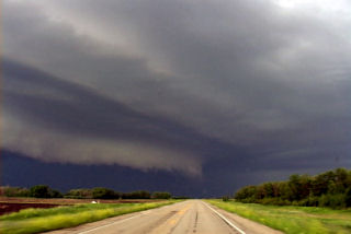
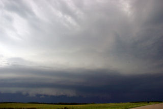
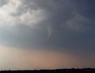
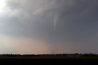
June 29th, 2005 Southwest Minnesota Tornadoes
The set up this day was conducive to supercells. A dryline/cold front would advance across far western Minnesota and provide the focal point for thunderstorm development. We started in west central Minnesota north of Marshall. Convection developed and went linear quickly. So we dropped south where the cap was stronger and caught a nice isolated supercell. This storm produced at least 2 tornadoes we could confirm.
June 26th, 2005 Dakotas Tornadic Supercells
Being the first day of the tour, we drove QUICKLY to South Dakota where we caught a decent supercell. Conditions looked good with high instability, decent shear and an outlfow boundary from previous night convection to focus intense convection on. It produced a couple of weak tornadoes before lining out. We then blew it off and drove towards the Bismarck, ND area where we caught a nice sculpted supercell that produced a couple of weak circulations.
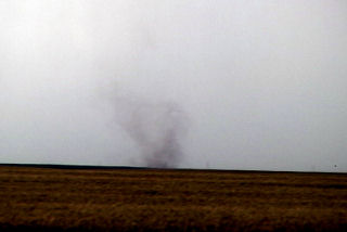
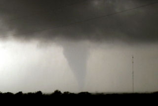
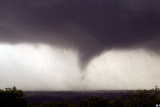
June 16th, 2005 Southwest Kansas Tornadic Supercell
This day was actually a surprise. An old outflow boundary across southwest Kansas into northwest Oklahoma would provide sufficient convergence and lift to develop supercells this day. One such beast developed near Garden City and intensified as it moved southeast. It produced a landspout and had beautiful structure.
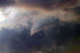
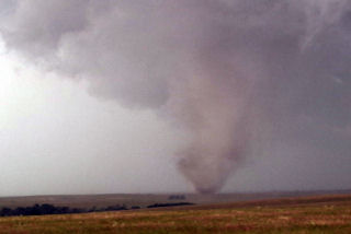
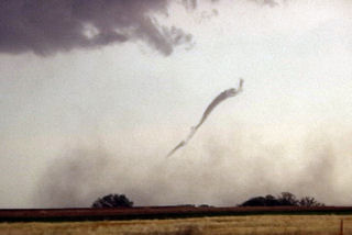
June 12th, 2005 Kent County, Texas Tornadofest
June 12 had the look and feel of a decent tornadic set up in the eastern Texas panhandle. A strong dryline, coupled with an old outflow boundary from overnight convection, high dewpoints and instability would set the stage for tornadic supercells this day. We blasted from Denver all the way to east of Lubbock to catch this monster. As we arrived a strong supercell became anchored in Kent county enhancing its shear, which would help it produce numerous tornadoes. This storm did not move much at all during its life cycle.
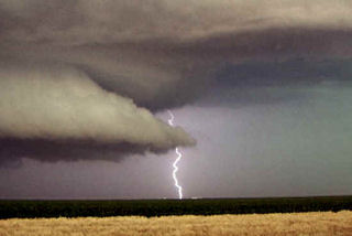
June 9th, 2005 North Central Kansas Tornadofest
June 9 had that feel to it. Everything was coming into place for a significant tornado outbreak. A triple point was situated over northwest Kansas, slowly drifting east. Very unstable, moist air was streaming in from the south, and with an approaching short wave trough, it was only a matter of time before rapid severe thunderstorm development would occur. I sat north of I-70, southwest of Hill City and watched the storm of the year develop from a small cumulus tower and become a prolific tornado producing monster.