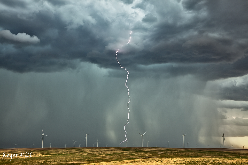
Late August continued our monsoon storm lightning tours, as evidenced by the many images below. If you want more information on our High Desert Thunder tour (or our other southwest tours) check out www.southwestphotographytours.com . There are also a couple landscape images taken on this tour, including Grand Falls (the Chocolate Niagra), which is a very rare sight!
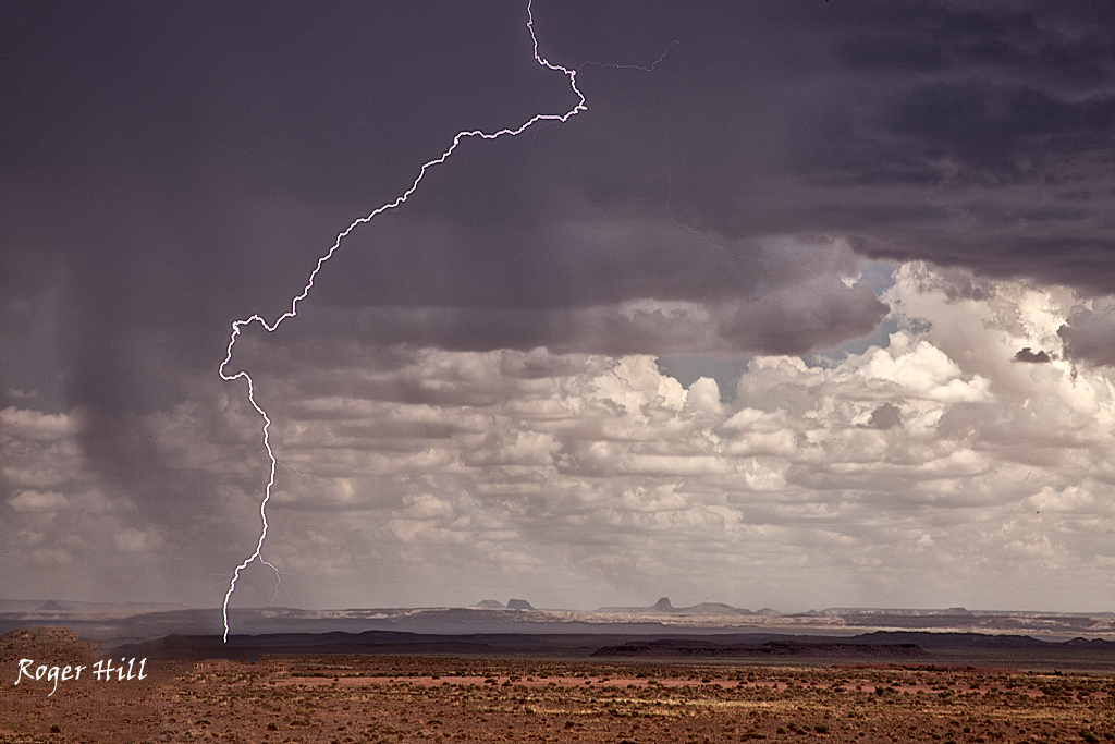
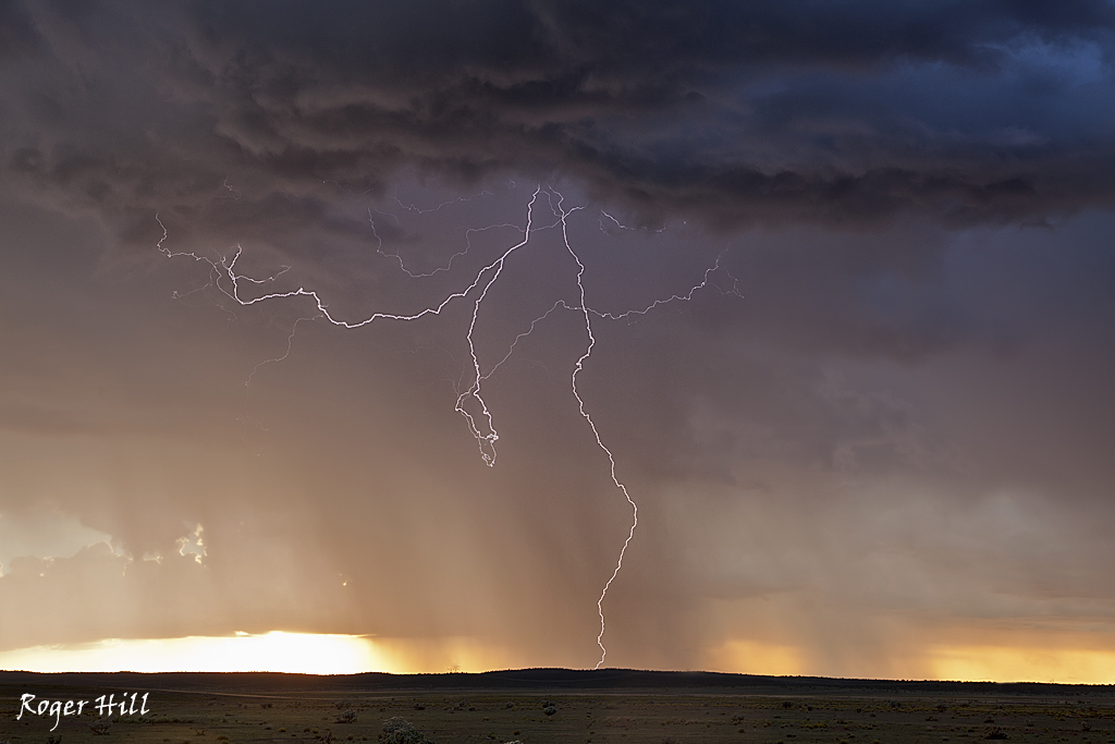
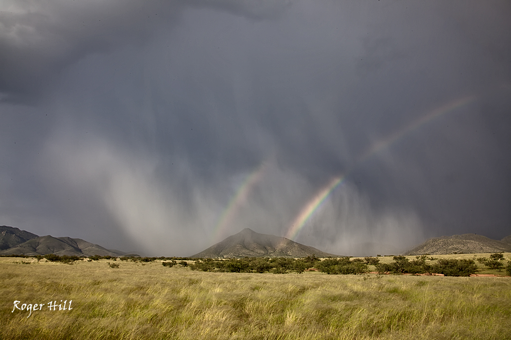
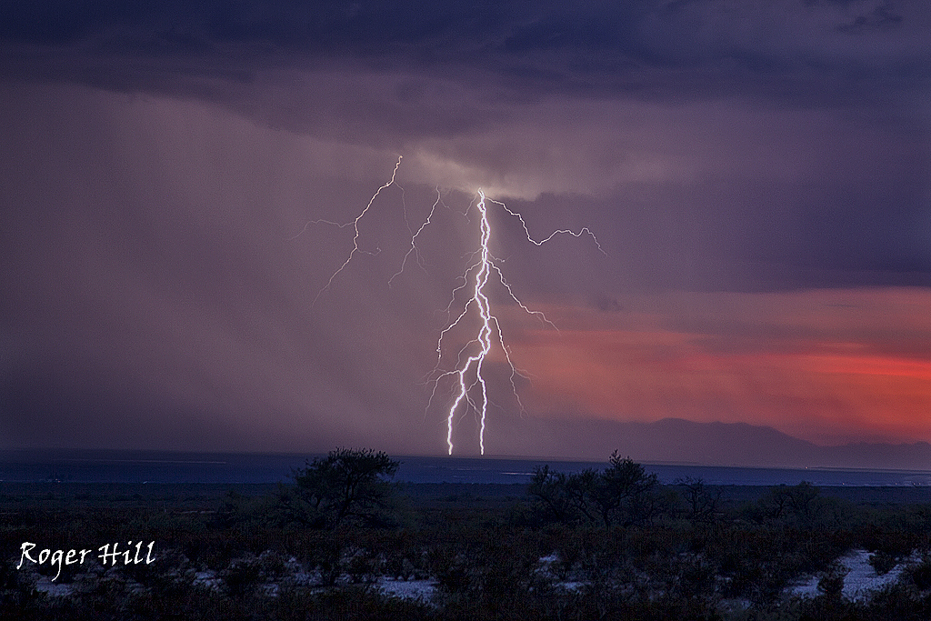
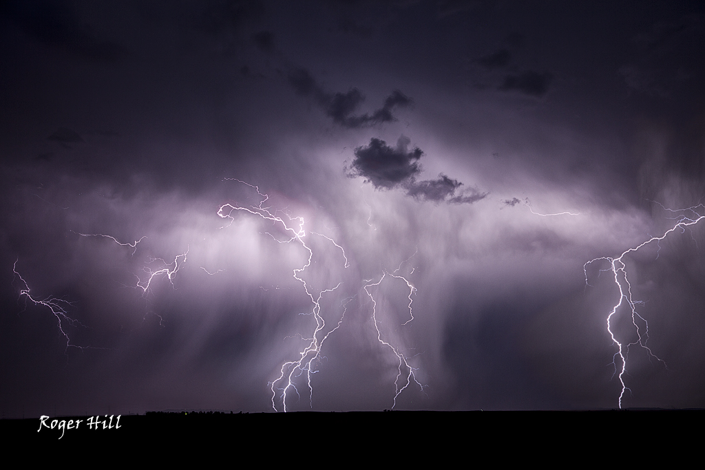
August Southern Arizona Lightning
Here are a bunch of images taken during our annual Desert Thunder monsoon tour during mid August in southern Arizona. Please check out www.southwestphotographytours.com for details on how you can join us for this “photographer’s dream” tour!
Late July Colorado Lightning
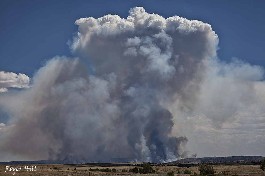
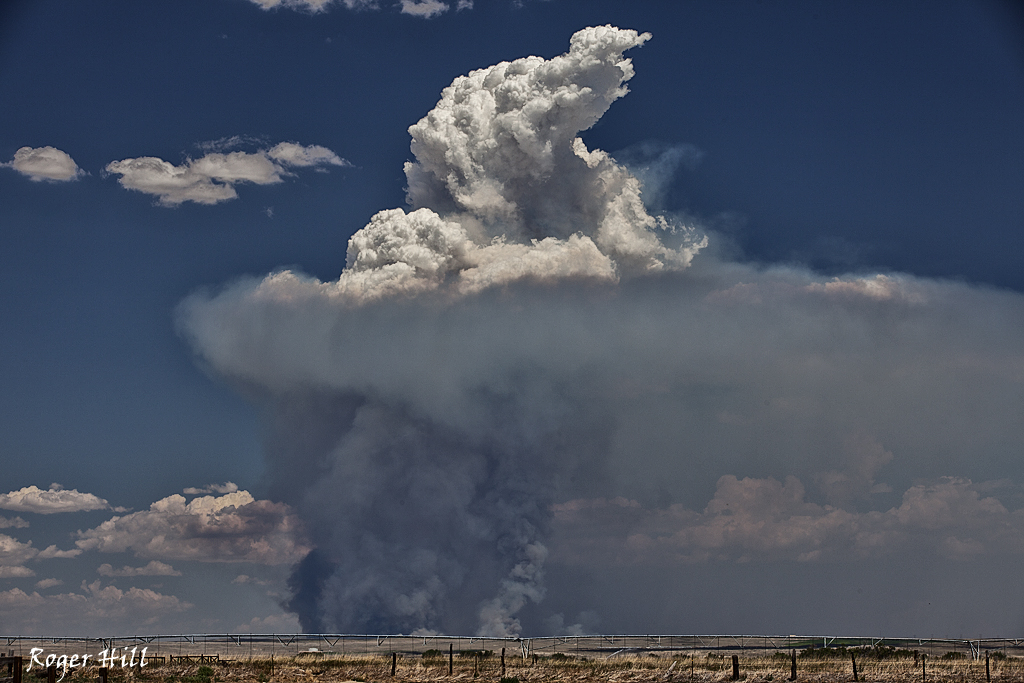
July 16th/17th SD Supercell/WY Fire
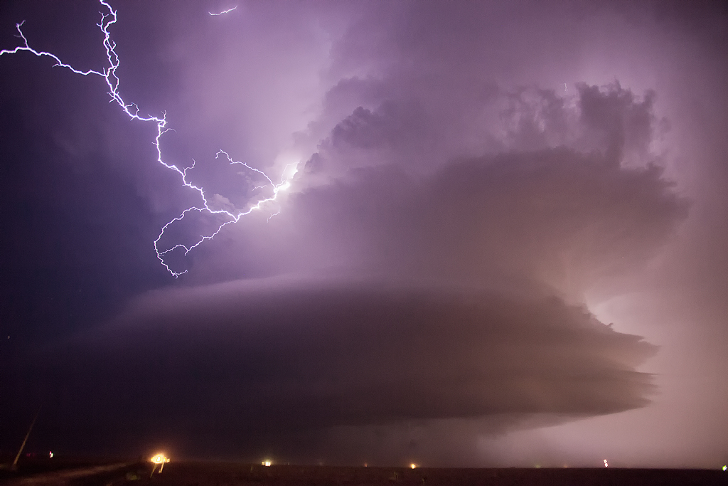
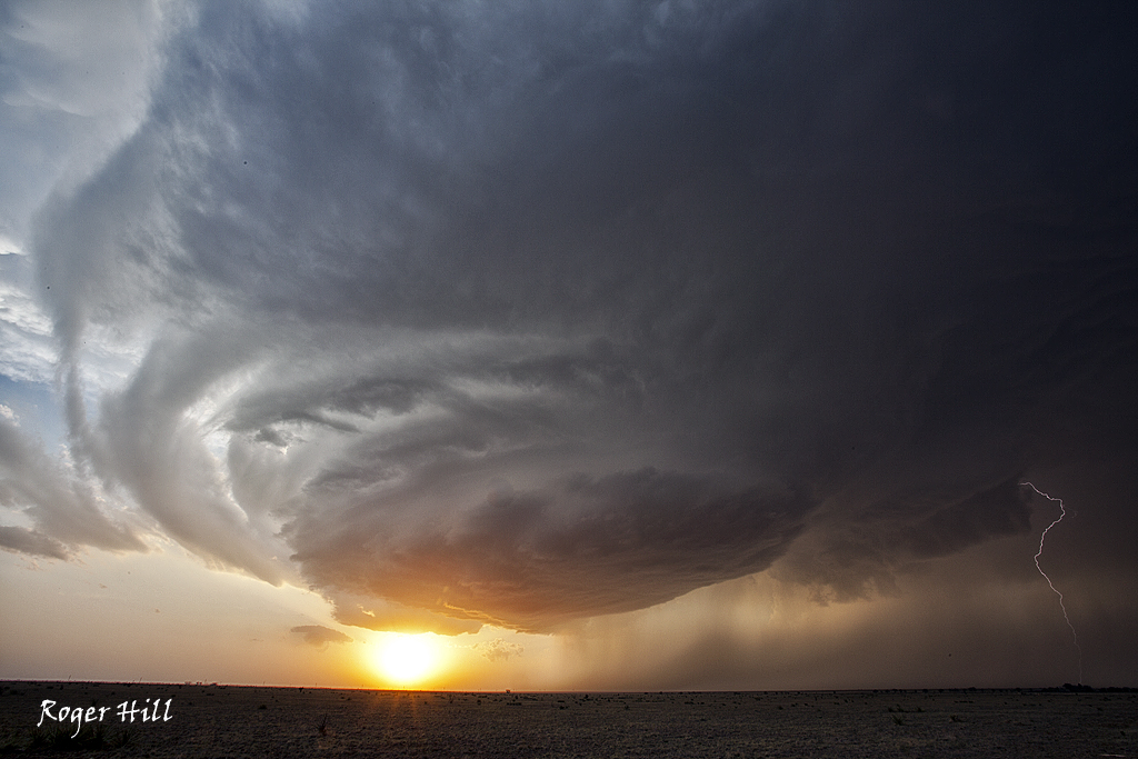
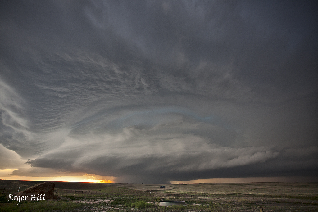
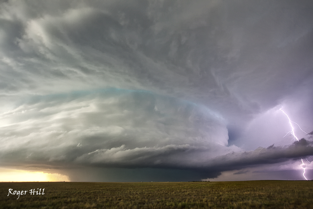
July 16th took us to central South Dakota for a marginal set up. Decent flow aloft, limited moisture and decent instability allowed a cluster of storms to form. The tail end storm became a gorgeous supercell and was very electrified. The next day on the way back to Denver, we passed the Sawmill Canyon, Wyoming fire. It was raging out of control and had consumed 13,000 acres.
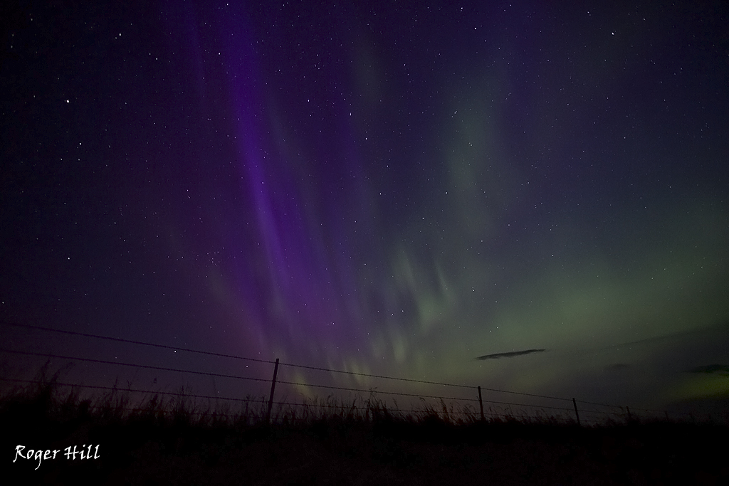
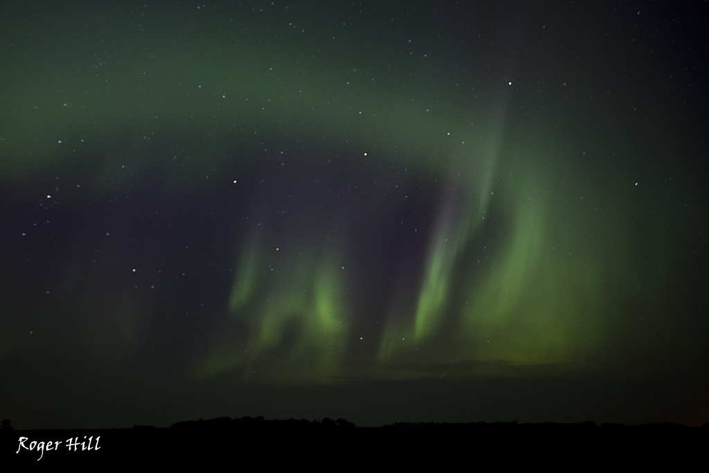
July 15th Aurora Borealis
Not a ground based storm, but the Aurora was quite vivid this night. We were in northern North Dakota after chasing a tornado warned supercell that died very fast. These shots are much better than the supercell 🙂 This display went on for several hours. Stunning!
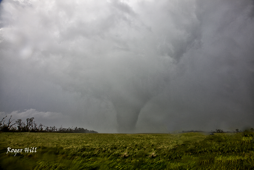
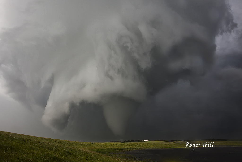
June 26th Parkbeg, Saskatchewan, Canada Strong Tornadoes
June 25th and 26th took us across the border to chase in Alberta and Saskatchewan. The trip resulted in my first ever Canadian tornado intercept. On June 25th we intercepted an HP supercell near Kindersly that had an amazing sunset under the gusted out storm. June 26th was the day to remember. An outflow boundary set up from southwest to south central Saskatchewan and become the focus for intense supercell development by late afternoon. The storm struggled at first and then spun like a top producing 2 photogenic tornadoes, with the 2nd one less than a mile from us and very strong. Amazing surface obs feeding the storm (82/77 with east winds at 20 mph) helped the base lower and ingest every bit of energy available. Check out the photos below. The first photo is from June 25th sunset. The rest are of the tornadic supercell on the 26th.
June 22nd Nebraska Briefly Tornadic Supercell
June 22nd had some great potential. A warm front lay across the NE/SD border, with a dryline extending south from it. I have to admit, my target that day was the warm front/dry line intersection near Lusk, then eastward as storms could potentially ride the warm front. Indeed, the storm of the day did just that and we missed it due to the this being the final day of the tour and our tendency to lean south towards the Cheyenne ridge, which was also a viable target. We intercepted a supercell near Sidney, NE that rode eastward and became a very nice supercell. It produced a brief, 2 minute tornado, before becoming extremely photogenic.
June 12th New Mexico Supercell
June 12th featured good upslope flow into eastern New Mexico. Dewpoints in the 50s to near 60, CAPE to 3000 j/kg, good directional and speed shear, would set the stage for supercell development across that region. A cluster of supercells developed southwest of Hobbs, but we stayed put near Santa Rosa and were rewarded with a very pretty, nearly tornadic supercell. The storm was high based to begin, and then as evening approached and dew points also rose, the base came down and was tornado warned. The night time CG barrage was quite impressive as the updraft was lit up constantly.
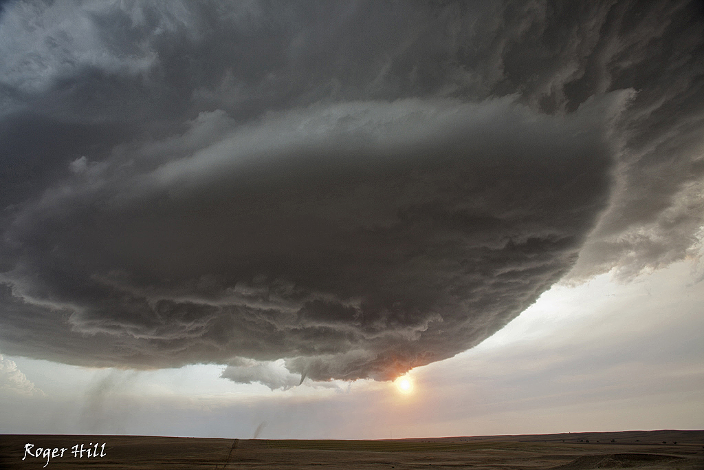
June 7th Palmer Divide Tornadic Supercell
June 7th was a tough choice. We agonized between the Platte river valley north of Chugwater or the Palmer Divide. Since we started in Denver, we chose the Palmer Divide. Of course, by mid afternoon a VERY nice tornado and supercell occurred in the northern target, which made us even more ill. Finally towers and eventual storms went up on the Palmer just southwest of Deer Trail. This storm intensified and right turned moving due south. It did produce several tornadoes, most of which were brief or rain wrapped (as seen below!). It also produced softball sized hail and intense lightning.
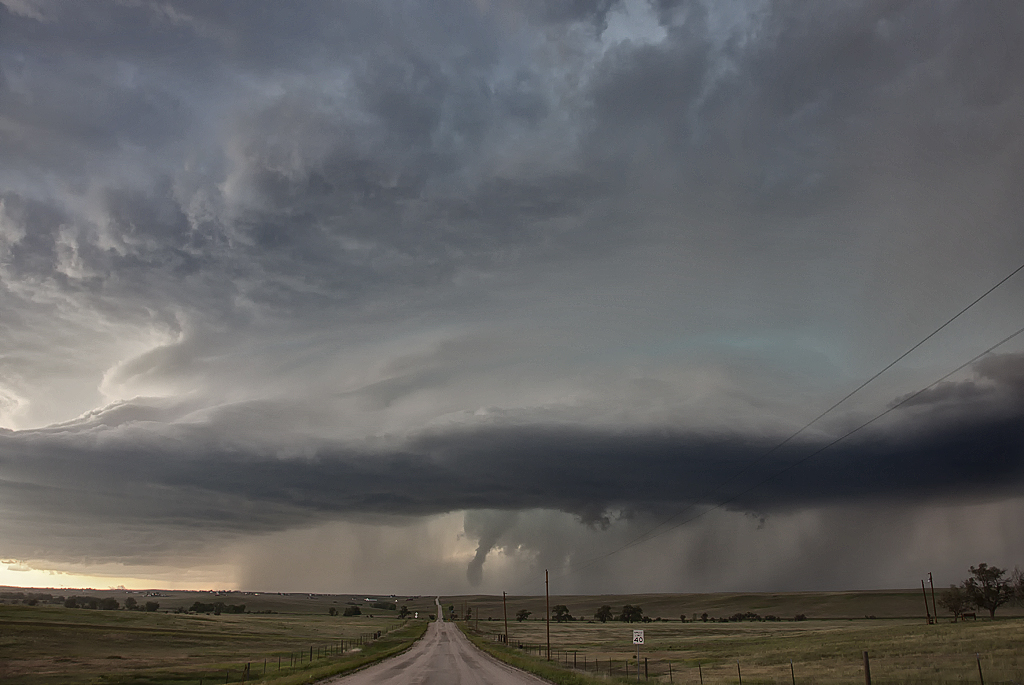
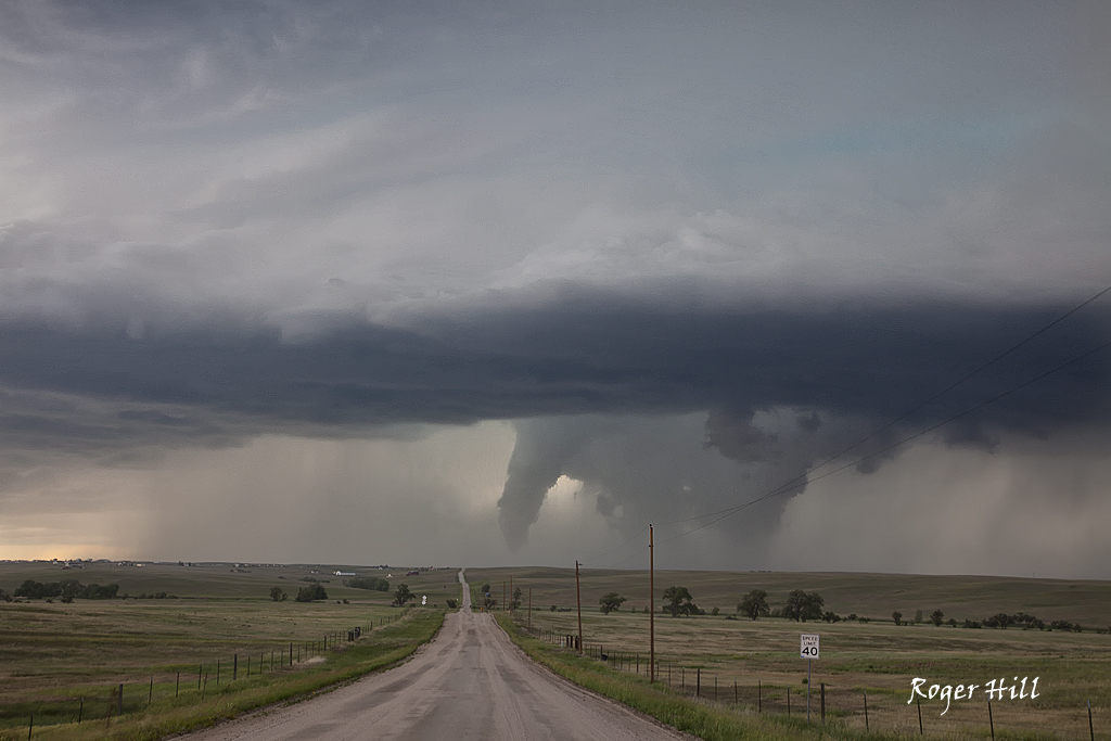
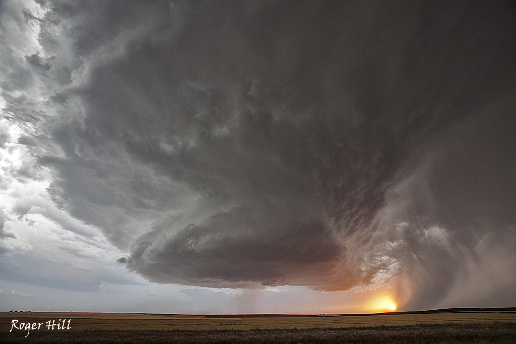
June 6th Elizabeth, CO Tornadic Supercell
June 6th was an interesting day. I didn’t feel all the ingredients were present to the extend needed for strong supercells. Moisture was a bit marginal with temp/dew point spreads near 25 degrees. By late afternoon, the Palmer Divide lit up. An intense supercell eventually formed northeast of Elizabeth. This storm was nearly anchored in the upslope flow and produced copious amounts of hail to baseball size and nearly a half foot of rain. As it back built to the southwest, just northeast of Elizabeth it produced a substantial cone/elephant trunk tornado that was on the ground for 10 minutes. Fun storm to watch and even better when the tornado stays in open terrain and does not cause much damage.