Tag Archives | April 2019

April 30th Red River Area Tornadic Supercell

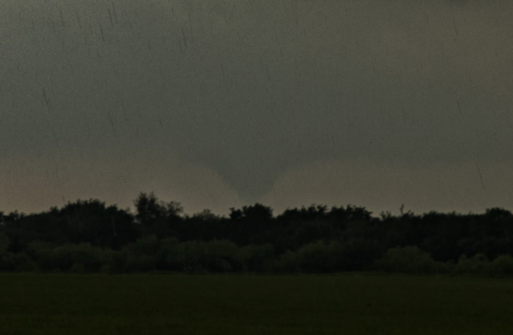
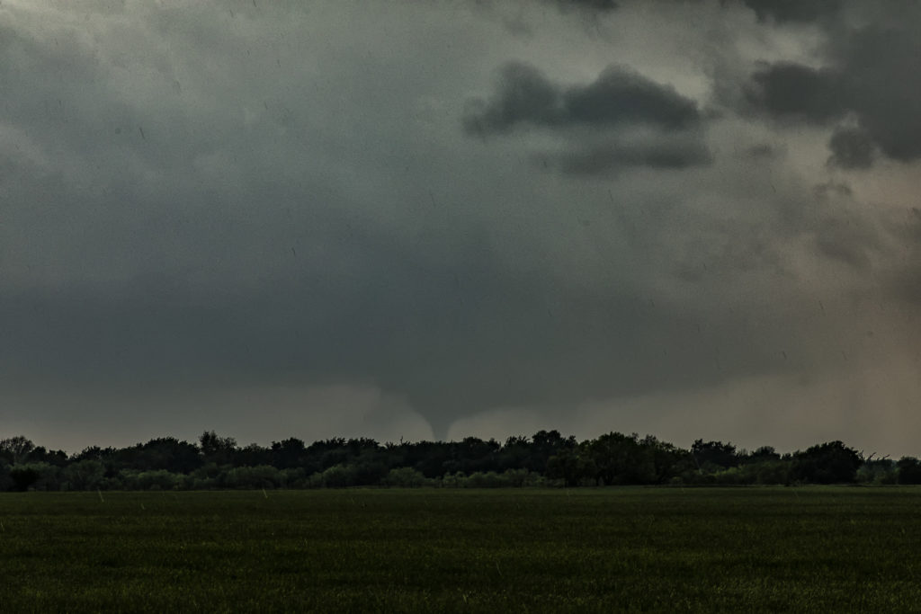
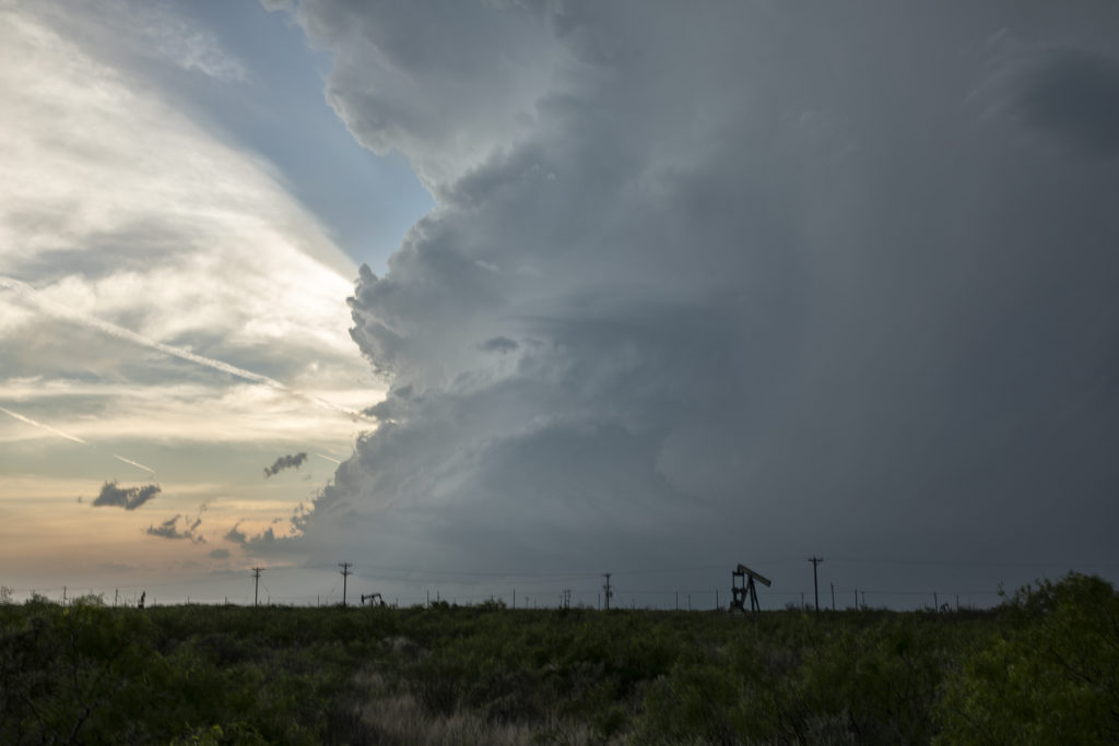
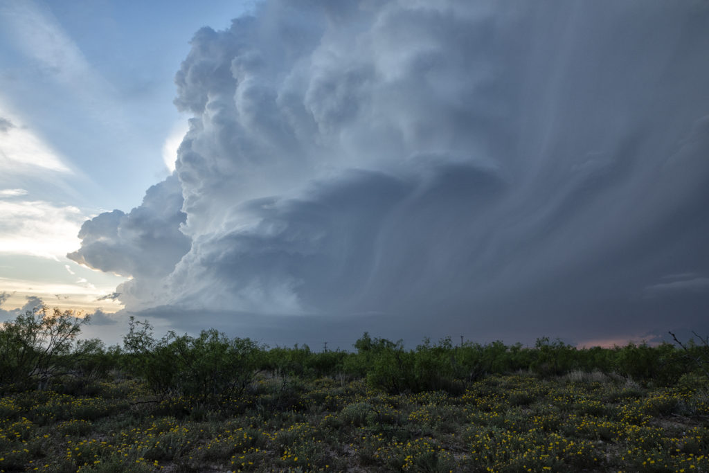
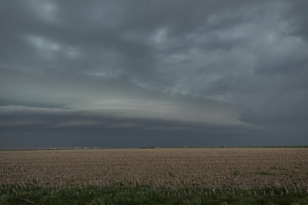
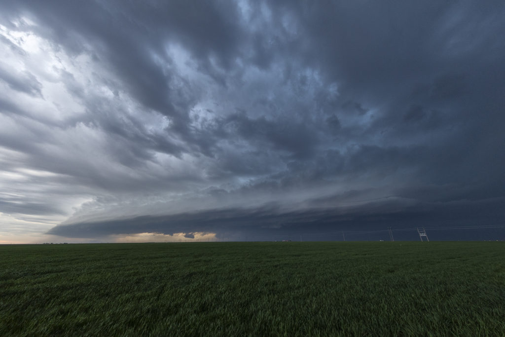
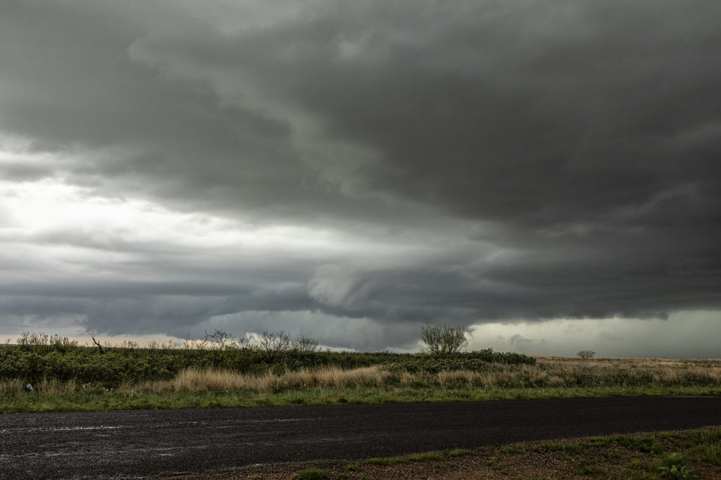
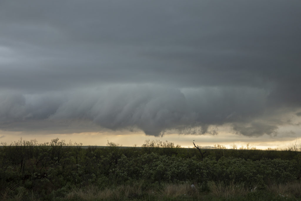
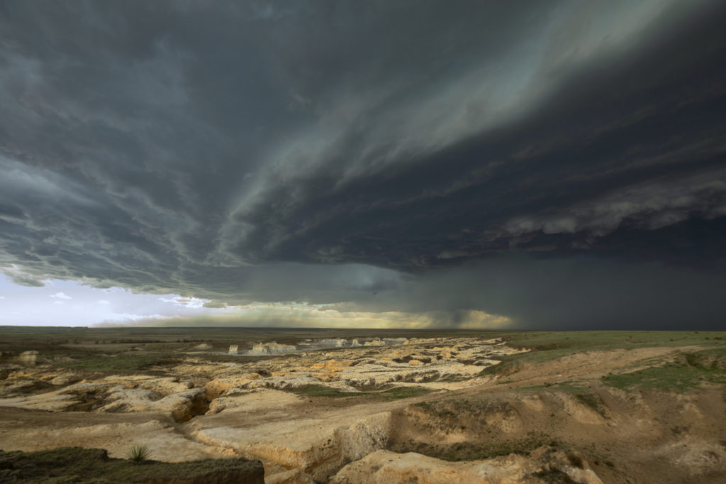
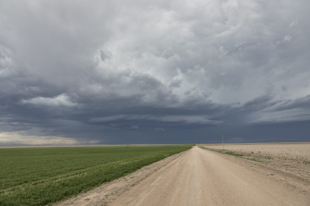
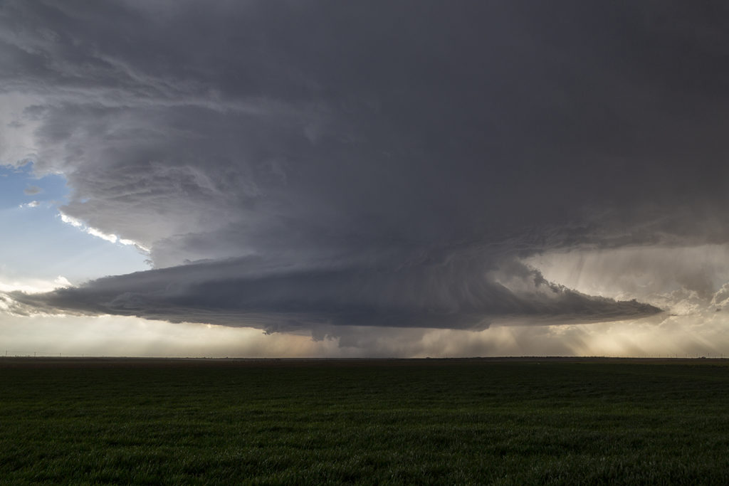
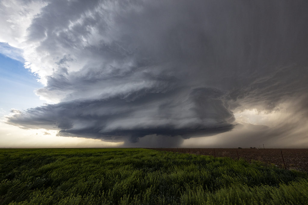
A day of big hopes was April 30th. Great moisture, high CAPE and strong deep layer shear would set the stage for supercell development. We started the day in Wichita Falls, Texas only to move across the Red River into southern Oklahoma. It appeared that storms would form along a cold front and intensify as they crossed the river into Oklahoma. We played with a cell near Randlett, OK initially, which never did much. It was severe, but never looked like a threat to produce tornadoes. Eventually a couple of cells formed in front of the cold front and rapidly became severe. One storm near Byers, Texas dropped a significant tornado just across the Red River from us. We figured since the storm was moving northeast at 35 mph that we would stay on the Oklahoma side of the river (since there are FEW crossings!) and wait for the storm and tornado to approach. To our much surprise the tornado dissipated and the supercell died as it came to us! There was NO reason for the NEW supercell to abruptly diminish! However it did, but not before we were able to get some photos of the structure and of the tornado in the distance. It was only about 8 miles away when it’s demise occurred. Fun day, frustrating day, but we all enjoyed ourselves!

April 29th Kermit, TX Supercell

April 29th was a strange day.  Models initially like the area west of Midland, only to show no storms forming later in the day. A composite outflow boundary was moving steadily south and we were afraid it would push too far south and undercut any chance of a storm sustaining itself. Eventually however, large cumulus towers formed west of Odessa and turned into a pair of very pretty LP supercells. The structure was very nice and the lightning pretty. One thing to remember when you are in the desert is to watch out for reptiles as we encountered a young rattlesnake where we stopped. It was more afraid of us than we were of it. Pretty desert flowers dotted the countryside as this storm continued for several hours. A good result on a day that didn’t look great. We NEVER give up!!!!

April 28th Central Kansas Tornado Warned Supercell

April 28th had potential. A warm front was draped across northern Kansas, while a moisture gradient/boundary was draped across southern Kansas. Both areas appeared to be primed for severe weather. Strong shear, good moisture, moderate CAPE and lift along the boundaries would result in intense severe thunderstorms along the northern boundary. The southern boundary stayed capped through the day. We went with the northern boundary and intercepted a very pretty, INSANELY electrified, tornado warned supercell not far from Sanford, Kansas. The storm had latched onto the boundary and spun hard, becoming tornado warned for hours. It also had baseball sized hail and 80 mph winds. We stayed with the storm to Ness City, Kansas and left it as it bowed out and eventually weakened. A great day and a fun and exciting chase for all the guests! Enjoy the pics!

April 22nd Seminole, Texas Tornado Warned Supercell

Triple point action would be the play this day as a moist southeast surface flow would advect decent moisture northwestward towards a surface low in southwest Texas. By late afternoon, decent CAPE, moisture, shear and lift would result in a few storms developing at the triple point south of Seminole. After an hour of pulsing, one storm intensified and right turned along the boundary, becoming a supercell and eventually becoming tornado warned. It spun had as a very low hanging wall cloud would form. It just couldn’t focus in one area very long before shearing apart and a different area started spinning. As we moved east along highway 180, it became continuously tornado warned, but just couldn’t focus enough to produce. A couple of high based funnels occurred, as well as hail golfball size. If low level flow would have been a bit stronger, it may have eventually produced a tornado. By early evening the storm weakened and dissipated as the sunset and stabilization occurred. Fun day for us all!

April 21st Western Kansas Supercell

April 21st didn’t look great on paper. However, storms erupted along a lee trough in far western Kansas and intensified as they moved eastward. A couple of embedded supercells would produce 70 mph winds and golfball sized hail. With the pretty Smoky Hill River badlands in the foreground, it sure made for a pretty scene! Bases of the supercells were quite high, as much as 8000 feet off the ground. Structure was pretty and lightning became frequent. We stayed with the storms until they weakend mid evening and then headed south for the night. I nice surprise chase for us on a day when it didn’t look very good at all!

April 3rd Southwest Oklahoma Supercell

April 3rd took us to southwest Oklahoma to film a commercial for Chevy Silverado trucks. After 2 days of intense filming in Colorado, we took the film crew to southwest Oklahoma in search of a supercell storm. It did not disappoint! Late afternoon a storm formed southwest of Wellington, Texas and moved into southwest Oklahoma near Hollis as it intensified into a formidable supercell! Fantastic structure, hail the size of tennisballs and nice lightning greeted us and the film crew. We stayed with the storm till sunset south of Snyder and then let it go. The tv crew was astonished at the sight of the supercell and came away with fantastic footage to use in the commercial. It will air late spring first on CNN and then later on other channels.