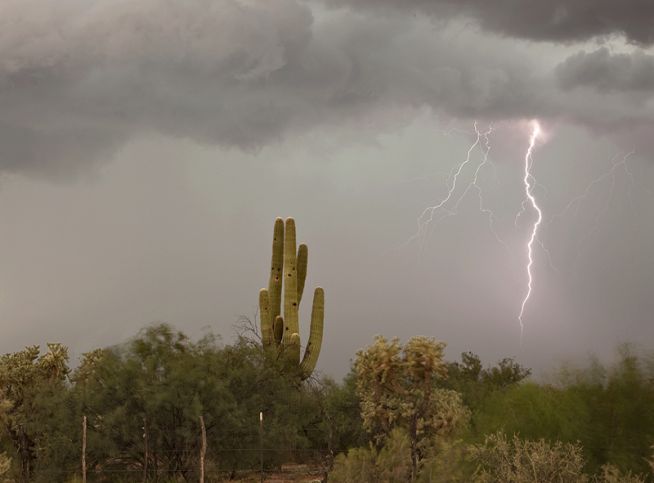
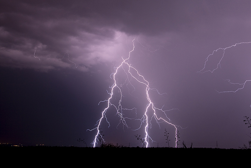
Caryn and I were fortunate to spend a few days in Arizona to film the monsoon storms. Well, I filmed, she shopped, but did film the beautiful cactus in bloom. Check out some of these photos for what the deserts have to offer in late summer. Magnificent place! A photographer’s delight! This will be a VERY LONG page, so be prepared!
The Supercells of Mid July
Mid July provided several opportunities to chase tornado warned supercells that did not produce tornadoes. The northern plains is my favorite spot to chase in summer. Modest westerly flow aloft with good low level moisture, instability and winds, set the stage for several days of photogenic supercells. The best of these are featured below. Enjoy!
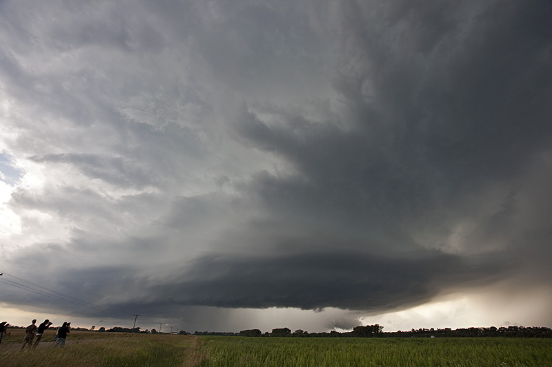
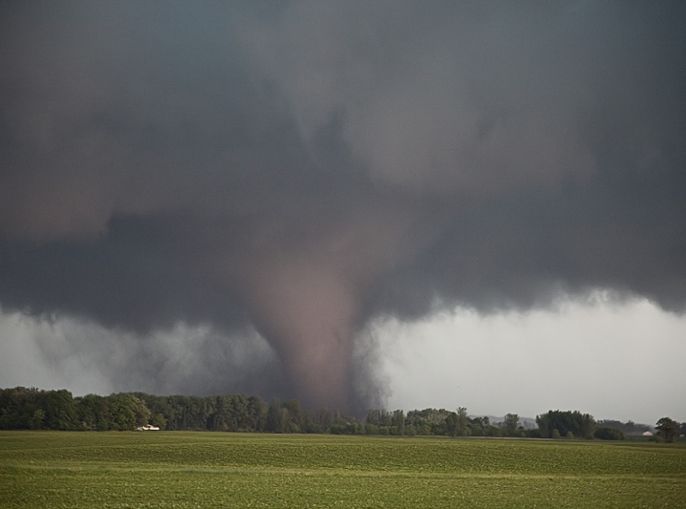
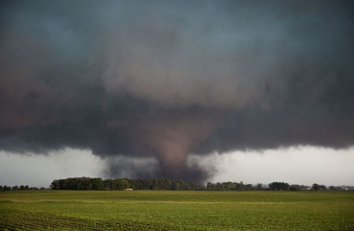
July 14, 2010 Northfield, Minnesota Tornadoes
Had high expectations this day as all parameters pointed to a significant tornado outbreak. I just had a gut feeling it would line out quickly and that you would have to be in position to intercept any discreet supercells before they lined out. That is what happened. I took the Canadian Prairie tour to Faribault, MN for lunch and watched as surface based storms broke the cap. We blasted up I-35 and approached highway 19. We quickly noticed an amazingly rapid development in the mesocyclone of this supercell and it took a matter of moments and it dropped a nice truncated cone tornado that crossed I-35 and flipped a couple vehicles as the white debris cloud moved into a field next to the interstate. This tornado skipped along the countryside for a couple miles and lifted.
Quickly, another tornado, a slender truncated elephant trunk shaped tornado touched down and rotated around the outer periphery of the mesocyclone. It stayed in contact for only a few minutes before lifting. The rotation in the mesocyclone was still quite intense. Another long snaking elephant trunk tornado touched down with full condensation to the ground and looked very nice. Unfortunately it did a bit of damage, as shown below. All this occurred not far from Northfield, MN. Then the cells lined out and the show was over on a day that was hyped to be a big tornado outbreak.
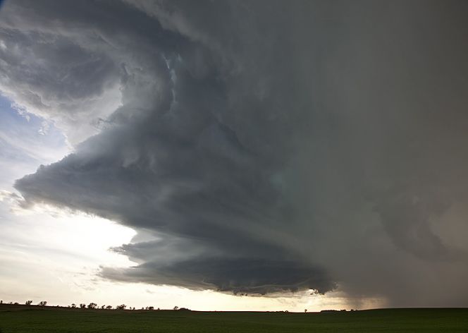
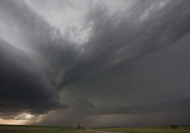
June 24, 2010 Bismark, North Dakota Tornado Warned Supercell
June 24th was a surprise day for me. Fairly poor low level shear, little forcing, no decent boundaries, and only meager moisture had me concerned about the quality of a storm today. I wasn’t even sure a storm would form. However along a confluence line, towering cu went up late afternoon, and a gorgeous supercell formed. This storm refused to quit and even after we left it, it was still severe and even briefly tornado warned. While we were chasing it up until dark it had been tornado warned twice with one very convincing funnel reaching 3/4 of the way to the ground. However, I can not confirm a touchdown. Nonetheless, it was a very pretty classic supercell most of its life cycle.
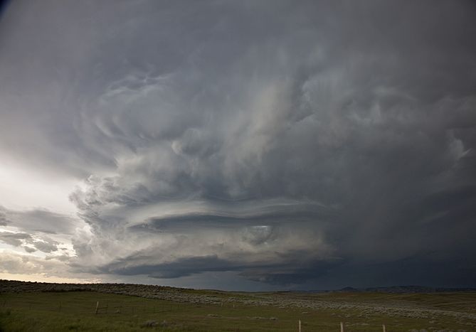
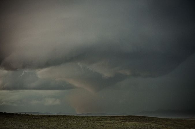
June 21, 2010 Broadus, Montana Tornadoes
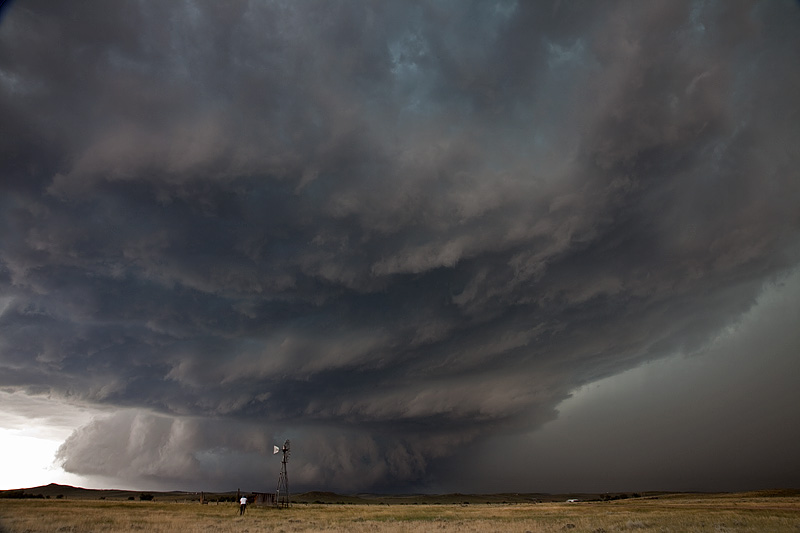
June 21st had good promise with a strong short wave trough ejecting through the northern and central high plains. Plenty of moisture, shear, and good instability would provide the fuel needed for supercell storms. A surface boundary formed on the north side of the Black Hills and extended all the way to east of Billings, Montana. Storms formed and anchored themselves along the boundary, while spinning nicely. Two supercells we encountered produced tornadoes this day. Storm structure was fantastic and the tornadoes were very nice, churning across the hills of southeast Montana causing no damage.
June 20, 2010 Chugwater, Wyoming Tornadoes
Amazing day! I wasn’t quite expecting what we got. Early afternoon storms in the Laramie Range in southeast Wyoming created an outflow boundary for one last storm to ride down. The early storms were tornado warned, but produced nothing, and finally the last cell, ingesting cool, moist surface air, spun like a top and dropped two tornadoes, as well as hail nearly 5″ in diameter! The largest tornado was on the ground for nearly 10 minutes.
June 17, 2010 Southern Minnesota Tornado Outbreak!
Another spectacular day! Witnessed 13 tornadoes in southern Minnesota from near Kiester to north of Albert Lea. There was a near mile wide wedge that was on the ground for nearly an hour! Decided to play further south for the later show and was rewarded for patience. Pretty tough sitting tight and waiting while numerous tornado reports filter in from north of you. My sympathy goes out to all those who suffered losses this day. We came across many damaged properties where authorities were already heading to the scene.
June 16, 2010 Dupree, South Dakota Tornado Outbreak
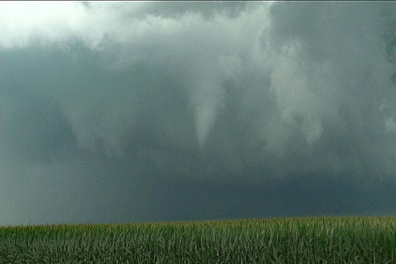
What an amazing day! We left North Platte, NE headed north to chase the warm front in South Dakota. I was certainly not expecting what occurred this day. After a quick lunch in Rapid City, we took off targeting the warm front near Faith. As we arrived a supercell formed, turned right and anchored on the warm front. This became the tornado machine of the year. We counted 16 tornadoes, with as many as 4 and possibly 5 on the ground at the same time. Three large wedge tornadoes occurred, along with about every other look and shape tornado imaginable. The town of Dupree came within a mile of being wiped off the face of the earth. Thank goodness the worst stayed just west and north of town. Here are a few images.

June 13, 2010 Oklahoma Panhandle Tornadoes
June 13th was the first day of our historic Tour 6 (31 tornadoes total on this tour!). We were a bit late to see the first tornado from this HP supercell southwest of Slapout, OK. By the time we arrived, it was cycling, with several occlusions occuring before it finally cycled and produced a fairly stout, low contrast, partially rain wrapped tornado. A second small and brief tornado occurred after the first one wrapped completely in rain. Fun day, even though we were a bit too late for the most photogenic tornado of the day.
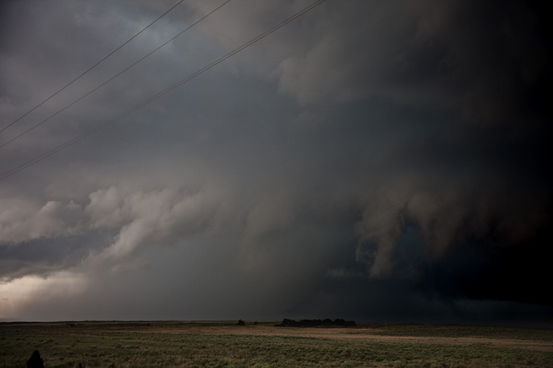
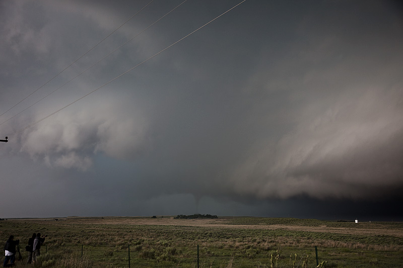
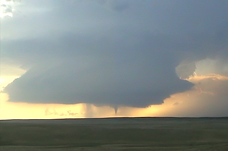
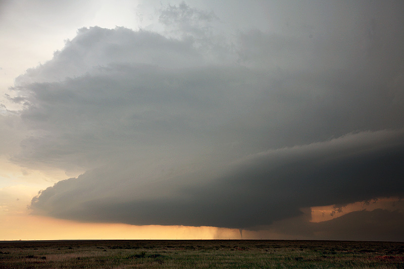
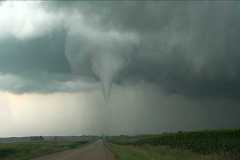
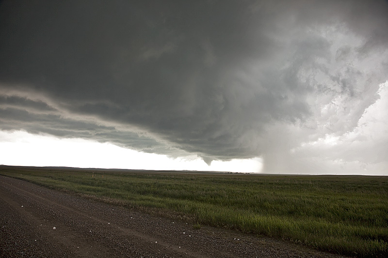
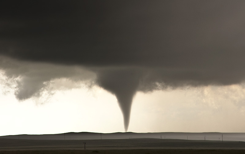
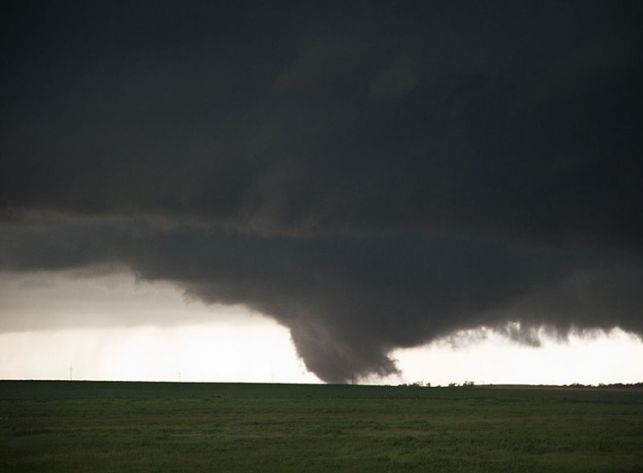
June 10, 2010 Last Chance, Colorado Tornadoes
June 10th had very good instability and moisture, and fairly decent shear. Upslope flow at the surface with moderate southwesterly flow aloft would set the stage for supercell development off the Palmer Divide and the Cheyenne Ridge in Colorado. We ended up a bit late to the Palmer Divide to chase the Last Chance storm due to a large tornado warned supercell near the Cheyenne Ridge northward, but we soon left it and made it in time to witness two tornadoes and gorgeous structure of the Last Chance supercell. Some of these images are digital stills and a few others are video grabs from Caryn’s camcorder.