July 16th featured very high dew points in the mid 70s and CAPE values over 3000 j/kg. Shear was modest, so we weren’t certain we would get supercells. An early day supercell over eastern Nebraska laid out an outflow boundary over central Nebraska from Valentine southeast towards Grand Island. Storms formed along this boundary and moved east into the cool stable air and died. Later in the afternoon a cluster of storms formed on the boundary and the tail end storm anchored. It immediately started spinning and became a formidable supercell! As the storm right turned on the boundary and moved towards Burwell, it was rotating strongly and was extremely electrified! I thought it had a decent chance to produce a tornado, but it did not. A couple of weak funnels did form. As the storm continued southeast, it became tornado warned with strong rotation continuing. Another supercell formed west of this and rotated down towards I-80 near Gibbon and also became tornado warned. The structure was incredible with one of the best shelf clouds I’ve seen in years! As the storms pushed south of I-80, they gusted out and became a wind machine. A great day with far better results than we were expecting! Enjoy the pics!
July 11th Northeast New Mexico Severe Storms
We weren’t expecting much this day. Modest moisture, CAPE and shear were present, thus we were hoping for a few pulse storms. Thunderstorms formed over the higher terrain of northeast New Mexico and collapsed. Their outflow pushed east and helped developed additional storms on the south side of the Raton Mesa. These storms congealed into a cluster of high wind producing severe storms in far eastern parts of the state and eventually moved into northwest Texas panhandle. Lightning was decent as well.
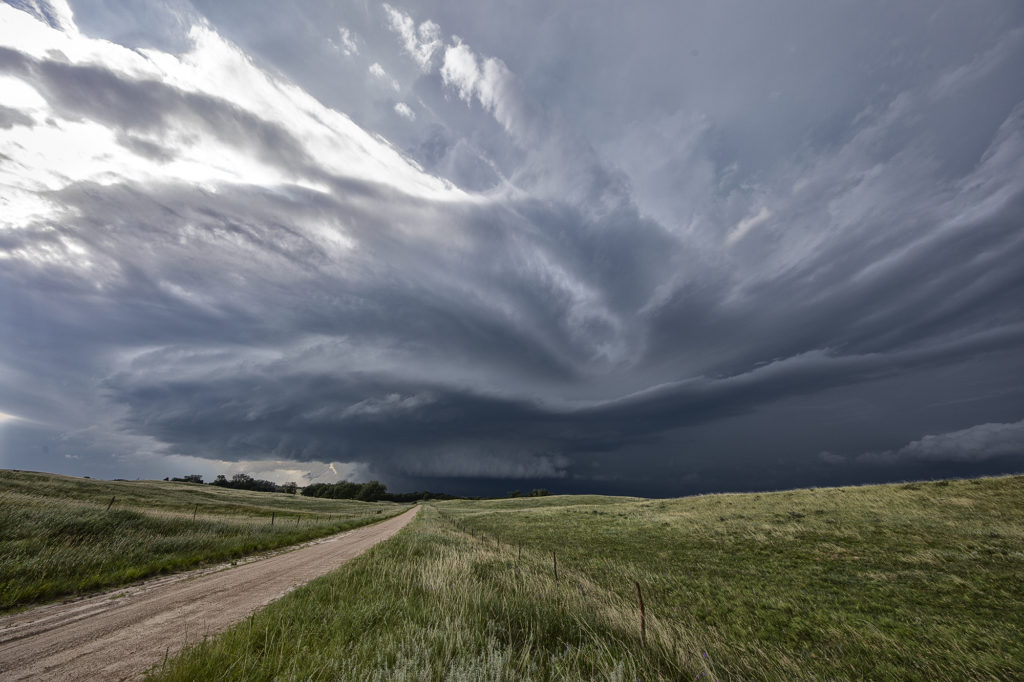
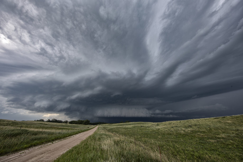
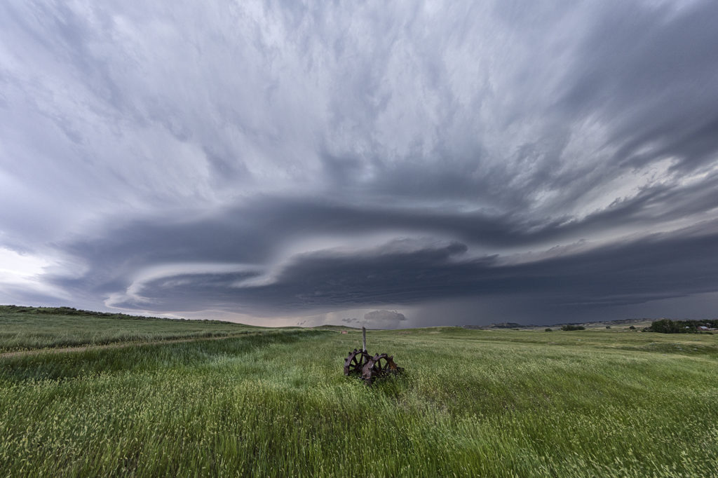
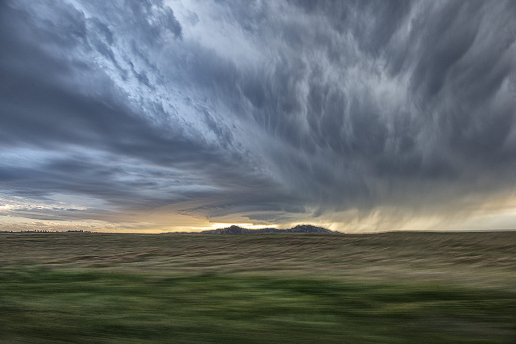
July 10th Southeast Montana Supercells
Southeast Montana was the target this day for what appeared to be a decent chance of high based supercells. Great shear was in place, but limited moisture and instability would temper the threat of significant severe weather. Nonetheless, storms formed off the Big Horn mountains and moved east and intensified. Hail the size of half dollars and winds to 70mph occurred from these supercells. Structure was typical for high based storms and one can wonder only what if there would have been better moisture and instability. It was still a fun day and we at least had severe storms.
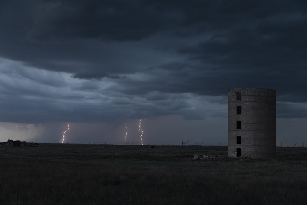
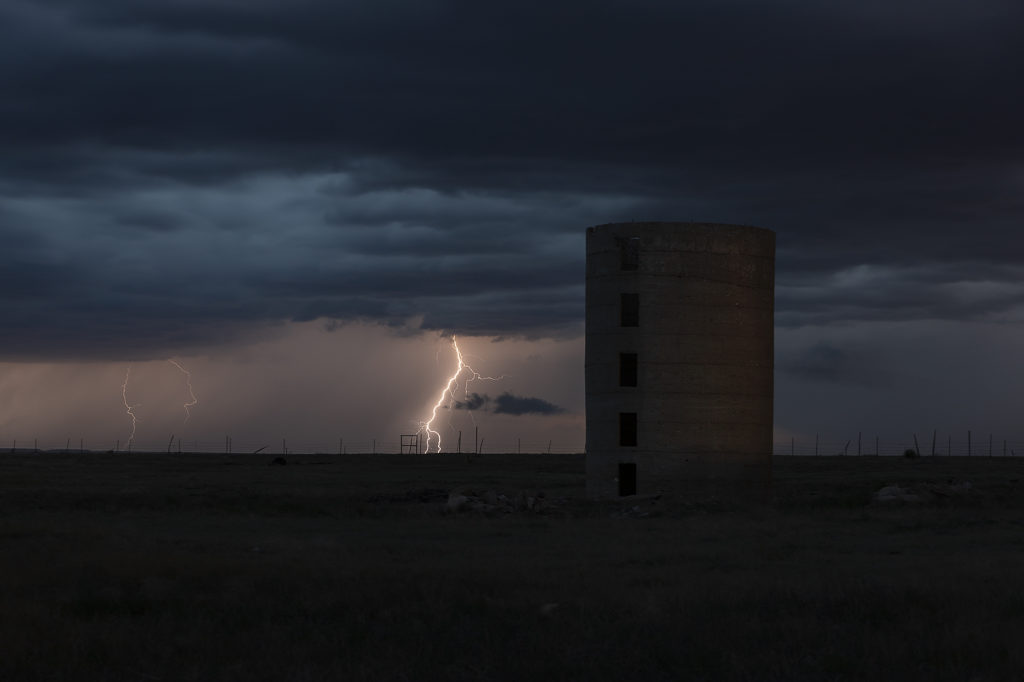
July 6th Eastern Colorado Tornado Warned Supercell
July 6th took us to eastern Colorado. Good moisture and instability, along with modest shear and upslope flow into the Palmer Divide would set the stage for supercells and multicells. One such storm formed just west of Limon and right turned southeast towards Hugo. As it did, the structure improved as severe thunderstorm warnings were issued for golfball sized hail. As it moved further east, it became better organized and was tornado warned. It didn’t produce one, but you could clearly see the rotation in the storms updraft. As it moved furth east towards Eads, it encountered drier are and eventually weakened. Pretty storm, and the eastern plains of Colorado certainly needed all the moisture it can get! Enjoy the photos!
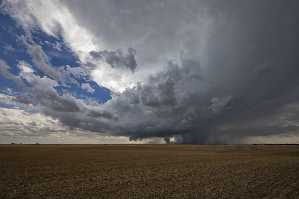
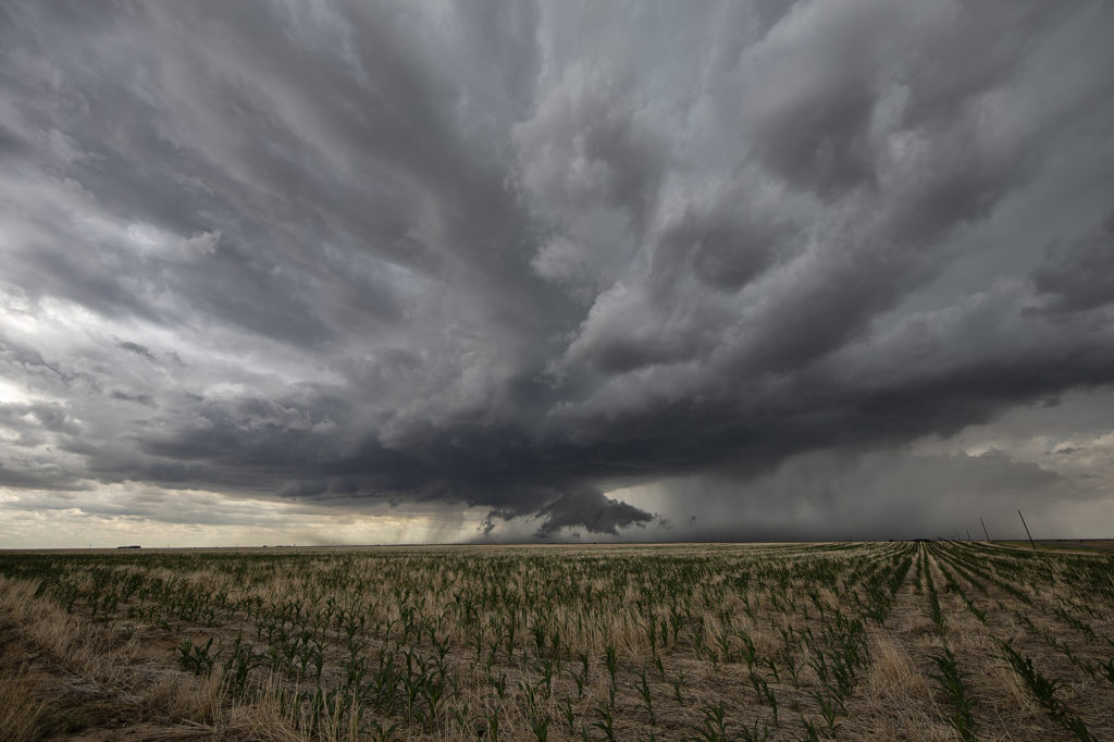
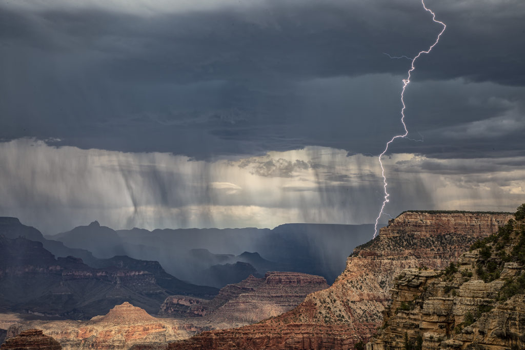
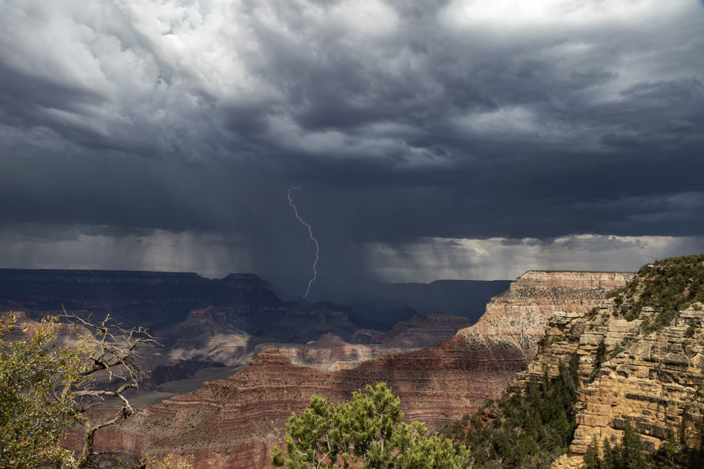
Photo Tour #3 Thunderstorm Images June 26th through July 1st
Due to a very poor weather pattern across the plains of the US, we took our Photo Tour #3 group to Arizona to photograph the monsoon thunderstorms. We had some AMAZING success in northern Arizona, capturing severe storms near Winslow and the Grand Canyon. On the final day of the tour, July 1st, we ended up in southeast Colorado on a supercell that came out of the Sangre de Cristo moutains near Aguilar, Colorado and produced golfball sized hail and high winds. A testament to the fact that Silver Lining Tours will get you ANYWHERE there are severe storms and photogenic storms! Enjoy the pics!