Tag Archives | 2019

July 15th Northeast Wyoming Potentially Tornadic Supercell

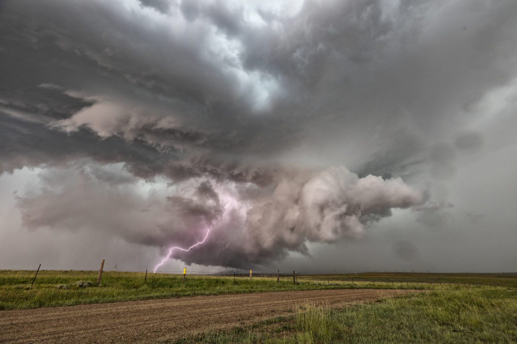
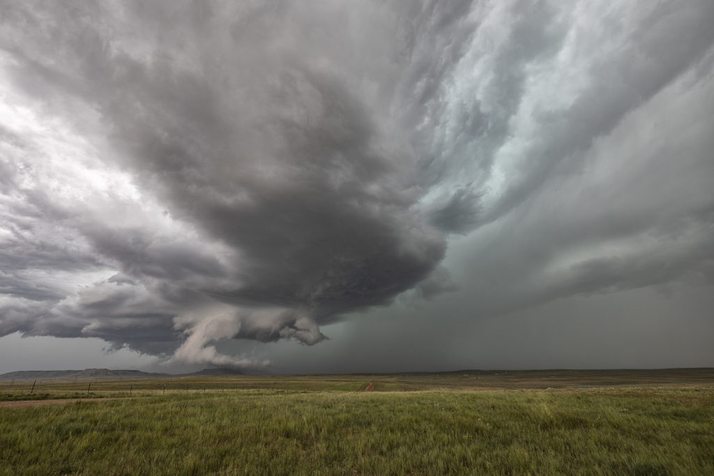
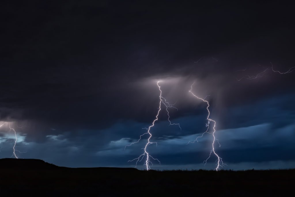
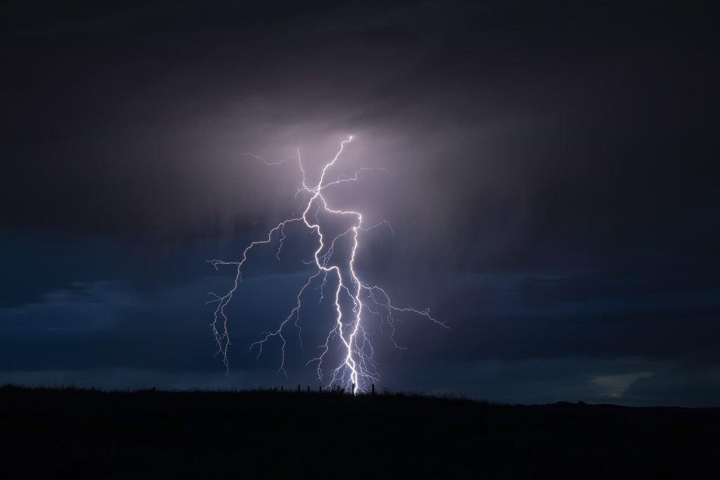
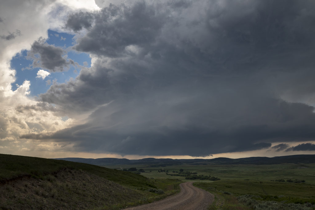
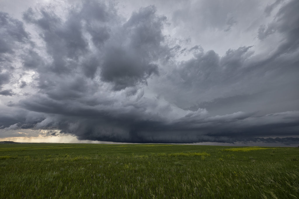
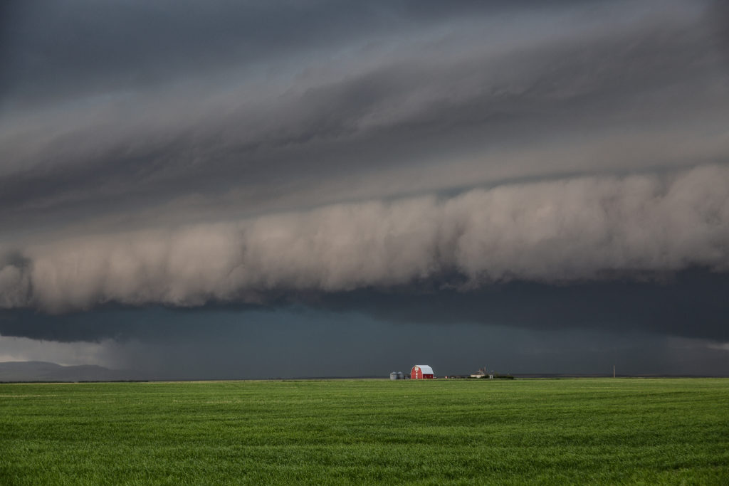
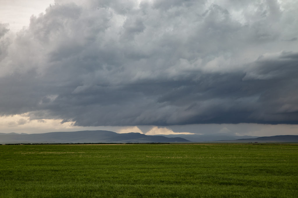
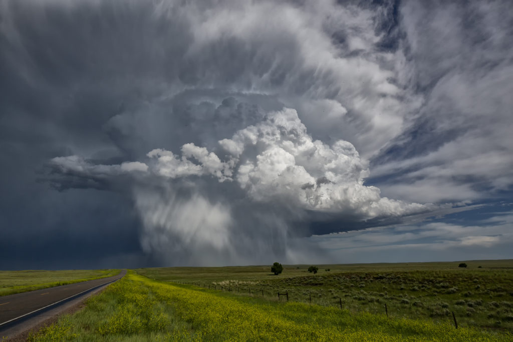
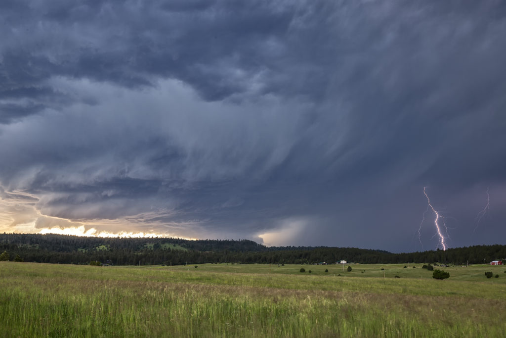
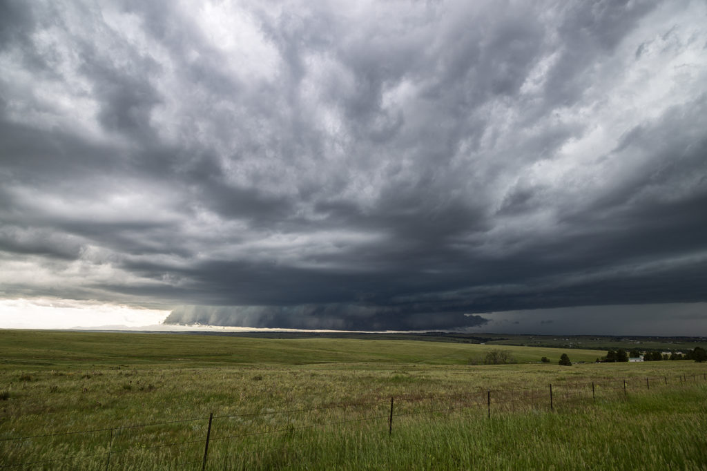
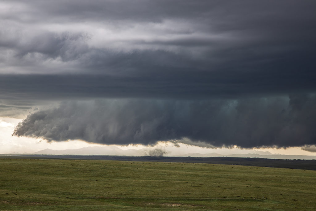
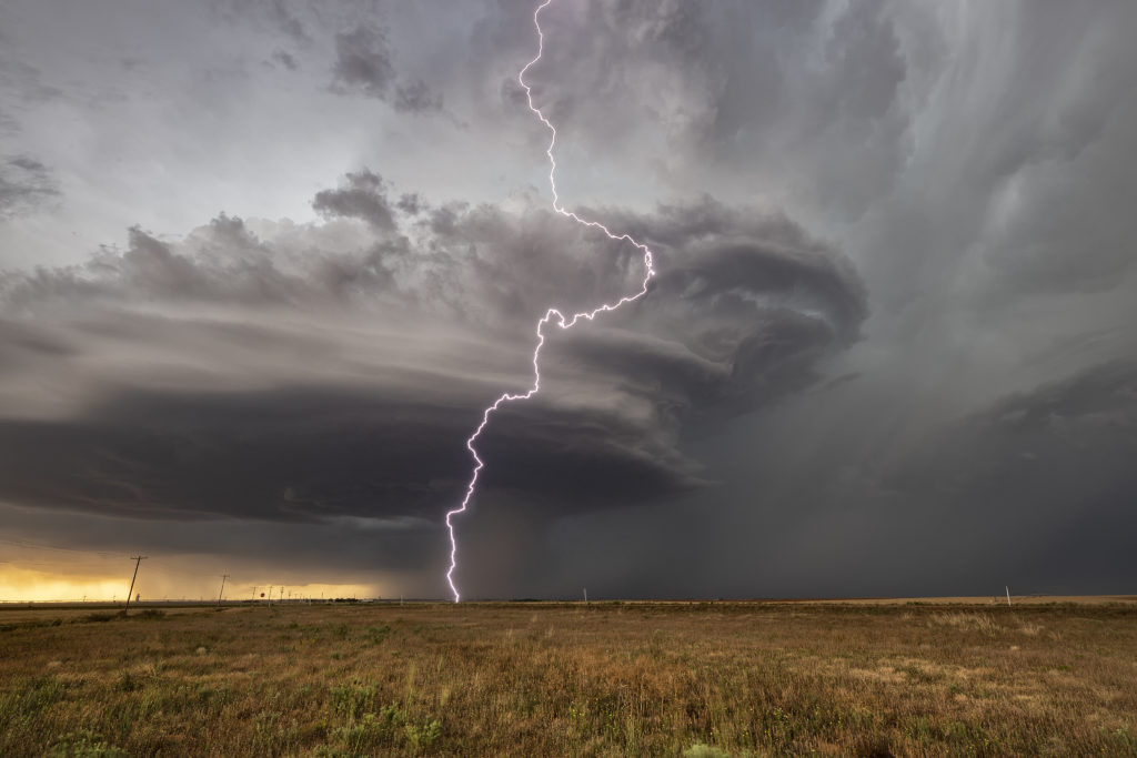
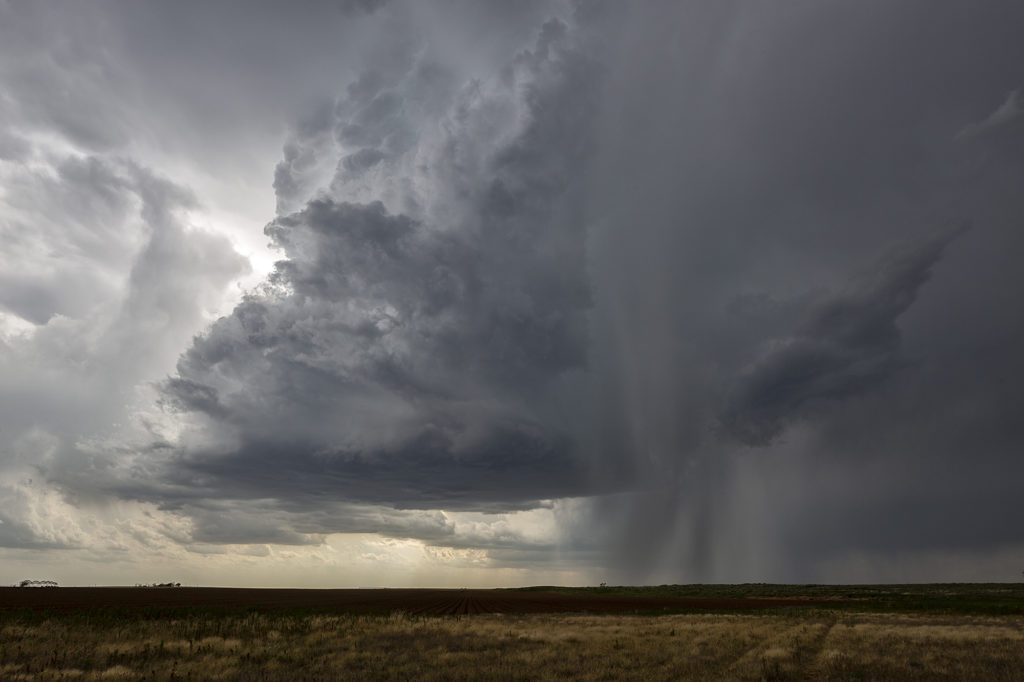
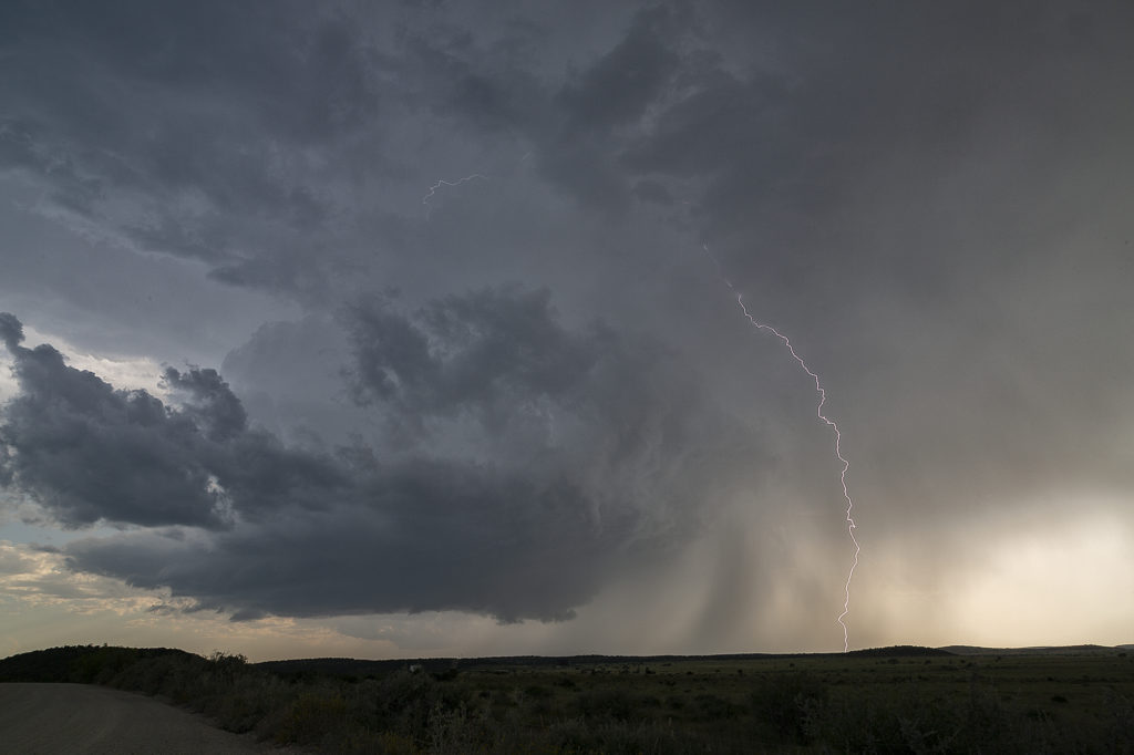
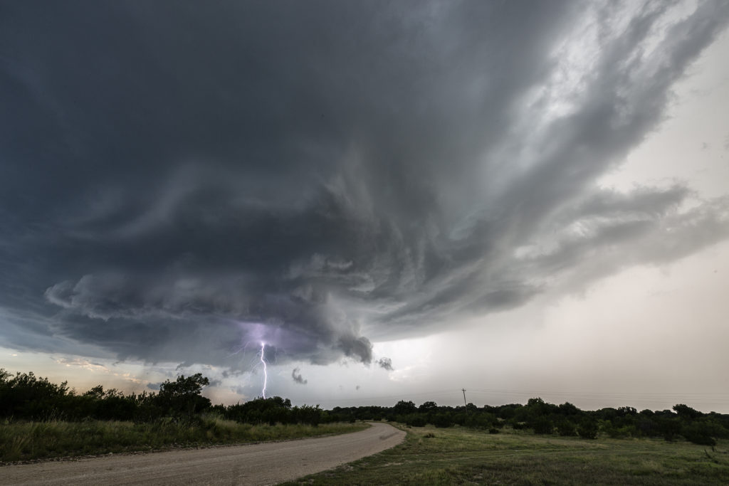
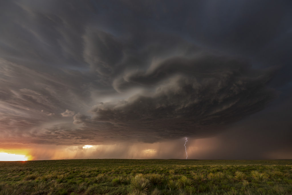
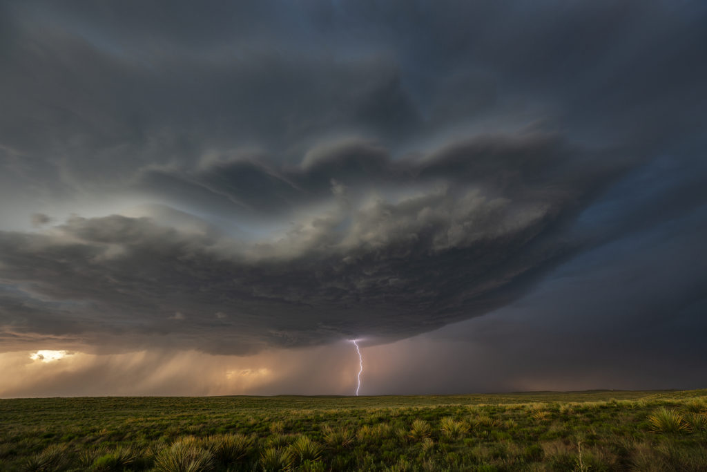
July 15th had the right stuff. Good moisture, instability and lift were available, however shear was a touch weak. Storms formed over the southern end of the Big Horn mountains in Wyoming and tracked east/southeast becoming severe. One particular cell near the Pumpkin Buttes area southwest of Gillette, quickly intensified and became a strong supercell thunderstorm. Strong low level shear along a boundary caused it to spin viciously. A couple of funnels formed, but we could never confirm anything on the ground. However by the appearance and the damage we saw afterwards, it would not be a surprise if there was a tornado. The storm was quite electrified and intense. As it moved off the buttes towards Wright, it steadily weakened and dissipated east of that area.

July 11th Black Hills of South Dakota Severe Storm

We weren’t expecting much on July 11th. Nature decided to give us a pretty storm southwest of Spearfish, SD late day. The cell was very photogenic, and throw in the fields of sweet clover and you had a winner! The cell traveled for a few hours across northeast Wyoming into western South Dakota, where it dissipated over the Black Hills. Very pretty to watch and photograph! Enjoy the pics!

July 7th Broadus, MT Lightning

July 7th was the first day of tour 9. We headed north from Denver to arrive in southeast Montana. Decent shear, moisture and instability provided the needed ingredients to get severe storms going this day. By evening clusters of storms formed and as the sun went down they were beautifully electrified! We were headed just north of Broadus when a new updraft developed and started sparking quickly. We stopped on the side of a road and watched as the storm had tons of cgs in  it. As the storm weakened we headed north to our hotel. Enjoy the pics!

July 4th Chugwater, Wyoming Tornado

What a way to spend the 4th of July! We decided mid morning that it looked too tempting not to chase this day. Upslope flow into the Laramie Range in southeast Wyoming was the hot spot. Good shear,  instability and moisture would help form an intense supercell mid afternoon. This storm crossed the Laramie Range and intensified as it moved east off the higher terrain. We were just west, then southwest of town as the storm spun hard. A funnel formed and nearly touched down as it crossed the mountains. Once close to town a very low and strongly rotating wall cloud formed. Soon a nice cone shaped tornado touched down and stay on the ground for nearly 25 minutes! It crossed I-25 south of town and as the cell moved east it encountered more stable air and weakened.

This supercell had fantastic structure, intense cloud to ground lightning and baseball sized hail.  The tornado caused no damage thankfully and was a treat to watch and photograph. In hindsight I wish we would have stayed south of it instead to trying to stay in front of the storm. The views from the south were stunning! A fun way for us to spend the 4th of July. Once we got back home after dark, we had our own private fireworks from a large pack we bough last year in Missouri. Enjoy the pics!

June 27th Judith Basin, Montana Tornadic Supercell

We had high hopes for June 27th in central Montana. Great shear, instability and decent moisture would provide the needed ingredients for storms this day. Lift in the mountain areas would give us the final missing link for storm formation. Mid afternoon storms developed southwest of Eddie’s Corner where we had made our base. As the cells came over the mountains, they intensified and became supercells. One storm southwest of Utica, MT spun wildly and was very pretty. It didn’t take long for a cone tornado to form. It stayed in the higher terrain where there was no road network, so we had to position ourselves to get the best distant view of it. As the cell approached us, it was nicely structured.

We decided to drop south to the tail end storm, which was also tornado warned. A pretty sculpted supercell was quite photogenic! Outflow from northern storms gushed south, undercutting the supercell and killed it. Further south near Judith Gap, another storm form and became my favorite cell of the day! Gorgeous structure, strong rotation and intense lightning occurred. As it moved east, we decided to take the dirt roads eastward toward Roundup. The storm became a jaw dropper and drifted east over the yellow sweet clover fields and made for an amazing sight! It became tornado warned one last time just north of Roundup where we waved goodbye and headed to our hotel for the night. An awesome day and the guests on Photo Tour #3 got their money’s worth from this event! Enjoy the pics!!!!!

June 25th Devil’s Tower, Wyoming Tornadic Supercell

June 25th had a lot going for it. Strong shear, good moisture and increasing instability were present, as well as a nice boundary along the Black Hills Convergence Zone (BHCZ).  Initially storms formed in the drier, well mixed air off the Big Horn mountains in north central Wyoming. These cells moved east with one storm in particular taking over and becoming a pretty high based supercell. We stayed on the back side of it east of Wright and watched it race off into the southern Black Hills.

I had a hunch that more storms would form along the boundary, and due to good moisture, these cells would not be so high based. A few storms formed south of Broadus, Montana and moved southeast along the boundary. The tail end cell, as usual, took over and became a very formidable supercell. As this storm approached the area just north of Hulett, twin EF1 tornadoes formed (Per NWS damage survey). We could briefly get a visual of one of them.  Structure was superb, and the lightning was very intense. As the storm approached us, we had to blast south to Hulett to get out of it’s way. It raced eastward and we had no way of staying up with it. Other storms also formed and became quite electrified. We stayed with this cluster through dusk when they weakened. Two pretty, but very different supercells from each other and two tornadoes. Indeed, a great chase day to kick off the SLT Photo Tour #3! Enjoy the pics!

June 21st Palmer Divide Briefly Tornadic Supercell

We weren’t expecting anything significant on June 21st. However, as often happens in the upslope regions of Colorado combined with terrain features, a decent supercell formed north of Colorado Springs along the Palmer Divide. Good directional shear due in part to strong easterly winds helped the storm to organize and rotate. As the cell approached the town of Kiowa, the low levels started spinning strongly. You can see a hook forming visually and rotate pretty rapidly. A tornado warning was issued by the NWS and soon an area of rotating debris was seen under the hook area of the storm. This weak tornado only lasted a couple of minutes.

As the cell moved further east, it encountered less surface moisture and instability, which caused it to steadily weaken and eventually dissipate east of Limon. Several other storms initiated in the cold side of the first cell’s outflow and never could really intensify for long periods. A fun chase and right in our backyard.

June 17th West Texas Tornado Warned Supercell

Sometimes, you just don’t care if a storm produces a tornado. It can be that pretty. Dryline supercell thunderstorms can be quite pretty, although they are often higher based. This day would give us just that. We had a high based supercell that formed along the Texas/New Mexico border and drifted slowly southeast towards Muleshoe, Texas. It spun like crazy. There was plenty of shear and instability this day and with the active dryline closeby we were hoping for a pretty storm. Active for several hours, this supercell produced incredible lightning, some of the best of 2019 to date and had nice structure.

Other storms would form later in the day and especially during the early evening as the cap was breached. Many of these storms were very electrified and intense, often being warned for large hail and damaging winds. A couple storms would become tornado warned, however no tornadoes occurred this day in our area. All in all, a fun day with a great storm and superb lightning!

June 16th Mertzon, Texas Tornado Warned Supercell

June 16th featured strong instability, good moisture and moderate deep layer shear. An old outflow boundary across the I-20 area west of Abilene would be the focal point for severe and tornado warned storms this day. We started the day in Denver and left very early to reach our target by initiation time. We made it with little time to spare! Storms rapidly developed and intensified along the southward sagging boundary. We headed south from Sterling City and got in front of a beautifully structured and tornado warned supercell! This storm was quite pretty, had a rotating wall cloud and incredible lightning. It spun southward for hours giving us a treat to watch.

Eventually near dark, the storm weakened, but not before giving us one last great lightning show! Over an 800 mile day, but worth it! Just goes to show we’ll go anywhere we need to so we can get our guests the best storms around!

June 13th Nara Vista, New Mexico Tornado Warned Supercell

The set up for June 13th wasn’t great. Very limited moisture would result in fairly low CAPE values, however deep layer shear was strong. In the end, a cluster of storms would form over eastern New Mexico and slowly track east and south. The tail end cell became tornado warned for nearly 2 hours and was very strong, also producing hail golfball sized. We started the day near Clayton, and eventually dropped south to get on the tail end supercell. The structure was decent, but the main story of this storm was the lightning and amazing colors! Just before sunset, the storm spun hard and became incredibly electrified. As sun set, the storm weakened and gusted out as it moved southeast of Nara Vista. A fun day and on the photography side of things, it was quite spectacular! Enjoy the photos!