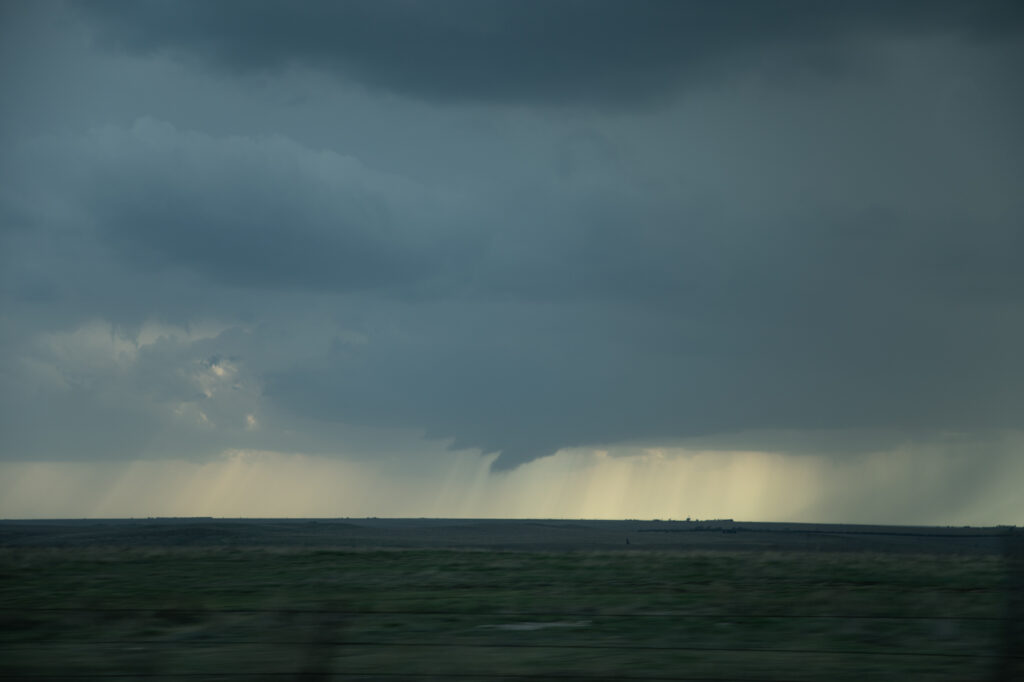
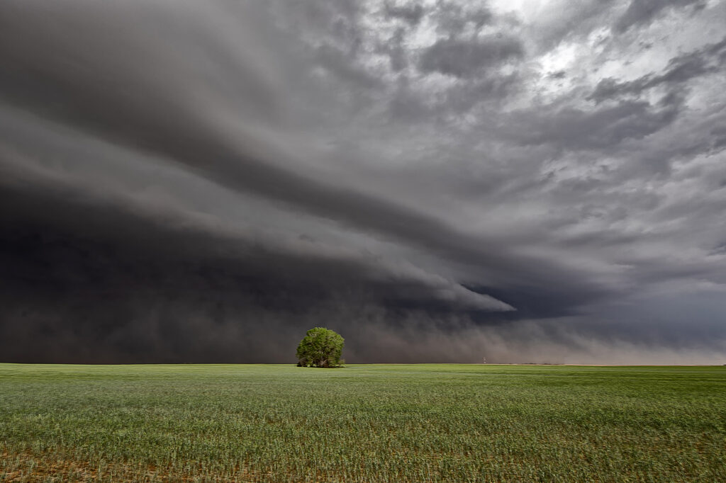
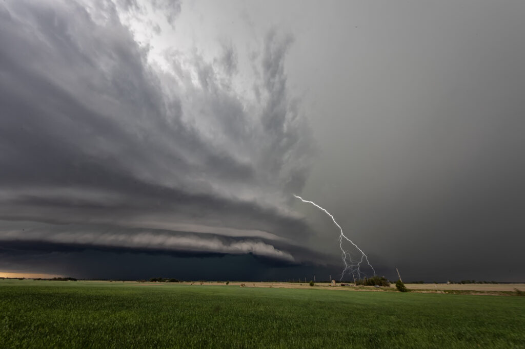
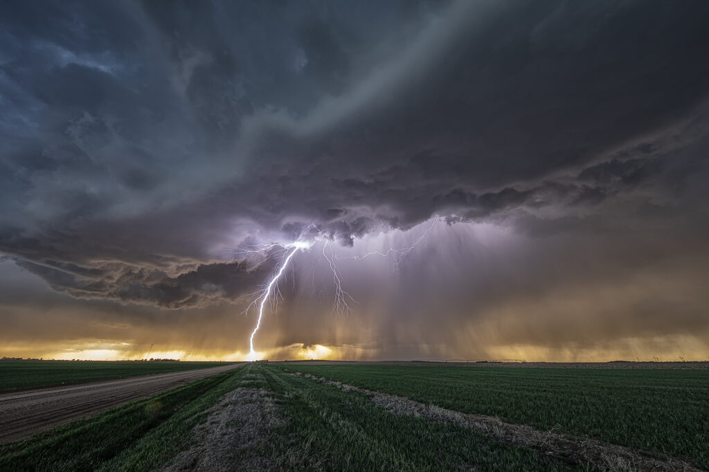
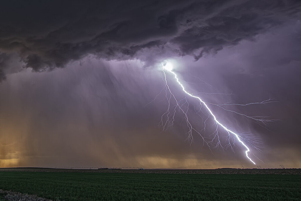
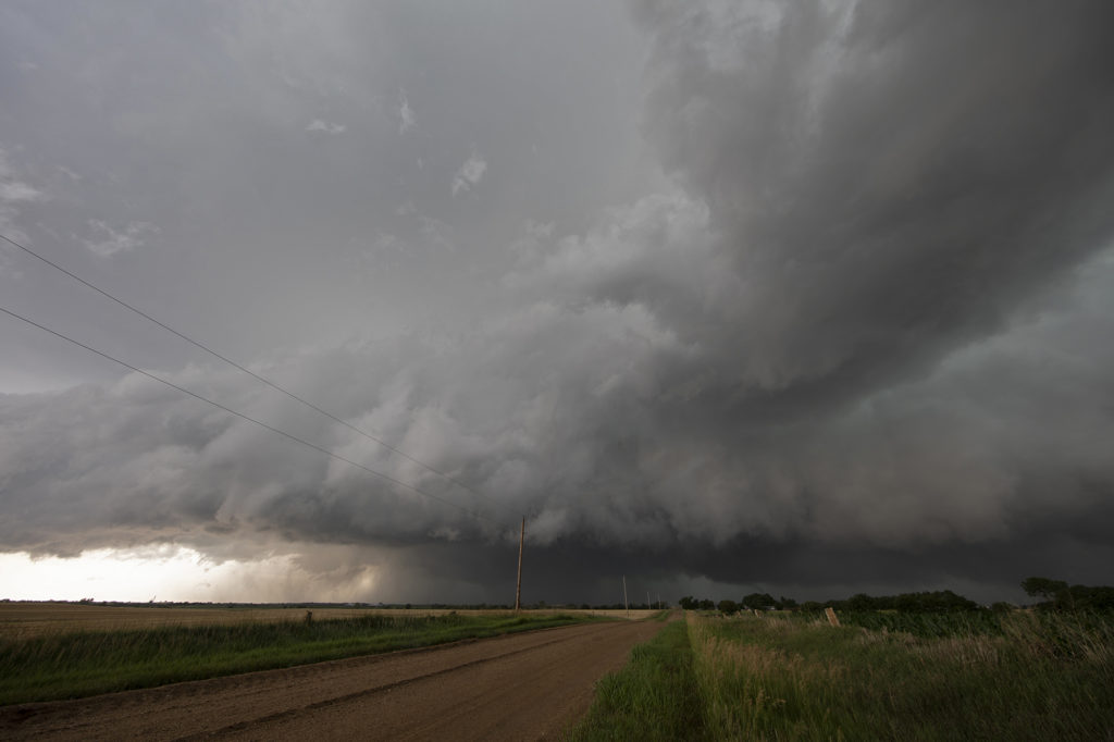
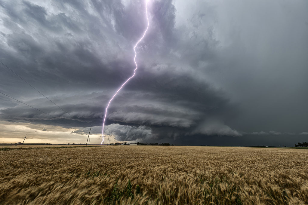
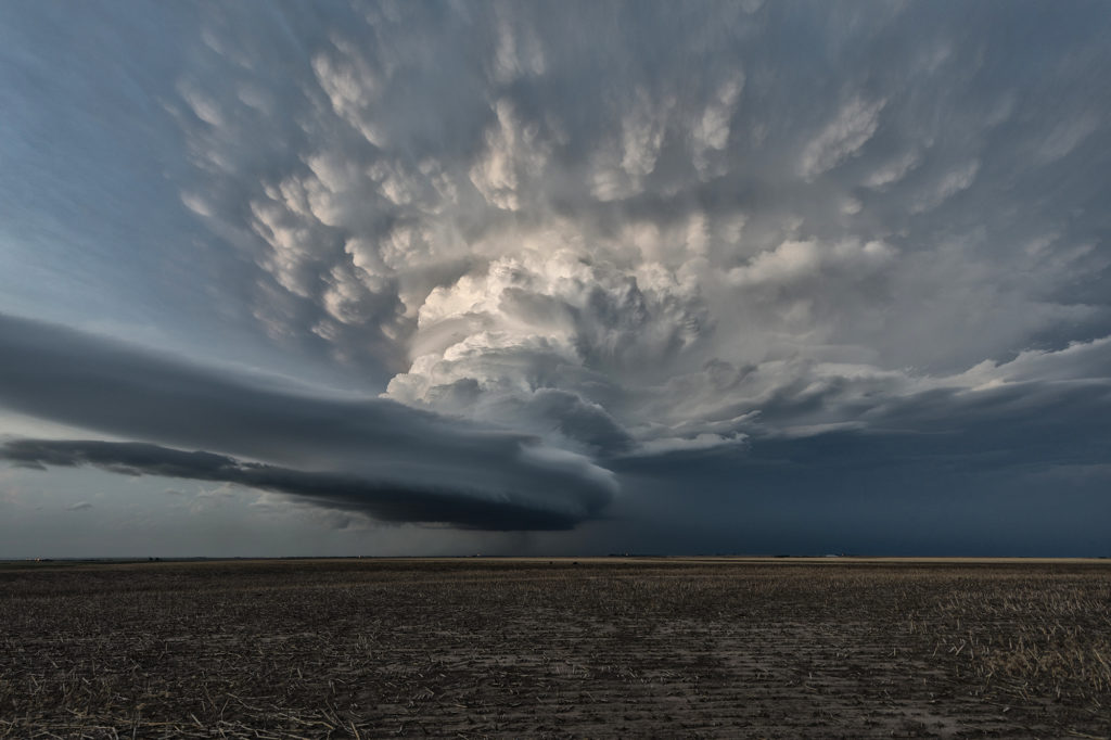
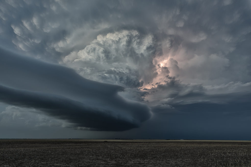
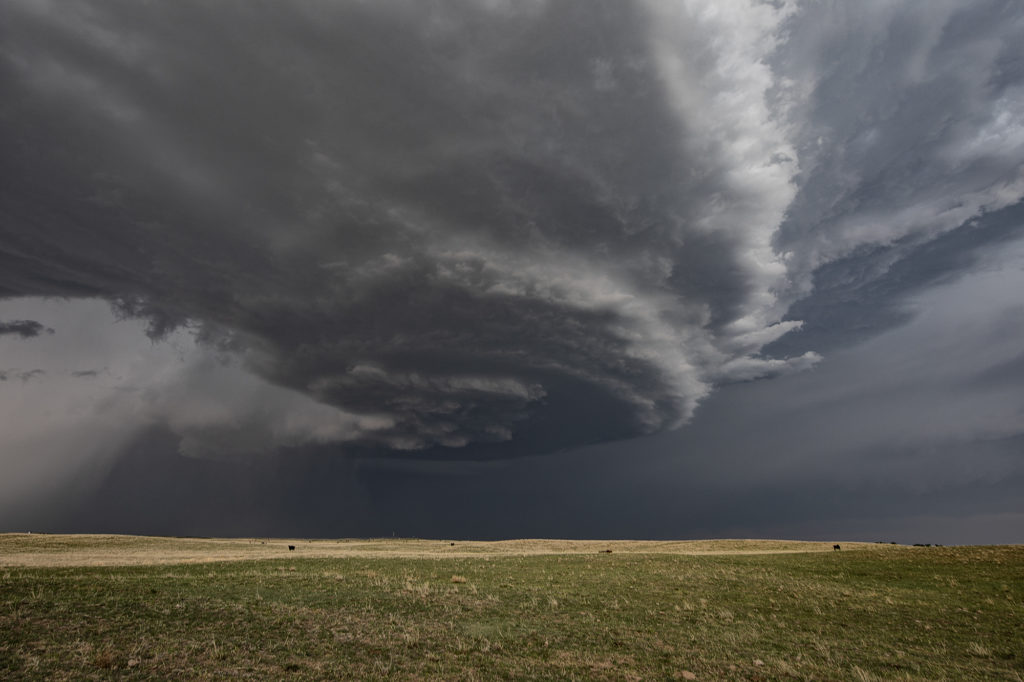
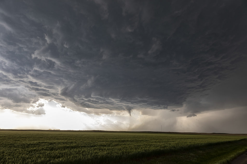
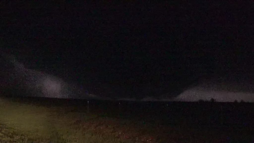
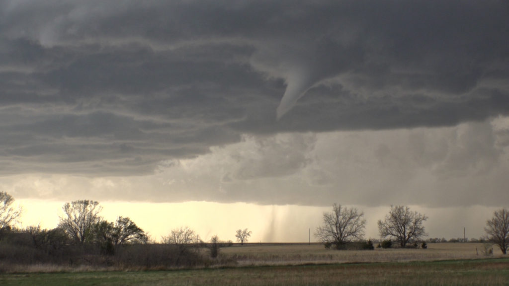
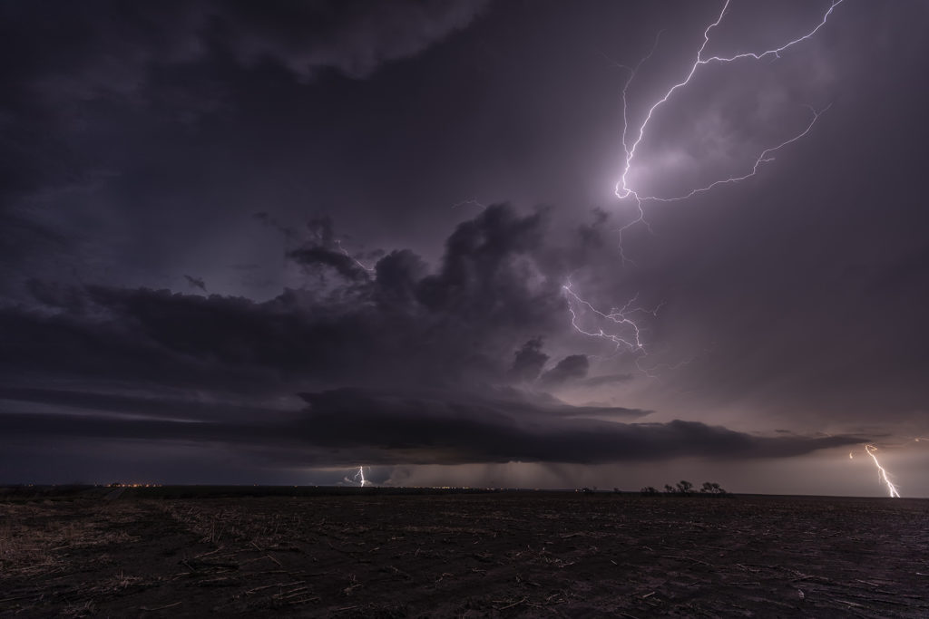
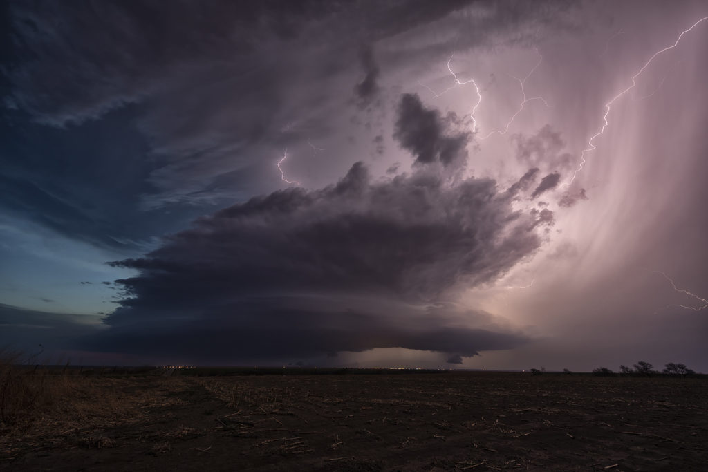
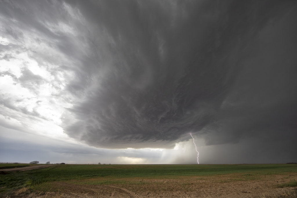
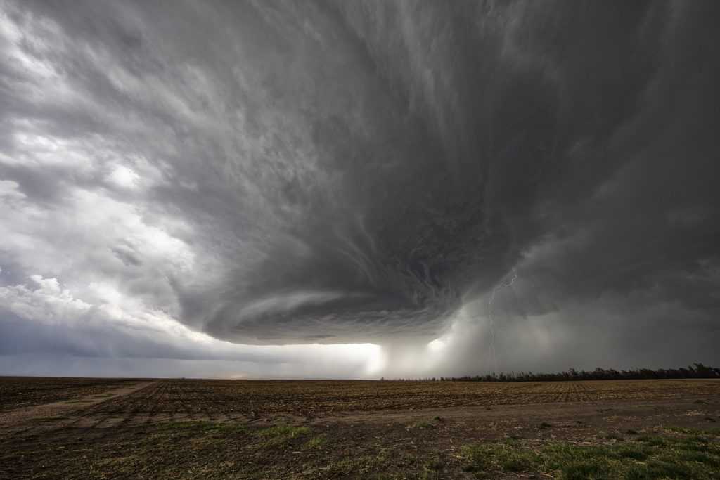
Tag Archives | Kansas

May 9th Central Kansas Supercells

Surging outflow would be the big deal this day. Storms would form on the cold side of a boundary and have very little tornado threat. However their structure was quite pretty. Elevated supercells would produce hail up to softball size and torrential rain. We chased one storm from near Larned, Kansas east towards Hutchinson. A couple other elevated supercells also formed just to the southwest and became hailers as well. With the elevated nature of the storms, the tornado potential was near zero. Hopefully the huge hail didn’t cause too much damage to the farmlands and ranchers in the area!

April 14th Medicine Lodge, Kansas Severe Thunderstorm

April 14th had plenty of shear, decent instability and a dryline in place. However, moisture was lacking, but enough of present to fire severe storms along the dryline late afternoon into the evening. I took the group the furthest south we could to get closer to better moisture, but still have enough forcing to help maintain storms as they moved off the dryline. Several storms formed and most went severe warned. However the tail end storm, as is often the case, became the strongest. Near sunset it started producing numerous lightning strikes, some starting fires. The structure was pretty good with the shear in place and it gave us a nice show as it rolled east towards Wichita. A fun day, we got about what we thought we would and had some very pretty scenes in the gypsum hills south of Pratt. Enjoy the pics!

June 23rd Central Kansas Cyclic Tornadic Supercell

The ingredients for severe storms on June 23rd were there. We only needed a focusing mechanism to get a storm to form on and ride along the boundary. It certainly did! An outflow boundary from previous night’s thunderstorms lay across the I-70 corridor in central Kansas. Storms formed along it and continuously crossed northward into the colder, more stable air. As they did, they weakened and moved off to the northeast. Finally, a storm formed along the boundary at the intersection of the dryline and anchored along it. It started spinning wildly as we sat just a mile east of the updraft and watched low stratocumulus race westward into the updraft twisting and turning along the way. At that point it was just a matter of time before a tornado would form. During the next 3 hours at least 6 tornadoes occurred, although most were brief, dissipating within a couple minutes. We first had a slender slanted tornado that touched down near Wilson Lake. It didn’t last more than a minute. Next another tornado, a slender elephant trunk touched down just west of Dorrance. Little did we know, but another larger tornado was not visible from our position, so we moved east to get in front of the supercell updraft. The structure was insane! While we drove that 3 miles east, the larger tornado came out of the rain and near the interstate. One of our long time guests, Cathy Murphy snapped a shot of it out the rear window. (Thanks Cathy for letting us use your image!) We continued to move east as the storm also moved east, spinning like crazy the whole time. Another white tornado from our view formed near a cluster of wind turbines and was confirmed a brief touchdown. Eventually we ended up just west of Salina as the final tornado formed and also briefly touched down just before the storm died. A heck of a day! Great structure and a few tornadoes to boot! Enjoy the pics! A Youtube video will be releases shortly from this day! Check out our channel!

June 9th Southwest Nebraska Gorgeous Supercell!

June 9th had one target for us, southwest Nebraska. An existing boundary would be the focal point for storm development that afternoon. Numerous storms formed, several becoming severe, however only one would survive and be the storm of the day. This supercell formed south of North Platte, NE and turned hard right, spinning like a top all the way to Oberlin, KS. The structure was top notch. When it first got its act together, it did have a slowly rotating wall cloud. We thought for a minute it might try to become tornadic, but the wall cloud eventually disappeared. As the storm moved south, it had the appearance of a mothership, and as it moved into Kansas as a low precipitation supercell, the structure at sunset was just stunning! A great day for the tours and an amazing way to end the evening! Enjoy the pics!

May 14th Southern Kansas/Northern Oklahoma Supercells

Lack of low level moisture was the theme this day. Good shear was present, however due to limited moisture, cloud bases were too high to produce tornadoes. Storms formed over south central Kansas and right turned into northwest Oklahoma as they became supercells. One storm even developed a clear slot and tried to produce a funnel. The intense lightning caused several grassland fires as well. Hail to the size of tennisballs also fell. They persisted through early evening before weakening due to loss of daytime heating. Very photogenic to say the least!

April 29th Central and Southern Kansas Tornadoes

A big day was in store for Kansas. Supercells with tornadoes were possible as a combination of wind shear, moisture and instability were present with an approaching trough. By mid afternoon the dryline sharpened and soon cumulus towers formed. A cluster of storms had formed northeast of McPherson and the tail end storm started spinning. One small tornado formed as the cell moved north towards the warm front. As it approached it, other storms started forming on an advancing cold front and also became severe. We decided to leave the first storm as storm mergers made things too messy. As we blasted south towards Wichita, a landspout tornado formed underneath an updraft in the line and stayed on the ground for 12 minutes. When is dissipated, when then turned our attention to a supercell near Wichita. It had just spawned the Andover tornado and continued to cycle and become tornadic again near El Dorado. We blasted down to town, now in the dark and headed east towards the supercell’s updraft base. Quickly a tapered cone tornado formed and became visible through power flashes and lighting. It crossed the road in front of us and dissipated. Another one formed within a couple minutes and stabbed down to the ground and lifted. We continued to drift east with the storm and turned north at Rosalia. As we did a massive bowl formed and dropped to the ground! A wedge type tornado formed with multiple vortices. We got blasted with RFD winds wrapping around the tornado and had to vacate the area. As we continued east the tornado lifted as a line of storms merged with it ending the tornado threat. A crazy day with 5 tornadoes! Enjoy the pics!

April 28th North Central Kansas Supercells

April 28th looked good in terms of shear and a boundary for storms to form on. However, moisture was quite marginal. A supercell would form near Alma, Nebraska by mid afternoon and intensify while drifting southward along the residual boundary. It had decent structure and was also very electrified. The tornado threat was very small due to higher cloud bases, but by evening the bases would lower as low level moisture would increase. It never did produce a tornado, but certainly had everything else going for it. Late evening it was still active as it dropped up to a foot of rain and hail 6 inches deep. A fun day for Tour 2! Enjoy the pics!


April 27th Southwest Kansas Surprise Beautiful Supercell

Certainly not expecting much this day as moisture was greatly lacking with dewpoints only near 50F. Shear was good and there was a boundary present as a weak cold front was drifting southeast through the area. Numerous high based storms formed and didn’t do a whole lot, but finally one formed southwest of Dodge City, Kansas and started getting organized. A severe thunderstorm warning was issued and soon the storm developed a nice circular rotating base and vault region with copious amounts of hail falling out of it to the size of tennisballs! The storm persisted for a few hours and was eventually overtaken by a line of storms that formed along the advancing front. The structure of this high based supercell was quite impressive and it was also a lightning machine! We hope you enjoy the pics!

May 24th Southwest Kansas Tornado Warned Supercell

May 24th had substantial potential in western Kansas. A very moist and unstable airmass would develop over the region with multiple boundaries around for storms to form and spin on. We chose to play the usual triple point north of Leoti, where the first severe storm of the day formed. The triple point is the location where 3 air masses meet and it typically spawns one of the best storms of the day! It would struggle to sustain itself due to some small capping issues, but it eventually became tornado warned. However off to the north, a supercell formed and drifted north and produced tornadoes near Selden, Kansas. Since it’s a chasing rule never to leave your storm if it has a tornado warning to chase a different one (because, you KNOW what the one you left would do!), we stayed with it. More storms developed west of Garden City and would also become tornado warned. Our storm weakened, as did the Selden, Kansas storm, so south we went to play the tail end storm. What a beauty! Big, wet classic supercell with beautiful structure that would go on through the evening hours! At times the rotation became pretty tight, but it just couldn’t get a substantial tornado to the ground. We stayed with it till dark and then went back to Garden City for the night. Another day, where a secondary target produced tornadoes and the primary target would not. Such is the life of storm chasing! Please enjoy the pics!

May 13th Western Kansas Gorgeous Supercell

May 13th took us to the triborder area between CO/NE/KS. Strong shear, but marginal moisture would be the story this day. A supercell formed mid afternoon and tracked south along the dryline. Structure, lightning and big hail would be the results from this pretty supercell. A couple of shear funnels occurred as well. The storm rolled south until about 9pm when it dissipated. A fun chase day and we got more than we thought we would. Sometimes good shear can overcome a limited moisture set up and still produce a beautiful storm! Enjoy the pics!