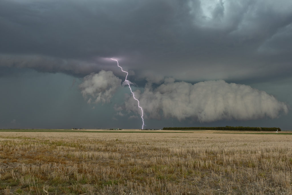
Lack of low level moisture was the theme this day. Good shear was present, however due to limited moisture, cloud bases were too high to produce tornadoes. Storms formed over south central Kansas and right turned into northwest Oklahoma as they became supercells. One storm even developed a clear slot and tried to produce a funnel. The intense lightning caused several grassland fires as well. Hail to the size of tennisballs also fell. They persisted through early evening before weakening due to loss of daytime heating. Very photogenic to say the least!
April 29th Central and Southern Kansas Tornadoes
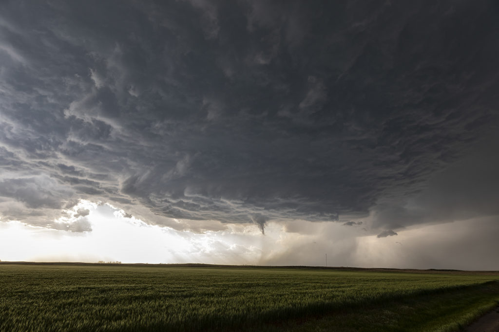
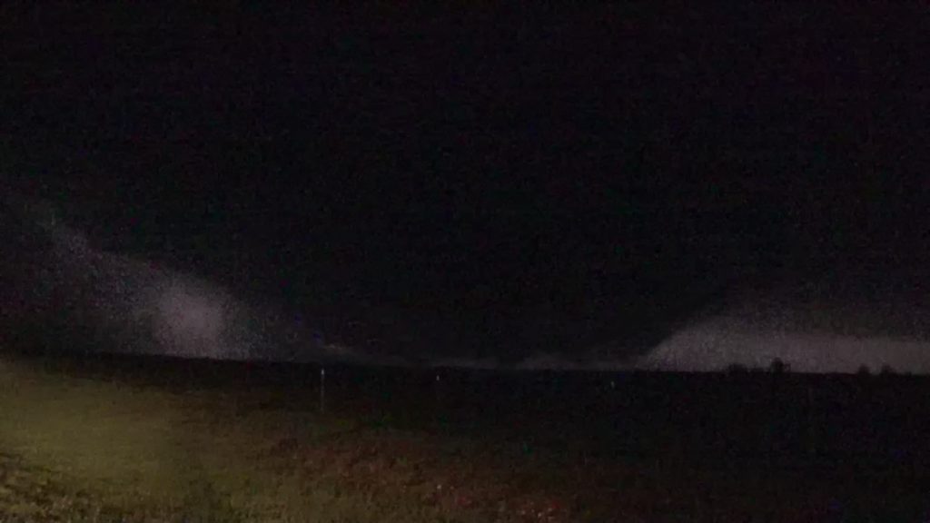
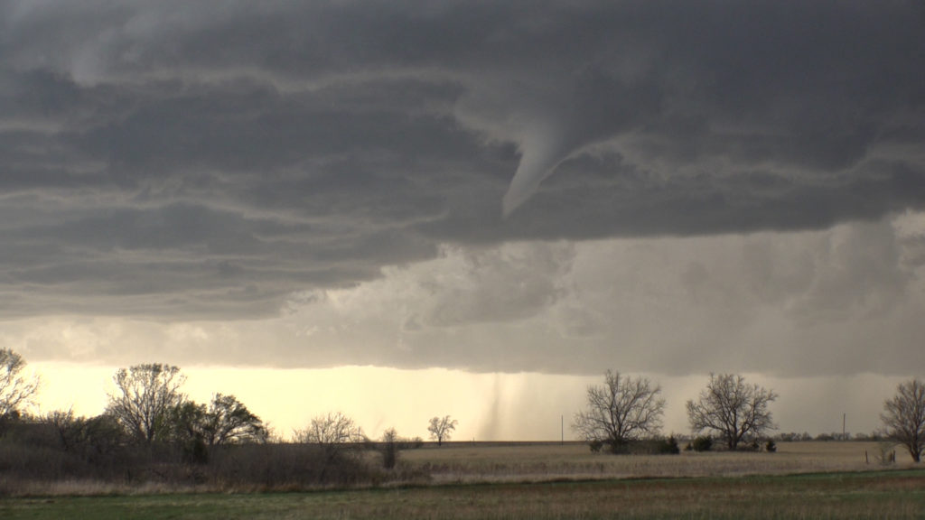
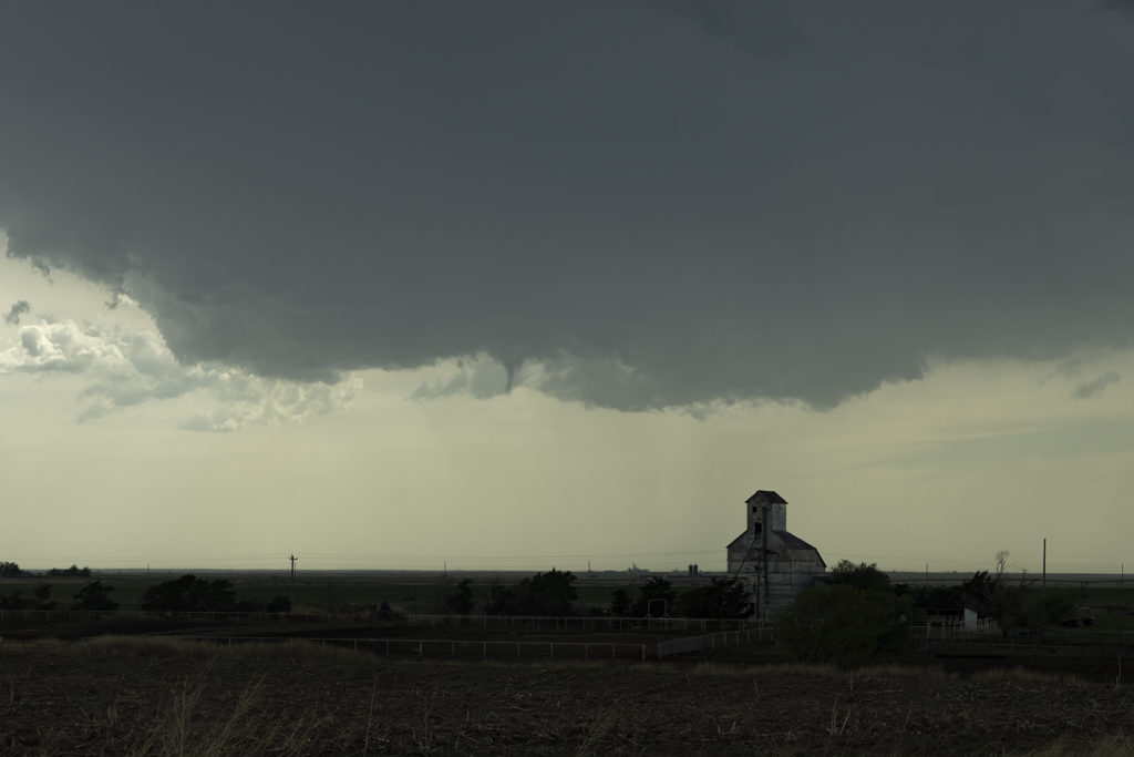
A big day was in store for Kansas. Supercells with tornadoes were possible as a combination of wind shear, moisture and instability were present with an approaching trough. By mid afternoon the dryline sharpened and soon cumulus towers formed. A cluster of storms had formed northeast of McPherson and the tail end storm started spinning. One small tornado formed as the cell moved north towards the warm front. As it approached it, other storms started forming on an advancing cold front and also became severe. We decided to leave the first storm as storm mergers made things too messy. As we blasted south towards Wichita, a landspout tornado formed underneath an updraft in the line and stayed on the ground for 12 minutes. When is dissipated, when then turned our attention to a supercell near Wichita. It had just spawned the Andover tornado and continued to cycle and become tornadic again near El Dorado. We blasted down to town, now in the dark and headed east towards the supercell’s updraft base. Quickly a tapered cone tornado formed and became visible through power flashes and lighting. It crossed the road in front of us and dissipated. Another one formed within a couple minutes and stabbed down to the ground and lifted. We continued to drift east with the storm and turned north at Rosalia. As we did a massive bowl formed and dropped to the ground! A wedge type tornado formed with multiple vortices. We got blasted with RFD winds wrapping around the tornado and had to vacate the area. As we continued east the tornado lifted as a line of storms merged with it ending the tornado threat. A crazy day with 5 tornadoes! Enjoy the pics!
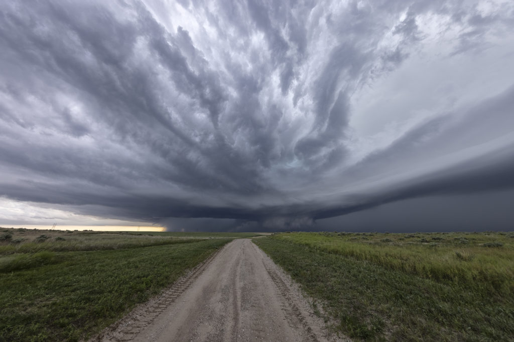
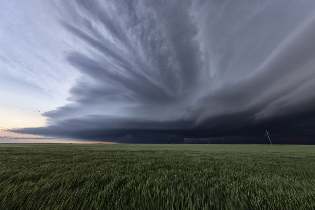
April 28th North Central Kansas Supercells
April 28th looked good in terms of shear and a boundary for storms to form on. However, moisture was quite marginal. A supercell would form near Alma, Nebraska by mid afternoon and intensify while drifting southward along the residual boundary. It had decent structure and was also very electrified. The tornado threat was very small due to higher cloud bases, but by evening the bases would lower as low level moisture would increase. It never did produce a tornado, but certainly had everything else going for it. Late evening it was still active as it dropped up to a foot of rain and hail 6 inches deep. A fun day for Tour 2! Enjoy the pics!
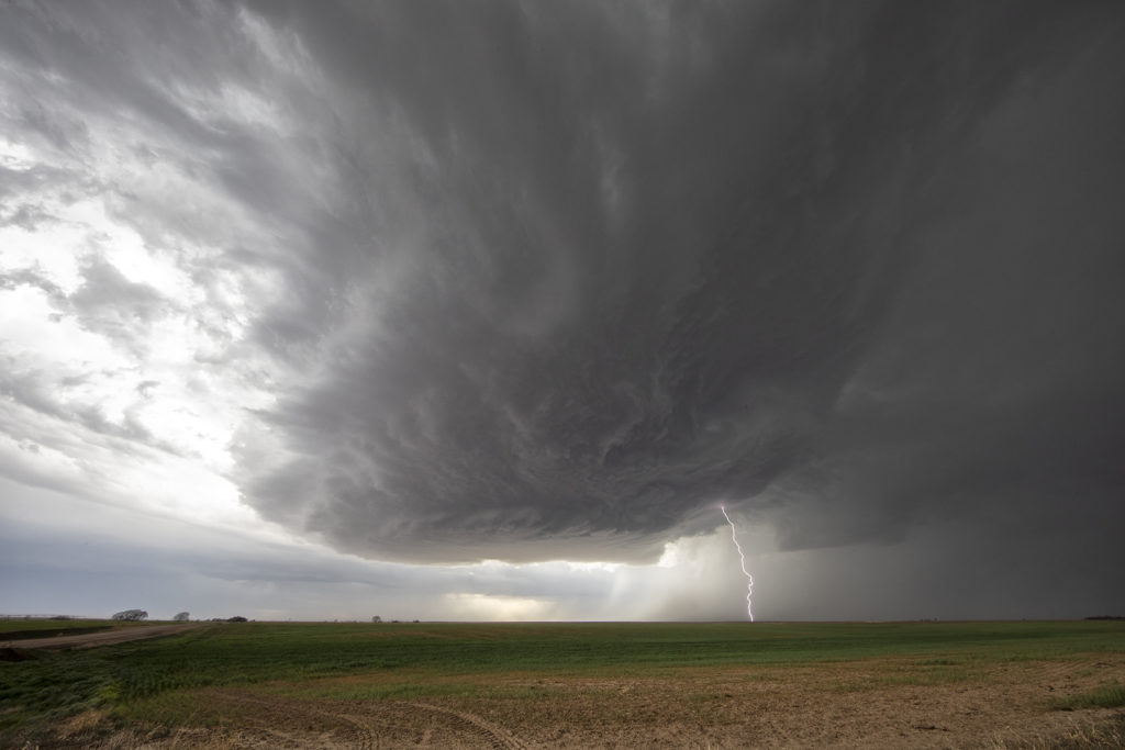
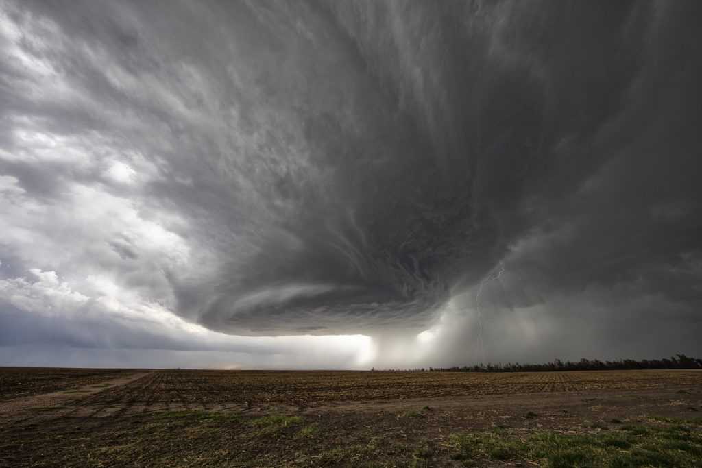
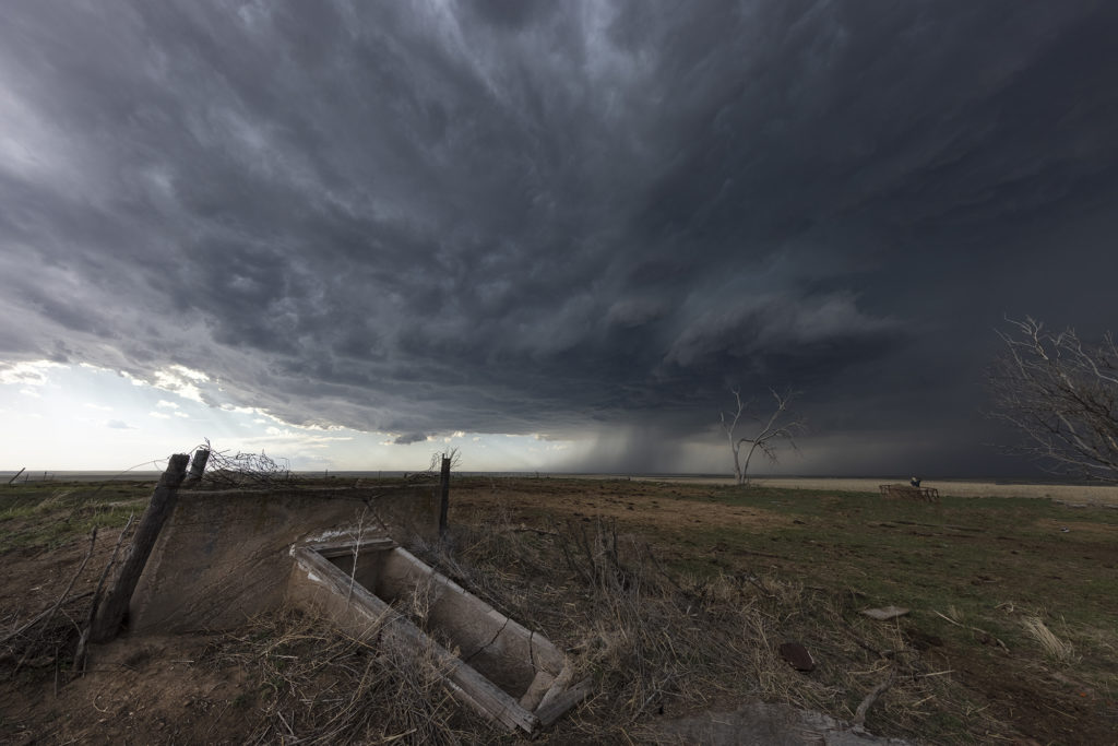
April 27th Southwest Kansas Surprise Beautiful Supercell
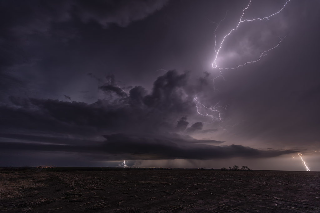
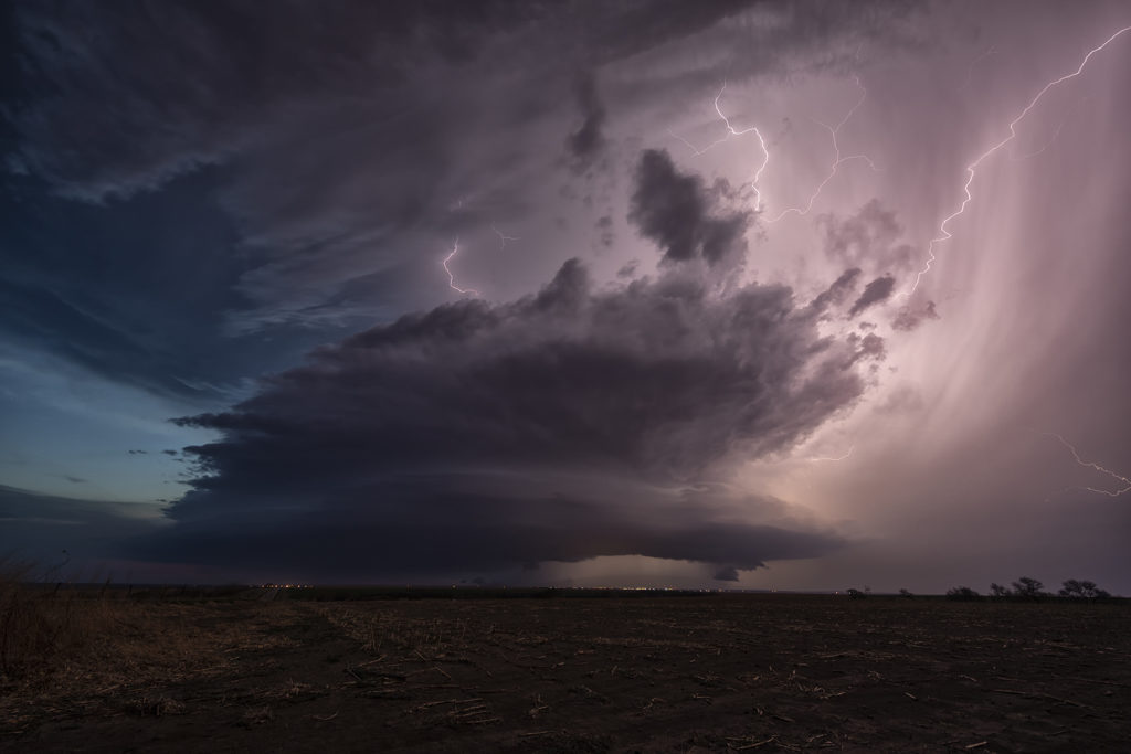
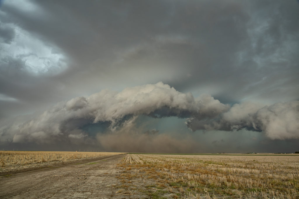
Certainly not expecting much this day as moisture was greatly lacking with dewpoints only near 50F. Shear was good and there was a boundary present as a weak cold front was drifting southeast through the area. Numerous high based storms formed and didn’t do a whole lot, but finally one formed southwest of Dodge City, Kansas and started getting organized. A severe thunderstorm warning was issued and soon the storm developed a nice circular rotating base and vault region with copious amounts of hail falling out of it to the size of tennisballs! The storm persisted for a few hours and was eventually overtaken by a line of storms that formed along the advancing front. The structure of this high based supercell was quite impressive and it was also a lightning machine! We hope you enjoy the pics!
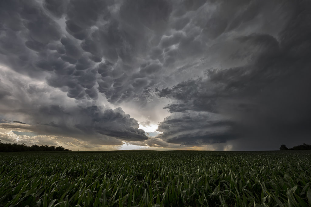
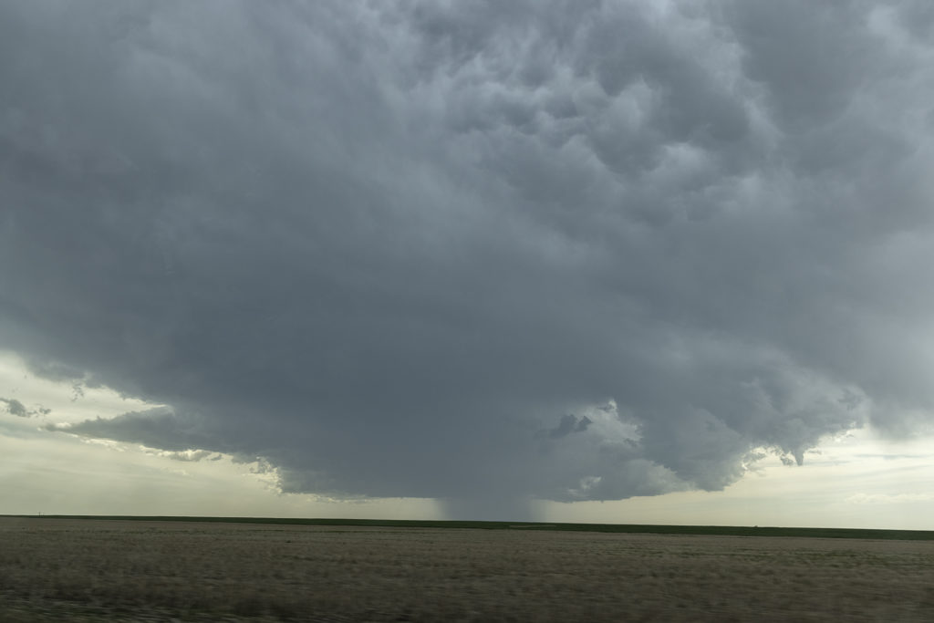
May 24th Southwest Kansas Tornado Warned Supercell
May 24th had substantial potential in western Kansas. A very moist and unstable airmass would develop over the region with multiple boundaries around for storms to form and spin on. We chose to play the usual triple point north of Leoti, where the first severe storm of the day formed. The triple point is the location where 3 air masses meet and it typically spawns one of the best storms of the day! It would struggle to sustain itself due to some small capping issues, but it eventually became tornado warned. However off to the north, a supercell formed and drifted north and produced tornadoes near Selden, Kansas. Since it’s a chasing rule never to leave your storm if it has a tornado warning to chase a different one (because, you KNOW what the one you left would do!), we stayed with it. More storms developed west of Garden City and would also become tornado warned. Our storm weakened, as did the Selden, Kansas storm, so south we went to play the tail end storm. What a beauty! Big, wet classic supercell with beautiful structure that would go on through the evening hours! At times the rotation became pretty tight, but it just couldn’t get a substantial tornado to the ground. We stayed with it till dark and then went back to Garden City for the night. Another day, where a secondary target produced tornadoes and the primary target would not. Such is the life of storm chasing! Please enjoy the pics!
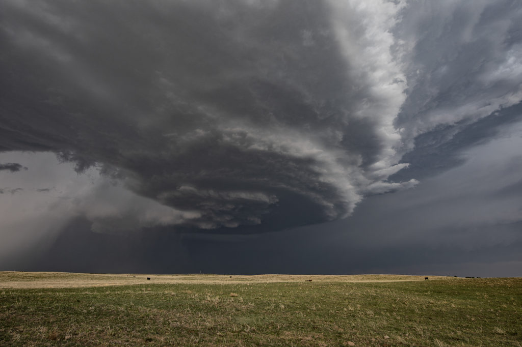
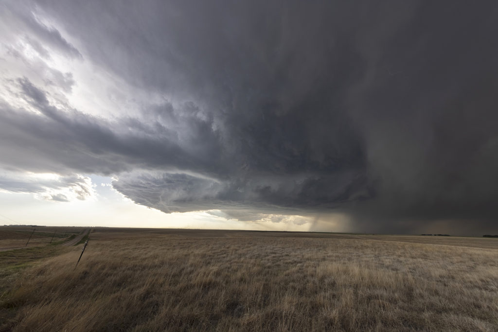
May 13th Western Kansas Gorgeous Supercell
May 13th took us to the triborder area between CO/NE/KS. Strong shear, but marginal moisture would be the story this day. A supercell formed mid afternoon and tracked south along the dryline. Structure, lightning and big hail would be the results from this pretty supercell. A couple of shear funnels occurred as well. The storm rolled south until about 9pm when it dissipated. A fun chase day and we got more than we thought we would. Sometimes good shear can overcome a limited moisture set up and still produce a beautiful storm! Enjoy the pics!
May 8th Central Kansas Tornado Warned Supercells
May 8th took us to central Kansas along I-70. Good shear and convergence along a boundary would provide the focus for severe storms. However limited moisture and instability would eventually temper the overall threat. A supercell formed at the triple point southwest of LaCrosse, KS. It looked like THE storm to be on, however, it ingested dry air and died a couple hours later. Outflow from a decaying cluster of storms over northern Kansas would fire off several supercells in the daylight and darkness, of which a couple became tornado warned. There was little threat of a tornado due to the high bases of these supercells. They did produce baseball sized hail and a lot of lightning. Fun day for Tour 3! Enjoy the pics!
May 2nd Northwest Kansas Severe Thunderstorms
Day 1 of Tour 2 took us north from Oklahoma City to western Kansas. Shear was good this day, however moisture was lacking. This resulted in higher based severe thunderstorms with hail and high winds. Some of the areas of northwest Kansas near the Smoky Hill River bottoms are full of badlands type formations and make for a great photo! Lots of lightning also occurred with these storms as the built southward along an advancing cold front. Fun first day for Tour 2!! Enjoy the pics!
July 13 Eastern Colorado/Western Kansas Supercells
July 13th was the second day of our Tour 9, Great North Tornado Hunt tour, and it took us east of Denver towards the Kansas border. Decent shear, limited moisture and CAPE, and an approaching dryline, would set the stage for high based storms to form. As the storms moved into Kansas, they intensified and the bases came down. We had a couple very pretty rotating storms in far western Kansas that were quite electrified. The final storm of the day was a very nicely structured LP supercell near Leoti, that spewed out numerous lightning strikes and intercloud discharges. I thought for a minute that it had some tornado potential, however the base lifted, the wall cloud dissipated and it eventually died as well. A fun day, great storms and super lightning. Please click on a pic for a larger photo. Enjoy!
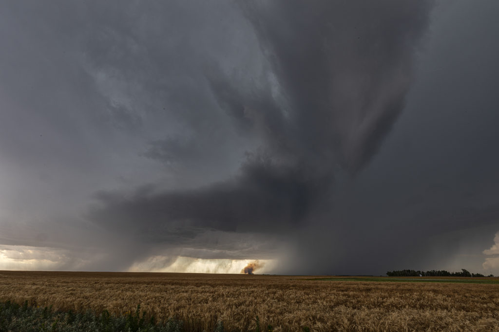
June 24th Southern Kansas Supercells
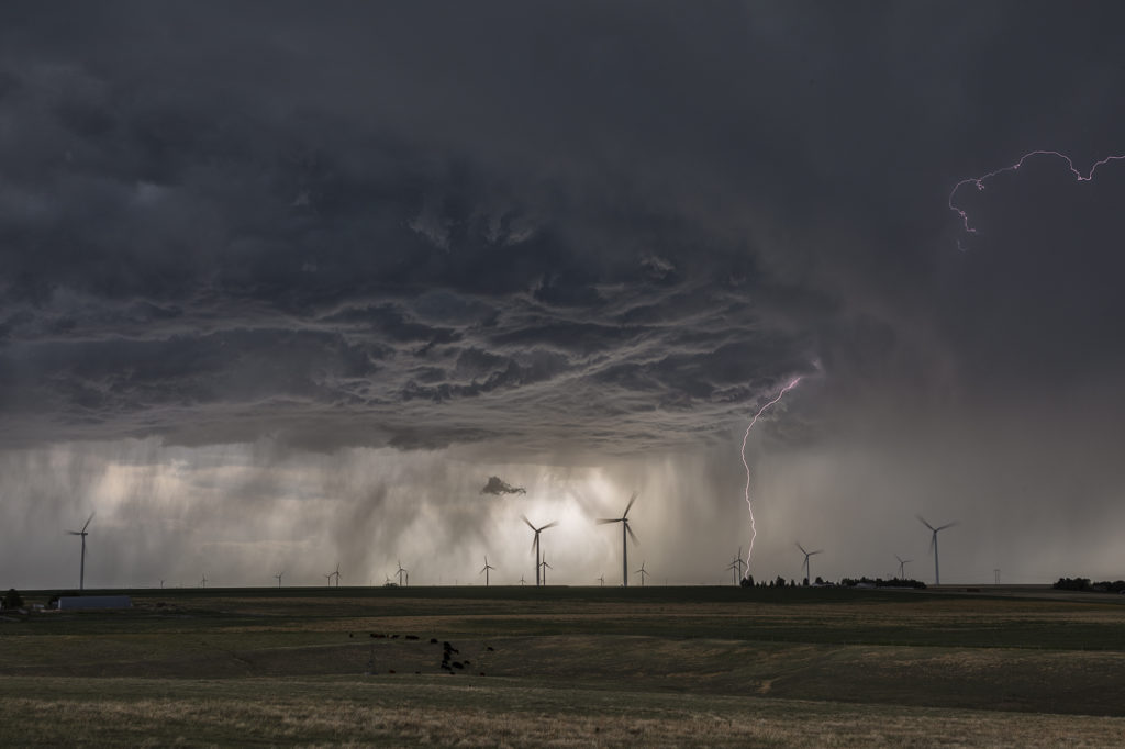
We had high hopes for some great supercells in southern Kansas on June 24th. The atmosphere didn’t disappoint! High CAPE, strong shear, moderate moisture and decent lift along existing boundaries would set the stage for afternoon severe thunderstorms. An explosive supercell formed in central Kansas mid afternoon and became severe. This storm produced hail to baseball size and high winds. It weakened as it remained nearly stationary and other storms formed south and west of it. A well structured supercell emerged and became very electrified. A grassland fire occurred and fortunately was put out before consuming any farmsteads. As it continued to move south/southwest, it became undercut by outflow and slowly weakened. It continued to produce very large hail and high winds during the remainder of it’s life as it slowly drifted south into far southern Kansas. A fun day of chasing with well structured storms and very large hail. We stopped and examined the hail stones we found up to tennisball sized. Click on a pic for a larger photo. Enjoy!