
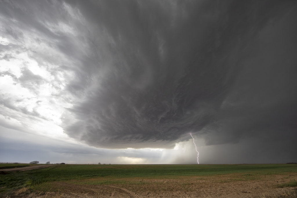
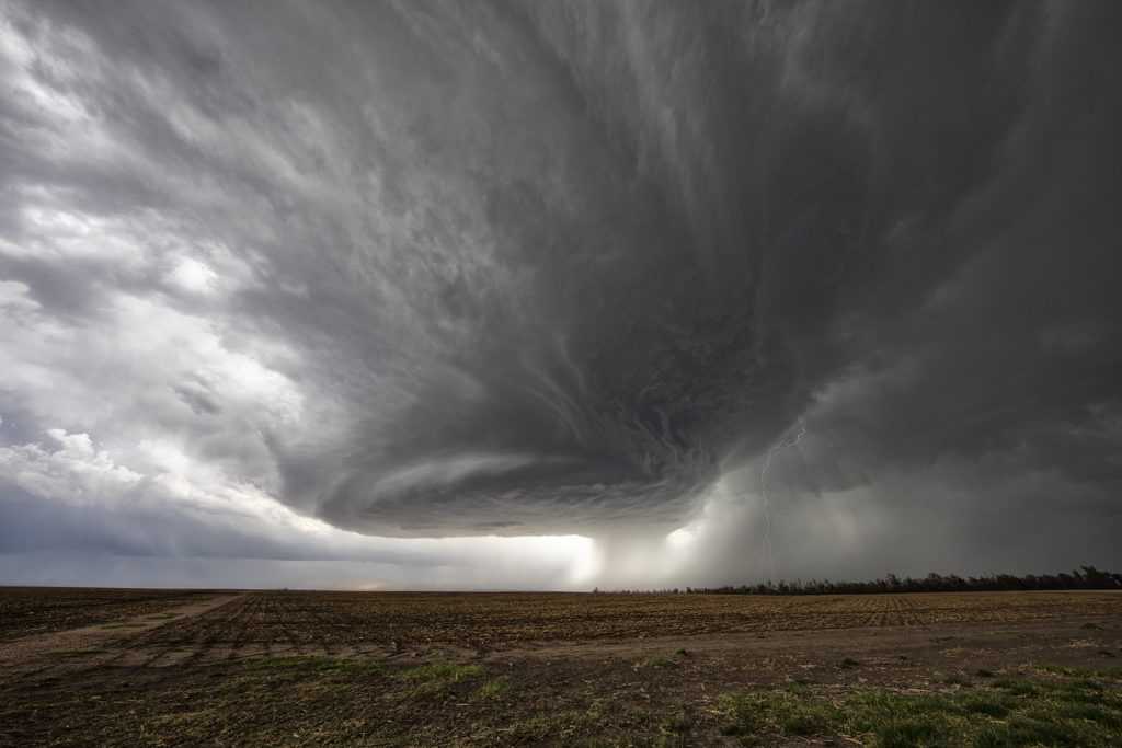
April 27th Southwest Kansas Surprise Beautiful Supercell
Certainly not expecting much this day as moisture was greatly lacking with dewpoints only near 50F. Shear was good and there was a boundary present as a weak cold front was drifting southeast through the area. Numerous high based storms formed and didn’t do a whole lot, but finally one formed southwest of Dodge City, Kansas and started getting organized. A severe thunderstorm warning was issued and soon the storm developed a nice circular rotating base and vault region with copious amounts of hail falling out of it to the size of tennisballs! The storm persisted for a few hours and was eventually overtaken by a line of storms that formed along the advancing front. The structure of this high based supercell was quite impressive and it was also a lightning machine! We hope you enjoy the pics!
No comments yet.