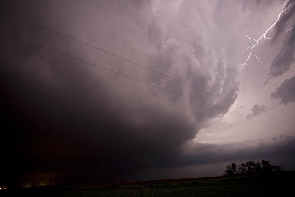
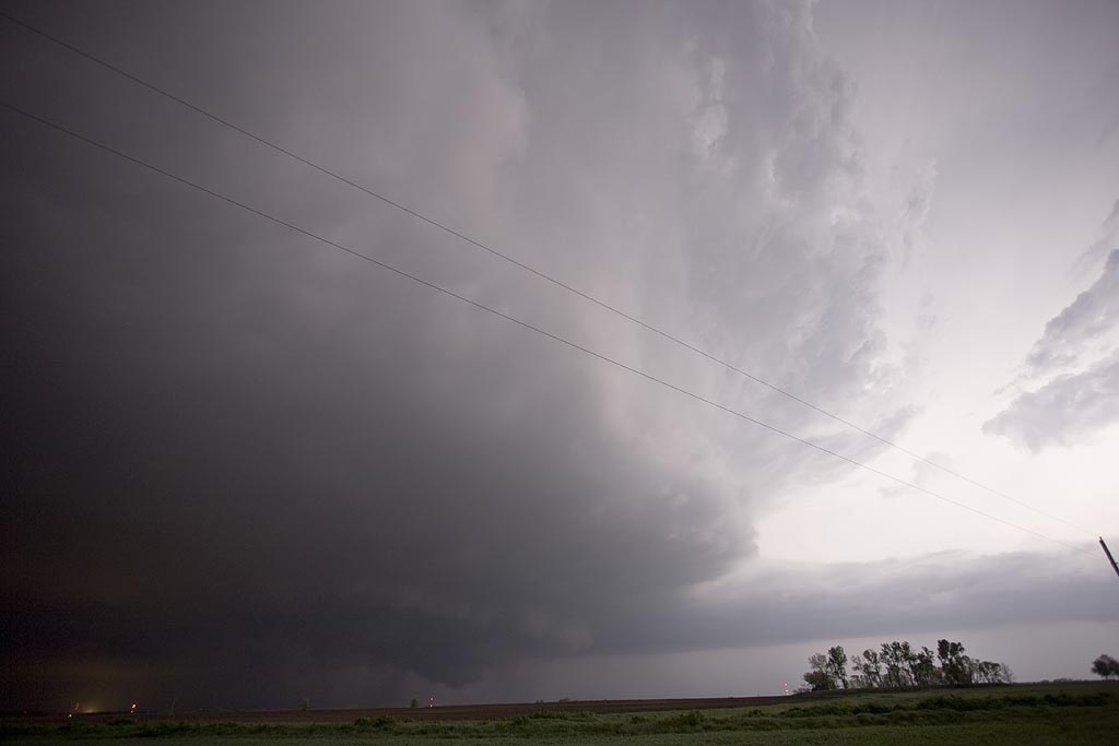
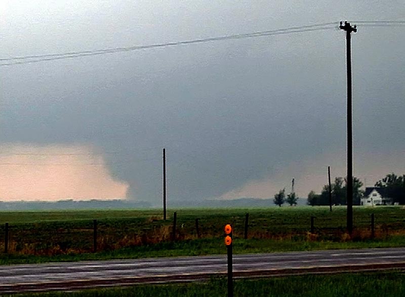
May 29th was advertised as a High Risk from the Storm Prediction Center. It seemed all ingredients were in place for a significant severe weather event, including strong to violent tornadoes. We decided to play the warm front along the KS/NE border area and as far west as we could. The first supercell of the day formed north of Mc Cook and became tornado warned almost instantly. It produced the Kearney, Nebraska tornado that caused significant damage. We followed the storm to east of Kearney when it became totally rain choked. We then dropped south into north central Kansas and caught the cyclic tornadic supercell from Tipton, Kansas, northeast towards Jewell, Kansas. The storm was a sight to behold!
May 25th Kansas Supercell and Tornado
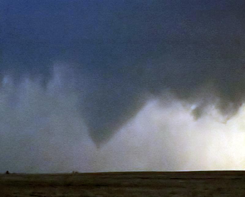
May 25th was a day I wish I had been in Iowa. However, good shortwave energy, good shear, moisture and instability would keep me in Kansas. I caught two nicely structured supercells this day, one of which produced a landspout type tornado that persisted for about 5 minutes. The first supercell, south of Hays,, was tornado warned and actually produced a few very weak brief touchdowns. We had chased farther west on a tornado warned storm that ended up VERY high based, and thus missed the initial “dusty multivortex” tornado report. I fully believe the report based on what we saw. The second storm just east of the first had pretty structure and produced the landspout.
May 22/23rd, 2008 Kansas Tornadoes
May 22 and 23 were advertised as big days for the central plains. Moderate and High Risks were issued by SPC and well justified. Numerous supercells exploded, especially in Kansas both days and we were fortunate to intercept a few of them. On May 22nd, we were on a storm that would produce tornadoes near Collyer, Kansas, but due to a flat tire we couldn’t keep up with it. The day was salvaged as we intercepted a massive supercell near Wakeeney, Kansas that produced two confirmed tornadoes.
May 23rd would be the best of both worlds where we would intercept two sets of supercells that produced tornadoes near Quinter, Kansas with one being EF4. However due to the state patrol rightfully blocking the interstate, we were only able to get about 4 miles from it. Check out the video stills below. I didn’t shoot many stills due to having to spend my time navigating to keep up with these rapidly moving supercells.
May 14th, 2008 West Texas Tornadic Supercell
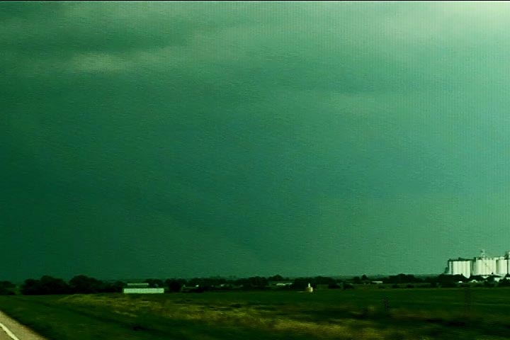
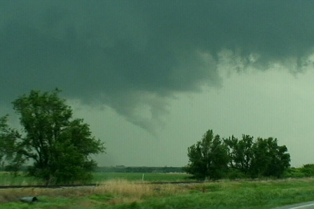
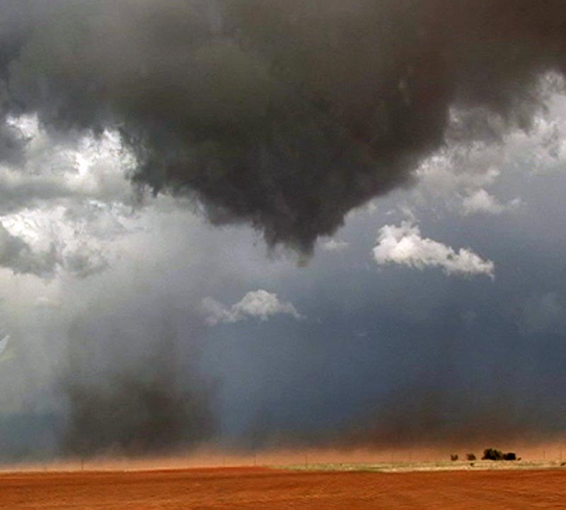
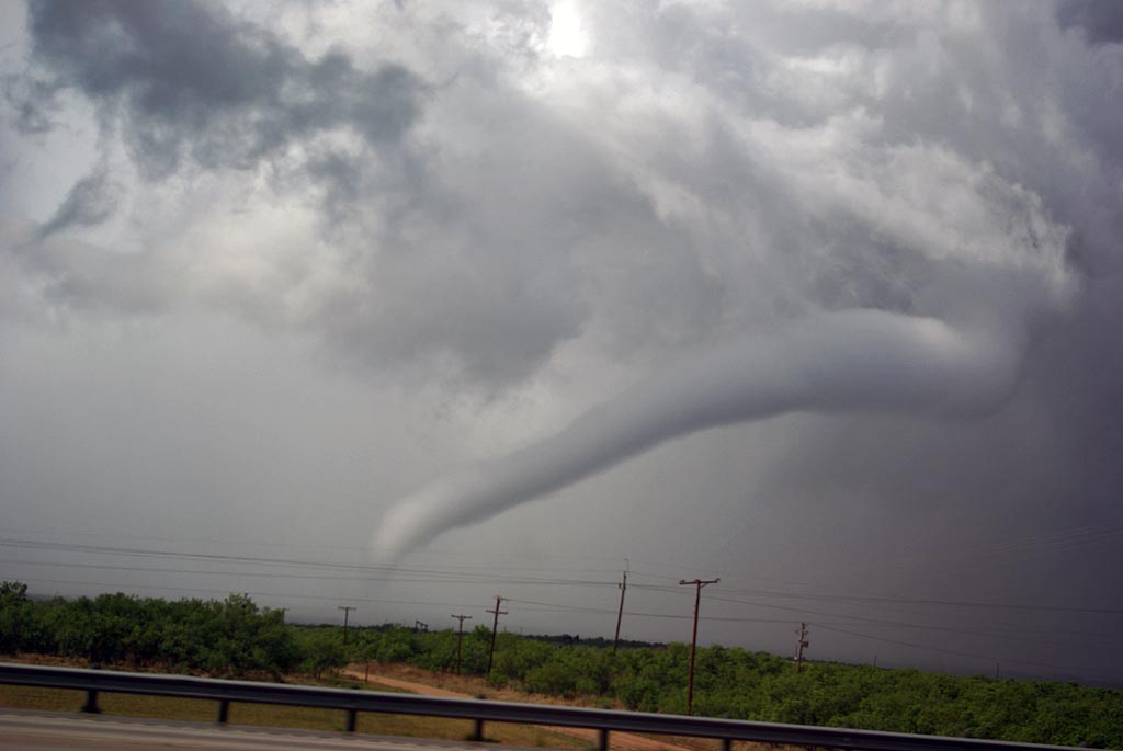
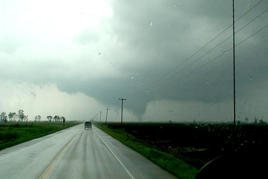
The set up on May 14th looked great. I had been looking forward to this day for many days, and it did not disappoint. Overnight convection produced an outflow boundary that intersected the dryline near Midland, Texas. An upper level low was moving out of the southern Rockies and was forecast to produce good lift and cooling over the dryline/outflow intersection by later afternoon. We arrived northwest of Big Springs as a nice storm formed, showing rotation from it beginning. It produced a landspout tornado as it formed with strong shear along the boundary. As it matured, it produced nearly golf ball sized hail.
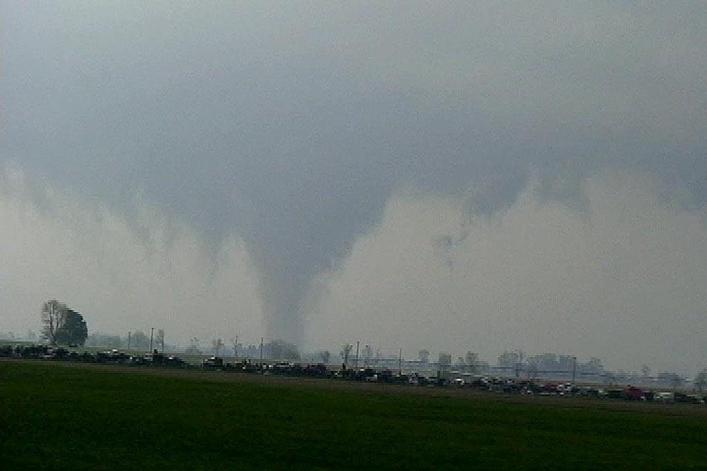
Another storm formed directly in front of it and as it encountered the outflow from the newly formed storm, it’s base came down very low and it produced the tornado shown above, followed by another smaller tornado, along with numerous funnels before dissipating as the eastern most storm became the dominant storm. The eastern storm approached Abilene and produced a couple of brief tornadoes, along with baseball sized hail. Click on the image below for a larger image.
May 6th, 2008 Roswell, New Mexico Supercell
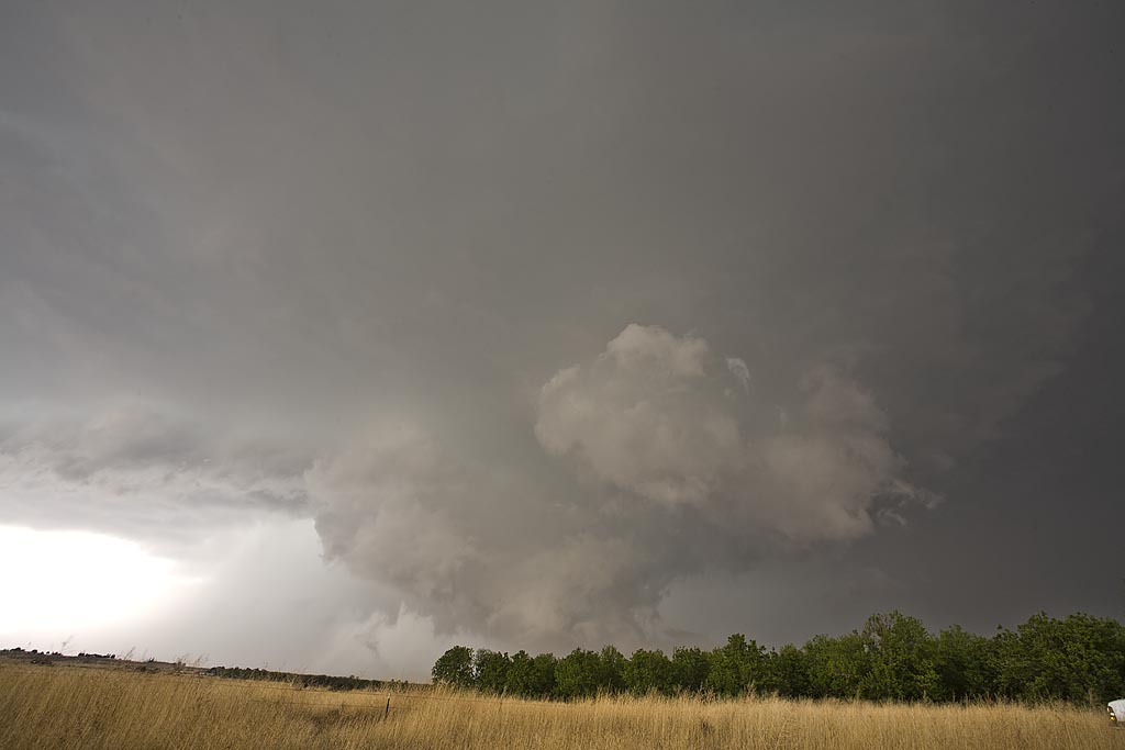
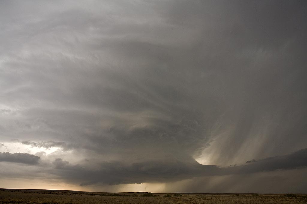
May 6th had good supercell potential, but the tornado threat was minimal with marginal low level shear. Upslope flow would develop into southeast and east central New Mexico and generate supercell thunderstorms of f the mountains west of Roswell. This beautiful supercell formed and gave us a spectacular show as it tracked eastward across all of east central New Mexico and was eventually tornado warned. It did not produce a tornado, but produced hail nearly softball size. The structure was text book classic, then morphed into a monstrous hp supercell.
May 2nd, 2008 Arkansas and Mississippi Tornadic Supercells
May 2nd had big potential. But, when we awoke in Joplin, Missouri, a huge squall line had moved through, taking the instability and moisture with it. I was afraid the squall line would be all that formed that day. Despite great kinematics and good thermodynamics, I figured the day would be spoiled by this raging squall line. I couldn’t have been more wrong. We blasted east and south through southern Missouri and northern Arkansas to my target northwest of Memphis. As we did, it became apparent that this day would go down as a major event. The squall line became cellular with numerous tornado warned, long lived tornadic supercells forming from Little Rock, AR eastward and southeastward through western Tennessee and western Mississippi. We intercept numerous tornado warned superells and filmed 3 tornadoes, one very close near Gilmore, Arkansas. Early evening found us farther into Mississippi than I have chased, while intercepting two significant tornadic supercells, both near New Albany, MS.
Our first tornado occurred just north of Marked Tree, Arkansas, and was a short lived multivortex tornado. The second tornado was a rather large, strong cone tornado near West Ridge, Arkansas that unfortunately caused considerable damage to many farmsteads. The closest tornado that we caught was near Gilmore, AR as a tornadic supercell approached our location from the southwest. The tornado passed only a few hundred yards from our location. Unfortunately, in the heat of navigating our group, I was not able to get my digital camera out until we intercepted the supercells near New Albany, MS. Thu all the tornado photographs are video stills.
Our final excitement came as we tried to punch the hook of a tornadic supercell just north of New Albany. I stopped us about two miles north of the tornado as radar was showing over 140 kts of shear in the circulation. This could have been disastrous had we continued on the highway. The final supercell had structure like I had never seen before in east of the Mississippi river! As it passed into New Albany, the RFD ripped up trees and downed power lines, as a rain wrapped tornado churned just north of town. Please click on the thumbnail image for a larger image.
May 1st, 2008 Kansas Supercells
May 1st promised a set up that contained good shear, a sharpening dryline, but questionable moisture. All indications were that storms would form, initially high based, over southeast Kansas and possibly northern Oklahoma. As the evening went on, models showed moisture deepening and storms becoming quite intense. We played the area around Independence, Kansas. By late afternoon, storms formed, a few becoming supercells. They quickly became a cluster of supercells, with embedded mesocyclones, but just couldn’t get the job done to produce a tornado.
A couple of isolated supercells developed in northern Oklahoma and one produced several tornadoes not far from Stillwater. However, we just couldn’t get there to chase it. Finally after dark, one intense supercell, tornado warned, developed on the tail end of the line of storms near Altoona, Kansas. Photos and video revealed a bowl shaped wall cloud, possible funnel, but nothing could be confirmed touching down.