
May 29th, 2008 Nebraska and Kansas Tornadofest
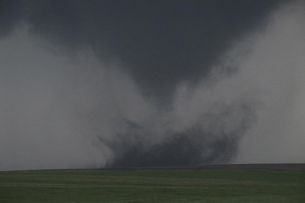
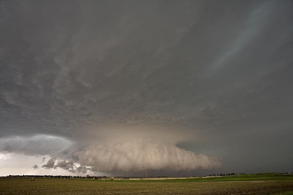
May 29th was advertised as a High Risk from the Storm Prediction Center. It seemed all ingredients were in place for a significant severe weather event, including strong to violent tornadoes. We decided to play the warm front along the KS/NE border area and as far west as we could. The first supercell of the day formed north of Mc Cook and became tornado warned almost instantly. It produced the Kearney, Nebraska tornado that caused significant damage. We followed the storm to east of Kearney when it became totally rain choked. We then dropped south into north central Kansas and caught the cyclic tornadic supercell from Tipton, Kansas, northeast towards Jewell, Kansas. The storm was a sight to behold!
No comments yet.