Tag Archives | funnel

April 29th Canton, Texas Violent Tornado

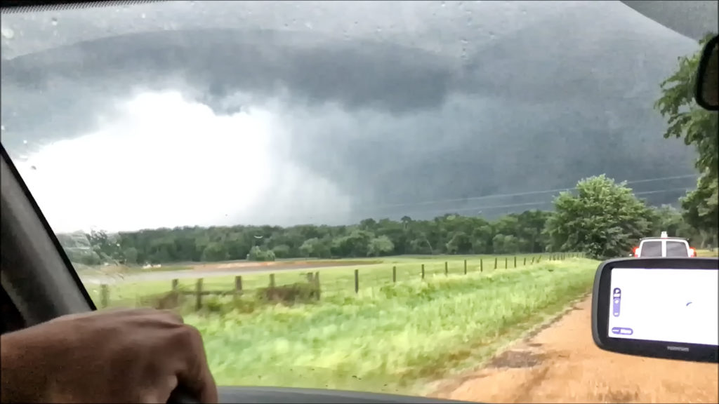
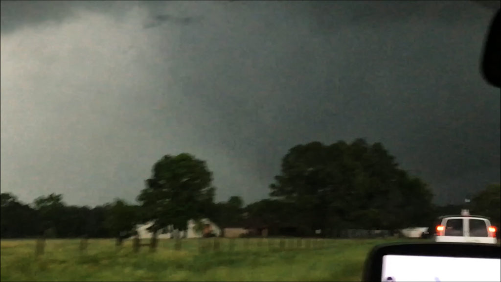
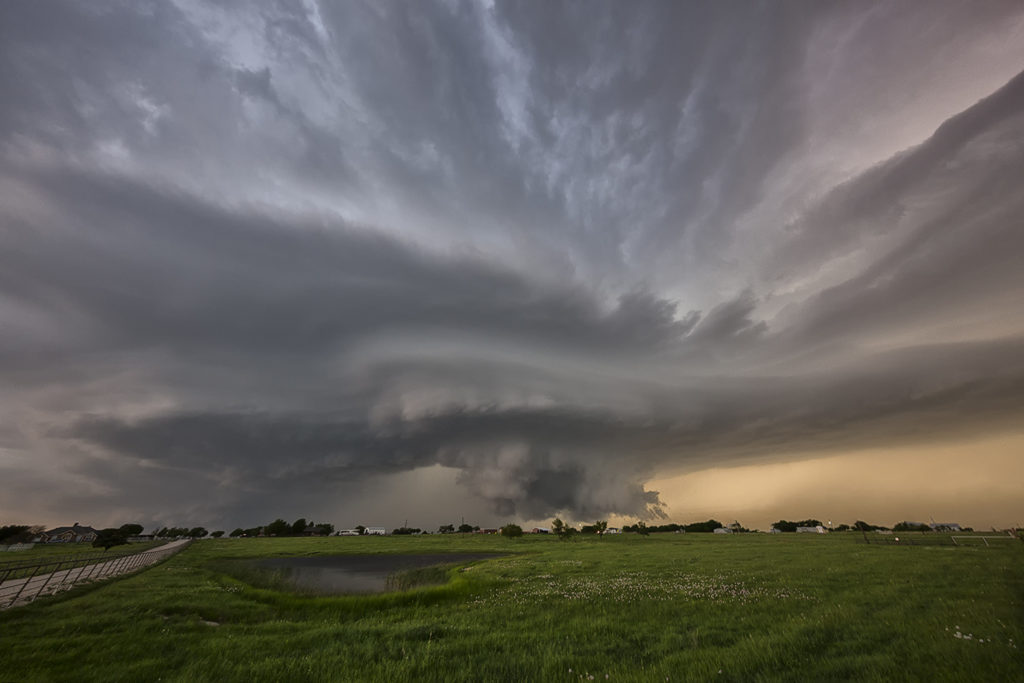
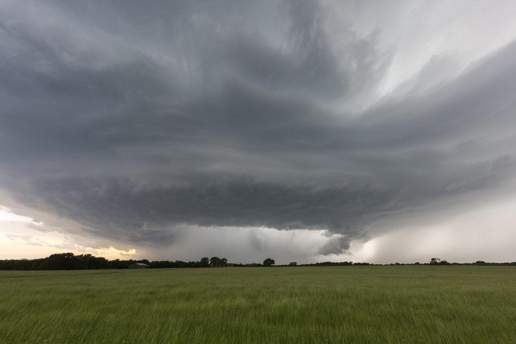
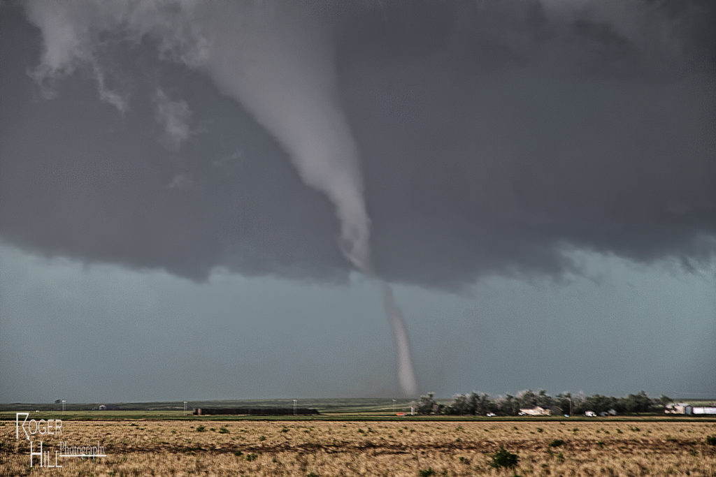
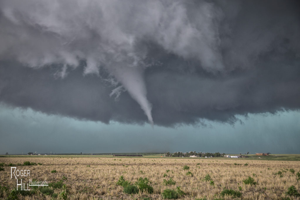
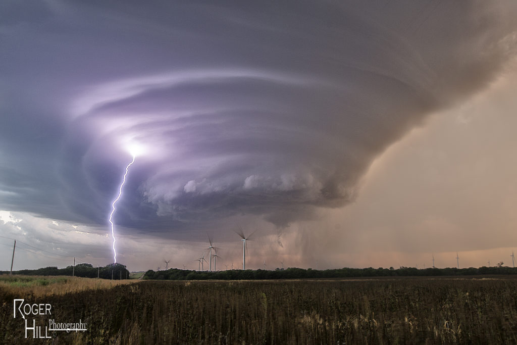
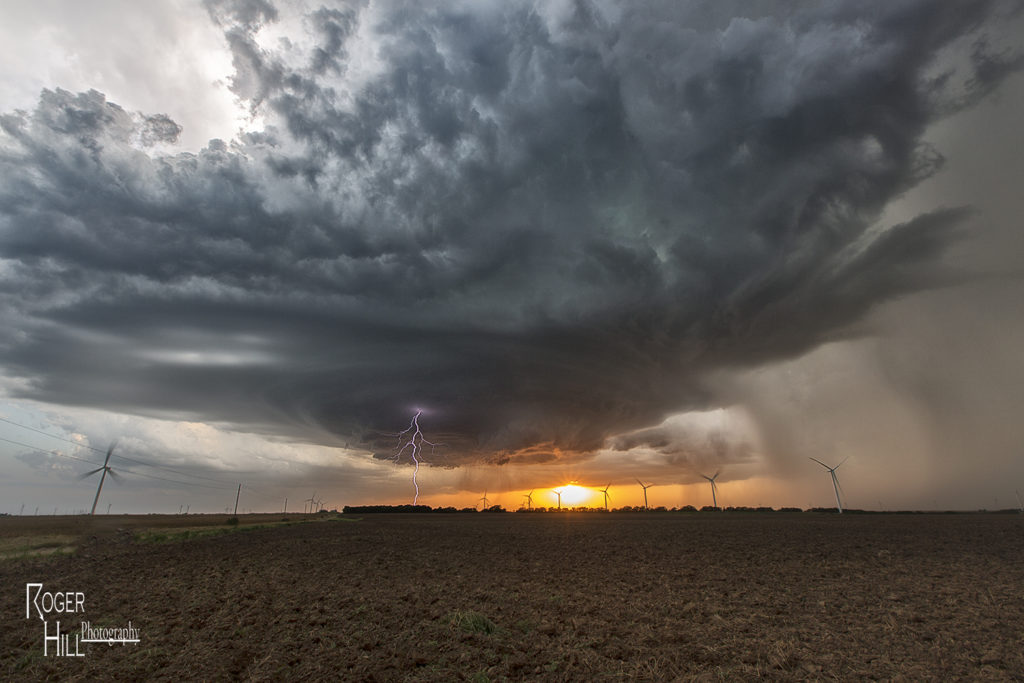
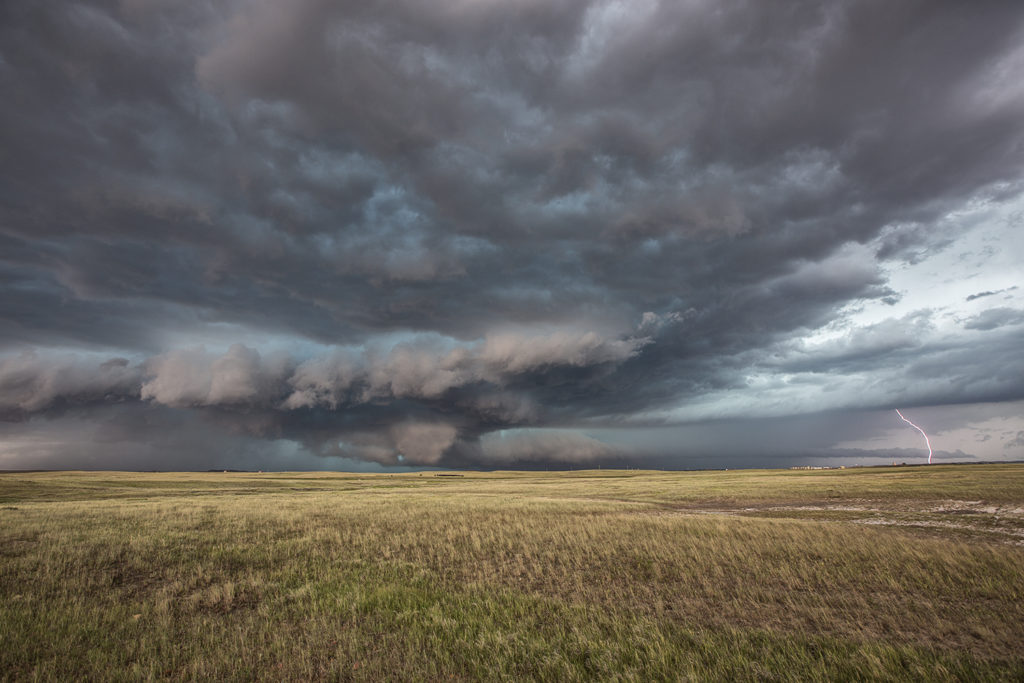
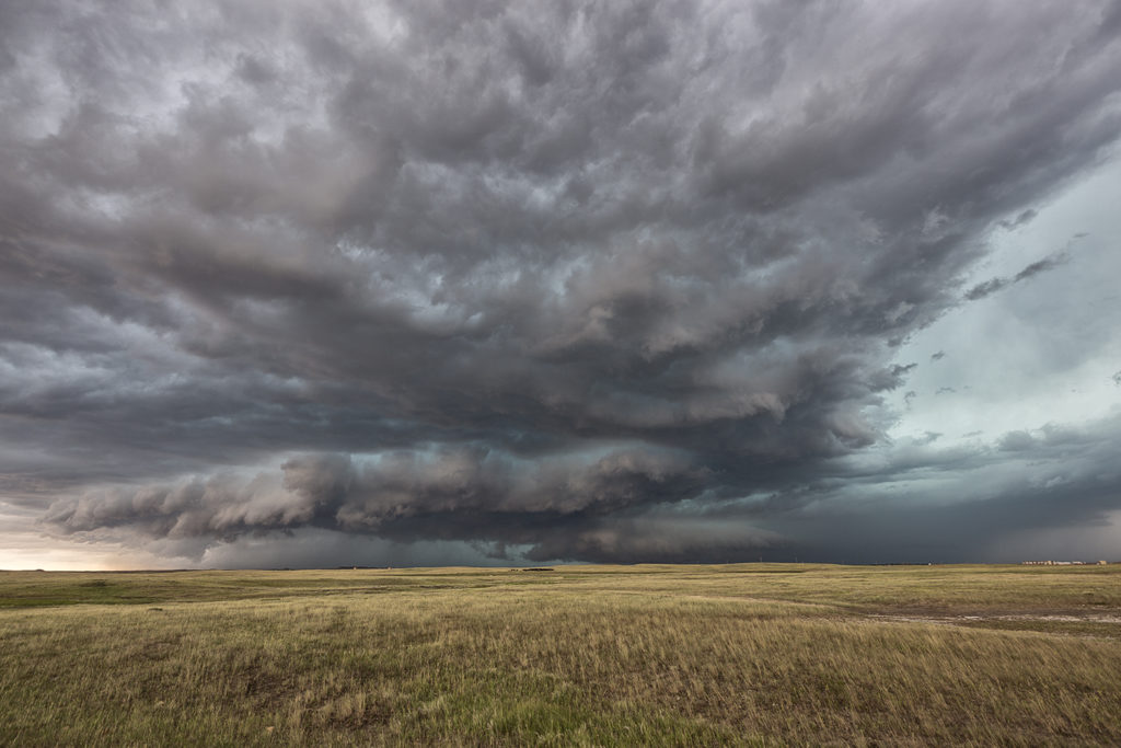
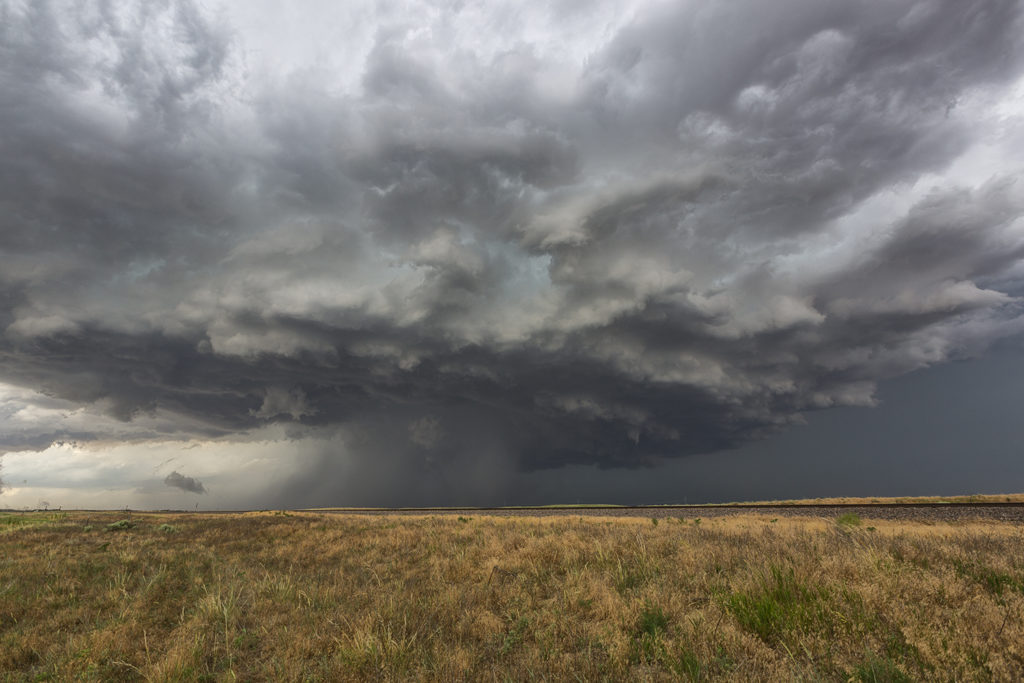
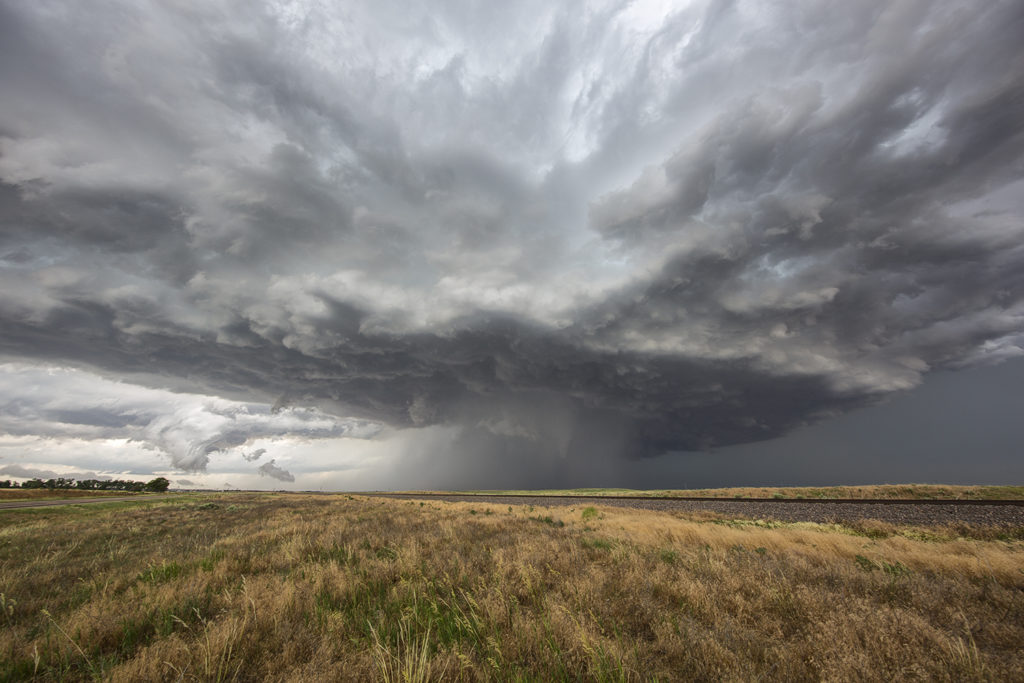
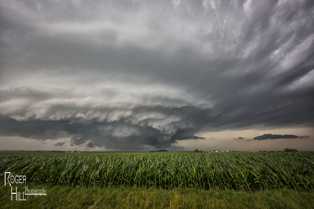
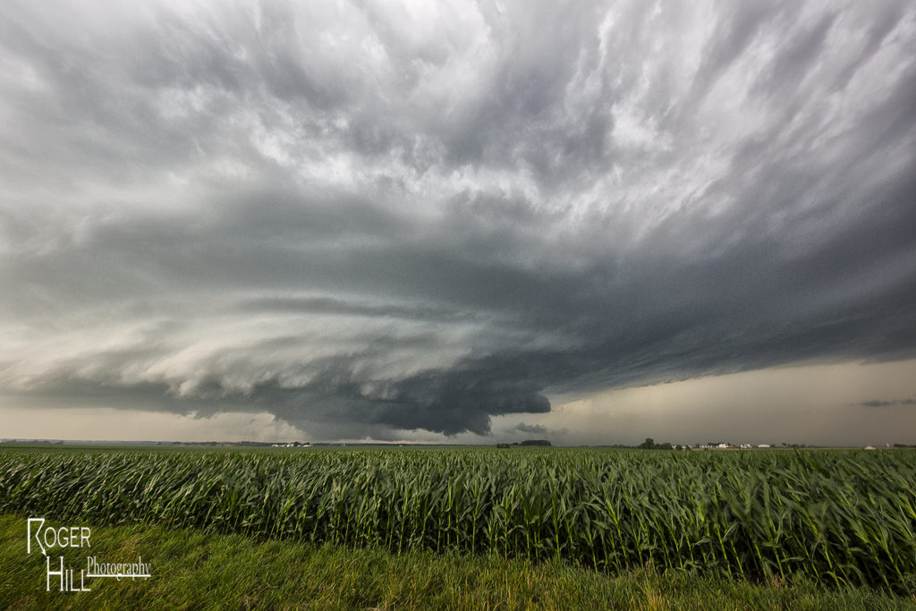
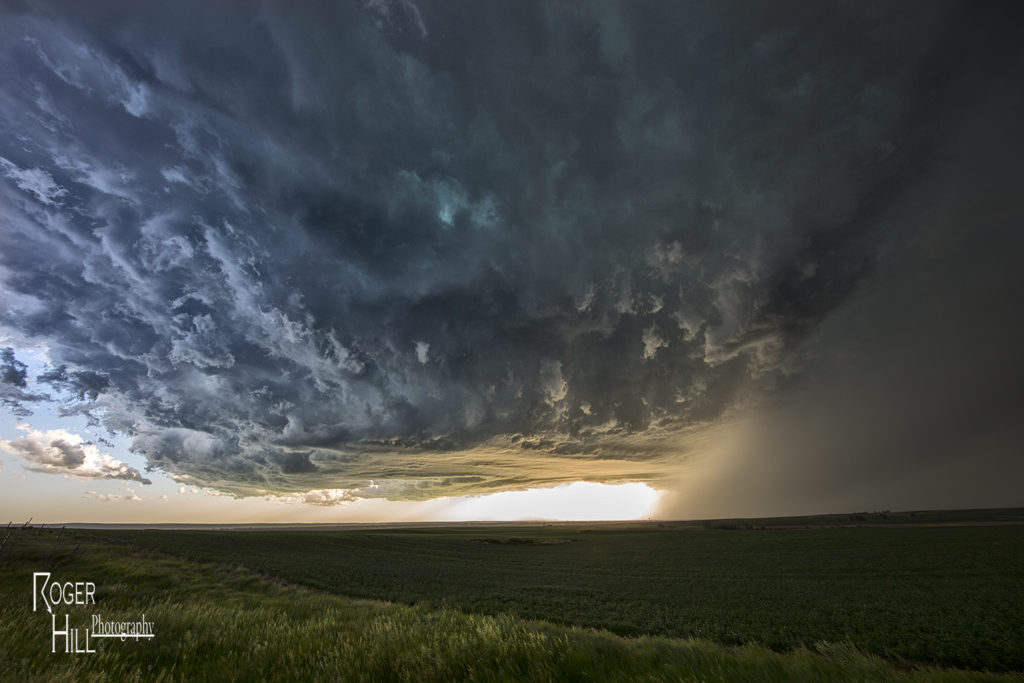
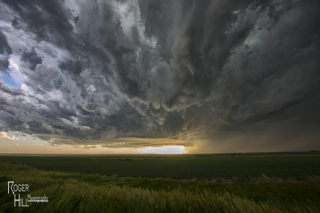
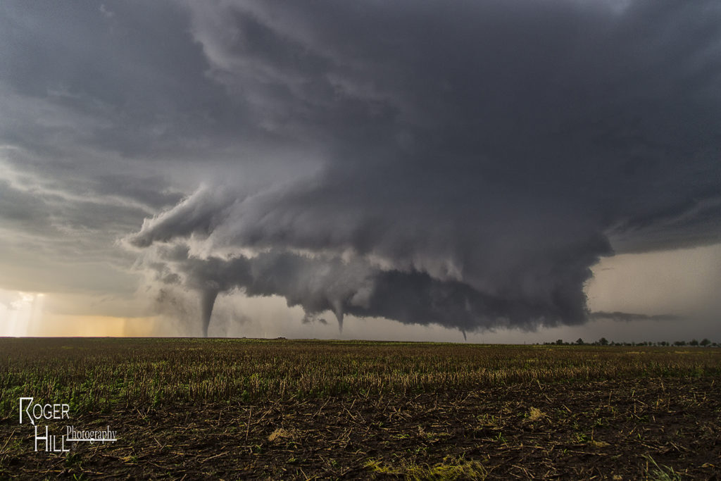
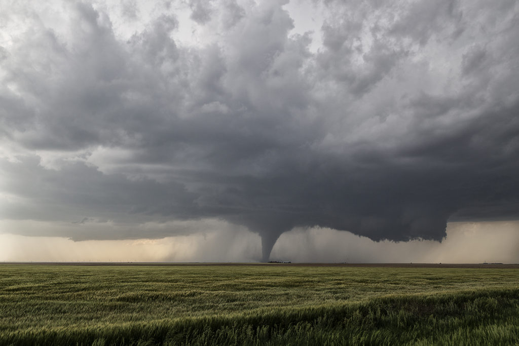
April 29th was the inbetween day from Tour 1 and 2. However, we also ran an on call tour this day. Many guests from Tour 2, and the On Call tour, went to northeast Texas to chase. As things started to become clear, we blasted south towards the Canton, Texas area. Strong southeast surface winds, extreme instability, high dewpoints in the mid 70s and strong shear set the stage for supercell storms to form and intensify as they moved northeast. Several tornadoes formed as storms matured, with one tornado in particular staying on the ground for 50 miles and over 2.5 hours, getting a rating of EF4! Unfortunately this storm caused significant damage and fatalities in Canton, Texas as well as Fruitvale, Texas. Our hearts go out to those who suffered this day and we hope for a speedy recovery.


April 21st Pilot Point, Texas Tornadic Supercell

April 21st had high potential. Strong shear, high CAPE and deep moisture would provide the ingredients for intense supercell storms. One storm formed over southeast Oklahoma. We decided to wait it out for later storms to form over northern Texas. A cluster did form with the tail end storm becoming a beautiful HP supercell. It produced a tornado north of Pilot Point, which was mostly rain wrapped. It tried again later in its cycle as you can see from the photos below. Finally, at dusk, another supercell formed and tracked over the region in the dark. Amazingly eery sight watching a storm spin in the dark. Enjoy the pics!


July 17th Northeast Colorado Tornado Warned Supercell

July 17th was a high plains upslope set up. Southeast winds along a boundary would funnel moisture into the Cheyenne ridge. A supercell formed early afternoon near Chugwater, WY and would right turn and track down the boundary into northeast Colorado. This storm was outflow dominant most of its life cycle and was a major hail producer. In Colorado it became tornado warned, although not a big threat in my opinion since it was outflow dominant. We came across some beautiful landscapes to photograph the storm, and everyone had a great time with it. The storm never produced a tornado but it did produce significant hail the size of baseballs along its path.  This was to be the last great day for the season as we wrapped up tours and headed home to Denver. Thank you all for a wonderful tour season. We have the best guests and guides on the planet!

July 15th Syracuse, Kansas Tornado

July 15th had big potential. An outflow boundary lay across the Kansas/Colorado border area by early afternoon. A cold front intersected that boundary near Cheyenne Wells, CO. Deep moisture, strong shear and high instability formed along and east of the boundary. By 2pm a severe storm formed and quickly became supercellular. It tracked due south right along the outflow boundary. We encountered huge hail the size of baseballs to softballs near Arapahoe, Colorado. Fortunately we did not lose any windows. We dropped south and had to stay on the western side of the storm where very hot and dry air was being entrained in the supercell creating a violent downdraft with intense blowing dirt and 90 mph winds. Finally at Granada, CO we were able to go east and get into the better moisture. As our storm gusted out, another storm formed on the boundary and ingested 84/70 air! A lowering quickly formed and within 20 minutes started rotating. A truncated cone funnel formed and dissipated 5 minutes later. We were right in the path of the mesocyclone. We moved a mile east and stopped. Rotation dramatically increased and soon a tapered white funnel formed. Another one formed and wrapped around the larger one. The larger funnel touched down and became a stout stovepipe tornado. It widened into a large cone. I couldn’t believe my eyes! Was this May or July?  This was the largest July tornado I had ever witnessed in Kansas. The tornado moved south with a large debris cloud and after 19 minutes, roped out. It was quite the sight to see! An absolutely amazing day for the Great North Tornado Hunt tour again!

July 13th Peckham, Oklahoma Gorgeous Supercell

July 13th was the second great day for the Great North Tornado Hunt tour. We started the day in Wichita. Extreme heat and instability would form that afternoon with temperatures near 100F and dewpoints in the upper 70s. Cells tried to form for a couple hours along a dryline/outflow boundary composite, and finally by around 5pm a significant supercell formed just west of Arkansas City, KS. This storm quickly became severe for large hail to tennisball size. As it continued to intensify, it moved due south towards northern Oklahoma near Peckham. This storm was a striated beast. It had continuous lightning, huge hail to baseball sized, and a wall cloud that spun like crazy.  By mid evening, the storm weakened as it merged with other cells to its west, and eventually lined out moving into central Oklahoma. One of my favorite nontornadic chases of 2016!

July 10th Eastern Montana Tornado Warned Supercell

July 10th was day one for the Great North Tornado Hunt.  A strong area of low pressure over southern Montana and an associated warm front extending east of there would provide the lift to produce numerous storms, including a few supercells. We intercepted the only tornado warned supercell in the country near Baker, Montana and followed it eastward along the boundary as it spun wildly. A few of times it appeared to produce a couple of funnels and even a brief dirt swirl under one, but the story with this beast was the pretty structure and amazing green colors.  This supercell produced very large baseball sized hail and had long inflow bands eastward from the updraft. The open prairieland of eastern Montana always gives a great foreground for one of nature’s most violent storms, the supercell. A fun way to start off the final tour of the year!

June 27th Southwest Nebraska/Northeast Colorado Tornado Warned Supercells

The first day of the Reunion tour provided a decent high plains set up. Upslope flow into western Nebraska would push 60 dewpoints along a boundary as moderate westerly mid level winds would help generate enough wind shear for supercells. Two such storms formed along the northwest/southeast oriented boundary and would produce giant hail to softball size. Both supercells were tornado warned with the second storm producing a confirmed tornado near Eckley, Colorado. Structure was decent as well. We came back through the area the next day to find thousands of acres of cropland shredded to the ground, mostly corn. Sometimes hailstorms can produce more significant damage than a tornado can. This was the case with these storms.

June 22nd Western Illinois Tornadic Supercell

We made a long hard dash from North Dakota to Illinois on June 22nd for what appeared to be a setup that had high tornado potential. Extreme instability, upper 70s dewpoints, strong wind shear and a warm frontal boundary would set the stage for a pretty decent tornado event. By late afternoon we arrived near Moline as storms finally got going along the boundary. Several supercells evolved along the warm front and several became tornadic. We intercepted two supercells that produced tornadoes, albeit weak tornadoes. Surprisingly there was only one tornado rated EF2 this day, which occurred well after dark. We chased along and north of I-80 from east of Moline to north of Peru, Illinois. Too many cell interactions made for a sloppy event, although the first tornadic supercell we intercepted near Hooppole had very pretty structure. I was sure this storm would drop a significant tornado. It produced a weak tornado that skipped along the ground for a couple minutes. As it continued east, it produced another tornado, a short lived multiple vortex tornado northwest of Peru. Later another supercell we saw in the dark produced the EF2 southeast of us. We couldn’t stay up with it. A long day, but a rewarding day for the tour!

June 21st Northeast Montana Tornado Warned Supercell

June 21st was the first day we had decent shear, instability and some moisture to work with. A dryline and old outflow boundary set up in northeast Montana and would be the focus for supercells late afternoon. We drove to Bainville, Montana and waited at this cute little gas station/restaurant for storms to form and intensify. We were torn between cells near Glascow or further southeast near the Belfield, North Dakota area. We ended up choosing the northeast Montana storms. After a few cycles, a supercell emerged near Wolf Point as we drifted west towards Brockton to intercept it. Although it was a bit higher based, the structure was nice. As the supercell moved east, it became tornado warned near Culbertson. Near Fairview, a report of a tornado occurred, but we couldn’t see anything under the base. Not sure what the locals were looking at as with lcls at 800MB, it was pretty obvious the tornado threat was fairly limited. It stayed tornado warned all the way to Watford City, North Dakota where it was feeding on outflow air from storms to the east, and weakened quickly. Fun chase day, good storm, lots of lightning, hail and wind. Northeast Montana is a very pretty area to chase in!


May 24th Southwest Kansas Tornadic Supercell

May 24th had the best of both worlds. As Photo Tour #1 went to Colorado for its rewards, Tour #4 had a special day along an outflow boundary south of Dodge City.  As Tour #4 moved north out of Oklahoma, hard cumulus towers formed along the boundary near Minneola. Soon, a storm emerged from these towers and would become an intense tornadic supercell as it drifted north towards Dodge city and spun like crazy. It took it awhile to really get going good, but when it did, a huge wall cloud formed, and started spinning wildly. The first of a dozen tornadoes would form of every shape, size and intensity, and at some point as many as 3 tornadoes were on the ground at the same time. Dodge city eventually came under a tornado emergency as a large multivortex tornado hit the west side of town. As the supercell moved north of town, many other storms formed and eventually turned into a huge cluster of severe storms that moved across Kansas. As that happened, we left the storm and went to Garden City for the night. An amazing day, with a dozen tornadoes from this storm and the fact both of our tours capitalized on the days potential was even more special!