
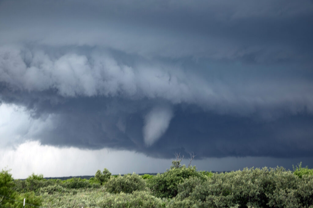
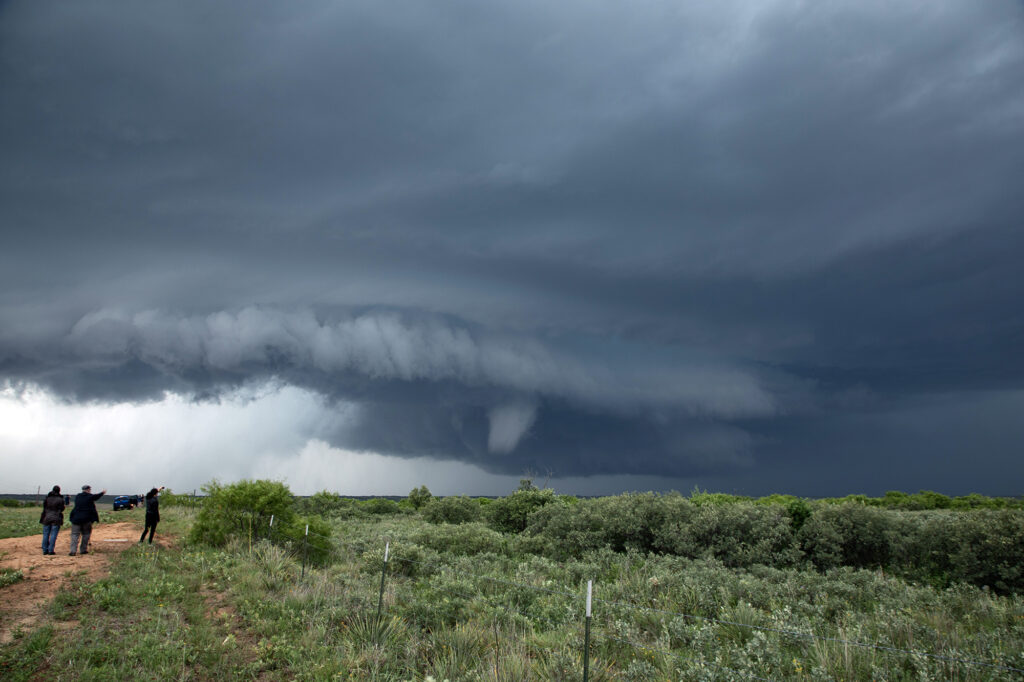
May 25th Afton, Texas Tornadic Supercell
May 25th looked like a high CAPE, lower shear day. A supercell formed west of Matador early in the afternoon, and drifted south along a boundary. It just never had the look like it wanted to produce. Flow around 850-700mb was lacking and it showed. Further south from town, we ended up near Afton on an FM road. Chaser traffic was pretty bad, but we managed to get out from under the hook and watched as the storm’s RFD really cranked up. A truncated cone funnel formed and reportedly touched down. Within a few minutes it dissipated and the storm became outflow dominant. Still in chase mode, we targeted a new supercell southwest of Haskell. By the time we got there, the tail end storm rapidly intensified. Reports of a brief tornado came in, but from our location northeast of the updraft, looking down the notch, we could not confirm or deny. A couple of suspicious lowerings were observed, but that was about it. The electrification of this storm was other worldly! Eventually it weakened as a cluster formed, so we blew it off and headed back to Oklahoma City for other chase day. An exciting day that we all enjoyed some edge of your seats chasing! We hope you like the photos!
No comments yet.