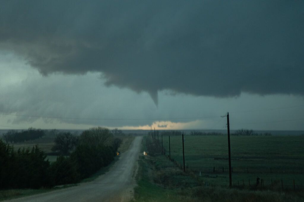
June 3rd looked like a day with abundant moisture and CAPE, but fairly weak shear. We knew we’d need a boundary interaction to produce some rotating storms to get a tornado to form. We dropped south from OKC to Wichita Falls, TX to play a developing supercell. The cell quickly took on an outflow dominant look, so we decided to drop south of it and see if anything else would form. As we did near Archer City, a new updraft formed and merged with the old storm. An outflow boundary surged south from Oklahoma convection and smashed into our newly intensifying cell. Just what we needed! Soon, the low levels started spinning wildly! A couple of small funnels would form and dissipate. Then as rain and huge hail wrapped around the mesocyclone, a large cone funnel formed back in the rain. We could never confirm if it touched down or not, but usually when it is 3/4 of the way down, you would assume there would be a circulation. The darkened pic to highlight the funnel is courtesy of SLT guide James Breitenbach. It is certainly compelling that it could have touched down! Excuse the blurry image as I accidentally hit the focus ring as I sat the camcorder on the dash! Ugh….
May 25th Afton, Texas Tornadic Supercell
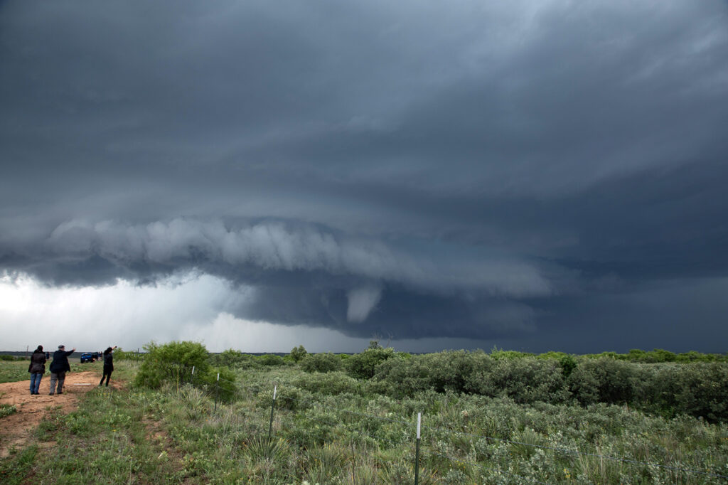
May 25th looked like a high CAPE, lower shear day. A supercell formed west of Matador early in the afternoon, and drifted south along a boundary. It just never had the look like it wanted to produce. Flow around 850-700mb was lacking and it showed. Further south from town, we ended up near Afton on an FM road. Chaser traffic was pretty bad, but we managed to get out from under the hook and watched as the storm’s RFD really cranked up. A truncated cone funnel formed and reportedly touched down. Within a few minutes it dissipated and the storm became outflow dominant. Still in chase mode, we targeted a new supercell southwest of Haskell. By the time we got there, the tail end storm rapidly intensified. Reports of a brief tornado came in, but from our location northeast of the updraft, looking down the notch, we could not confirm or deny. A couple of suspicious lowerings were observed, but that was about it. The electrification of this storm was other worldly! Eventually it weakened as a cluster formed, so we blew it off and headed back to Oklahoma City for other chase day. An exciting day that we all enjoyed some edge of your seats chasing! We hope you like the photos!
April 23rd, 2025 Southwest Kansas Tornado Warned Supercells
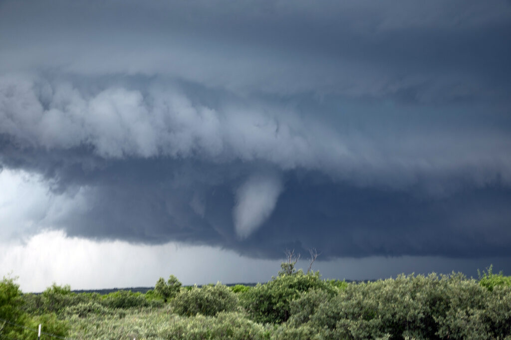
April 23rd took me to southwest Kansas. A surface low and triple point was southeast of Goodland. Models showed supercells developing on the dryline and interacting with the warm front as they moved northeast and were forecast to spin hard there. That’s exactly what happened. I intercepted one supercell near Healy, Kansas that attached itself to the warm front in an environment of high theta-e air and it became tornado warned. I had to drive through copious amounts of golfball sized hail to get to the hook and what a beauty it was!! Low bowl shaped wall cloud with rain/hail wrapping around it as it spun HARD. It tried to cone up a couple times but couldn’t maintain it’s tight rotation to get a tornado down. Eventually it moved into colder air north of the warm front and weakened. I dropped south to catch another developing supercell west of Kalvesta, Kansas. a massive bowl shaped lowering was spinning hard. It produced a tapered funnel halfway to the ground, but never did contact it. Structure was nice with that classic backward “C” shape to the RFD eroded updraft. It also crossed into colder air and weakened. By then it was almost dark and time to head to the hotel for the night. Fun day and enjoy the pics!