
May 21st Southwest Kansas Tornado Warned Supercells
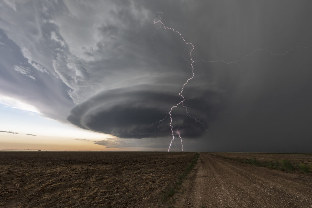
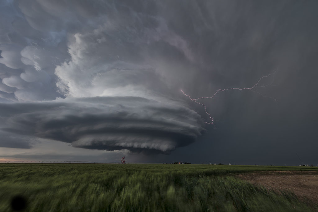
May 21st had a lot of potential. A surface low and triple point was over southwest Kansas. Strong instability, good shear and lift along the various boundaries would set the stage for intense, potentially tornadic supercells this day. We targeted the first intense storm to go up near Lamar, Colorado. It produced tons of hail, great lightning and a couple of weak landspouts. As it pushed east, a second storm formed and quickly became tornado warned. It had great structure and was quite severe. The best storm of the day, however formed near Satanta, Kansas and was an absolute treat to watch. Incredibly electrified and well structured, it persisted for a long time. Just before dark, it produced a couple of funnels, but just couldn’t get the circulations to the ground. One of my favorite chases of 2020 thus far! Please click on an image for a larger pic. Enjoy!!!
No comments yet.