
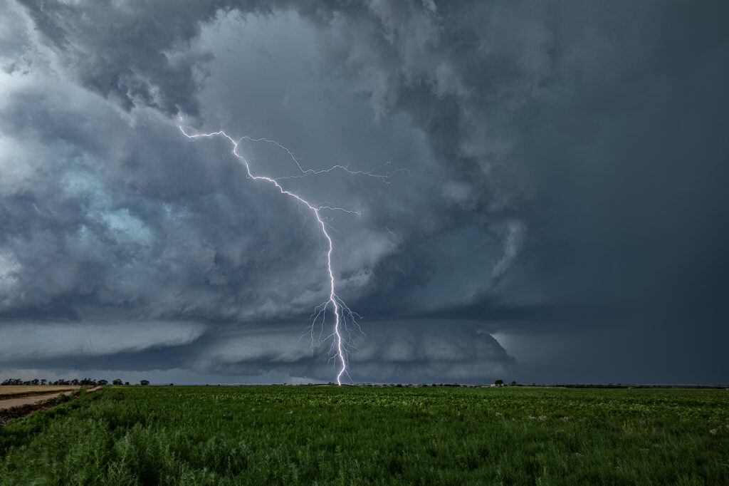
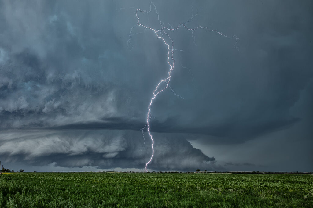
June 8th Lakeview, Texas Tornado Warned Supercell
June 8th featured a couple of different plays. First one could play the cold front dropping south across the high plains into the OK/TX panhandles. This ultimately produced one tornadic storm that was high based ingesting only dewpoints in the 50s, but still managed to drop a couple of tornadoes. The second play was to chase the area just off the caprock southeast of Amarillo along an outflow boundary with extreme instability and very high dewpoints in the 70s. We chose the southern play based on the great parameters. We arrived in Amarillo as cumulus towers formed southeast of town and developed into severe thunderstorms. One storm latched on to the boundary and spun like crazy, getting tornado warned. We stayed with it south of Claude all the way down to Lakeview and beyond. It was an electrified machine. It also produced huge hail and tried numerous times to produce a tornado. But it did not unfortunately. It was one of those days where the least likely area produced the only decent tornado of the day. Only a couple of chasers played the northern play and were coming from Denver headed to the southern target when the northern storm went up and produced. Luck of the draw lol!!! Anyway, our supercell was a beauty! It eventually gusted out so we moved southwest along the dryline to play more supercells. We encountered one near Jayton that came very close to producing a tornado. It was also tornado warned. Soon, everything merged into a line and the show was over. Fun day for all! Enjoy the pics!
No comments yet.