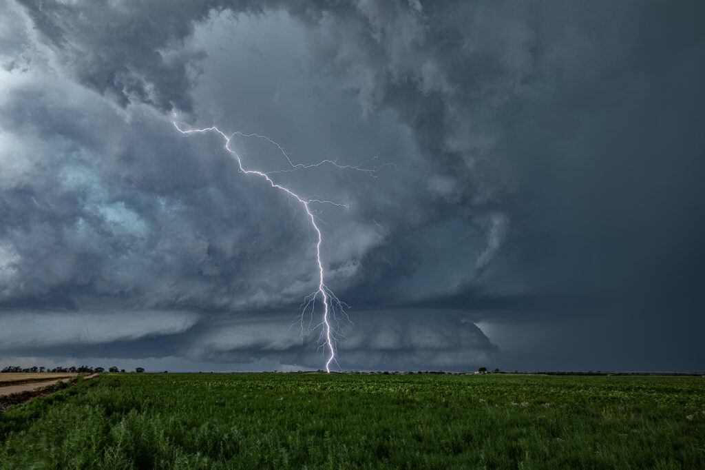
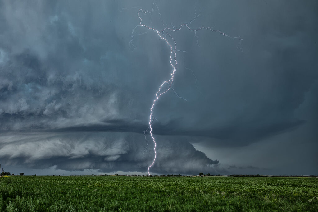
June 23rd we chose to chase the Texas panhandle were a stout dryline, good shear and instability were present. It was a long drive to make it there in time, but we did, intercepting 2 supercells, one near Happy and the other near Plainview. The latter supercell became tornado warned and had some interesting structure as well as great lightning, a couple gustnadoes, and a lot of mammatus clouds under the anvil. A lot of New Mexico smoke from wild fires covered the area and often gave the updrafts a yellowish tint to them. Cool coloring! A fun day and a couple really pretty supercells.
May 18th Northern Kansas Tornadic Supercells
May 18th was a good set up in Kansas. An outflow boundary laid across north of I-70 and a dryline stretched north/south along US highway 81. A significant supercell formed north of Salina and moved northeast, producing at least a couple brief tornadoes. Other supercells formed along the triple point and also became tornado warned. We chased SEVEN different supercells that had tornado warnings. The biggest problem this day wasn’t just the fact there was a lot of seeding going on, it was the shear number of chasers that were in the area. Sooner or later there will come a day when a large tornado hits a line of chasers and causes a lot of problems. Sometimes, it pays to stay back a bit and let the chaser hoards get close. But, great shear an 70 dewpoints certainly allowed for numerous tornado warned supercells to form. A few weak tornadoes did occur, and a few look a likes also that were reported as tornadoes, and were not. Enjoy the pics please!!
June 8th Lakeview, Texas Tornado Warned Supercell
June 8th featured a couple of different plays. First one could play the cold front dropping south across the high plains into the OK/TX panhandles. This ultimately produced one tornadic storm that was high based ingesting only dewpoints in the 50s, but still managed to drop a couple of tornadoes. The second play was to chase the area just off the caprock southeast of Amarillo along an outflow boundary with extreme instability and very high dewpoints in the 70s. We chose the southern play based on the great parameters. We arrived in Amarillo as cumulus towers formed southeast of town and developed into severe thunderstorms. One storm latched on to the boundary and spun like crazy, getting tornado warned. We stayed with it south of Claude all the way down to Lakeview and beyond. It was an electrified machine. It also produced huge hail and tried numerous times to produce a tornado. But it did not unfortunately. It was one of those days where the least likely area produced the only decent tornado of the day. Only a couple of chasers played the northern play and were coming from Denver headed to the southern target when the northern storm went up and produced. Luck of the draw lol!!! Anyway, our supercell was a beauty! It eventually gusted out so we moved southwest along the dryline to play more supercells. We encountered one near Jayton that came very close to producing a tornado. It was also tornado warned. Soon, everything merged into a line and the show was over. Fun day for all! Enjoy the pics!
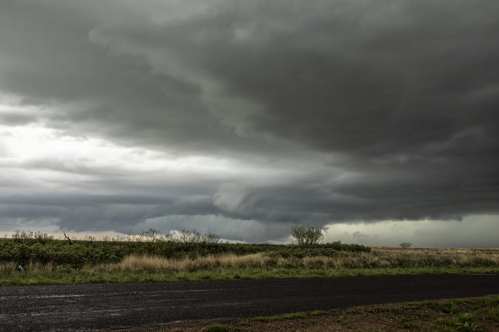
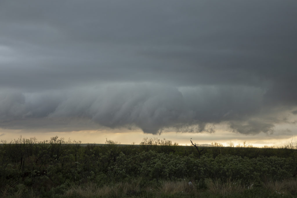
April 25th Muleshoe, Texas Tornadic Supercell
The arrival day for Tour #1 took us on an impromptu chase to west Texas. I knew it was a long way out and the we may or may not make it in time. We blasted west of Plainview just as the one decent (but short lived) tornado formed and dissipated. We arrived near Muleshoe to insane inflow winds into the supercell. Multiple wall clouds formed over the next 3 hours, but it just didn’t have that look. Areas of rotation formed, but never could tighten up enough to produce another tornado. The supercell persisted for many hours and was a prolific hail storm with stones up to 5 inches in diameter!!! Typically on arrival day, we restrict the chase within the state of Oklahoma, but this one was an exception, In the end, everyone enjoyed it, but a long way to go for what ended up transpiring, however it was tornado warned for several hours. Enjoy the pics!

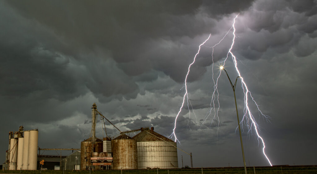
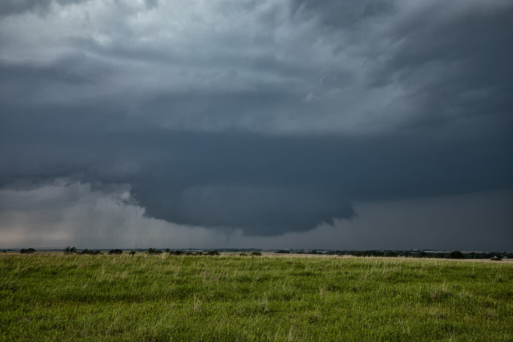
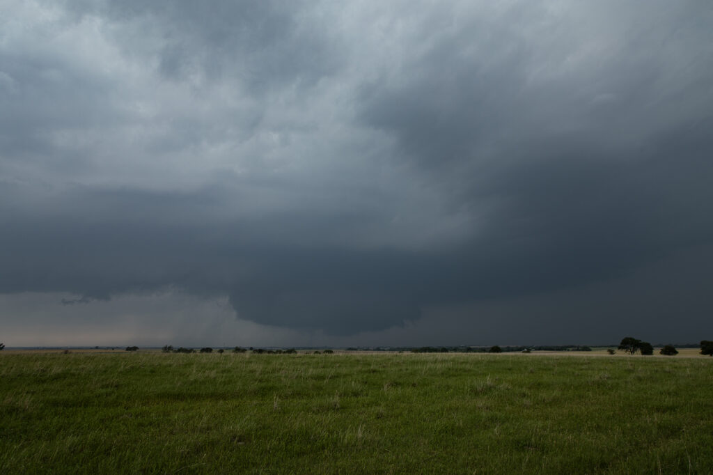
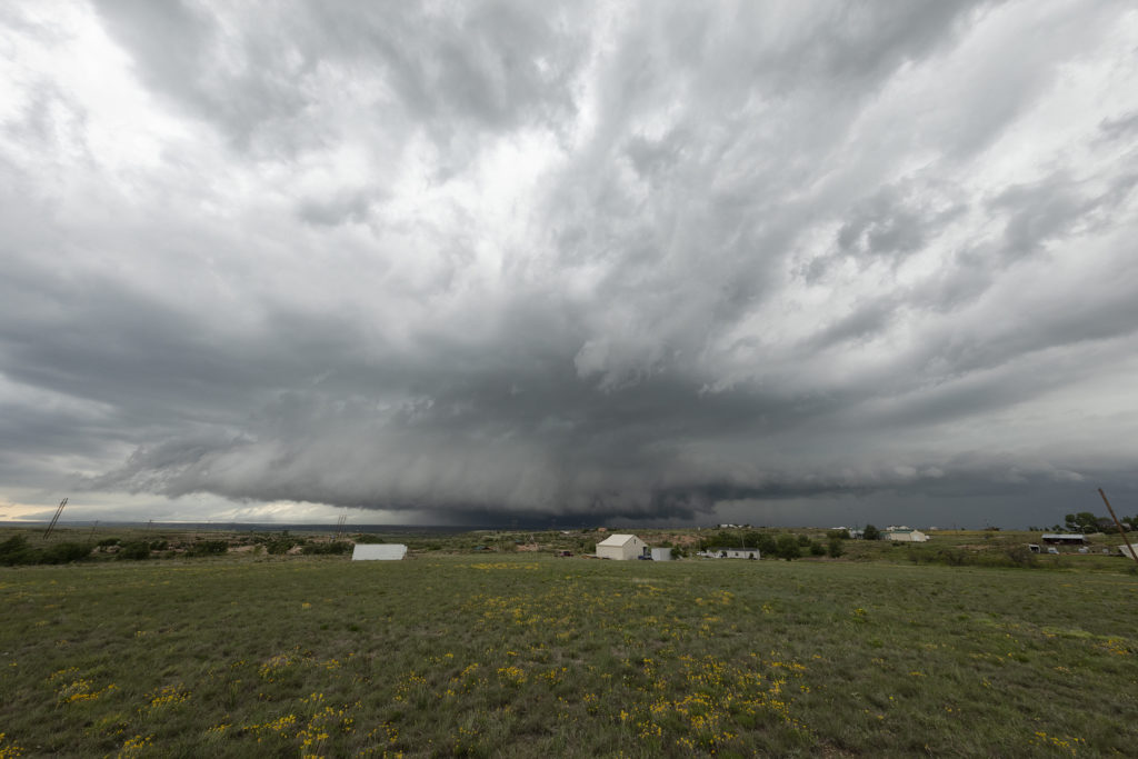
June 23rd Neptune, Saskatchewan Tornado Warned Supercell
June 23rd was the first day of Photo Tour #2. Models showed a triple point low over southern Saskatchewan, with a cold front/dry line extending south into northern Montana. We had a LONG was to go starting from Denver, with close to a 10-12 hour drive! So, we departed at sunrise and blasted north. We arrived in Wolf Point, Montana late afternoon as cumulus towers formed west toward Glasgow. Storms were already severe and tornado warned in Canada, with Environment Canada issuing a PDS (Particularly Dangerous Situation) tornado watch for parts of Saskatchewan. Knowing we still would have another 2-3 hour drive to make it up there, we decided to see what the Montana developing storms would do. SPC issued an MD for Montana talking about a couple supercells forming. We hedged our bets for Montana. Soon it became clear that was the wrong choice as storms formed as left moving supercells, so we crossed the border into Saskatchewan north of Plentywood, MT and blasted north towards the tornado warned supercell. We got within about 10 miles of it as the sun was setting so we stopped for photography. Structure was gorgeous and so were the pale blue and orange colors of the storms! We stayed with it the best we could and at one point a very dark, large “v” shaped lowering occurred although we could not tell whether it was a wall cloud or broad cone shaped funnel due to the distance we were from the storm. Having to get back to our border crossing, which closed at midnight, we waved goodbye and back tracked to get back into the US. A 1060 mile day that resulted in a stunning supercell near Neptune, Saskatchewan was well worth the drive! Enjoy the pics!


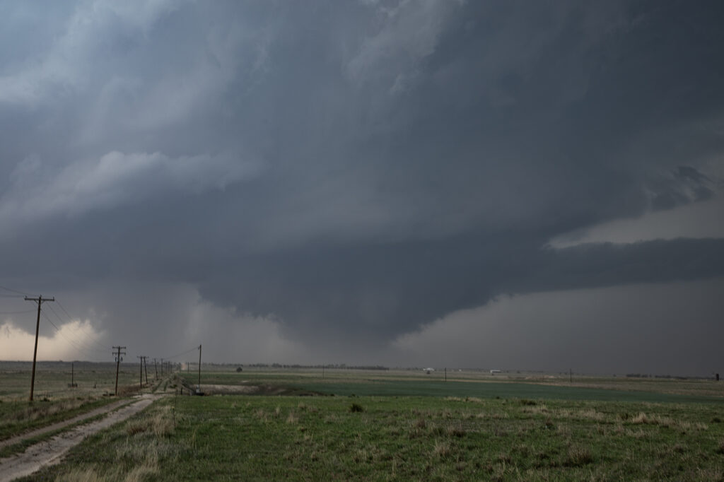
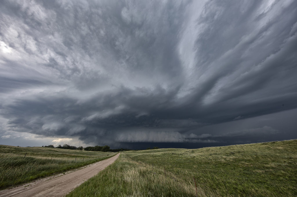
June 30th Kim, Colorado Tornado Warned Supercell
An interesting on June 30th. There was a fair potential for supercells but not a lot of potential for tornadoes due to lack of low level shear. By early afternoon storms formed east of Trinadad, CO. As they moved east, one storm became a supercell. We arrived at the time it pushed east towards Kim. It became tornado warned within 30 minutes. At one point it had a rotating wall cloud, but never looked like it would produce. Structure was decent and the hail very large, tennisball sized. Numerous storms formed later and merged into a squall line, producing a haboob over western Kansas. It’s always fun encountering a haboob as a wall of blowing dirt pushes away from the storms in the shape of a wedge. Fun day and great way to end the evening! Enjoy the pics!
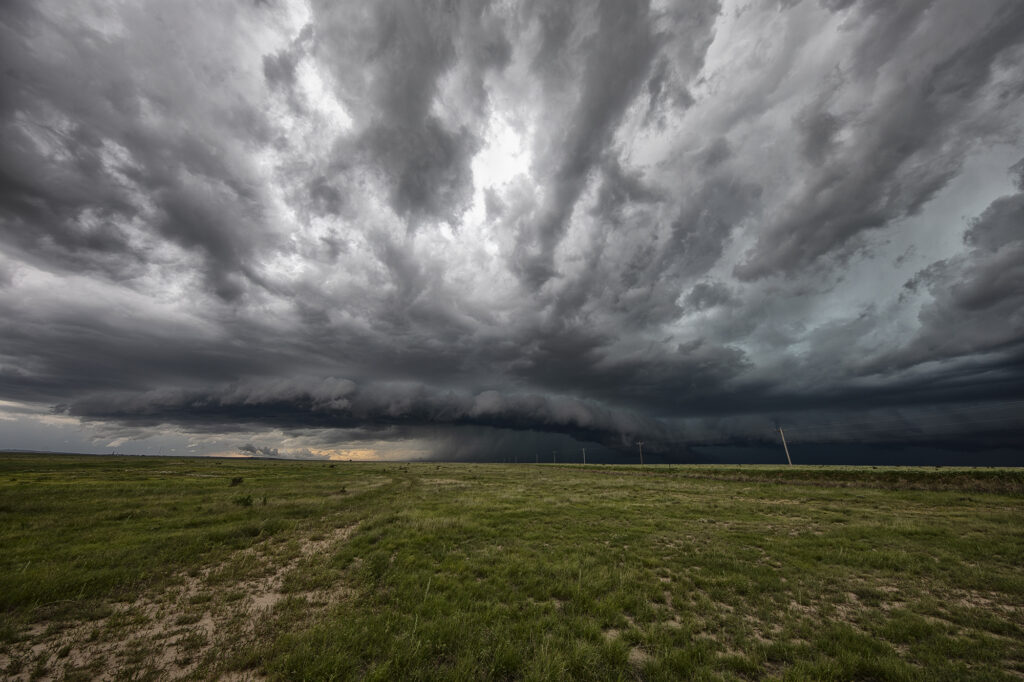
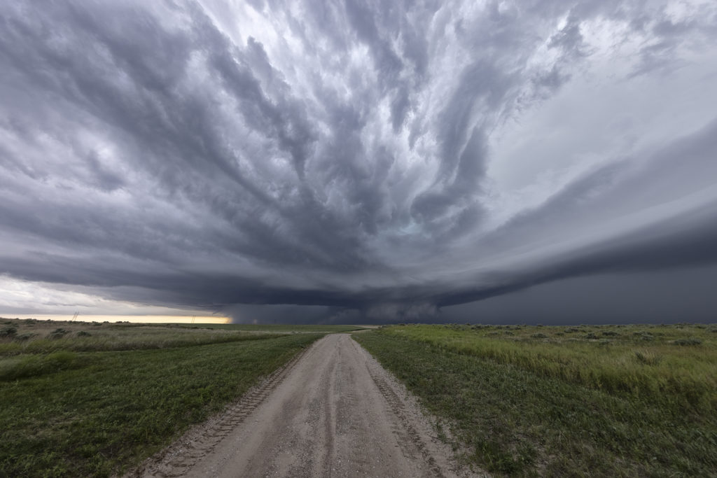
July 16th Central Nebraska Tornado Warned Supercell
July 16th featured very high dew points in the mid 70s and CAPE values over 3000 j/kg. Shear was modest, so we weren’t certain we would get supercells. An early day supercell over eastern Nebraska laid out an outflow boundary over central Nebraska from Valentine southeast towards Grand Island. Storms formed along this boundary and moved east into the cool stable air and died. Later in the afternoon a cluster of storms formed on the boundary and the tail end storm anchored. It immediately started spinning and became a formidable supercell! As the storm right turned on the boundary and moved towards Burwell, it was rotating strongly and was extremely electrified! I thought it had a decent chance to produce a tornado, but it did not. A couple of weak funnels did form. As the storm continued southeast, it became tornado warned with strong rotation continuing. Another supercell formed west of this and rotated down towards I-80 near Gibbon and also became tornado warned. The structure was incredible with one of the best shelf clouds I’ve seen in years! As the storms pushed south of I-80, they gusted out and became a wind machine. A great day with far better results than we were expecting! Enjoy the pics!
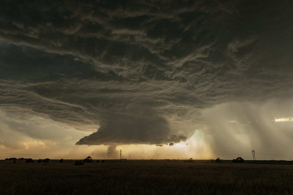
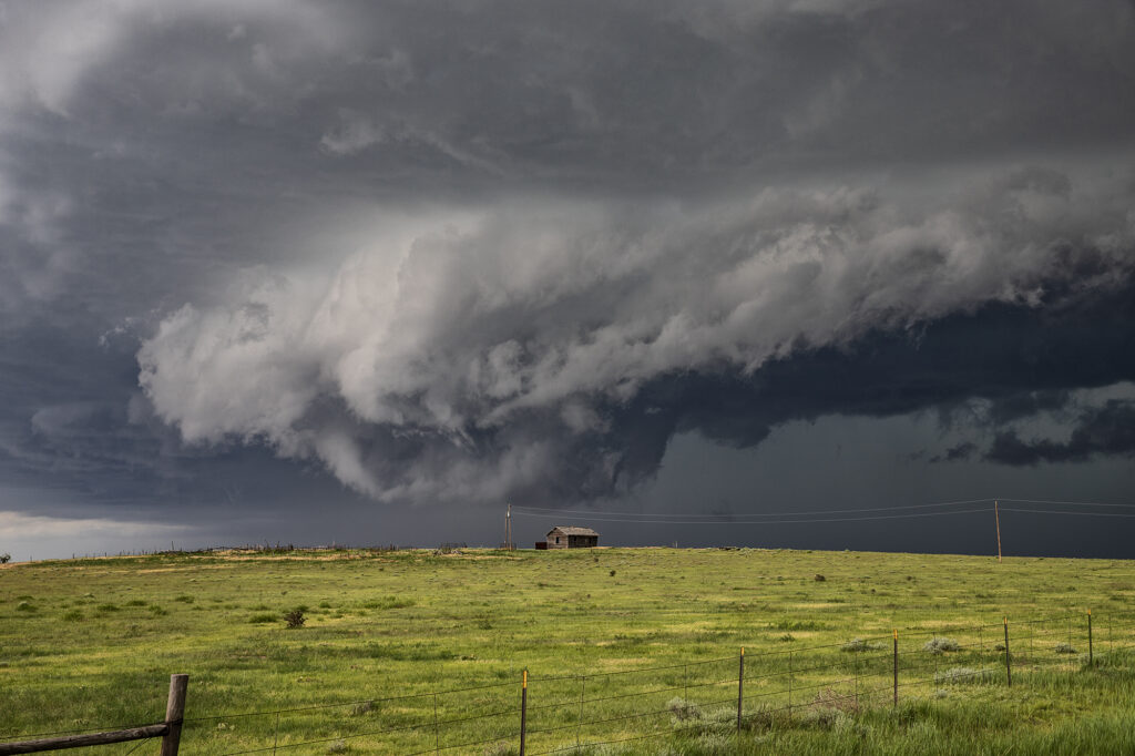
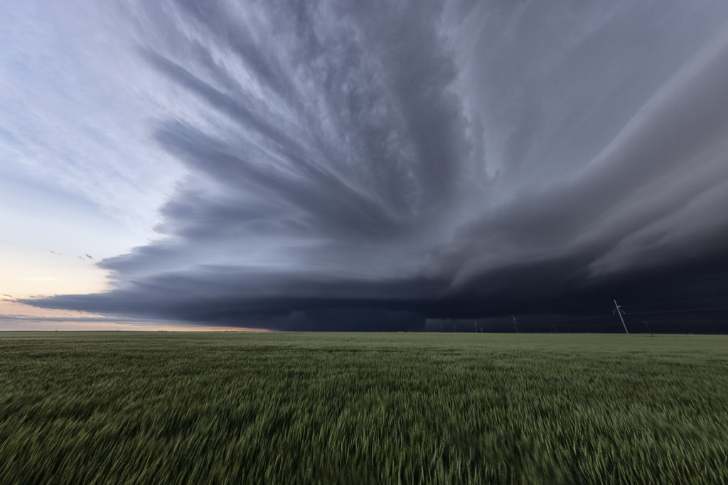
May 24th Southwest Kansas Tornado Warned Supercell
May 24th had substantial potential in western Kansas. A very moist and unstable airmass would develop over the region with multiple boundaries around for storms to form and spin on. We chose to play the usual triple point north of Leoti, where the first severe storm of the day formed. The triple point is the location where 3 air masses meet and it typically spawns one of the best storms of the day! It would struggle to sustain itself due to some small capping issues, but it eventually became tornado warned. However off to the north, a supercell formed and drifted north and produced tornadoes near Selden, Kansas. Since it’s a chasing rule never to leave your storm if it has a tornado warning to chase a different one (because, you KNOW what the one you left would do!), we stayed with it. More storms developed west of Garden City and would also become tornado warned. Our storm weakened, as did the Selden, Kansas storm, so south we went to play the tail end storm. What a beauty! Big, wet classic supercell with beautiful structure that would go on through the evening hours! At times the rotation became pretty tight, but it just couldn’t get a substantial tornado to the ground. We stayed with it till dark and then went back to Garden City for the night. Another day, where a secondary target produced tornadoes and the primary target would not. Such is the life of storm chasing! Please enjoy the pics!
May 7th Texas Tornado Warned Supercells
May 7th was advertised to be a strong tornado threat. In the end of the day, there really weren’t many tornadoes and none that were strong/violent. Too many storms would form and create a competition where none were able to be long lived tornado producing machines. We were able to chase 3 significant supercells, one near Stinnett, Texas, one near Amarillo and another near Tulia, Texas. The Tulia storm was the only one that produced, and even that was not significant. We arrived near Tulia a few minutes too late to see a weak bowl with a couple condensation fingers and also another small tornado. As we arrived, video caught a tornado in the distance about 10 miles away. The storm was high precipitation and very messy. We stayed with it as long as we could, however the caprock escarpment has few roads off of it and it made it impossible to stay with the storm. Later in the evening we chased 2 other tornado warned supercells in southwest Oklahoma near Hobart and Vinson. Fun day, a bit frustrating, but we still had several tornado warned storms to chase!
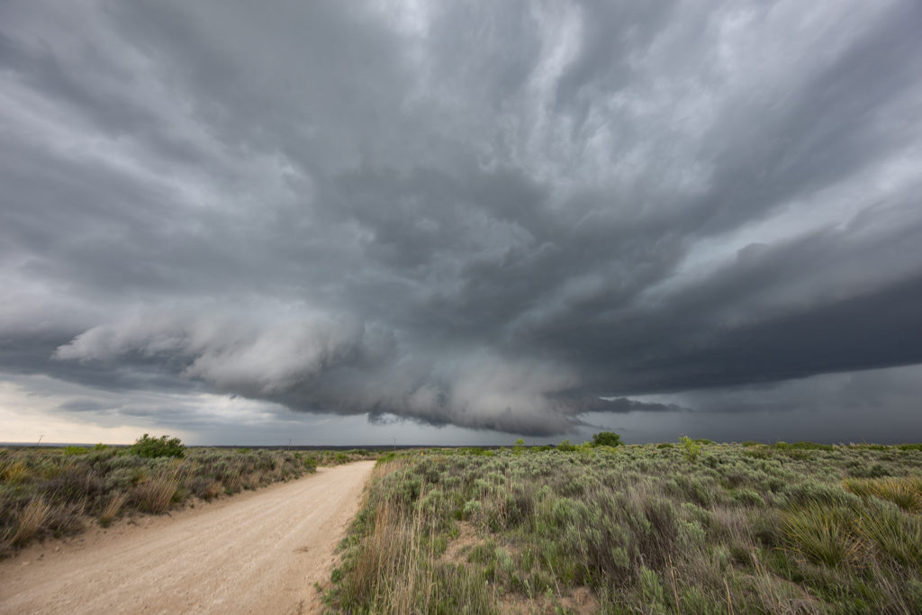
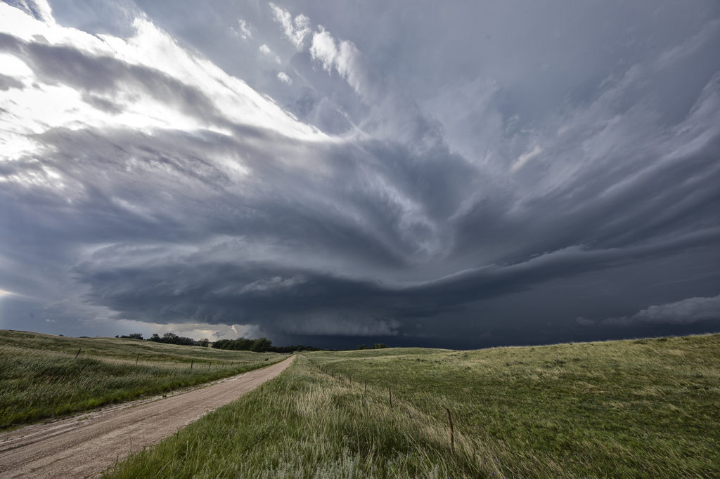
April 22nd Seminole, Texas Tornado Warned Supercell
Triple point action would be the play this day as a moist southeast surface flow would advect decent moisture northwestward towards a surface low in southwest Texas. By late afternoon, decent CAPE, moisture, shear and lift would result in a few storms developing at the triple point south of Seminole. After an hour of pulsing, one storm intensified and right turned along the boundary, becoming a supercell and eventually becoming tornado warned. It spun had as a very low hanging wall cloud would form. It just couldn’t focus in one area very long before shearing apart and a different area started spinning. As we moved east along highway 180, it became continuously tornado warned, but just couldn’t focus enough to produce. A couple of high based funnels occurred, as well as hail golfball size. If low level flow would have been a bit stronger, it may have eventually produced a tornado. By early evening the storm weakened and dissipated as the sunset and stabilization occurred. Fun day for us all!