
June 10th Marfa, Texas Supercell and Weak Tornado
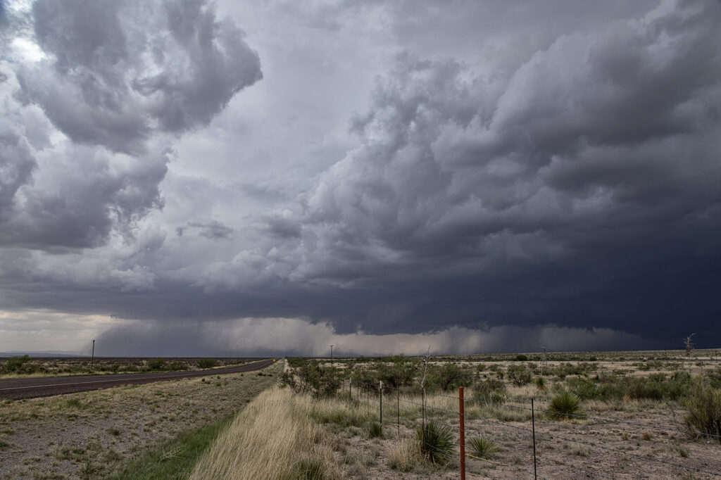
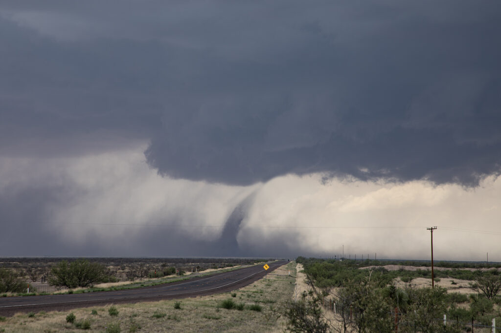
June 10th took us deep into southwest Texas in the Davis Mountains. One of the prettiest places in the state. Northwest flow aloft and southeast surface winds provided decent shear, and dewpoints in the low to mid 60s, fueled 3000 CAPE. The ingredients were there for severe storms and supercells. What we didn’t expect was to see a tornado, albeit a weak one! Mid afternoon we were near Alpine watching storms come off Mt Livermore and move southeast. The struggled mightily, so we left there and headed west to the surface triple point just west of Marfa. A supercell had formed and was anchored so we knew it would be spinning. As we arrived, a big blocky wall cloud was present with intense cgs raining down to our west. Soon a clear slot formed and you coudl see the RFD wrapping around the mesocyclone. Within another 15 minutes a dirt column formed and a small funnel was visible at cloud base. This persisted for about 8 minutes. What a surprise! The storm became outflow dominant due to weak flow at anvil level, and soon a tornado warning was issued (for the one we saw, but reported by another storm chaser!). We stayed with it for a bit longer until the outflow surged out from the supercell and it collapsed. A nice end to a day that we though would produce a decent storm. Enjoy the pics!
No comments yet.