
April 2nd Eastern Iowa Tornadic Supercell
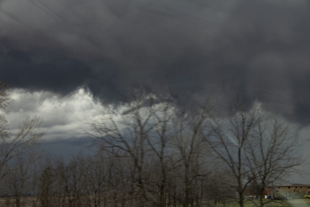
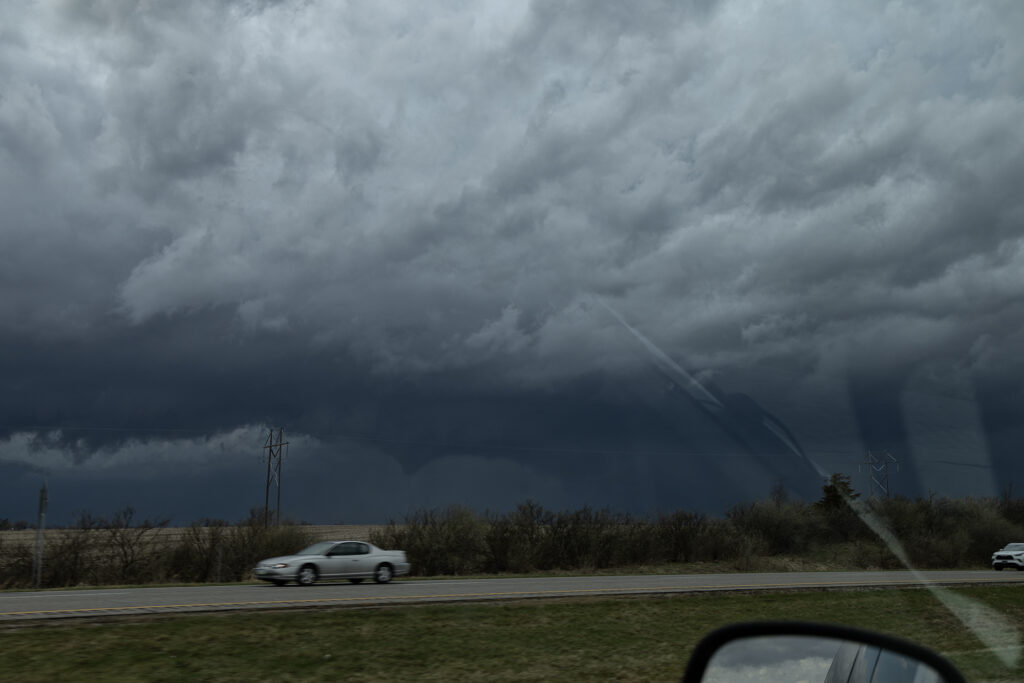
April 2nd had potential but there were a few flies in the ointment. First would storms form ahead of a surging front? Second would they form north of a warm front? The answer to these questions was soon resolved. An isolated supercell formed ahead of the front/squall line near Ottumwa, also south of the warm front. As it moved northeast, it strengthened and soon became tornado warned. Several times it produced funnels and even a couple of brief tornadoes as it moved just east of Iowa City. Eventually it was absorbed in the surging squall line. Structure on the supercell was decent, and it had low and mid level striations. Wall clouds were persistent the entire time it was tornado warned. It also produce hail to golfball sized. Fun chase day, but it is always difficult to stay up with storms moving at 60 mph!!
No comments yet.