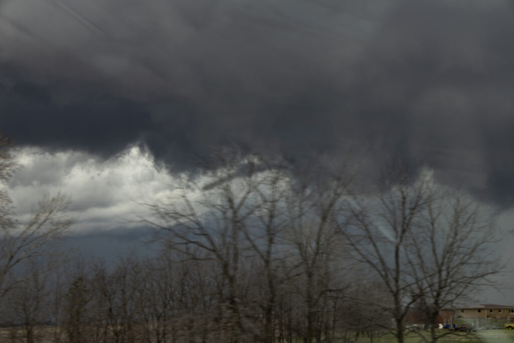
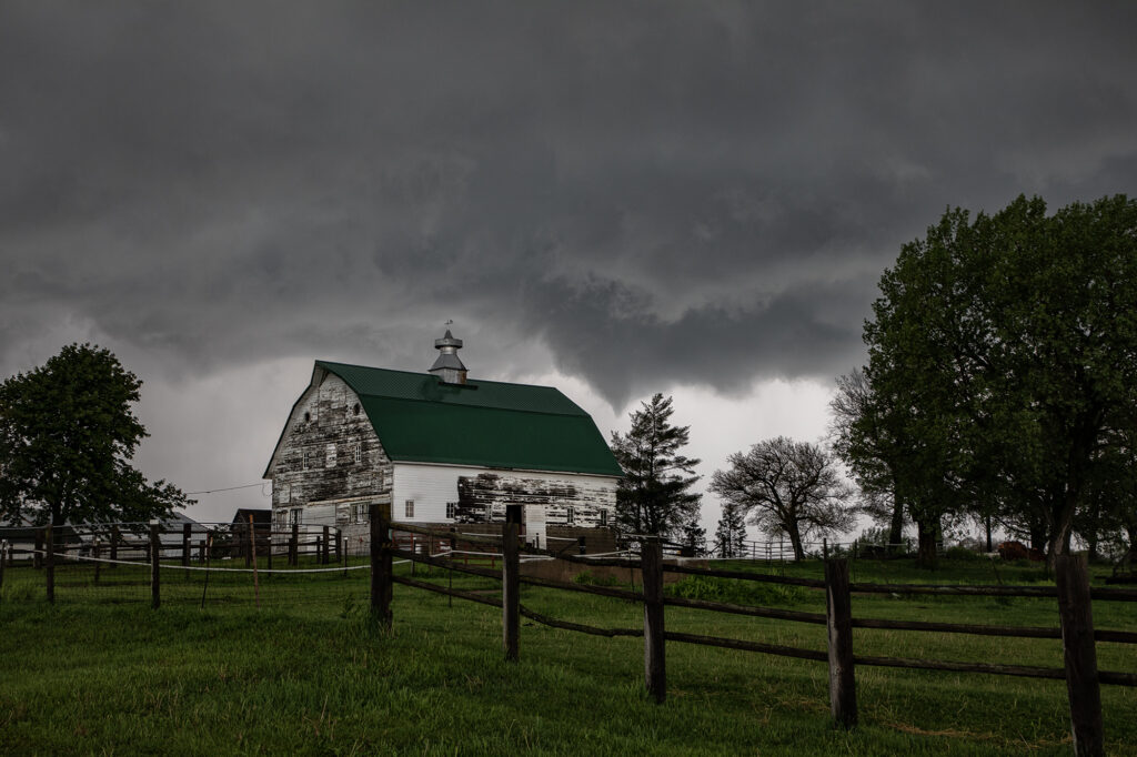
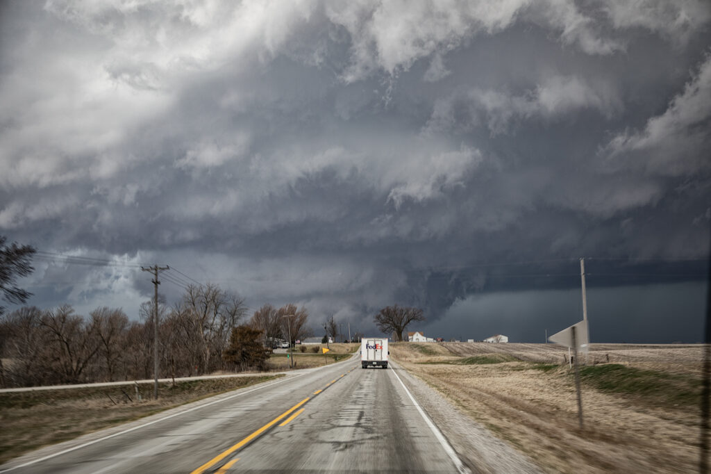
April 14th kept us in the northern plains. The same synoptic warm front/triple point from the 13th, was evident on the 14th centered northwest of Des Moines, Iowa. By mid afternoon storms formed there and intensified as they moved northeast. Near Eldora, Iowa, one supercell cranked up quickly and spun like a top. A rotating wall cloud formed, spinning wildly, and dropped a tornado that skipped across the ground for about 10 minutes causing some damage to farm buildings. After the storm occluded, the cell moved east towards Waterloo and kept having cell mergers which interfered with it’s ability to produce more tornadoes. East of Waterloo, near Masonville, it cranked back up and became tornado warned. A lowering/truncated cone funnel formed and wrapped quickly with rain. It touched down producing some minor damage as it stayed on the ground for several minutes. After it lifted, the storm became rain clogged as more cells developed merging with the parent supercell. At this point, having to be back in Denver the next day, we dropped south to Iowa City and headed west to Lincoln, NE for the night (arriving after midnight!). As did dropped south, another supercell developed a hook and became tornado warned as well. We could see the lowering, which 30 minutes later produced a pretty 3 minute tornado, as we headed westbound for the night. Overall a fun day, great storms, messy tornadoes, but everyone enjoyed it! Enjoy the pics! Video coming soon too!
April 2nd Eastern Iowa Tornadic Supercell
April 2nd had potential but there were a few flies in the ointment. First would storms form ahead of a surging front? Second would they form north of a warm front? The answer to these questions was soon resolved. An isolated supercell formed ahead of the front/squall line near Ottumwa, also south of the warm front. As it moved northeast, it strengthened and soon became tornado warned. Several times it produced funnels and even a couple of brief tornadoes as it moved just east of Iowa City. Eventually it was absorbed in the surging squall line. Structure on the supercell was decent, and it had low and mid level striations. Wall clouds were persistent the entire time it was tornado warned. It also produce hail to golfball sized. Fun chase day, but it is always difficult to stay up with storms moving at 60 mph!!
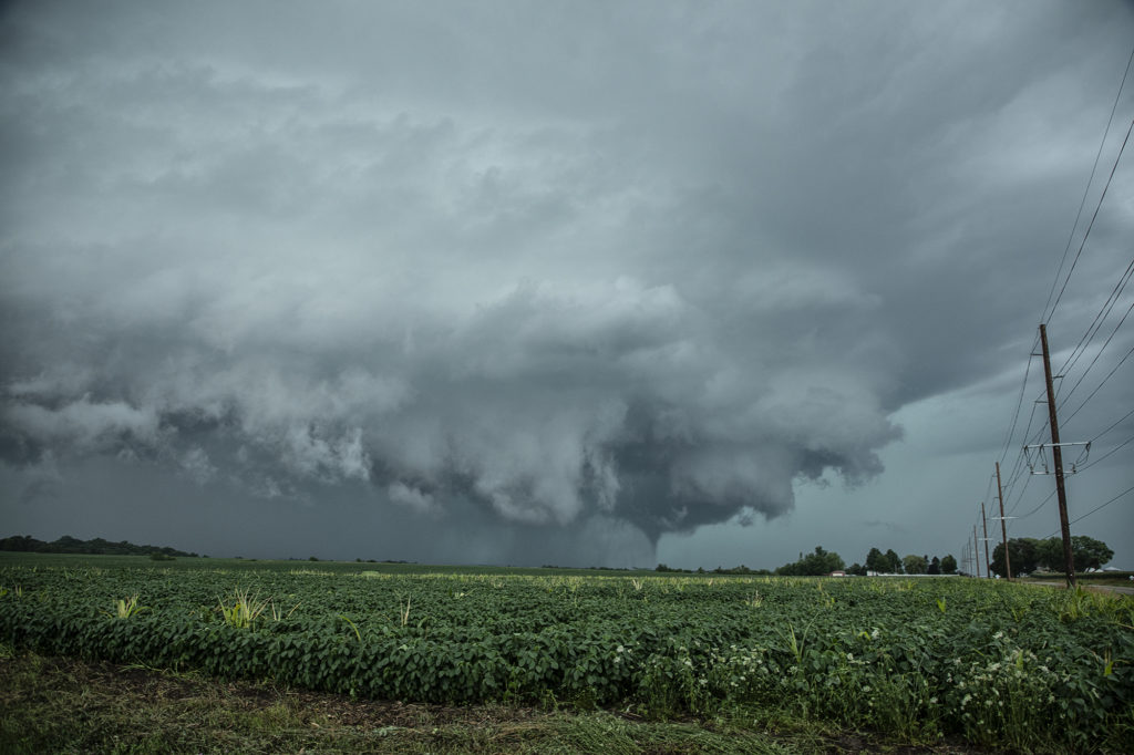
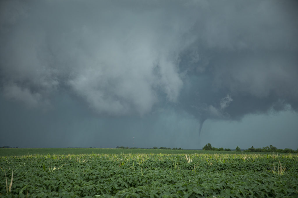
May 21st Southwest Iowa Tornado Outbreak
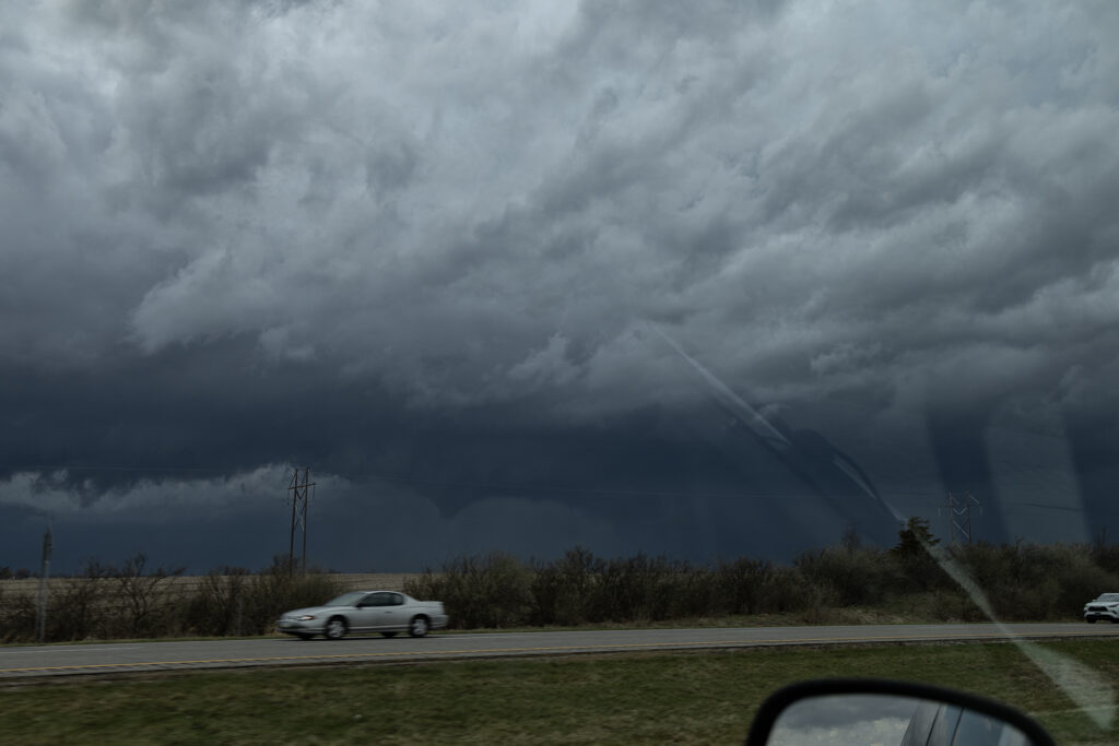
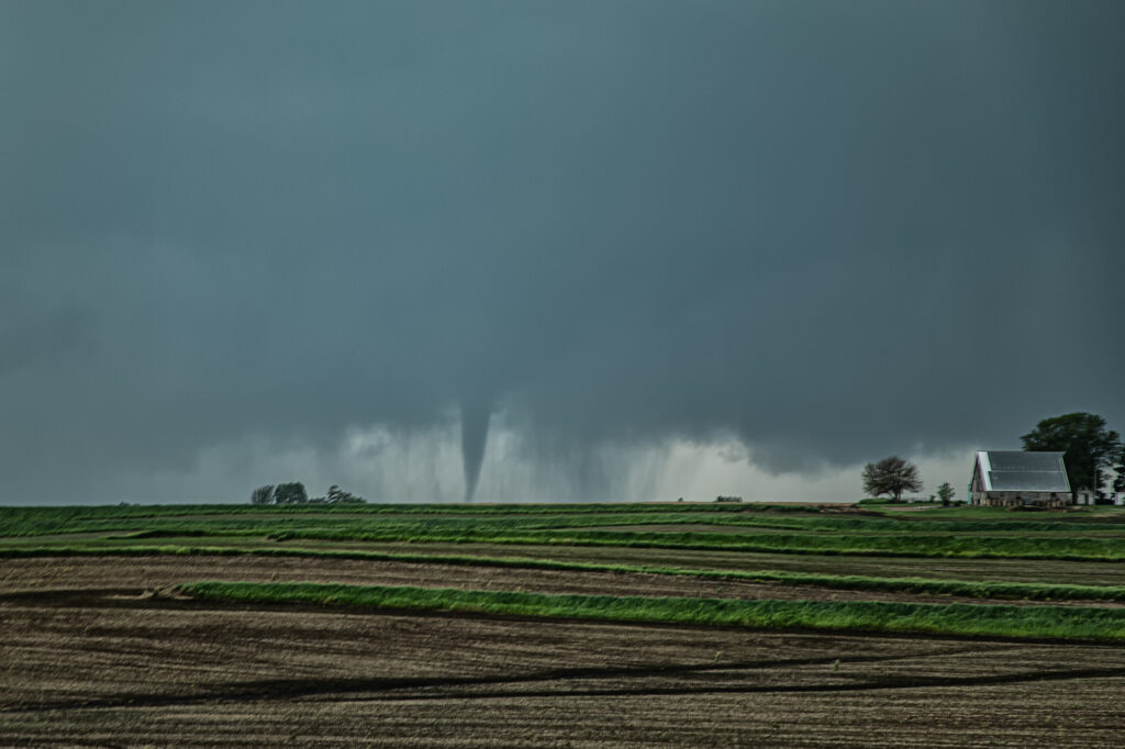
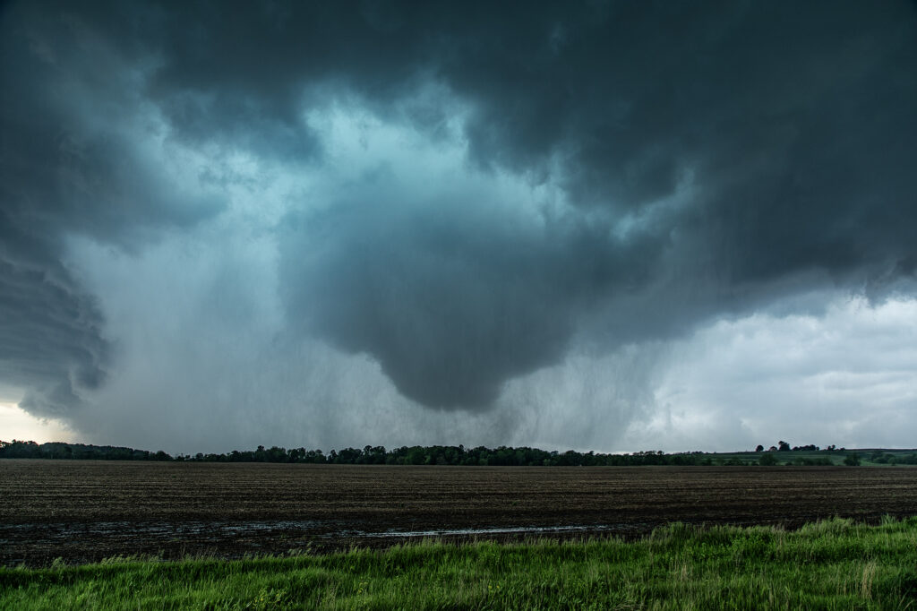
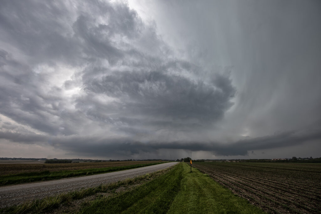
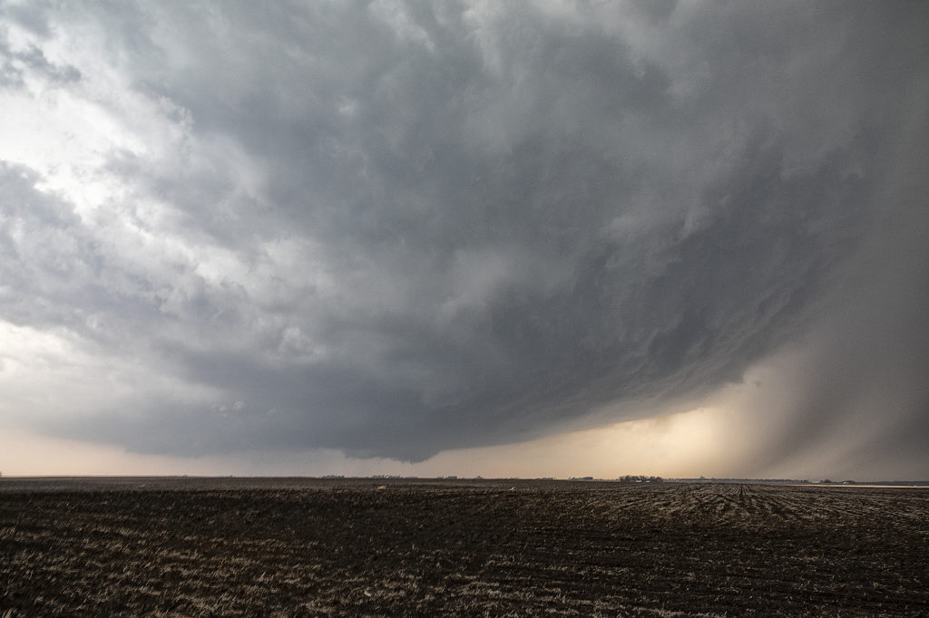
May 21st was a high potential set up in Iowa. A strong dry line, with fantastic shear, high CAPE and deep moisture would create a very dangerous environment in Iowa. By early afternoon storms exploded along the dry line and intensified as they moved east. Initial storms were not tornadic, but as the afternoon progressed, low level shear increased and tornadoes occurred with many storms! Our first tornado intercept was near Red Oak, Iowa as a supercell started spinning hard. The tornado went from a slender elephant trunk to a stovepipe and persisted for several minutes. The second tornado formed southwest of Carbon. It started as a big bowl, then vortices spun up and wrapping rain curtains were rotating violently around it. With motions of 60 mph we had to get out of its way as it approached us within a mile. The next tornado is now probably the most well-known. A strong multivortex tornado formed to our south near Corning and intensified as it moved northeast. It eventually turned into a raging F3 tornado that caused significant loss of property and life in the town of Greenfield. Our heartfelt sympathies go out to those who suffered losses there. Always the downside of significant tornadoes. Another tornado occurred to our southeast as a cell raced north towards Creston but we lost it due to storm motion and another core with huge hail causing us to have to slow down. Crazy, wild day that most will never forget.
April 30th Red Oak, Iowa Tornado Warned Supercell
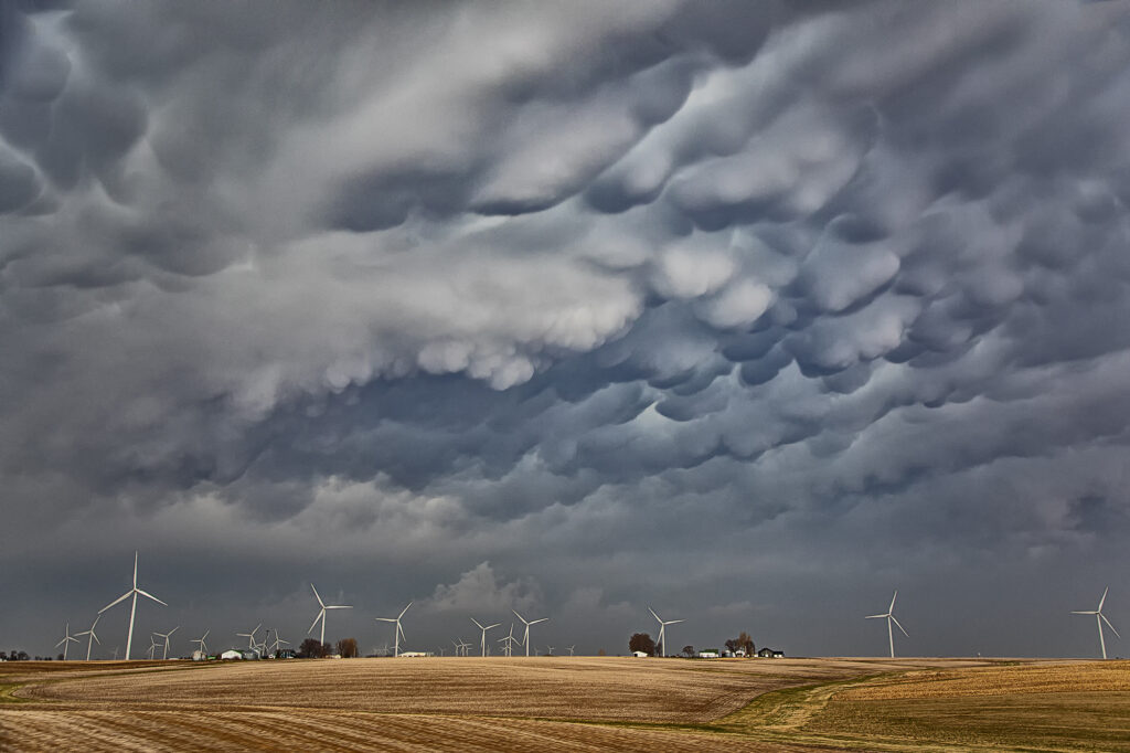
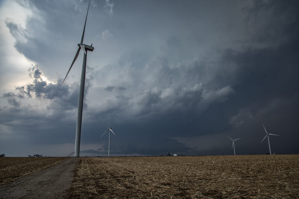
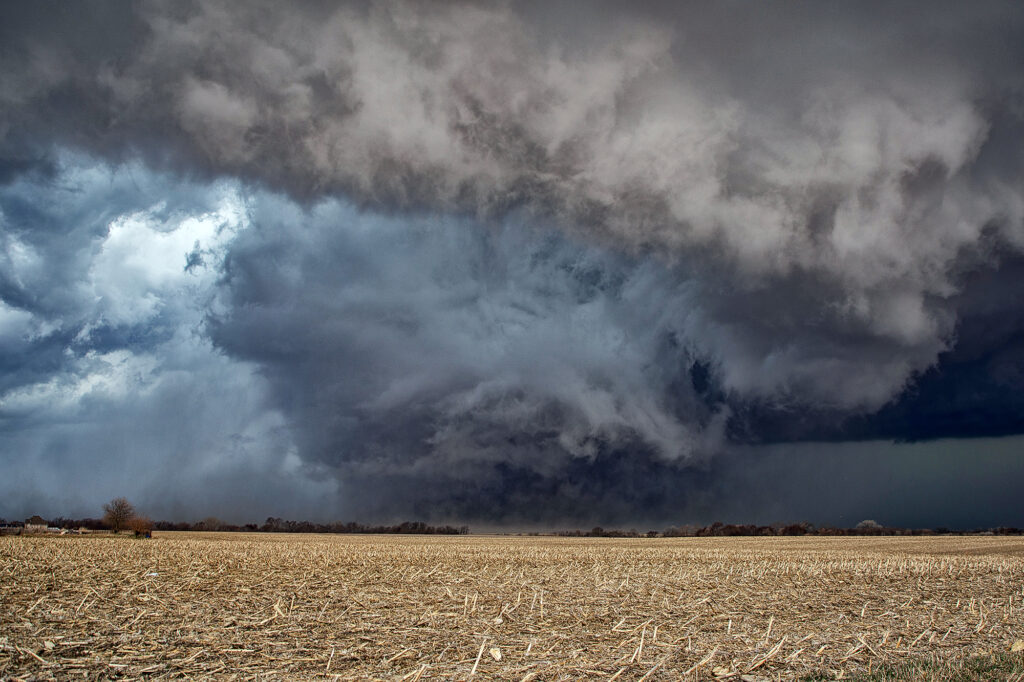
April 30th provided a fast moving, but strong upper level system across the central states. Moisture was sparse, but racing north of southerly low let jet winds. We knew it would be close to get enough good moisture to allow cloud bases to be low enough to produce tornadoes in Iowa. By mid afternoon clusters of storms for in southeast Nebraska. One such storm intensified as it moved into southwest Iowa. It became severe as it moved further east and eventually became tornado warned. On radar it looked like a classic tornadic supercell, but in real life, it’s base was just a tad too high to produce tornadoes. It was a prolific hailer and had nice structure. At one point it had a very large wall cloud that had the look. However, it could never maintain tightened rotation, only broad slow motion. A pretty storm, but just couldn’t produce any tornadoes. A fun day nonetheless!
April 26th Iowa Violent Tornado Outbreak
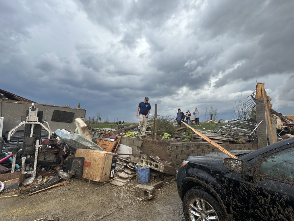
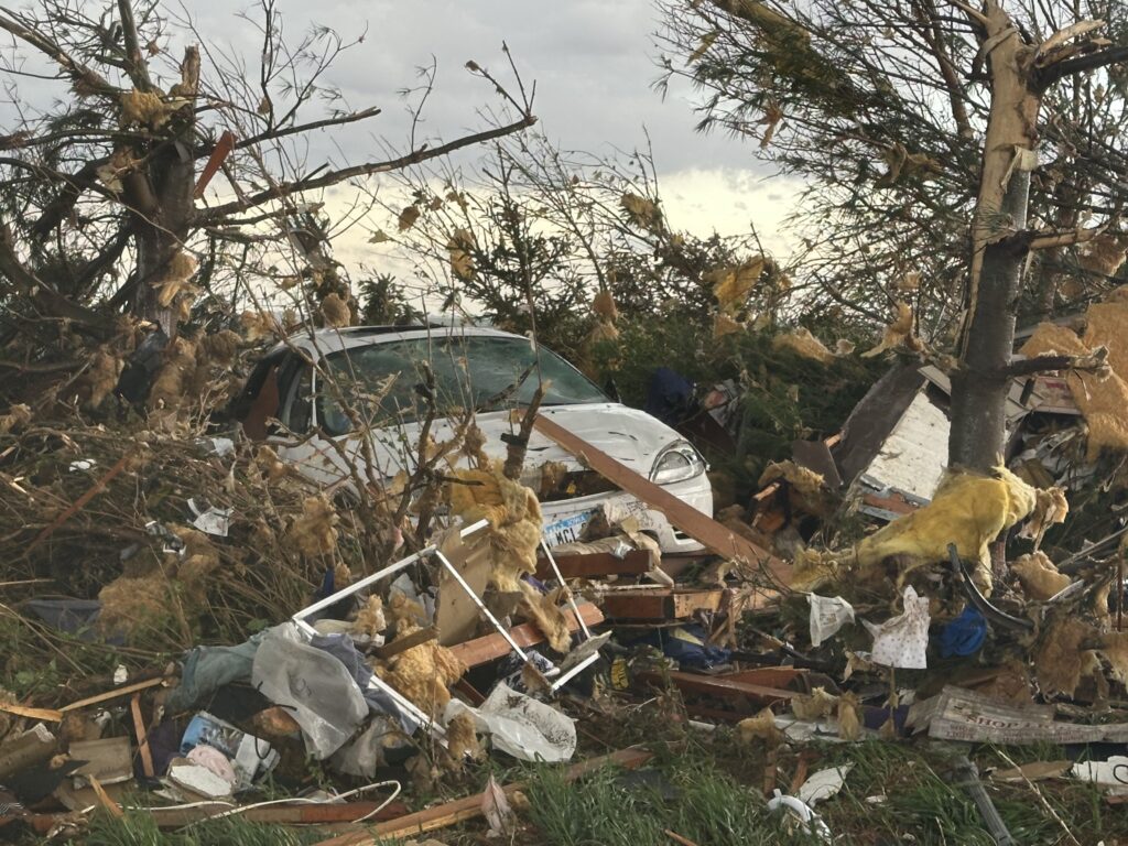
April 26th had the appearance of a major tornado outbreak. It certainly lived up to the hype! We had spent the night in Salina, Kansas and targeted Nebraska City, NE to Creston, Iowa for tornadic supercells. Strong wind shear, with dew points in the lower 60s and surface based instability of 2500 CAPE would set the stage for the event. We arrived in the Nebraska City area mid afternoon, as a supercell produced a couple of tornadoes between Lincoln and Omaha, Nebraska. Due to storm motion and speed, we could not catch up to it, so we decided to stay put. An hour later storms erupted along a confluence line near the Missouri river and quickly gained rotation. Near Council Bluffs we decided to go east and get in front of a tornado warned storm. When we saw it, it was ready to produce a tornado. As it approached a cone shaped tornado formed, turning into an 800 yard wide EF3 wedge tornado as it crossed the road within a half mile of us. It completely destroyed 2 farmsteads along highway 92 and as we approached them, nobody was there to help the residents. We immediately stopped and went into search and rescue mode. We found a family trapped in their storm shelter as their home collapsed on them. After removing a lot of debris as a few other chasers stopped to help, we were able to get them freed. Shook up, but healthy, attention turned to the other farm. An elderly woman and her dog were buried in debris as her house was demolished except for the walls. They also were able to be rescued. Soon paramedics and the local fire department arrived as we directed them to the residents and told them about propane tank leaks. At that point, it was time for us to leave and let the authorities do their jobs they did so well!
By the time we were able to depart the scene, it was too late to keep chasing as the tornadic supercell was 15 miles north moving away. It went on and produced more strong tornadoes near Minden and Harlen as we turned south to make the journey back to Oklahoma City. I do NOT regret missing the other tornadoes to stop and render help to those in need. Given the opportunity to do it again, there would be no hesitation!!! People are far more important than weather. Thanks to all who stopped that day to help families in desperate need of assistance.
May 13th Pleasantville, Iowa Tornadoes
May 13th showed significant moisture and instability along a warm front and outflow boundary from previous days’ convection. The boundaries met and formed a triple point southwest of Des Moines, Iowa. Storms fired very early by 1pm and became tornado warned. Nothing significant formed but we stayed with them. Several false reports of multivortex tornadoes occurred, which has been the case all spring. The old philosophy of if you aren’t sure it’s a tornado, it is not one should be taken by many storm chasers! Numerous tornado warnings were issued, and the monster supercell spun like crazy. It eventually weakened as it moved east off the boundary. Another supercell formed southwest of Pleasantville and produce at least 3 tornadoes that we witnessed. A multivortex, an elephant trunk and then another multivortex that was less than a quarter mile from us! The motion was incredible right over the vans as this tornadic storm drifted northeast and produced. An overall exciting day that the guests loved! Enjoy the pics!!!!
April 4th Pleasantville, IA Tornadic Supercell
April 4th was a complicated day. A powerful upper level low would pivot out onto the plains late in the period. Low level moisture was fairly shallow for a big event, with pockets of dry air mixing out the better moisture. It seemed like two areas would be the best targets: 1) southwest Iowa as the forcing came out, however moisture was forecast to mix (and did!), 2) southeast Iowa and western Illinois in the free warm sector. We sat in Ottumwa for a couple hours waiting for one target to become clear. It never really did. A cluster of storms formed in eastern Missouri and consolidated into a few supercells as they moved into western IL. We started to head that way to chase, but it would have been a long way back to Kansas City that night as several guests had to be back in Denver by late afternoon the next day. Shortly after we headed out to go to IL, the Iowa play started forming. A line of storms, now severe, formed along the dryline west of Osceola and moved east. The tail end storm really started getting it’s act together so we quickly turned around and headed toward Pella (where we saw a tornado 2 years ago!). As we approached Pella, a tornado warning came out with a confirmed tornado towards Pleasantville, which was another 15 miles west. We did all we could to get there, but were only able to get a glimpse of the pretty tornado before it dissipated. We stayed with the supercell as it approached the warm front and became tornado warned again. A brief spin up happened south of Malcom. The storm continued its path across the warm front, weakening in the colder air. Here’s a few pics of what we saw with the supercell, distant tornado and the second spin up. Enjoy!!!!
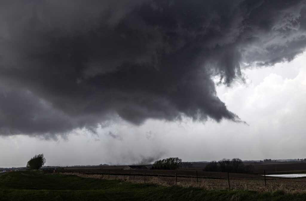
March 31st Ollie, Iowa Violent Tornado
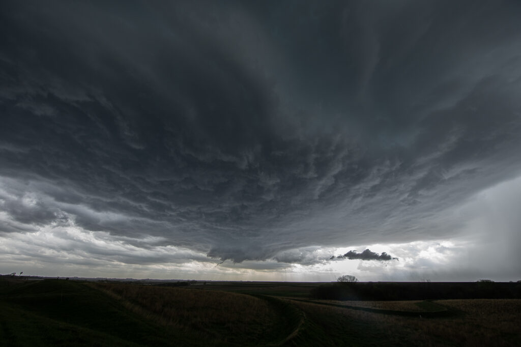
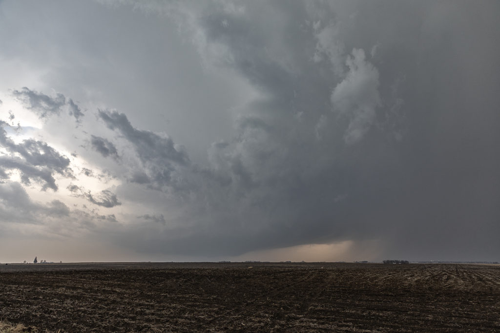
An extremely volatile day was in store on March 31st. A powerful trough was moving out of the Rockies onto the plains as a surface low intensified north of Omaha. We took our on call tour towards the Des Moines area in anticipation of rapid supercell formation early afternoon. The dryline lit up like a Christmas tree shortly after noon as storms raced northeast at 60-70 mph! Strong shear, good moisture and instability and a strong jet would fuel these storms. By 2pm a large thunderstorm formed in northwest Missouri and rapidly moved northeast, becoming tornado warned as it approached Ottumwa, Iowa. We moved to position ourselves in front of it to see what it could produce. We approached the small town of Packwood as a cone tornado stabbed down to the ground west of us and grew to massive proportions.
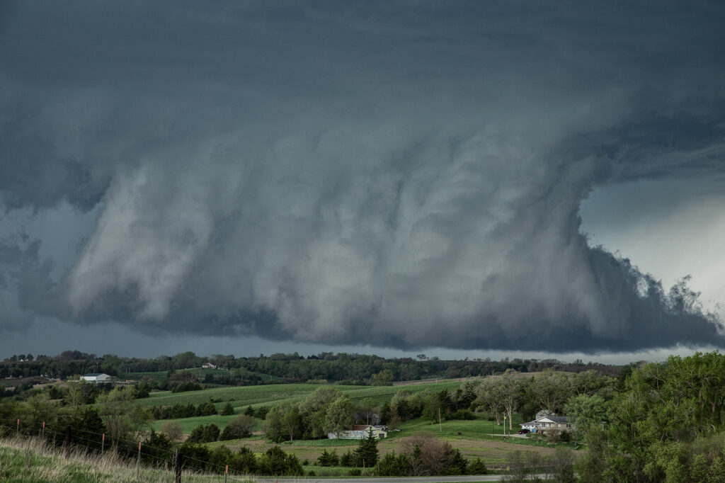
As we drove west on highway 78 towards Hedrick, the tornado wedged out becoming a massive twister less than a mile from us! The roar of the tornado and rear flank downdrafts winds filled the senses with the sound of a rushing waterfall. Due to fast storm motions and the unfortunate road closures in the area, we were only able to stay with it for about 15 miles before we lost it. This tornado caused a lot of damage, but fortunately no fatalities. It has been officially rated EF-4 by the National Weather Service.
Our thoughts and prayers go out to anyone affected throughout the central and southern plains this day as 60 tornadoes raked the region causing many casualties and much damage.
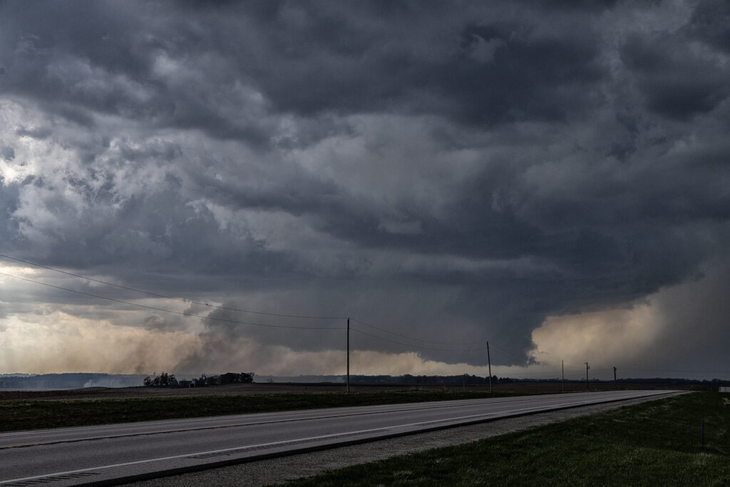
April 12th, 2022 Gilmore City, Iowa Strong Tornado
April 12th had a lot going for it. The problem was there were two clear targets. Play the better moisture, but less shear in central Texas, or play the warm front with a bit less moisture but better shear in Iowa. We started the morning in Oklahoma City and made the decision at 6am to head to Iowa, while looking over our shoulder at Texas. At the end of the day, both targets produced strong tornadoes! As we headed north it became pretty clear that the warm front was going to be our target with a strong theta-e axis slamming into it, instead of playing the triple point back northwest of Omaha. That decision was a good one as by mid afternoon, the warm front lit up with intense storms, some of which were supercells.
We had over a 500 mile trip to get into position and we made it by minutes! We stopped in Dakota City for fuel quickly and then headed west, to just east of Gilmore City. The supercell became tornado warned as we left Dakota City. So, with storm motion showing 50 mph plus, we positioned ourselves about 6-10 miles down wind of the storm, figuring it would take a few minutes for it to become tornadic. It sure didn’t wait long! I wish we would have gone a couple more miles south to get closer, but as the tornado formed, we decided to stay put so as not to miss any of it and thought it would come very close to us. The models showed the potential of long tracked tornadoes, however this one dissipated as it came about a mile to our west. We stayed with the supercell for awhile as it became very messy and hp in nature. Eventually we blew it off, as we knew we had to be in Arkansas the next day, and stopped to watch an electrified storm on the way to our hotel.
Great day, beautiful storms and fortunately there were no injuries or fatalities from the tornadoes! Enjoy the pics!
July 14th Central Iowa Tornadoes
July 14th had it all. Boundary, great moisture, instability and good low level shear. We blasted from Pierre, SD to central Iowa as storms formed and became severe and tornado warned. Several tornadoes did occur in central and eastern Iowa with one particular tornado we just missed by 15 minutes being the most intense near Lake City. Frustrating day to say the least, but we still managed some great supercells and a tornado late in the day. Moral of the story is to NEVER give up until storms are weakening and loss of heating reduce instability.