Good shear, but limited moisture would be the problem this day. Storms formed along a cold front in central Oklahoma by mid afternoon, but were high based. We were watching a cluster of towers west of Lawton and hoped something would form from them. Later in the afternoon, they did just that. A supercell emerged and produced baseball sized hail. Early evening it became tornado warned. It produced a couple of funnels but was moving into capped air and weakened. The setting sun made for a cool image as the updraft evaporated.
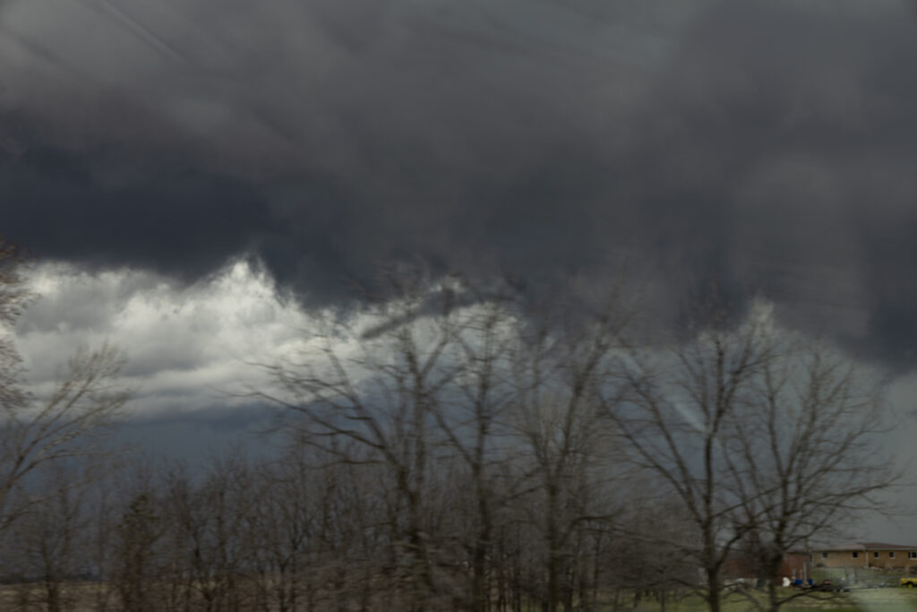
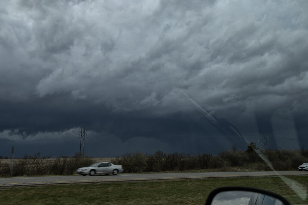
April 2nd Eastern Iowa Tornadic Supercell
April 2nd had potential but there were a few flies in the ointment. First would storms form ahead of a surging front? Second would they form north of a warm front? The answer to these questions was soon resolved. An isolated supercell formed ahead of the front/squall line near Ottumwa, also south of the warm front. As it moved northeast, it strengthened and soon became tornado warned. Several times it produced funnels and even a couple of brief tornadoes as it moved just east of Iowa City. Eventually it was absorbed in the surging squall line. Structure on the supercell was decent, and it had low and mid level striations. Wall clouds were persistent the entire time it was tornado warned. It also produce hail to golfball sized. Fun chase day, but it is always difficult to stay up with storms moving at 60 mph!!
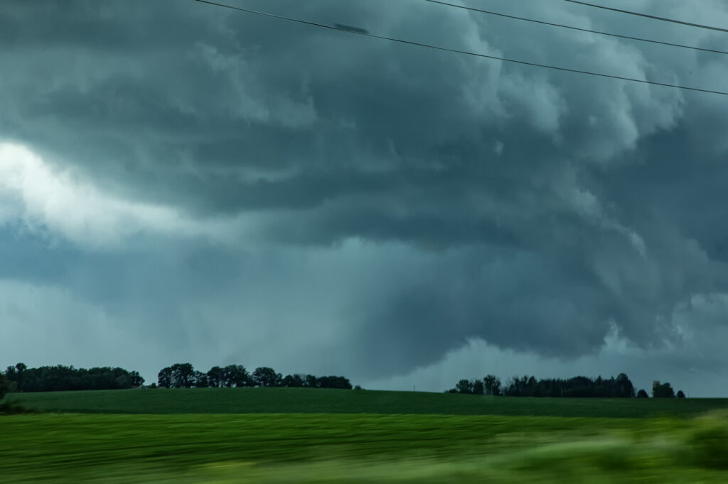
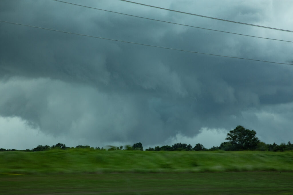
June 25th Southeast Minnesota Tornadic Supercells
June 25th was an unusual day to say the least. Very high dewpoints in the mid to upper 70s were present along a boundary in southern MN. This boundary slowly moved north through the day. As it did, storms formed along and just north of it from around Alber Lea north and northeast. We intercepted one such storm that was tornado warned. As it rode the boundary, it spun hard. It had a good velocity couplet on radar and developed low level rotation quite obvious! Soon a broad rotating lowering formed with condensation fingers rising into it. Then a funnel formed that we could not confirm touched down. There were tornado reports from other locals that were right near it. These types of set ups are extremely difficult to chase, let along witness a tornado with numerous storms along and north of the boundary. But it was a pretty fun day, with decent results!
July 7th Lubbock, Texas Supercells
A major change in the weather pattern started around July 5th. An expanding ridge was developing in the west, with one lone weak short wave dropping down the eastern side of it into the southern plains. This is very late in the season to be chasing that far south, but you chase what nature gives you! We headed south on the first day of the tour and were greeted with several high based storms, some rotating, northwest of Lubbock. A couple mid level funnels occurred, as did hail baseball sized, however, due to high bases, there was virtually no tornado threat. Tons of blowing dust happened as thunderstorm outflows became quite strong, and many gustnados formed. Pretty cool sight, but this would be the last day of this tour that would chase the plains states. Summer heat and ridging came early this year.


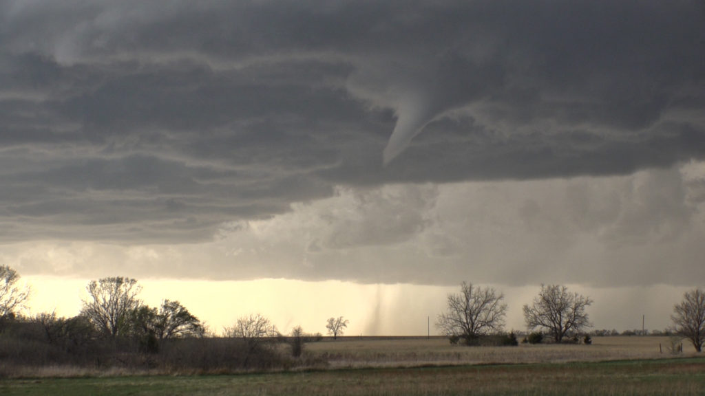
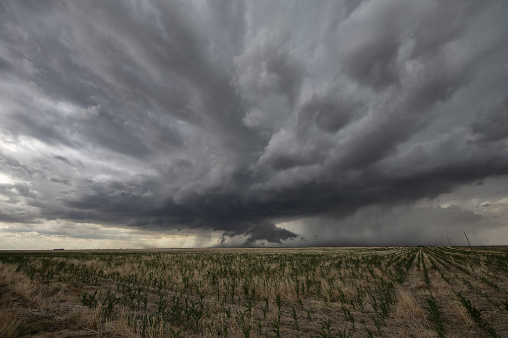
June 27th Amidon, North Dakota Tornado Warned Supercell
June 27th had a lot going for it. An approaching shortwave trough, an outflow boundary along with a dryline, as well as decent moisture with dewpoints in the 60s and moderate CAPE around 2500 j/kg would set the stage for severe weather in Montana, North Dakota and South Dakota. We originally targeted the area around Buffalo, South Dakota, but as moisture mixed out, we knew we’d have to venture a bit further north into southwest North Dakota. A supercell formed near Beach and became tornado warned. An hour later another supercell formed northwest of Amidon and also became tornado warned. We pushed north to get in position to watch it and as we did a couple of weak funnels formed under it and were reported to the NWS. The storm was anchored along a boundary and slowly back built. Numerous times there were rotating lowerings under the southwest portion of the updraft, as golfball sized hail fell from the vault region. Eventually the cell turned southeast and moved off the boundary. However, it moved into more stable air and slowly weakened but not before becoming tornado warned one last time! We stayed with it over beautiful canola fields and stopped for some photography. A fun day, and some amazing scenery!!!


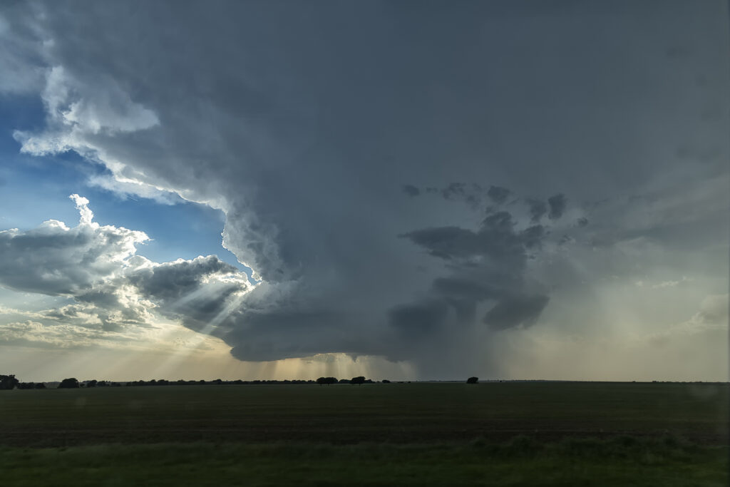
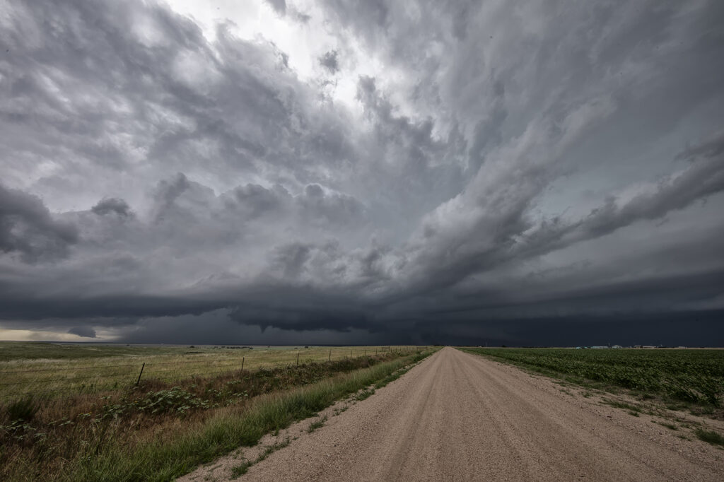
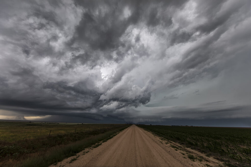
July 13th Eastern Colorado Tornado Warned Supercell
July 13th featured a play in eastern Colorado along an old outflow boundary from previous day convection. Storms formed fairly early, by 1pm along this boundary. It didn’t take long for them to become well organized and severe warned. One cell developed an impressive hook on radar and spun strongly. It produced a couple of funnel clouds, but nothing that touched down. Structure was nice, but storms became HP in nature as they moved almost due south in northwesterly flow aloft. Another cell formed southwest of the first and became tornado warned. We blasted towards it since our storm was weakening due to ingesting outflow air from the new storm. As we arrived on the new cell, it was quite messy and never looked like it would produce anything. We stayed with it for a couple more hours until numerous storms exploded between LaJunta and Lamar, CO. At that point, we called it a day and dropped south to our hotel in the Oklahoma panhandle. A fun day and our first supercell came very close to producing a tornado! Enjoy the pics!
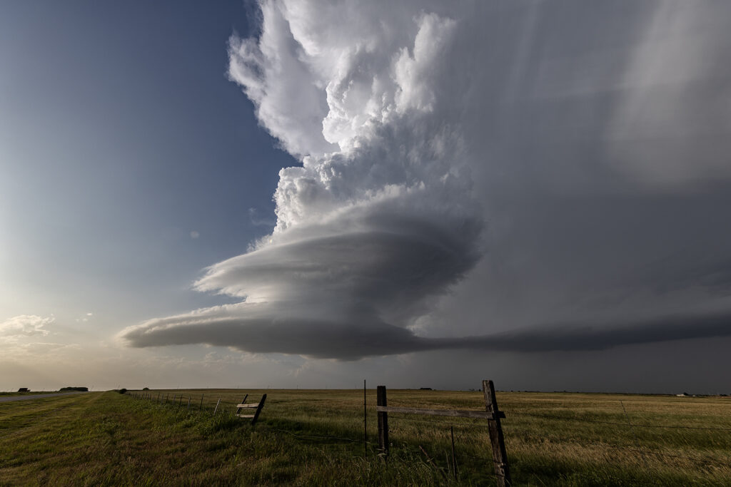
July 6th Eastern Colorado Tornado Warned Supercell
July 6th took us to eastern Colorado. Good moisture and instability, along with modest shear and upslope flow into the Palmer Divide would set the stage for supercells and multicells. One such storm formed just west of Limon and right turned southeast towards Hugo. As it did, the structure improved as severe thunderstorm warnings were issued for golfball sized hail. As it moved further east, it became better organized and was tornado warned. It didn’t produce one, but you could clearly see the rotation in the storms updraft. As it moved furth east towards Eads, it encountered drier are and eventually weakened. Pretty storm, and the eastern plains of Colorado certainly needed all the moisture it can get! Enjoy the photos!
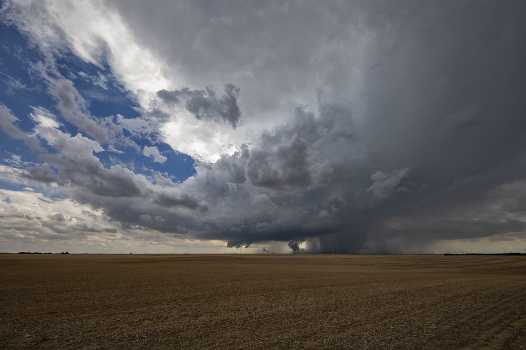
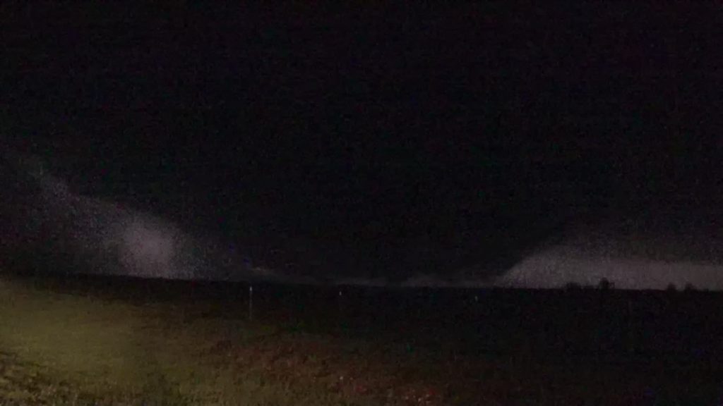
April 29th Central and Southern Kansas Tornadoes
A big day was in store for Kansas. Supercells with tornadoes were possible as a combination of wind shear, moisture and instability were present with an approaching trough. By mid afternoon the dryline sharpened and soon cumulus towers formed. A cluster of storms had formed northeast of McPherson and the tail end storm started spinning. One small tornado formed as the cell moved north towards the warm front. As it approached it, other storms started forming on an advancing cold front and also became severe. We decided to leave the first storm as storm mergers made things too messy. As we blasted south towards Wichita, a landspout tornado formed underneath an updraft in the line and stayed on the ground for 12 minutes. When is dissipated, when then turned our attention to a supercell near Wichita. It had just spawned the Andover tornado and continued to cycle and become tornadic again near El Dorado. We blasted down to town, now in the dark and headed east towards the supercell’s updraft base. Quickly a tapered cone tornado formed and became visible through power flashes and lighting. It crossed the road in front of us and dissipated. Another one formed within a couple minutes and stabbed down to the ground and lifted. We continued to drift east with the storm and turned north at Rosalia. As we did a massive bowl formed and dropped to the ground! A wedge type tornado formed with multiple vortices. We got blasted with RFD winds wrapping around the tornado and had to vacate the area. As we continued east the tornado lifted as a line of storms merged with it ending the tornado threat. A crazy day with 5 tornadoes! Enjoy the pics!