Tag Archives | rain

June 5th Great Sand Dunes National Park Storms

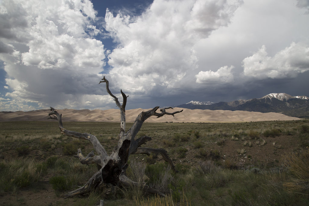
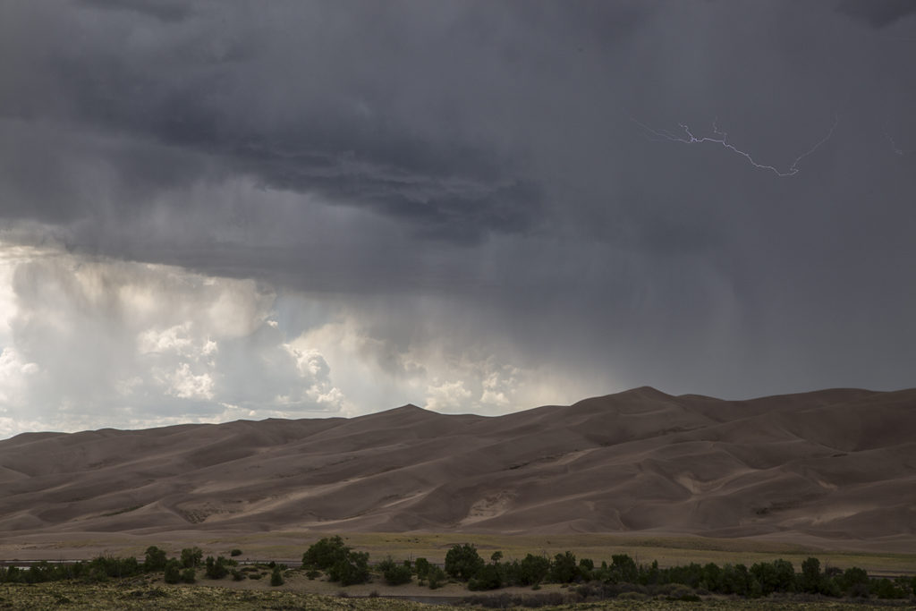
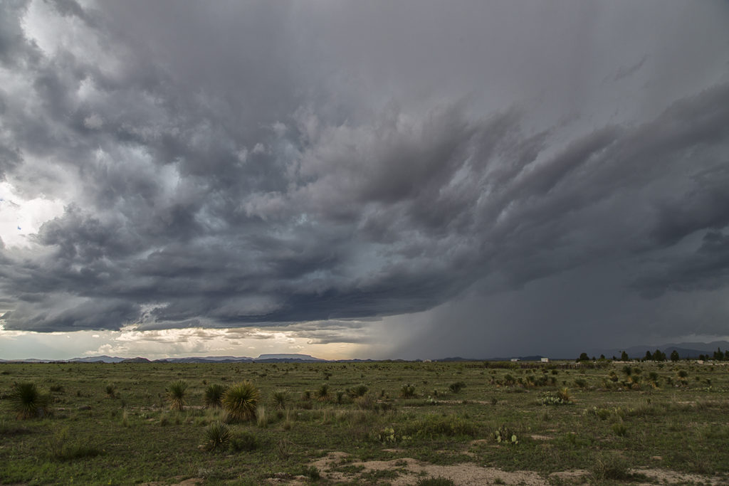
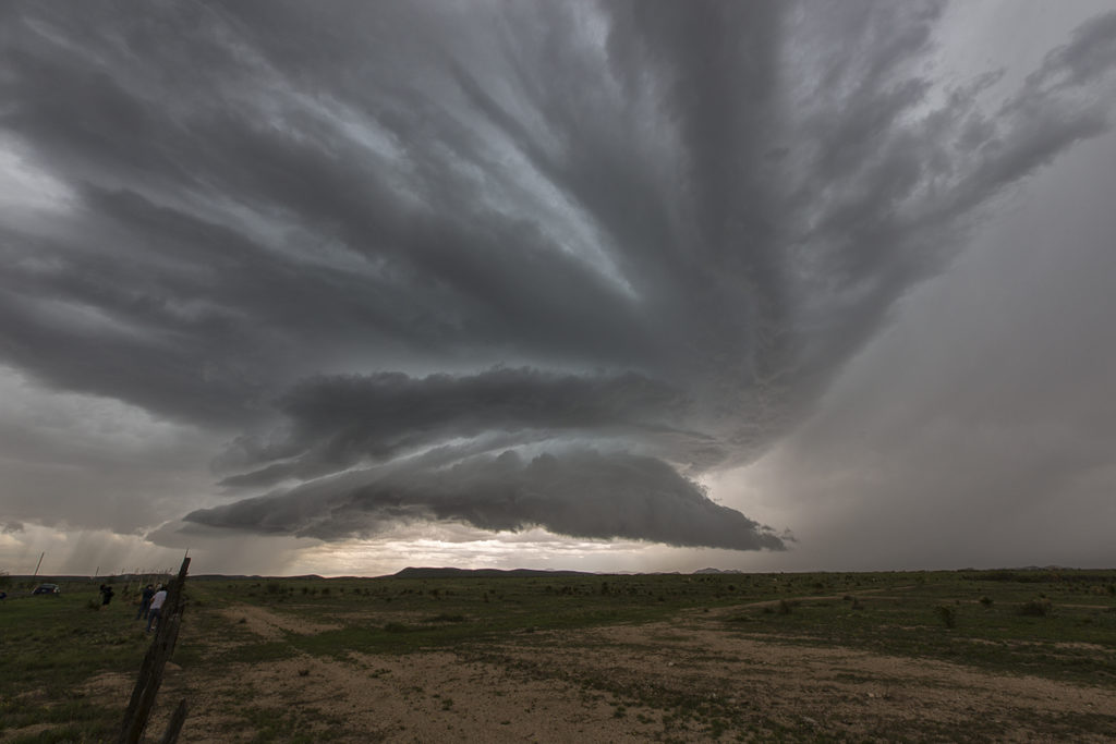
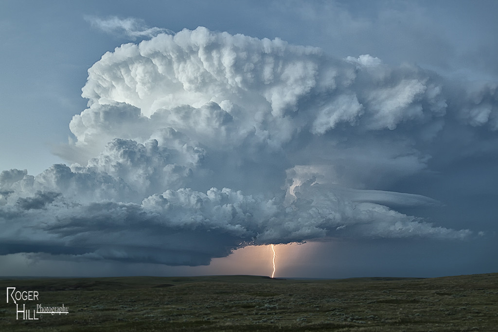
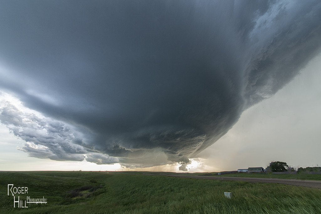
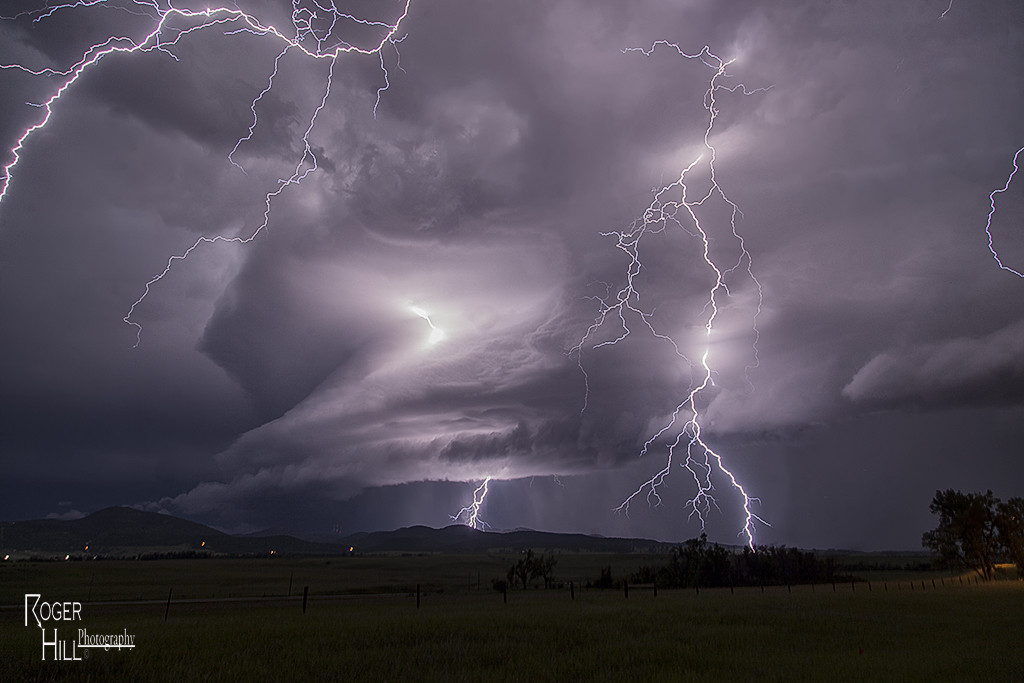
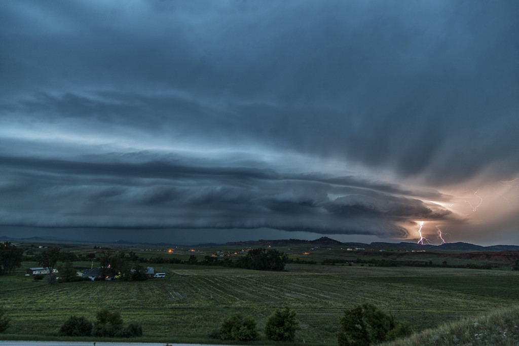
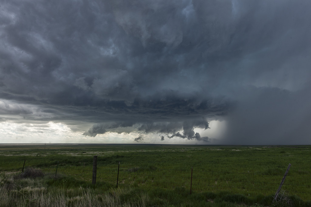
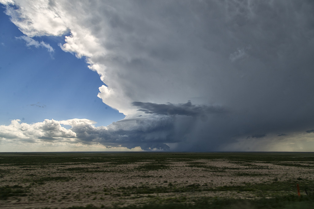
June 5th continued the extended period of low severe weather potential across the United States. However, we always do everything we can to get our guests a storm of any kind! June 5th looked like a good day for storms in the Alamosa/Great Sand Dunes NP area. So off we went. By mid afternoon storms formed over the mountains and some slid off the mountains into the valleys below. It just so happened to be in a very scenic area in the Great Sand Dunes park.  When there’s not much of a chance of severe storms we like to take our guests to scenic areas, with this area being quite pretty. Storms rolled over the dunes and produce heavy rain, lightning, wind and small hail. All in all it made for a pretty satisfying day, with a nice Mexican dinner in Alamosa to follow.


June 1st Marathon, Texas Supercell Thunderstorm

June 1st continued the streak of limited moisture and shear for the US. We decided to chase the Davis mountains in southwest Texas and were treated to a pretty storm with very large hail to tennisball size.  Two supercells emerged from the mountains with one storm in particular becoming a prolific hail producer. It tracked from near Marathon eastward to Sanderson where it dropped its largest stones of the day, measured 2.5″ in diameter.  Later on, the storm gusted out and outflow kicked up a cluster of new cells on the Mexico border that were producing an incredible amount of lightning strikes. Pretty indeed, and a great way to finish the day!

May 31st Lamesa, Texas Supercell Thunderstorm

The latter part of May and early June was a period of little severe threat in the US. Record low numbers of tornadoes in this period would attest to the poor set up. We searched high and wide for those little needles in the haystack, sort of speaking, for any tidbit of severe weather we could find. May 31st was one of those days. A cluster of storms formed over west Texas, and one storm near Lamesa latched onto an old boundary and rode it, twisting, turning and spinning for a couple hours. It’s structure was pretty, and coupled with the red dirt of west Texas, made for an interesting sight!


May 24th Eastern Colorado Tornadic Supercell

May 24th was a day that had huge potential. Unfortunately there were two pretty clear targets. Play the upslope in eastern Colorado for what would certainly be a pretty tornadic supercell, or play southwest Kansas with high instability along an outflow boundary. Fortunately we had two tours going at that time, Tour #4 and also Photo Tour #1. After considerable discussion Photo Tour #1 headed for Colorado while Tour #4 headed for southwest Kansas. Both tours scored big this day!  Upon arrival in Colorado Photo Tour #1 intercepted an intensifying supercell east of Denver. This storm would become a formidable supercell that would cycle multiple times and produce a half dozen tornadoes.  As this storm approached an area south of Ft Morgan it began it’s tornadic phase as it intercepted better moisture and instability and the storm’s base came down. the Photo Tour, true to its name, found numerous beautiful places to photograph this supercell and it’s tornadoes all the way out towards the Kansas border. It kept producing tornadoes off and on the rest of the day and into the evening. Nothing wilder than night time tornadoes. Finally as it moved into northwestern Kansas, the Photo Tour dropped off it and headed to their night destination.


May 23rd Northfield, Texas Night Tornadoes

May 23rd was a big day of ups and downs. Nature seemed to play a cruel joke on us and give us all the potential ingredients for a major severe weather event, but put all those ingredients too far east of the dryline in the Texas panhandle to do much good. Storms formed and were high based, never a tornadic threat, along the dryline. These cells would move off and die due to a capping inversion. Finally late afternoon one storm formed at the tail end of a cluster and moved far enough east to intercept 70 degree dewpoints and 4000 CAPE values. This storm would go crazy near dark and produce at least 2 significant tornadoes. The first tornado, a tapered cone, churned across the countryside west of Northfield, while the second tornado, a large EF3 multivortex turned wedge tornado, would be very close to Northfield. Lightning would illuminate this tornado and at one point, 4 bolts were visible around the tornado. An AMAZING event to say the least! Fortunately there were no fatalities from these tornadoes. Night time tornadoes are especially dangerous as you cannot see them unless they are lit by lightning or hit power lines to cause them to glow green.  An incredible event to what would be the warm up day for the next day, the largest tornado outbreak in a couple years in western Kansas!

May 11th West Texas Supercell

The set up this day was not ideal for tornadoes, but with moderate shear, instability, moisture and a dryline in place, we knew storms would fire along it. Due to large temperature and dewpoint spreads, cloud bases were fairly high, and thus storms became outflow dominant quickly. We intercepted several storms near the I-20 corridor west of Abilene that gave us some pretty structure, an occasional wall cloud and lots of lightning. They all were severe at times and even one became tornado warned. A big dusty haboob formed as the main cell turned into a line and eventually gusted out. At that point we dropped south on new cells and watched then rotate slowly and produce large hail.

June 21st South Dakota Tornado Outbreak

June 21st was a day that had great potential. Very good shear, moisture and instability were in place across the high plains into the western Dakotas. An approaching shortwave trough would provide the necessary lift to spark intense supercells in southeastern Montana.  One particular supercell formed near Baker, Montana and cycled several times as it entered northwest South Dakota.  This storm would be responsible for a half dozen tornadoes we witnessed across northern South Dakota.  The first tornado occurred as the storm really ramped up near Ralph, South Dakota. It would cycle several times and keep producing tornadoes all the way to near Eagle Butte where it dissipated late evening. The structure was some of the best of the season and several tornadoes were quite photogenic! Tour 8 scored big with this gorgeous beast!

June 17th East Central Wyoming Tornado Warned Supercell

June 17th had a short wave trough moving across the northern high plains. Decent moisture and instability was in place to fuel significant storms. However a capping inversion kept storms from forming until late in the day. A storm complex moved out of Montana into eastern Wyoming, and it was this complex that developed significant rotation as a storm in front of the line became absorbed into it and caused it to rotate rapidly. A tornado warning was issued for the western Black Hills as the storm approached Beaulah and into the Spearfish area. The structure as dusk was quite nice and the lightning was amazing! One of the best lightning displays all season so far!


June 11th Southeast Colorado Supercell

June 11th had issues, but still produced some nice storms. Marginal moisture, but decent shear overlaid eastern Colorado. By mid afternoon storms formed along a boundary that stretched across east central and southeast Colorado.  One particular supercell tracked along the boundary from north of LaJunta to far southeast Colorado. It struggled to stay on the moist side of the boundary occasionally, but managed to be quite a prolific hail producer. Never a real threat to produce a tornado, it did however manage to produce several short lived funnels. By early evening a cluster of storms formed south of Lamar. A tail end storm became a powerful supercell and was tornado warned for a couple hours. Visually it was stunning with constant rotation under the updraft. Two tornado reports came in, however they were not validated.  As the supercell tracked into southwest Kansas, it became an outflow dominant storm and produced significant winds.

June 5th Eastern Colorado Tornadoes

June 5th kept us close to home. A warm front draped over east central Colorado would become the focus for intense supercell storm development by late afternoon. It provided a differential heating boundary where storms erupted on the south side of it and interacted with the strong low level shear on the boundary. We sat between Anton and Cope and watched as a strongly tornadic supercell anchored at that point and produced multiple tornadoes. All in all we counted 4 confirmed tornadoes. The storm was a tad messy, and thus photos from the day clearly show the rain/hail as we took each shot. A couple of the tornadoes appeared to be strong, but fortunately only destroyed a barn in the wide open eastern Colorado plains. Tour 5 and Photo Tour #2 enjoyed the event as both were in great position to watch the entire tornadic cycle of the supercell.