
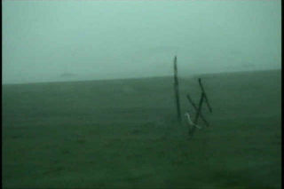
June 9th, 2001 Bismarck, ND Supercell & Tornado?
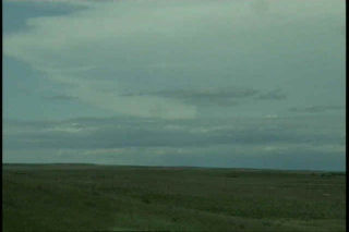
June 9, 2001 took us to North Dakota. Never again will I underestimate the importance of a boundary in tornado genesis. A weak bubble high formed over South Dakota after a morning MCS moved through, scouring out all moisture. However, north of the warm front in western North Dakota moisture was pooling with dewpoints in the 60s. So north we headed. There was 50 kts at 500 mb, great veering profile, high CAPE, and an approaching short wave. On the way northward through South Dakota, dewpoints bounced from the upper 40s through the 60s, but by the time we hit I-94 they increased to 66F. A couple of severe storms were ongoing, with one storm potentially tornadic. Other storms rapidly formed along the boundary, which was also collocated with I-94. Within 30 minutes upon arrival, a supercell exploded just to out east, so we raced after it, and what a show it gave us. Rapid cascading from the RFD was visible, huge hail soon followed, and finally as we got in front of it a possible tornado crossed in front of us causing significant damage.
No comments yet.