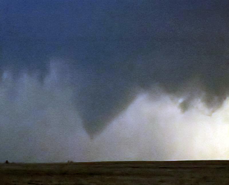
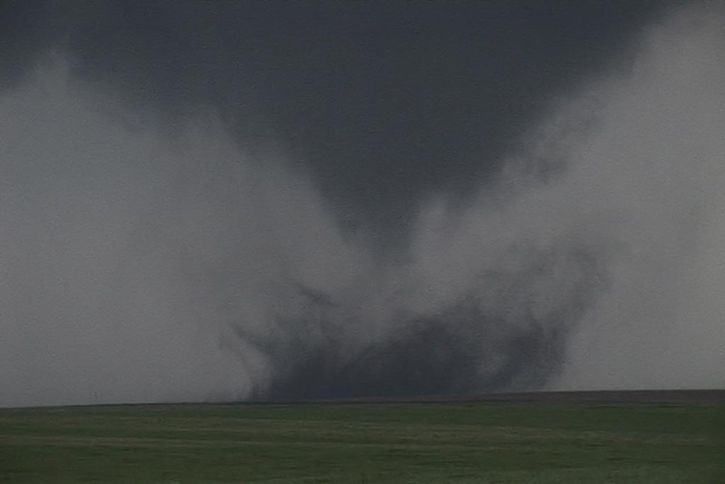
July 15 and 16 took me to northern Nebraska and South Dakota to play storms along the dryline. Shear wasn’t expected to be very strong, but enough to help generate supercells, and to my surprise tornado warned supercells. July 15th took us to Nebraska where a large supercell developed west of O’Neill. This storm was fairly high based, but rotating nonetheless. It produced golfball sized hail and had very high winds once it lined out. July 16th took me to central South Dakota along the Missouri River where numerous severe storms formed near dark. Lightning was decent and the hail was large, also to golfball sized.
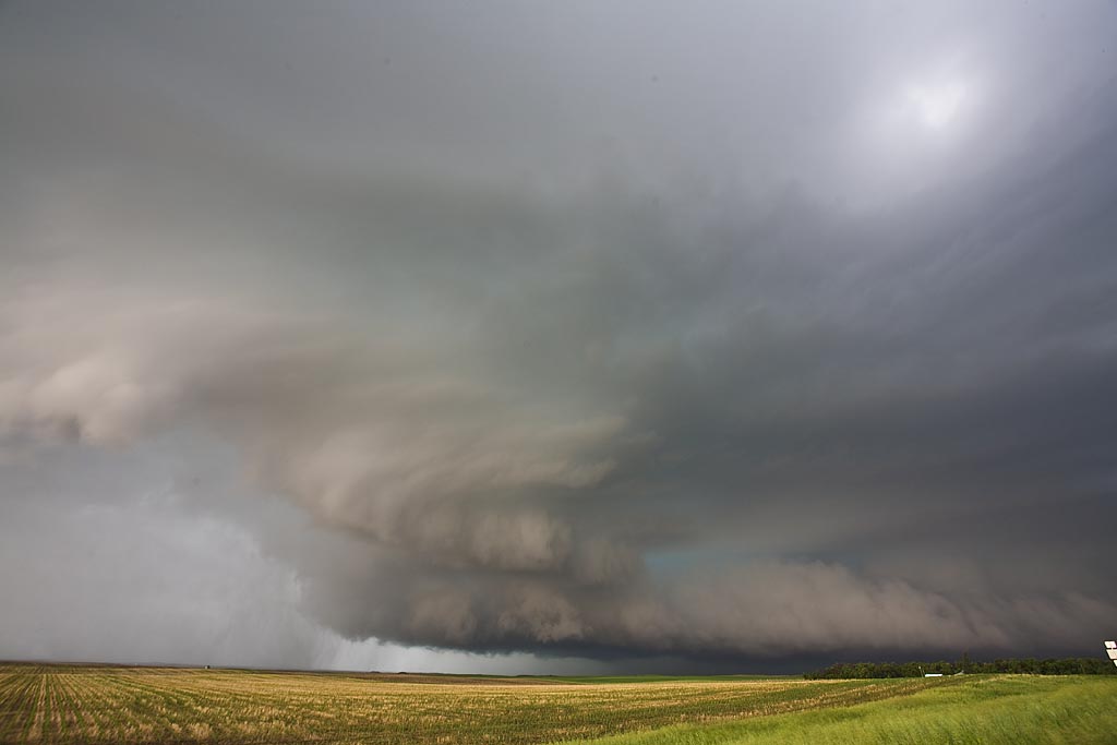
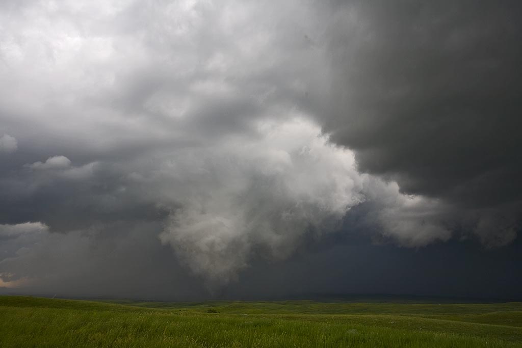
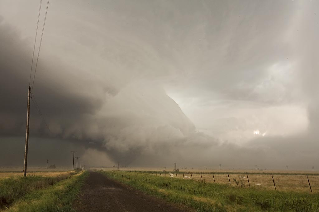
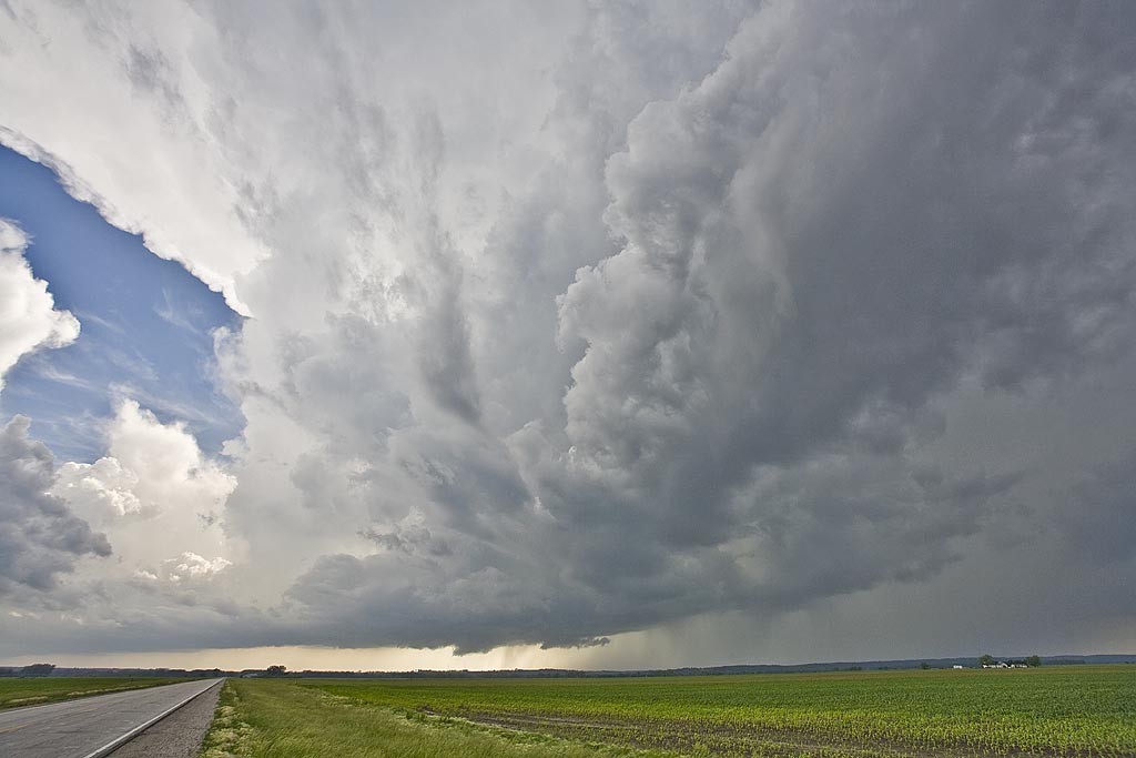
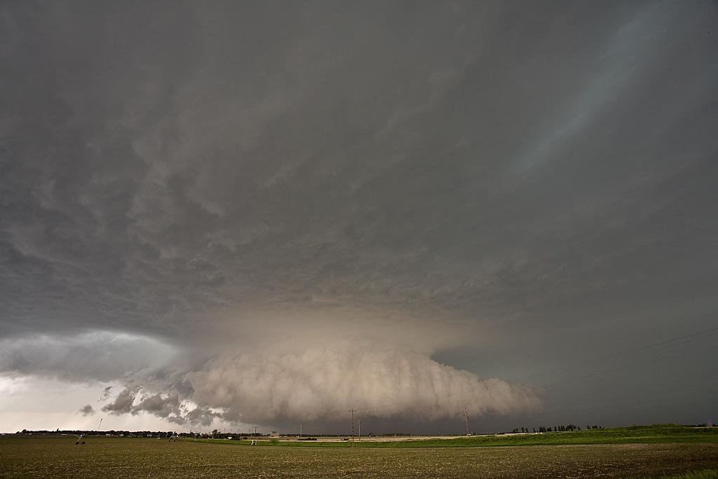
June 26th, 2008 South Dakota Tornadic Supercell
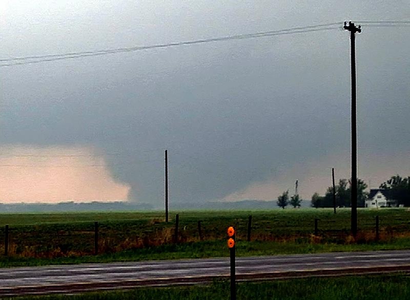
June 26th ended up being my favorite chase day in June. Good moisture, a boundary and strong shortwave energy would set the stage for supercells across North and South Dakota. I started the day in Rapid City and ended up near Mobridge as two tornadic storms formed not far from the North and South Dakota border west of the river. It was absolutely stunning scenery watching this storm interact with the surroundings! It produced at least two tornadoes, possibly more as it wrapped in rain. It also produced tons of hail to tennisball sized. The structure later in the evening was stunning!
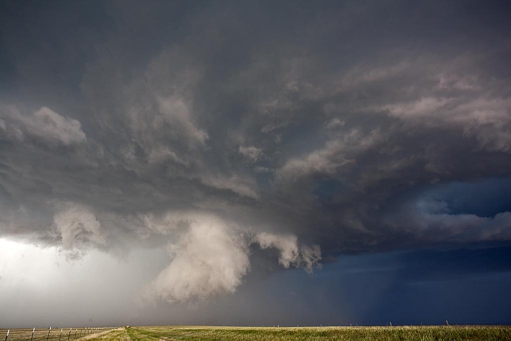
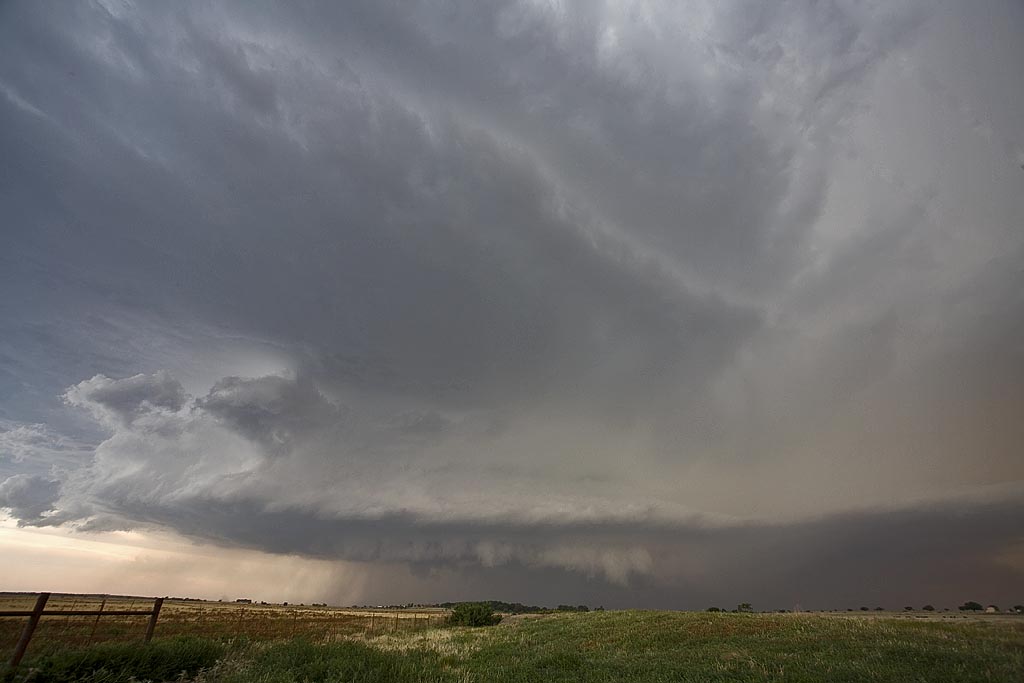
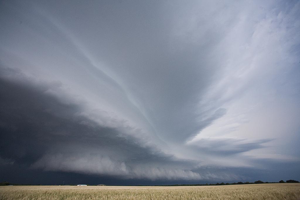
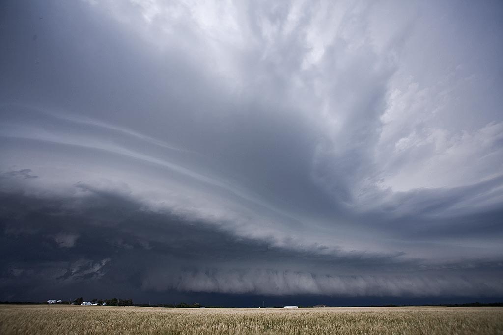
June 20th, 2008 Colorado Tornado Warned Supercells
June 20th kept us in Colorado for a great set up for higher based supercell hailers. We got them! We also caught 3 supercells that were tornado warned, although none produced. Good directional shear, and lift, but only fair moisture was present. Large temperature/dewpoint spreads would keep storm bases fairly high. Storms were pretty structured and produced copious amounts of hail, some places over half foot deep near Eads. Storms also produced very nice CGs which were quite photogenic due to their higher bases.
June 16th, 2008 Southwest Oklahoma Supercells
I wasn’t expecting what I caught on June 16th. Southwest Oklahoma lit up like a Christmas tree as HP supercells graced the landscape, many tornado warned. Good moisture, instability and decent shear, albeit fairly weak in the low levels, was present this day. A north/south boundary would be the firing grounds for storms. We intercepted 3 tornado warned storms, with one likely tornado occurring northwest of Hobart, Oklahoma. The Hobart storm was one of my favorites for the year!
June 12th, 2008 Kansas Tornadic Supercells
June 12th had some potential, but low level shear was not the greatest. We intercepted 4 tornado warned cells, all of which had decent low level rotation, wall clouds, respectable structure, but just couldn’t produce much. One cell near Cottonwood Falls, Kansas had strong rotation, a streaming tail cloud into the mesocyclone and then we were getting rained on with debris! Thus we vacated our position quickly. Click on the image for a larger shot.
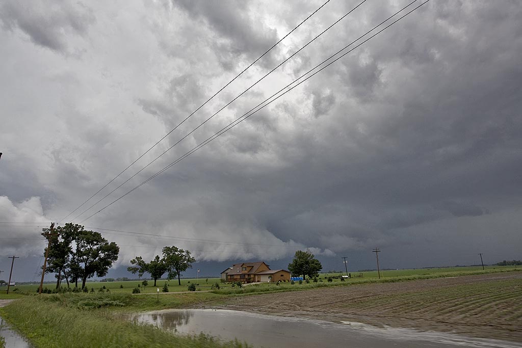
June 11th, 2008 Iowa Tornadic Supercells
June 11th was highly advertised as a big tornado potential day. Shortwave energy was ejecting from the high plains and would interact with a boundary from northern Kansas through Iowa and Minnesota. By the end of the day, several fatal tornadoes would occur, with the most noted being the Little Sioux, Iowa tornado and the Manhattan, Kansas tornado. We chased in Iowa this day and intercepted several storms that had tornado warnings, including the Little Sioux storm, which was quite messy and rain clogged.
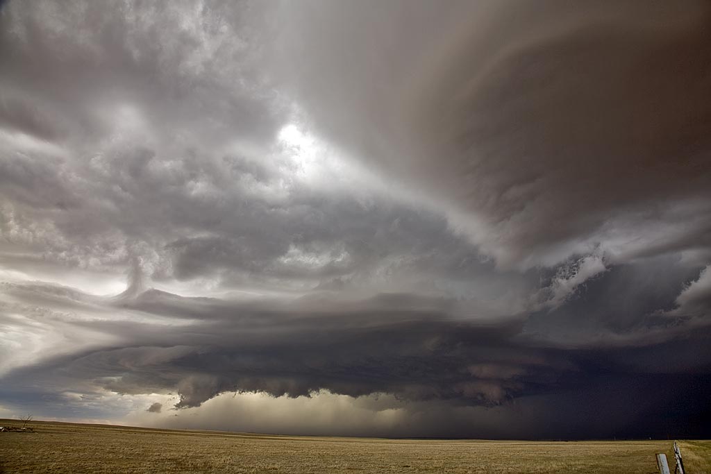
June 1st, 2008 Western Nebraska Tornado Warned Supercell
I didn’t have a lot of hope for this day. Limited moisture and CAPE, along with respectable shear, I thought would result in high based storms, producing marginal hail. I did not expect a tornado warned higher based supercell to form and become one of the prettiest storms of the young season thus far. We started with trashy storms near Scottsbluff and watched as this storm developed amidst the piles of crappy cumulus towers associated with those storms. We finally let it pummel s with golfball sized hail near Chappell, NE.
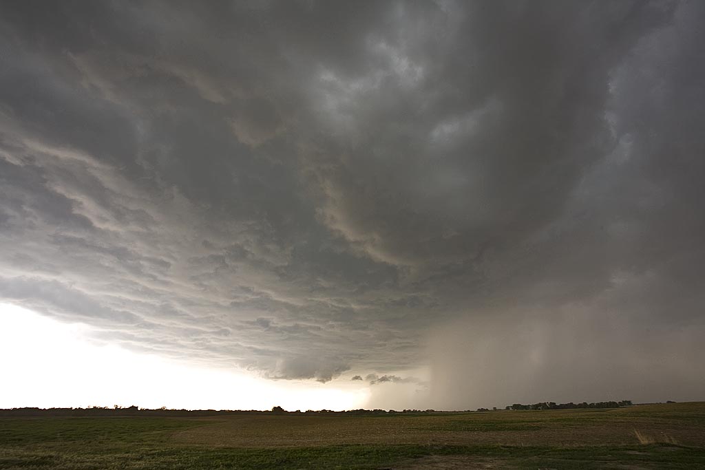
May 29th, 2008 Nebraska and Kansas Tornadofest
May 29th was advertised as a High Risk from the Storm Prediction Center. It seemed all ingredients were in place for a significant severe weather event, including strong to violent tornadoes. We decided to play the warm front along the KS/NE border area and as far west as we could. The first supercell of the day formed north of Mc Cook and became tornado warned almost instantly. It produced the Kearney, Nebraska tornado that caused significant damage. We followed the storm to east of Kearney when it became totally rain choked. We then dropped south into north central Kansas and caught the cyclic tornadic supercell from Tipton, Kansas, northeast towards Jewell, Kansas. The storm was a sight to behold!
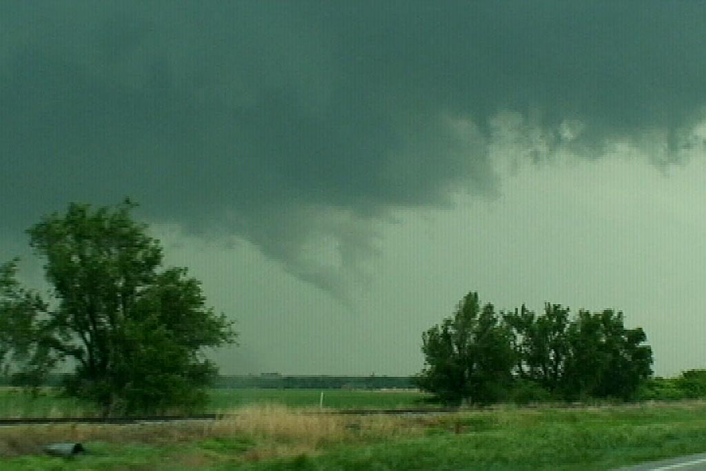
May 25th Kansas Supercell and Tornado
May 25th was a day I wish I had been in Iowa. However, good shortwave energy, good shear, moisture and instability would keep me in Kansas. I caught two nicely structured supercells this day, one of which produced a landspout type tornado that persisted for about 5 minutes. The first supercell, south of Hays,, was tornado warned and actually produced a few very weak brief touchdowns. We had chased farther west on a tornado warned storm that ended up VERY high based, and thus missed the initial “dusty multivortex” tornado report. I fully believe the report based on what we saw. The second storm just east of the first had pretty structure and produced the landspout.
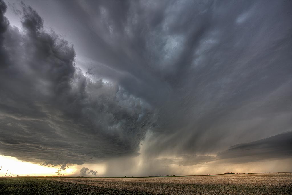
May 22/23rd, 2008 Kansas Tornadoes
May 22 and 23 were advertised as big days for the central plains. Moderate and High Risks were issued by SPC and well justified. Numerous supercells exploded, especially in Kansas both days and we were fortunate to intercept a few of them. On May 22nd, we were on a storm that would produce tornadoes near Collyer, Kansas, but due to a flat tire we couldn’t keep up with it. The day was salvaged as we intercepted a massive supercell near Wakeeney, Kansas that produced two confirmed tornadoes.
May 23rd would be the best of both worlds where we would intercept two sets of supercells that produced tornadoes near Quinter, Kansas with one being EF4. However due to the state patrol rightfully blocking the interstate, we were only able to get about 4 miles from it. Check out the video stills below. I didn’t shoot many stills due to having to spend my time navigating to keep up with these rapidly moving supercells.